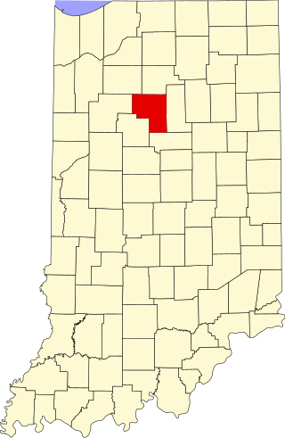
Cass County is a county located in the U.S. state of Indiana. As of the 2020 United States Census, its population was 37,870. The county seat is Logansport. Cass County comprises the Logansport, IN Micropolitan Statistical Area.

Royal Center is a town in Boone Township, Cass County, Indiana, United States. The population was 861 at the 2010 census.
Milton Township is a civil township of Cass County in the U.S. state of Michigan. The population was 3,128 at the 2020 census.

Cassville is an unincorporated community in Howard Township, Howard County, Indiana, United States. It is part of the Kokomo, Indiana Metropolitan Statistical Area and located approximately 5.9 miles from downtown Kokomo.

Wabash Township is one of thirteen townships in Parke County, Indiana, United States. As of the 2020 census, its population was 768 and it contained 325 housing units.
Washington Township is one of fourteen townships in Carroll County, Indiana. As of the 2020 census, its population was 551 and it contained 297 housing units.
Cass Township is one of twelve townships in Dubois County, Indiana. As of the 2010 census, its population was 2,115 and it contained 873 housing units.
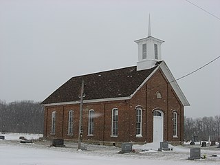
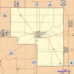
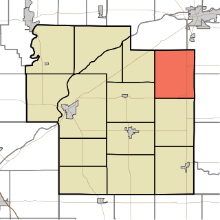
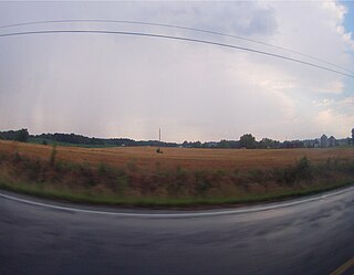
Clinton Township is one of fourteen townships in Cass County, Indiana, United States. As of the 2020 census, its population was 646 and contained 226 housing units.

Deer Creek Township is one of fourteen townships in Cass County, Indiana. As of the 2020 census, its population was 897 and contained 374 housing units.

Jefferson Township is one of fourteen townships in Cass County, Indiana. As of the 2020 census, its population was 1,297 and contained 580 housing units.

Tipton Township is one of fourteen townships in Cass County, Indiana, United States. As of the 2020 census, its population was 2,304 and contained 1,011 housing units.

Washington Township is one of fourteen townships in Cass County, Indiana, and one of the forty-six townships sharing the name in the state. As of the 2020 census, its population was 1,557 and contained 708 housing units.

Cass is an unincorporated community in Cass Township, Sullivan County, in the U.S. state of Indiana.
Anoka is an unincorporated community in Washington Township, Cass County, Indiana.
Georgetown is an unincorporated community in Jefferson Township, Cass County, Indiana.

Dubois is an unincorporated town and census-designated place (CDP) in Dubois County, Indiana, United States. Its population at the 2010 census was 488.

Hudson Lake is an unincorporated community and census-designated place (CDP) in Hudson Township, LaPorte County, Indiana, United States. The town sits on the dividing line between Central and Eastern time zones. It is the site of the Hudson Lake station stop of the South Shore Line. As of the 2010 census, the population of the CDP was 1,297.
East Oolitic is an unincorporated community and census-designated place in Shawswick Township, Lawrence County, Indiana.

Lake Santee is an unincorporated town and census-designated place in Decatur and Franklin counties, Indiana, United States. As of the 2010 census, it had a population of 820.

Cordry Sweetwater Lakes is a census-designated place (CDP) in Hamblen Township, Brown County, in the U.S. state of Indiana. The population was 1,128 at the 2010 census. Sweetwater Lake is 260 acres in size.