
U.S. Route 31 or U.S. Highway 31 (US 31) is a major north–south U.S. highway connecting southern Alabama to northern Michigan. Its southern terminus is at an intersection with US 90/US 98 in Spanish Fort, Alabama. Its northern terminus is at an interchange with Interstate 75 (I-75) south of Mackinaw City, Michigan.
State Road 37 (SR 37) is a major route in the U.S. state of Indiana, running as a four-lane divided highway for 110 miles of its course.
U.S. Route 224 (US 224) is a spur of US 24 that runs through the states of Indiana, Ohio and Pennsylvania. It currently runs for 289 miles (465 km) from US 24 in Huntington, Indiana, east to US 422 Business and Pennsylvania Route 18 (PA 18) in New Castle, Pennsylvania. It goes through the cities of Canfield, Ohio, Akron, Ohio, and Findlay, Ohio. In Northeast Ohio, US 224 is located a short distance north of the Western Reserve's southern boundary.

State Road 1 (SR 1) is a north–south state highway in eastern Indiana, consisting of two segments. Its southern segment begins at U.S. Highway 50 and Interstate 275 in east-central Dearborn County, just east of Lawrenceburg, and ends at Interstate 469 south of Fort Wayne. Its northern segment begins at Interstate 69 on Fort Wayne's north side, and ends at U.S. Route 20 in east-central Steuben County, approximately 6 miles (9.7 km) east of Angola.

State Road 3 (SR 3) in the U.S. state of Indiana is a discontinuous state highway running through eastern Indiana from near the Ohio River to near the Michigan state line. The southernmost terminus is at SR 62 in Charlestown, and the northernmost terminus is at SR 120 near Brighton.

State Road 101 in the U.S. state of Indiana is a north–south state highway in the eastern portion of Indiana that exists in four sections with a combined length of 79.42 miles (127.81 km).

State Road 32 (SR 32) in the U.S. state of Indiana is an east–west state highway in central Indiana that crosses the entire state, covering a distance of about 157 miles (253 km). The western terminus of SR 32 is at the Illinois state line, southeast of Danville, Illinois, where the state highway becomes a county road. The eastern terminus is at Union City, Indiana, and Union City, Ohio, at the Ohio state border where the highway becomes Ohio State Route 47.
State Road 75, the highest two-digit route in the U.S. state of Indiana consists of two discontinuous north–south segments.
State Road 109 is a north–south discontinuous State Road in the US state of Indiana. The southern segment of the highway runs from U.S. Route 40 in the town of Knightstown north to SR 9 in Anderson. The northern segment of SR 109 runs from US 30 in Columbia City northerly to US 33 in Wolf Lake. The total length of the highway is 31.769 miles (51.127 km), including the southern segment which is 20.129 miles (32.394 km) and the northern segment at 11.640 miles (18.733 km). The first usage of the SR 109 designation dates back to 1934 with the original routing being between Columbia City and Wolf Lake. A southern section was added in 1940 between Knightstown and the Hancock–Madison County line. The southern segment was lengthened in the early 1940s and once again in the early 1950s extending the road north to just north of Anderson. The northern segment of SR 109 was shortened in Columbia City during the early 1970s. SR 109 in Madison County was moved to a new routing in the late 1990s.
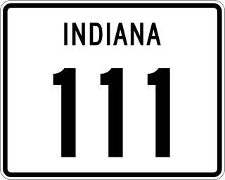
State Road 111 (SR 111) in the U.S. State of Indiana is a rural two-lane highway that runs between New Boston and New Albany in the far southern portion of the state. It has existed since 1935. Part of the highway was decommissioned in October 2012 and more was decommissioned in January 2013.
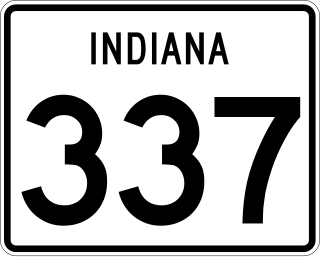
State Road 337 in the U.S. State of Indiana is divided into a northern section and a southern section.

State Road 5 (SR 5) is a north–south state road in the US state of Indiana. Its southern terminus is at SR 22 in Upland, and the northern terminus is at SR 120 just north of Shipshewana. The state road runs for just over 96 miles (154 km), passing through five counties in northern Indiana, mostly through rural farm fields and small towns. The largest city along its path is Huntington. It is entirely a surface highway that is very rural outside of the towns. SR 5 runs along two dams the first being J. Edward Roush Lake Dam and the second being the Wilmot Dam.

State Road 28 is an east–west road in central Indiana in the United States that crosses the entire state from east to west, covering a distance of about 153 miles (246 km) and passing about 20 miles (32 km) to the north of the state capitol of Indianapolis.

State Route 43 is a primary state highway in the U.S. state of Virginia. The state highway consists of two disjoint segments that have a total length of 61.20 miles (98.49 km). The southern portion of the state highway runs 39.79 miles (64.04 km) from U.S. Route 29 Business in Altavista north to the Blue Ridge Parkway at Peaks of Otter. The northern segment has a length of 21.41 miles (34.46 km) between the Blue Ridge Parkway near Buchanan and US 220 in Eagle Rock. The two sections of SR 43 are connected by 4.9 miles (7.9 km) of the Blue Ridge Parkway. The southern portion of the state highway connects Altavista with Bedford and Peaks of Otter. The northern section of SR 43 follows the James River through a narrow valley between Buchanan and Eagle Rock.

Interstate 65 (I-65) in the US state of Indiana traverses from the south-southeastern Falls City area bordering Louisville, Kentucky, through the centrally located capital city of Indianapolis, to the northwestern Calumet Region of the Hoosier State which is part of the Chicago metropolitan area. The Indiana portion of I-65 begins in Jeffersonville after crossing the Ohio River and travels mainly north, passing just west of Columbus prior to reaching the Indianapolis metro area. Upon reaching Indianapolis, the route alignment of I-65 begins to run more to the northwest and subsequently passes Lafayette on that city's east and north sides. Northwest of there, in west-central Jasper County, the route again curves more northward as it approaches the Calumet Region. Shortly after passing a major junction with I-80 and I-94, I-65 reaches its northern national terminus in Gary at I-90 which is carried on the Indiana East–West Toll Road. I-65 covers 261.27 miles (420.47 km) in the state of Indiana. This is one of the principal Interstate Highways that cross the state, and, more specifically, intersect at the city of Indianapolis, that has given the state the nickname of "Crossroads of America".

State Route 75 (SR 75) is a 33.4-mile-long (53.8 km) state highway that travels south-to-north through portions of White and Towns counties in the northern part of the U.S. state of Georgia. It connects Cleveland and the North Carolina state line, via Helen, Macedonia, and Hiawassee.
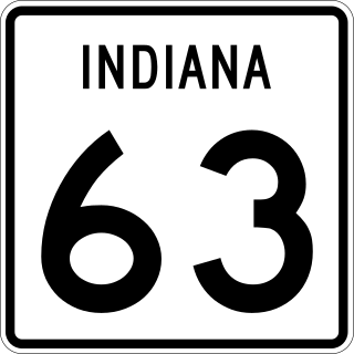
State Road 63 (SR 63) in the U.S. state of Indiana is a north–south route in the western portion of the state. Until mid-2008, it covered a distance of just over 96 miles (154 km), but now is a discontinuous route. For 63 miles (101 km), from the city of Terre Haute until it rejoins U.S. Route 41 (US 41) near Carbondale, it is a four-lane divided highway and replaces US 41 as the major north–south artery in this portion of the state.

State Road 119 exists as two separate roads in the U.S. state of Indiana. The road is a rural surface highway for the entire length of both sections.

U.S. Route 33 (US 33) is part of the United States Numbered Highway System that runs from Richmond, Virginia, to Elkhart of the US state of Indiana. In Indiana, it is a state road that enters the state at the Ohio state line between Willshire, Ohio, and Pleasant Mills, Indiana. The 106.217 miles (170.940 km) of US 33 that lie within Indiana serve as a major conduit. All of the highway is listed on the National Highway System. Various sections are rural two-lane highway, urbanized four-lane divided expressway and the Lincoln Highway. The northernmost community along the highway is Elkhart. The highway ends at an interchange in southern Elkhart after serving the northeastern region of Indiana. US 33 passes through farm fields and urban areas.

U.S. Route 231 is the longest numbered highway in Indiana, covering over 284 miles (457 km). It is a main north–south highway in the western part of the state. The southern terminus of US 231 is at the Kentucky state line and the northern terminus is at US 41 just south of St. John. The highway is a mixture of expressway and two-lane roadway. The expressway portions exist mainly in southern Indiana and around the Lafayette area, with the rest mainly being two lanes.

