Armstrong Tunnel

Last updated
Armstrong Tunnel
ArmstrongTunnel.JPG
The Armstrong Tunnel at Forbes Avenue. Duquesne University's Gumberg Library is visible in the background
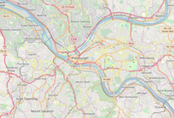
Pittsburgh locator map 2018.png
Red pog.svg
USA Pennsylvania location map.svg
Red pog.svg
Usa edcp location map.svg
Red pog.svg
LocationBetween Forbes and Second Aves. at S. Tenth St., Pittsburgh, Pennsylvania.
Coordinates 40°26′10″N79°59′28″W / 40.43620°N 79.99118°W / 40.43620; -79.99118
Built1926
Architect Covell, Vernon R.; Et al.
NRHP reference No. 86000015 [1]
Significant dates
Added to NRHPJanuary 7, 1986
Designated PHLF2003 [2]

The Armstrong Tunnel in Pittsburgh, Pennsylvania, connects Second Avenue at the South Tenth Street Bridge, under the Bluff where Duquesne University is located, to Forbes Avenue between Boyd Street and Chatham Square.

Contents

Construction

The tunnel was constructed between 1926 and 1927. The chief engineer was Vernon R. Covell of the Allegheny County Public Works Department. The tunnel portals were designed by a city architect, Stanley L. Roush, who is also noted for the Smithfield Street Bridge portals, the Pittsburgh City-County Building, the Corliss Tunnel, and many other municipal projects.[ citation needed ]

Characteristics

The tunnel itself is characterized by twin bores of horseshoe cross-section, and bends halfway through. It also has a pedestrian walkway on the western side.[ citation needed ]

A legend mentioned by the site involves a notion that the bend in the tunnel was a mistake, and whoever was responsible committed suicide in shame. Chief engineer Covell did not kill himself, invalidating this legend. Author Bruce S. Cridlebaugh suspects the bend was related to mines or other geological factors, property rights (including Duquesne University), or alignments with existing or proposed roads.[ citation needed ]

Since August 1987 the tunnels have provided cellular phone reception. [3]

Name

The tunnels were named in honor of Joseph G. Armstrong, County Director of Public Works. Most of the bridges over the Pittsburgh's three rivers were replaced between 1910 and 1940, years which included Mr. Armstrong's terms as Mayor of Pittsburgh and Allegheny County Commissioner.[ citation needed ]

Related Research Articles

<span class="mw-page-title-main">Allegheny Portage Railroad</span> National Historic Site of the United States

The Allegheny Portage Railroad was the first railroad constructed through the Allegheny Mountains in central Pennsylvania. It operated from 1834 to 1854 as the first transportation infrastructure through the gaps of the Allegheny that connected the midwest to the eastern seaboard across the barrier range of the Allegheny Front. Approximately 36 miles (58 km) long overall, both ends connected to the Pennsylvania Canal, and the system was primarily used as a portage railway, hauling river boats and barges over the divide between the Ohio and the Susquehanna Rivers. Today, the remains of the railroad are preserved within the Allegheny Portage Railroad National Historic Site operated by the National Park Service.

<span class="mw-page-title-main">Downtown Pittsburgh</span> Neighborhood of Pittsburgh in Allegheny County, Pennsylvania, United States

Downtown Pittsburgh, colloquially referred to as the Golden Triangle, and officially the Central Business District, is the urban downtown center of Pittsburgh, Pennsylvania, United States. It is located at the confluence of the Allegheny River and the Monongahela River whose joining forms the Ohio River. The triangle is bounded by the two rivers.

<span class="mw-page-title-main">Union Station (Pittsburgh)</span> Railway station in Pittsburgh, Pennsylvania, U.S.

Union Station, also known as Pennsylvania Station and commonly called Penn Station, is a historic train station in Downtown Pittsburgh, Pennsylvania. It was one of several passenger rail stations that served Pittsburgh during the 20th century; others included the Pittsburgh & Lake Erie Railroad Station, the Baltimore and Ohio Station, and Wabash Pittsburgh Terminal, and it is the only surviving station in active use.

<span class="mw-page-title-main">Three Sisters (Pittsburgh)</span> Bridge in Pittsburgh, Pennsylvania

The Three Sisters are three similar self-anchored suspension bridges spanning the Allegheny River in downtown Pittsburgh, Pennsylvania at 6th, 7th, and 9th streets, generally running north/south. The bridges have been given formal names to honor important Pittsburgh residents:

<span class="mw-page-title-main">Allegheny County belt system</span> Allegheny County belt system

The Allegheny County Belt System color codes various county roads to form a unique system of routes in Allegheny County, Pennsylvania, and around the city of Pittsburgh.

<span class="mw-page-title-main">Roberto Clemente Bridge</span> Bridge in Pittsburgh, Pennsylvania, United States

The Roberto Clemente Bridge, also known as the Sixth Street Bridge, spans the Allegheny River in downtown Pittsburgh, Pennsylvania, United States.

<span class="mw-page-title-main">Smithfield Street Bridge</span> Bridge over the Monongahela River in Pittsburgh, Pennsylvania

The Smithfield Street Bridge is a lenticular truss bridge crossing the Monongahela River in Pittsburgh, Pennsylvania, USA.

<span class="mw-page-title-main">Duquesne Incline</span>

The Duquesne Incline is a funicular located near Pittsburgh's South Side neighborhood, scaling Mt. Washington in the United States. Designed by Hungarian-American engineer Samuel Diescher, the incline was completed in 1877.

<span class="mw-page-title-main">Monongahela Incline</span> Funicular railway in Pittsburgh, Pennsylvania

The Monongahela Incline is a funicular located near the Smithfield Street Bridge in Pittsburgh, Pennsylvania. Designed and built by Prussian-born engineer John Endres in 1870, it is the oldest continuously operating funicular in the United States.

<span class="mw-page-title-main">National Register of Historic Places listings in Pennsylvania</span>

This is a list of properties and districts listed on the National Register of Historic Places in Pennsylvania. As of 2015, there are over 3,000 listed sites in Pennsylvania. All 67 counties in Pennsylvania have listings on the National Register.

<span class="mw-page-title-main">Homestead Grays Bridge</span> Bridge over the Monongahela River

The Homestead Grays Bridge, also known as the (Homestead) High Level Bridge, was built in 1936 and spans the Monongahela River between Homestead Borough and the southernmost tip of Pittsburgh's Squirrel Hill neighborhood. It is notable as the first bridge to incorporate the Wichert Truss, which uses a quadrilateral shape over each support, into its design. This made the truss statically determinate, so that forces in the structural members could be calculated. There are very few surviving Wichert Truss bridges, including one other example in Pittsburgh, the Charles Anderson Memorial Bridge.

<span class="mw-page-title-main">Allegheny County Courthouse</span> Courthouse and jail complex in Pittsburgh, Pennsylvania, U.S.

The Allegheny County Courthouse in downtown Pittsburgh, Pennsylvania, is part of a complex designed by H. H. Richardson. The buildings are considered among the finest examples of the Romanesque Revival style for which Richardson is well known.

<span class="mw-page-title-main">South Tenth Street Bridge</span> Bridge in Pittsburgh, Pennsylvania

The South Tenth Street Bridge, most often called the Tenth Street Bridge, but officially dubbed the Philip Murray Bridge, is a suspension bridge that spans the Monongahela River in Downtown Pittsburgh, Pennsylvania.

<span class="mw-page-title-main">West End Bridge</span> Bridge in Pittsburgh, Pennsylvania

The West End Bridge is a steel tied-arch bridge over the Ohio River in Pittsburgh, Pennsylvania, approximately 1 mile (1.6 km) below the confluence of the Allegheny and Monongahela Rivers. It connects the West End to the Chateau neighborhood on the North Side of Pittsburgh.

<span class="mw-page-title-main">George Westinghouse Bridge</span> United States historic place

George Westinghouse Memorial Bridge in East Pittsburgh, Pennsylvania, carries U.S. Route 30, the Lincoln Highway, over the Turtle Creek Valley near to where it joins the Monongahela River Valley east of Pittsburgh. The reinforced concrete open-spandrel deck arch bridge has a total length of 1,598 feet (487 m) comprising five spans. The longest, central span is 460 feet (140 m), with the deck height 240 feet (73 m) above the valley floor, for a time the world's longest concrete arch span structure. It cost $1.75 million. The design engineers were Vernon R. Covell and George S. Richardson, with architectural design by Stanley Roush. The pylons at the ends of the bridges feature Art Deco reliefs by Frank Vittor.

<span class="mw-page-title-main">Transportation in Pittsburgh</span> Transportation in Pittsburgh, Pennsylvania, United States

Transportation in Pittsburgh, Pennsylvania is different than in many other major American cities. A large metropolitan area that is surrounded by rivers and hills, Pittsburgh has an infrastructure system that has been built out over the years to include roads, tunnels, bridges, railroads, inclines, bike paths, and stairways; however, the hills and rivers still form many barriers to transportation within the city.

<span class="mw-page-title-main">Frederick J. Osterling</span> American architect

Frederick John Osterling was an American architect, practicing in Pittsburgh from 1888.

<span class="mw-page-title-main">Pennsylvania Route 837</span> State highway in Washington and Allegheny counties in Pennsylvania, US

Pennsylvania Route 837 is a state route located in western Pennsylvania. The southern terminus of the route is at Pennsylvania Route 88 in the Carroll Township hamlet of Wickerham Manor. The northern terminus is at U.S. Route 19 and PA 51 near downtown Pittsburgh at the junction of the Ohio, Allegheny and Monongahela rivers. The highway parallels the Monongahela River for all of its route with the exceptions of its extreme north and south ends. Popular amusement park Kennywood is located along this route.

Vernon R. Covell was an American engineer. He was chief engineer of the Allegheny County Public Works Department.

<span class="mw-page-title-main">George S. Richardson (engineer)</span> American civil engineer

George Sherwood Richardson (1896–1988) was an American engineer known for his elegant bridges, innovative construction techniques and skillful planning of highways. Designer of many bridges in the Pittsburgh and Allegheny County areas in the 20th century, he has been called "the dean of Pittsburgh bridge engineers".

References

  1. "National Register Information System". National Register of Historic Places . National Park Service. March 13, 2009.
  2. Historic Landmark Plaques 1968-2009 (PDF). Pittsburgh, PA: Pittsburgh History & Landmarks Foundation. 2010. Archived (PDF) from the original on 21 July 2011. Retrieved 2011-07-30.
  3. "Pittsburgh Post-Gazette - Google News Archive Search". google.com. Retrieved 19 March 2017.

Commons-logo.svg Media related to Armstrong Tunnel at Wikimedia Commons