Upper Strasburg, Pennsylvania | |
|---|---|
Unincorporated community | |
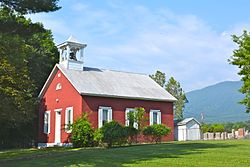 Methodist church | |
 Upper Strasburg  Upper Strasburg | |
| Coordinates: 40°3′37″N77°42′32″W / 40.06028°N 77.70889°W | |
| Country | United States |
| State | Pennsylvania |
| County | Franklin |
| Township | Letterkenny |
| Elevation | 728 ft (222 m) |
| Time zone | UTC-5 (Eastern (EST)) |
| • Summer (DST) | UTC-4 (EDT) |
| ZIP code | 17265 |
| Area code | 717 |
| GNIS feature ID | 1190256 [1] |
Upper Strasburg is an unincorporated community that is located in Letterkenny Township in Franklin County, Pennsylvania, United States.
Contents
It is situated near the Tuscarora Mountain ridge in the Appalachian Mountains at the intersection of Pennsylvania Route 533, State Route 4004 (Mountain Road/Valley Road), and Community Road, northwest of Chambersburg and north of the Letterkenny Army Depot. [2]


