Sylvan, Pennsylvania

Last updated
Sylvan, Pennsylvania
Unincorporated community
USA Pennsylvania location map.svg
Red pog.svg
Sylvan
Usa edcp location map.svg
Red pog.svg
Sylvan
Coordinates: 39°45′12″N78°1′18″W / 39.75333°N 78.02167°W / 39.75333; -78.02167 Coordinates: 39°45′12″N78°1′18″W / 39.75333°N 78.02167°W / 39.75333; -78.02167
Country United States
State Pennsylvania
County Franklin
Township Warren
Elevation
502 ft (153 m)
Time zone UTC-5 (Eastern (EST))
  Summer (DST) UTC-4 (EDT)
ZIP code
17236
Area code(s) 717
GNIS feature ID1189212 [1]

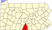
Sylvan is an unincorporated community in Warren Township in Franklin County, Pennsylvania, United States. Sylvan is located on Sylvan Drive east of Pennsylvania Route 456. [2]

Related Research Articles

Russell County, Kansas County in Kansas

Russell County is a county in the U.S. state of Kansas. As of the 2010 census, the population was 6,970. The largest city and county seat is Russell.

Big Spring State Forest Picnic Area

Big Spring State Forest Picnic Area is a 45-acre (18 ha) Pennsylvania state park in Toboyne Township, Perry County, Pennsylvania in the United States. The park is on Pennsylvania Route 274, 5.5 miles (8.9 km) southwest of New Germantown. Big Spring State Forest Picnic Area is a hiking and picnic area. A partially completed railroad tunnel in Conococheague Mountain is a feature of the park.

Michigan's 18th congressional district is an obsolete United States congressional district in Michigan. The first Representative to Congress elected from the 18th district, George Anthony Dondero, took office in 1953, after reapportionment due to the 1950 census. In 1933, Dondero had previously been the first representative elected from 17th district.

National Register of Historic Places listings in Franklin County, Pennsylvania Wikimedia list article

This is a list of the National Register of Historic Places listings in Franklin County, Pennsylvania.

Old Forge is an unincorporated community in Quincy Township, Franklin County, Pennsylvania, United States, within the Michaux State Forest, at 39°47′40″N77°29′3″W, at altitude 892 feet (272 m).

Sylvan Grove, Pennsylvania Unincorporated community in Pennsylvania, United States

Sylvan Grove is an unincorporated community in Cooper Township in Clearfield County, Pennsylvania, United States. It appears on the Frenchville U.S. Geological Survey Map. It is a small farming community originally called Hickory Bottom. Central to the history of Sylvan Grove is the Sylvan Grove Church and Cemetery.

Chesterville, Pennsylvania Unincorporated community in Pennsylvania, United States

Chesterville is an unincorporated community in Franklin Township in Chester County, Pennsylvania, United States. Chesterville is located at the intersection of Pennsylvania Route 841, Chesterville Road, and North Creek Road.

Willow Hill, Pennsylvania Unincorporated community in Pennsylvania, United States

Willow Hill is an unincorporated community in Metal Township in Franklin County, Pennsylvania, United States. Willow Hill is located along Pennsylvania Route 75 at its interchange with the Pennsylvania Turnpike, which is called the Willow Hill interchange.

Pleasant Hall, Pennsylvania Unincorporated community in Pennsylvania, United States

Pleasant Hall is an unincorporated community in Letterkenny Township in Franklin County, Pennsylvania, United States. Pleasant Hall is located at the intersection of Pennsylvania Route 533 and Pennsylvania Route 997 north of Chambersburg and northeast of the Letterkenny Army Depot.

Shimpstown, Pennsylvania Unincorporated community in Pennsylvania, United States

Shimpstown is an unincorporated community in Montgomery Township in Franklin County, Pennsylvania, United States. Shimpstown is located on Pennsylvania Route 75 south of Mercersburg.

Claylick, Pennsylvania Unincorporated community in Pennsylvania, United States

Claylick is an unincorporated community in Montgomery Township in Franklin County, Pennsylvania, United States. Claylick is located at the intersection of Pennsylvania Route 75 and Pennsylvania Route 995 south of Mercersburg.

Kasiesville, Pennsylvania Unincorporated community in Pennsylvania, United States

Kasiesville is an unincorporated community in Montgomery Township in Franklin County, Pennsylvania, United States. Kasiesville is located on Pennsylvania Route 75 south of Mercersburg and north of the Maryland border.

Welsh Run, Pennsylvania Unincorporated community in Pennsylvania, United States

Welsh Run is an unincorporated community in Montgomery Township in Franklin County, Pennsylvania, United States. Welsh Run is located at the intersection of Pennsylvania Route 416 and Pennsylvania Route 995 southeast of Mercersburg.

Upton, Pennsylvania Unincorporated community in Pennsylvania, United States

Upton is an unincorporated community in Peters Township in Franklin County, Pennsylvania, United States. Upton is located at the intersection of Pennsylvania Route 16 and Pennsylvania Route 995 east of Mercersburg and west of Greencastle.

Williamson, Pennsylvania Unincorporated community in Pennsylvania, United States

Williamson is an unincorporated community in St. Thomas Township in Franklin County, Pennsylvania, United States. Williamson is located along Pennsylvania Route 995 northwest of Greencastle and southwest of Chambersburg.

Lemasters, Pennsylvania Unincorporated community in Pennsylvania, United States

Lemasters is an unincorporated community in Peters Township in Franklin County, Pennsylvania, United States. Lemasters is located at the intersection of Lemar Road and Steele Avenue northeast of Mercersburg.

Upper Strasburg, Pennsylvania Unincorporated community in Pennsylvania, United States

Upper Strasburg is an unincorporated community in Letterkenny Township in Franklin County, Pennsylvania, United States.

Spring Run, Pennsylvania Unincorporated community in Pennsylvania, United States

Spring Run is an unincorporated community in Fannett Township in Franklin County, Pennsylvania, United States. Spring Run is located at the intersection of Pennsylvania Route 75 and Pennsylvania Route 641 west of Roxbury.

Dry Run, Pennsylvania Unincorporated community in Pennsylvania, United States

Dry Run is an unincorporated community in Fannett Township in Franklin County, Pennsylvania, United States. Dry Run is located at the intersection of Pennsylvania Route 75 and Back Road.

Amberson, Pennsylvania Unincorporated community in Pennsylvania, United States

Amberson is an unincorporated community in Fannett Township in Franklin County, Pennsylvania, United States.

References

  1. "Sylvan". Geographic Names Information System . United States Geological Survey.
  2. Franklin County, Pennsylvania Highway Map (PDF) (Map). PennDOT. 2015. Retrieved January 2, 2016.