Greene Township, Franklin County, Pennsylvania

Last updated

Greene Township, Franklin County,
Pennsylvania
Caledonia State Park Totem Pole Sign.JPG
Totem Pole Playhouse at Caledonia State Park
Map of Franklin County, Pennsylvania Highlighting Greene Township.PNG
Map of Franklin County, Pennsylvania highlighting Greene Township
Map of Pennsylvania highlighting Franklin County.svg
Map of Franklin County, Pennsylvania
CountryUnited States
State Pennsylvania
County Franklin
Settled1744
Incorporated1787
Government
  TypeBoard of Supervisors
  ChairmanCharles D. Jamison, Jr.
  Vice ChairmanGlenn O. Shetter
  SupervisorTodd E. Burns
Area
[1]
  Total57.31 sq mi (148.45 km2)
  Land57.30 sq mi (148.41 km2)
  Water0.01 sq mi (0.03 km2)
Population
 (2020)
  Total18,436
  Estimate 
(2016) [2]
17,554
  Density306.34/sq mi (118.28/km2)
Time zone UTC-5 (Eastern (EST))
  Summer (DST) UTC−4 (EDT)
Area code 717
FIPS code 42-055-30944
Website www.twp.greene.franklin.pa.us

Greene Township is a township in Franklin County, Pennsylvania, United States. The population was 18,436 at the 2020 census, [3] up from 12,284 at the 2000 census. Part of Caledonia State Park is in Greene Township.

Contents

History

The township has the name of Nathanael Greene, American general. [4]

The James Finley House, Corker Hill, and Culbertson–Harbison Farm are listed on the National Register of Historic Places. [5]

Geography

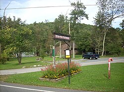
Greene Township is in eastern Franklin County, bordered to the east by Adams County. The township is bordered to the southwest by the borough of Chambersburg, the county seat. The primary settlement is the unincorporated community of Scotland in the center of the township. Fayetteville is located along the southern border of the township. Part of the Letterkenny Army Depot is in the west. Green Village and Culbertson are located between the Army Depot and Scotland.

The township is primarily in the Great Appalachian Valley, with the eastern portion climbing the slopes of South Mountain. Caledonia State Park is on the eastern edge of the township, and Michaux State Forest occupies much of the remaining portions of the mountain in the township.

Interstate 81 and U.S. Route 11 cross the township from north to south. Access to I-81 is from Exit 17 at the southern boundary and from Exit 20 at Scotland. US-11 passes through Green Village and leads south into Chambersburg and northeast to Shippensburg. U.S. Route 30 passes through the southeast corner of the township, serving Fayetteville and leading east to Gettysburg and west to Chambersburg.

According to the United States Census Bureau, the township has a total area of 57.3 square miles (148.4 km2), of which 0.01 square miles (0.03 km2), or 0.02%, is water. [6] The township is primarily drained by Conococheague Creek, which rises on South Mountain and enters the township at Caledonia Park, flowing west then south to Chambersburg and ultimately to the Potomac River. The northern corner of the township drains north via Rowe Run to Conodoguinet Creek, a tributary of the Susquehanna River.

Neighboring Townships

Communities

Demographics

Historical population
CensusPop.Note
2000 12,284
2010 16,70035.9%
2020 18,43610.4%
2016 (est.)17,554 [2] 5.1%
U.S. Decennial Census [7]

As of the census [8] of 2000, there were 12,284 people, 5,022 households, and 3,676 families residing in the township. The population density was 216.4 inhabitants per square mile (83.6/km2). There were 5,309 housing units at an average density of 93.5 per square mile (36.1/km2). The racial makeup of the township was 96.39% White, 1.54% African American, 0.08% Native American, 0.71% Asian, 0.10% Pacific Islander, 0.46% from other races, and 0.72% from two or more races. Hispanic or Latino of any race were 1.31% of the population.

There were 5,022 households, out of which 29.3% had children under the age of 18 living with them, 62.2% were married couples living together, 7.0% had a female householder with no husband present, and 26.8% were non-families. 22.8% of all households were made up of individuals, and 12.2% had someone living alone who was 65 years of age or older. The average household size was 2.45 and the average family size was 2.86.

In the township the population was spread out, with 22.9% under the age of 18, 6.5% from 18 to 24, 27.6% from 25 to 44, 25.3% from 45 to 64, and 17.7% who were 65 years of age or older. The median age was 40 years. For every 100 females, there were 94.4 males. For every 100 females age 18 and over, there were 91.2 males.

The median income for a household in the township was $44,380, and the median income for a family was $51,506. Males had a median income of $32,336 versus $25,675 for females. The per capita income for the township was $23,288. About 4.5% of families and 6.0% of the population were below the poverty line, including 7.6% of those under age 18 and 8.1% of those age 65 or over.

Related Research Articles

<span class="mw-page-title-main">Franklin County, Pennsylvania</span> County in Pennsylvania, United States

Franklin County is a county in the Commonwealth of Pennsylvania. As of the 2020 census, the population was 155,932. Its county seat is Chambersburg.

<span class="mw-page-title-main">West Burlington Township, Pennsylvania</span> Township in Pennsylvania, United States

West Burlington Township is a township in Bradford County, Pennsylvania. It is part of Northeastern Pennsylvania. The population was 696 at the 2010 census. Children residing in the township are assigned to attend the Troy Area School District.

<span class="mw-page-title-main">Ferguson Township, Clearfield County, Pennsylvania</span> Township in Pennsylvania, United States

Ferguson Township is a township in Clearfield County, Pennsylvania, United States. The population was 545 at the 2020 census.

<span class="mw-page-title-main">Upper Tyrone Township, Pennsylvania</span> Township in Pennsylvania, United States

Upper Tyrone Township is a township that is located in Fayette County, Pennsylvania, United States. The population was 1,768 at the time of the 2020 census. It is served by the Southmoreland School District.

<span class="mw-page-title-main">Antrim Township, Pennsylvania</span> Township in Pennsylvania, United States

Antrim Township is a township in Franklin County, Pennsylvania, United States. The population was 15,778 at the 2020 census, an increase over the figure of 12,504 tabulated in 2000. It was named after County Antrim in Northern Ireland.

<span class="mw-page-title-main">Fannett Township, Pennsylvania</span> Township in Pennsylvania, United States

Fannett Township is a township in Franklin County, Pennsylvania, United States. The population was 2,483 at the 2020 census. The township derives its name as an older variant spelling of Fanad, County Donegal, from early Irish settlement in the area. It was formed before 1762, and until about 1795 included the area now in Metal Township.

Fayetteville is an unincorporated community and census-designated place (CDP) in Franklin County, Pennsylvania, United States. The population was 3,208 at the 2020 census.

Guilford is a census-designated place (CDP) in Franklin County, Pennsylvania, United States. The population was 2,923 at the 2020 census.

<span class="mw-page-title-main">Guilford Township, Pennsylvania</span> Township in Pennsylvania, United States

Guilford Township is a township in Franklin County, Pennsylvania, United States. The population was 14,627 at the 2020 census, up from 13,100 at the 2000 census.

<span class="mw-page-title-main">Hamilton Township, Franklin County, Pennsylvania</span> Township in Pennsylvania, United States

Hamilton Township is a township in Franklin County, Pennsylvania, United States. The population was 11,374 at the 2020 census, up from 8,949 at the 2000 census.

<span class="mw-page-title-main">Letterkenny Township, Pennsylvania</span> Township in Pennsylvania, United States

Letterkenny Township is a township that is located in Franklin County, Pennsylvania, United States. The population was 2,462 at the time of the 2020 census, up from 2,074 at the 2000 census.

<span class="mw-page-title-main">Metal Township, Pennsylvania</span> Township in Pennsylvania, United States

Metal Township is a township that is located in Franklin County, Pennsylvania, United States. The population was 1,768 at the time of the 2020 census.

<span class="mw-page-title-main">Orrstown, Pennsylvania</span> Borough in Pennsylvania, United States

Orrstown is a borough in Franklin County, Pennsylvania, United States. The population was 214 at the 2020 census.

<span class="mw-page-title-main">Quincy Township, Pennsylvania</span> Township in Pennsylvania, United States

Quincy Township is a township that is located in Franklin County, Pennsylvania. The population was 5,318 at the time of the 2020 census, a decline from the figure of 5,541 that was tabulated during the 2010 census.

<span class="mw-page-title-main">Southampton Township, Franklin County, Pennsylvania</span> Township in Pennsylvania, United States

Southampton Township is a township that is located in Franklin County, Pennsylvania, United States. The population was 8,566 at the time of the 2020 census, an increase from the figure of 6,138 that was documented by the 2000 census.

<span class="mw-page-title-main">St. Thomas Township, Pennsylvania</span> Township in Pennsylvania, United States

<span class="mw-page-title-main">Franklin Township, Greene County, Pennsylvania</span> Township in Pennsylvania, United States

Franklin Township is a township in Greene County, Pennsylvania, United States. The population was 7,062 at the 2020 census, down from 7,280 at the 2010 census.

<span class="mw-page-title-main">Richhill Township, Greene County, Pennsylvania</span> Township in Pennsylvania, United States

Richhill Township is a township in Greene County, Pennsylvania, United States. The population was 773 at the 2020 census, down from 896 at the 2010 census. Ryerson Station State Park is a Pennsylvania state park on Duke Lake in the township.

<span class="mw-page-title-main">Green Township, Indiana County, Pennsylvania</span> Township in Pennsylvania, United States

Green Township is a township in Indiana County, Pennsylvania, United States. Green Township was formed from Wheatfield Township circa 1816 and was named for the great evergreen forests covering the area. The population was 3,457 at the 2020 census. The township includes the communities of Bencetown, Berringer, Commodore, Cookport, Cush Cushion, Dixonville, Fleming Summit, Grisemore, Leard, Lovejoy, Martintown, Pine Flats, Prosperity Hill, Purchase Line, Shanktown, Starford, Spruce, Utah, Uniontown, and Wandin.

<span class="mw-page-title-main">Chambersburg Area School District</span> School district in Pennsylvania

The Chambersburg Area School District is a public school district located in Franklin County, Pennsylvania. The district encompasses approximately 250 square miles, including the borough of Chambersburg, plus the townships of Hamilton, Greene, Lurgan, and Letterkenny, and a portion of Guilford Township. It operates the following schools: Andrew Buchanan Elementary, Guilford Hills Elementary, South Hamilton Elementary, Benjamin Chambers Elementary, Hamilton Heights Elementary, Thaddeus Stevens Elementary, Lurgan Elementary, Falling Spring Elementary, Grandview Elementary, Scotland Elementary, Marion Elementary, Fayetteville Elementary, New Franklin Elementary, Chambersburg Area Middle School South, Chambersburg Area Middle School North, Chambersburg Area Senior High School and the Chambersburg CareerTech Career Magnet School. In 2009, the US Census Bureau reported that the district' serves a resident population of 56,283 residents had a per capita incomes of $20,572, while the districts' median family income was $47,354 a year.

References

  1. "2016 U.S. Gazetteer Files". United States Census Bureau. Retrieved August 13, 2017.
  2. 1 2 "Population and Housing Unit Estimates" . Retrieved June 9, 2017.
  3. "Explore Census Data".
  4. M'Cauley, I. H. (1878). Historical Sketch of Franklin County, Pennsylvania. Patriot. p. 198.
  5. "National Register Information System". National Register of Historic Places . National Park Service. July 9, 2010.
  6. "Geographic Identifiers: 2010 Census Summary File 1 (G001), Greene township, Franklin County, Pennsylvania". American FactFinder. U.S. Census Bureau. Archived from the original on February 13, 2020. Retrieved August 9, 2016.
  7. "Census of Population and Housing". Census.gov. Retrieved June 4, 2016.
  8. "U.S. Census website". United States Census Bureau . Retrieved January 31, 2008.

40°01′00″N77°36′59″W / 40.01667°N 77.61639°W / 40.01667; -77.61639