Spring Run, Pennsylvania

Last updated

Spring Run, Pennsylvania
Unincorporated community
Spring Run PA house 3.JPG
House in Spring Run
USA Pennsylvania location map.svg
Red pog.svg
Spring Run
Usa edcp location map.svg
Red pog.svg
Spring Run
Coordinates: 40°8′31″N77°46′25″W / 40.14194°N 77.77361°W / 40.14194; -77.77361
Country United States
State Pennsylvania
County Franklin
Township Fannett
Elevation
840 ft (260 m)
Time zone UTC-5 (Eastern (EST))
  Summer (DST) UTC-4 (EDT)
ZIP code
17262
Area code 717
GNIS feature ID1188253 [1]

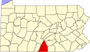
Spring Run is an unincorporated community in Fannett Township in Franklin County, Pennsylvania, United States. Spring Run is located at the intersection of state routes 75 and 641, west of Roxbury. [2]

Related Research Articles

<span class="mw-page-title-main">Franklin County, Pennsylvania</span> County in Pennsylvania, United States

Franklin County is a county in the Commonwealth of Pennsylvania. As of the 2020 census, the population was 155,932. Its county seat is Chambersburg.

<span class="mw-page-title-main">Fannett Township, Pennsylvania</span> Township in Pennsylvania, United States

Fannett Township is a township in Franklin County, Pennsylvania, United States. The population was 2,483 at the 2020 census. The township derives its name as an older variant spelling of Fanad, County Donegal, from early Irish settlement in the area. It was formed before 1762, and until about 1795 included the area now in Metal Township.

<span class="mw-page-title-main">Little Muncy Creek</span>

Little Muncy Creek is the major tributary of Muncy Creek in Lycoming and Sullivan Counties, Pennsylvania, United States. Via Muncy Creek and the West Branch Susquehanna River, it is part of the Susquehanna River drainage basin and waters from it flow ultimately into the Chesapeake Bay.

<span class="mw-page-title-main">Buchanan's Birthplace State Park</span>

Buchanan's Birthplace State Park is an 18.5-acre (7.5 ha) Pennsylvania state park near Cove Gap in Peters Township, Franklin County, Pennsylvania. The park is on Pennsylvania Route 16 along Tuscarora Mountain. Buchanan's Birthplace State Park was created from land donated to the state by Harriet Lane in honor of her uncle, the 15th President of the United States, James Buchanan.

Little Conococheague Creek is a 12.4-mile-long (20.0 km) tributary stream of the Potomac River in the U.S. states of Maryland and Pennsylvania. The stream rises on Two Top Mountain, west of the Whitetail Ski Resort in Franklin County, Pennsylvania, and proceeds south into Washington County, Maryland. It empties into the Potomac about 2 miles (3 km) southeast of Big Spring, Maryland. The watershed of the creek is 18 square miles (47 km2) and includes Indian Springs Wildlife Management Area. Tributaries include Toms Run.

<span class="mw-page-title-main">White Clay Creek Preserve</span> State park in Chester County, Pennsylvania

White Clay Creek Preserve is a 3,050-acre (1,230 ha) Pennsylvania state park along the valley of White Clay Creek in London Britain Township in Chester County, Pennsylvania in the United States. The park was donated by the DuPont Company in 1984 for the purpose of "preserving the diverse and unique plant and animal species, and the rich cultural heritage of the area". Dupont also donated an additional 528 acres (214 ha) for the adjoining White Clay Creek State Park to the state of Delaware. White Clay Creek Preserve is 3 miles (4.8 km) north of Newark, Delaware on Pennsylvania Route 896.

<span class="mw-page-title-main">Conewago Creek (west)</span> West tributary of the Susquehanna River in Pennsylvania, United States

Conewago Creek is an 80.2-mile-long (129.1 km) tributary of the Susquehanna River in Adams and York counties in Pennsylvania in the United States, with its watershed also draining a small portion of Carroll County, Maryland. The source is at an elevation of 1,440 feet (440 m), east of Caledonia State Park, in Franklin Township in Adams County. The mouth is the confluence with the Susquehanna River at York Haven in York County at an elevation of 259 feet (79 m).

<span class="mw-page-title-main">Ole Bull State Park</span>

Ole Bull State Park is a 132-acre (53 ha) Pennsylvania state park in Stewardson Township, Potter County, Pennsylvania in the United States. The park is located on Pennsylvania Route 144, 26 miles (42 km) north of Renovo and 18 miles (29 km) south of Galeton. Ole Bull State Park is in the Kettle Creek Valley, and is surrounded by Susquehannock State Forest. The woods surrounding the park are called the Black Forest because of its once dense tree cover.

<span class="mw-page-title-main">Denton Hill State Park</span> State park in Potter County, Pennsylvania

Denton Hill State Park is a 700-acre (283 ha) Pennsylvania state park in Ulysses Township, Potter County, Pennsylvania, in the United States. The park is a downhill skiing resort. Denton Hill State Park is on U.S. Route 6 between Coudersport and Galeton. In 2000 the park became part of the Hills Creek State Park complex, an administrative grouping of eight state parks in Potter and Tioga counties.

Schrader Creek is a tributary of Towanda Creek in Sullivan County and Bradford County, in Pennsylvania, in the United States. It is approximately 23.4 miles (37.7 km) long and flows through Fox Township in Sullivan County and Leroy Township, Franklin Township, and Monroe Township in Bradford County.

<span class="mw-page-title-main">Mont Alto State Park</span>

Mont Alto State Park is a Pennsylvania state park on 24 acres (9.7 ha) in Quincy Township, Franklin County, Pennsylvania in the United States. The park is on Pennsylvania Route 233 one mile from Mont Alto.

<span class="mw-page-title-main">Big Spring State Park (Pennsylvania)</span> State park in Perry County, Pennsylvania

Big Spring State Park is a 45-acre (18 ha) Pennsylvania state park in Toboyne Township, Perry County, Pennsylvania in the United States. The park is on Pennsylvania Route 274, 5.5 miles (8.9 km) southwest of New Germantown. Big Spring State Park is a hiking and picnic area. A partially completed railroad tunnel in Conococheague Mountain is a feature of the park.

<span class="mw-page-title-main">Fowlers Hollow State Park</span> State park in Perry County, Pennsylvania

Fowlers Hollow State Park is a 104-acre (42 ha) Pennsylvania state park in Toboyne Township, Perry County, Pennsylvania in the United States. The park is 0.25 miles (400 m) from Blain just off Pennsylvania Route 274. Fowlers Hollow State Park is on the site of a former sawmill, and was developed as a park by the Works Progress Administration during the Great Depression.

<span class="mw-page-title-main">Kooser State Park</span>

Kooser State Park is a 250-acre (101 ha) Pennsylvania state park in Jefferson Township, Somerset County, Pennsylvania, in the United States. The park, which borders Forbes State Forest, was built in the 1930s by the Civilian Conservation Corps, who also built the 4-acre (1.6 ha) Kooser Lake by damming Kooser Run. Kooser State Park is on Pennsylvania Route 31 a one-hour drive from Pittsburgh. The park is surrounded by Forbes State Forest.

<span class="mw-page-title-main">Pennsylvania Route 641</span> State highway in Pennsylvania, US

Pennsylvania Route 641 is a state route that is located in Central Pennsylvania in the United States. The route is 57.9 miles (93.2 km) long and runs from U.S. Route 522 near Shade Gap east to US 11/US 15 in Camp Hill.

<span class="mw-page-title-main">Pennsylvania Route 433</span> State highway in Franklin County, Pennsylvania, US

Pennsylvania Route 433 is a 9.1-mile-long (14.6 km) state highway located in Franklin County, Pennsylvania. The southern terminus is at U.S. Route 11 near Red Bridge. The northern terminus is at PA 997 in Lurgan Township. PA 433 is a two-lane undivided road that passes through farmland in northern Franklin County. The route passes to the east of the Letterkenny Army Depot before it crosses PA 997. The route heads northeast and north before curving northwest and crossing PA 533 in Orrstown. PA 433 continues northwest to its end at PA 997.

Pennsylvania State Game Lands Number 12 are Pennsylvania State Game Lands in Bradford County and Sullivan County, in Pennsylvania, in the United States. The game lands have an area of nearly 24,480 acres (9,910 ha) in Bradford County. The area is mainly mountainous and wooded and major streams in the area include Schrader Creek, Sugar Run, and Little Schrader Creek. Game animals within the game lands include black bear, gray squirrel, whitetail deer, and wild turkey. The main hardwood tree species include American basswood, American beech, black cherry, black birch, red maple, sugar maple, white ash, and aspen. The main conifer species include eastern hemlock, eastern larch, plantation Norway spruce, plantation red pine, and white pine.

<span class="mw-page-title-main">Welsh Run, Pennsylvania</span> Unincorporated community in Pennsylvania, United States

Welsh Run is an unincorporated community in Montgomery Township in Franklin County, Pennsylvania, United States. Welsh Run is located at the intersection of state routes 416 and 995, southeast of Mercersburg.

Dry Run is an unincorporated community in Fannett Township in Franklin County, Pennsylvania, United States. Dry Run is located at the intersection of Pennsylvania Route 75 and Back Road.

Middle Spring Creek is a 7.2-mile-long (11.6 km) tributary of the Conodoguinet Creek in Franklin and Cumberland counties in Pennsylvania in the United States.

References

  1. "Spring Run". Geographic Names Information System . United States Geological Survey, United States Department of the Interior.
  2. Franklin County, Pennsylvania Highway Map (PDF) (Map). PennDOT. 2015. Retrieved January 2, 2016.