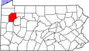
Warren County is a county in the Commonwealth of Pennsylvania. As of the 2020 census, the population was 38,587. Its county seat is Warren. The county was established in 1800 from parts of Allegheny and Lycoming counties; attached to Crawford County until 1805 and then to Venango County until Warren was formally established in 1819.

Venango County is a county in the Commonwealth of Pennsylvania. As of the 2020 census, the population was 50,454. Its county seat is Franklin. The county was created in 1800 and later organized in 1805.

Forest County is a county in the Commonwealth of Pennsylvania. As of the 2020 census, the population was 6,973, making it the third-least populous county in Pennsylvania. Its county seat is Tionesta. The county was created in 1848 and later organized in 1857.

French Creek is a town in Chautauqua County, New York, United States. The population was 997 at the 2020 census. The town is named after the stream flowing through it, which ultimately flows to the Allegheny River in Pennsylvania. The town of French Creek is located in the far southwestern corner of the state.

Bethel Township is a township in Armstrong County, Pennsylvania, United States. The population was 1,096 at the 2020 census, a decrease from the figure of 1,183 tabulated in 2010.

Hovey Township is a township which is located in far northern Armstrong County, Pennsylvania, United States. The population was seventy-four at the time of the 2020 census, a decrease from the figure of 97 tabulated in 2010.

Venango Township is a township in Butler County, Pennsylvania, United States. The population was 869 at the 2020 census.

Foxburg is a borough in Clarion County, Pennsylvania, United States. It is located along the east bank of the Allegheny River, about 2 miles (3 km) north of the mouth of the Clarion River. As of the 2020 census it had a population of 181.

Richland Township is a township in Clarion County, Pennsylvania, United States. The population was 473 at the 2020 census, a decrease from the figure of 494 tabulated in 2010.
Salem Township is a township in Clarion County, Pennsylvania, United States. The population was 901 at the 2020 census, an increase from the figure of 881 tabulated in 2010.

Oil Creek Township is a township in Crawford County, Pennsylvania, United States. The population was 1,708 at the 2020 census, a decrease from 1,877 at the 2010 census.

Townville is a borough in Crawford County, Pennsylvania, United States. The population was 328 at the 2020 census, up from 323 at the 2010 census.

Wattsburg is a borough in Erie County, Pennsylvania, United States. The population was 352 at the 2020 census. It is part of the Erie Metropolitan Statistical Area.
Tionesta Township is a township in Forest County, Pennsylvania, United States. The population was 739 at the time of the 2020 census, up from the total of 729 that was documented by the 2010, up from 610 at the 2000 census.

Franklin is a city and the county seat of Venango County, Pennsylvania. The population was 6,097 in the 2020 census. Franklin is part of the Oil City, PA Micropolitan Statistical Area.

Oil City is a city in Venango County, Pennsylvania, United States. Known for its prominence in the initial exploration and development of the petroleum industry, it is located at a bend in the Allegheny River at the mouth of Oil Creek.

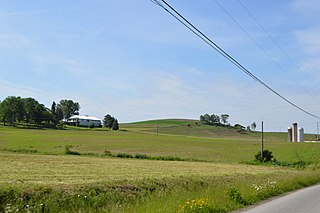
President Township is a township in Venango County, Pennsylvania, United States. The population was 451 at the 2020 census, a decrease from 540 in 2010, which represented, in turn, a decrease from the figure of 543 at the 2000 census. It is located at the confluence of the Hemlock Creek and Allegheny River, and is largely made up of seasonal/recreational camps and cottages, which are situated near state gamelands.
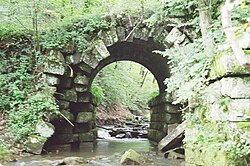
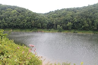
Rockland Township is a township in Venango County, Pennsylvania, United States. The population was 1,245 at the 2020 census. The township is quite remote, containing one general store, a Methodist church, and a volunteer fire department. A place of interest is Freedom Falls, where a waterfall and old iron furnace can be found.
The Kennerdell Bridge is a girder bridge connecting Rockland Township and Clinton Township in Venango County, Pennsylvania that serves the tiny village of Kennerdell. Originally, a 1907 truss bridge stood on this site. It was rehabilitated in 1981, but ultimately replaced in 2000. Only about 250 cars use the bridge each day
Hannasville is a census-designated place located in Canal Township, Venango County, in the state of Pennsylvania. The community is located along U.S. Route 322. As of the 2010 census the population was 176.