Polk, Pennsylvania

Last updated

Polk, Pennsylvania
Polk State School and Hospital Administration Building, April 2013.jpg
Polk State School Administration Building
Venango County Pennsylvania Incorporated and Unincorporated areas Polk Highlighted.svg
Location of Polk in Venango County, Pennsylvania.
USA Pennsylvania location map.svg
Red pog.svg
Polk, Pennsylvania
Coordinates: 41°22′18″N79°55′46″W / 41.37167°N 79.92944°W / 41.37167; -79.92944
Country United States
State Pennsylvania
County Venango
Settled1839
Incorporated1886
Government
  TypeBorough Council
   Mayor Larry Allen Boyle (Libertarian) [1]
Area
[2]
  Total
2.04 sq mi (5.28 km2)
  Land2.03 sq mi (5.25 km2)
  Water0.01 sq mi (0.03 km2)
Population
 (2020) [3]
  Total
634
  Density312.62/sq mi (120.73/km2)
Time zone UTC-5 (Eastern (EST))
  Summer (DST) UTC-4 (EDT)
Zip code
16342
Area code 814
FIPS code 42-61936

Polk is a borough in Venango County, Pennsylvania, United States. The population was 703 at the 2020 census. [4]

Contents

Polk State Center, a state-run facility for the intellectually disabled, was opened in 1897 and is located in the borough. In 2019, Pennsylvania announced a plan to close the facility. [5] Families and residents sued Pennsylvania in an attempt to prevent the closure. [6]

Geography

Polk (pronounced poke) is located at 41°22′18″N79°55′46″W / 41.37167°N 79.92944°W / 41.37167; -79.92944 (41.371532, -79.929445). [7]

According to the United States Census Bureau, the borough has a total area of 2.0 square miles (5.2 km2), of which 1.9 square miles (4.9 km2) is land and 0.51% is water.

Demographics

Historical population
CensusPop.Note
1900 1,037
1910 2,06699.2%
1920 2,66228.8%
1930 3,33725.4%
1940 3,69010.6%
1950 4,0048.5%
1960 3,574−10.7%
1970 3,6732.8%
1980 1,884−48.7%
1990 1,267−32.7%
2000 1,031−18.6%
2010 816−20.9%
2020 703−13.8%
2021 (est.)698 [4] −0.7%
Sources: [8] [9] [10]

As of the census [9] of 2000, there were 1,031 people, 196 households, and 127 families residing in the borough. The population density was 531.0 inhabitants per square mile (205.0/km2). There were 209 housing units at an average density of 107.6 per square mile (41.5/km2). The racial makeup of the borough was 96.22% White, 2.72% African American, 0.19% Native American, 0.29% Asian, 0.39% from other races, and 0.19% from two or more races.

There were 196 households, out of which 32.1% had children under the age of 18 living with them, 49.5% were married couples living together, 9.7% had a female householder with no husband present, and 35.2% were non-families. 33.2% of all households were made up of individuals, and 11.2% had someone living alone who was 65 years of age or older. The average household size was 2.34 and the average family size was 2.95.

In the borough the population was spread out, with 11.6% under the age of 18, 3.2% from 18 to 24, 31.0% from 25 to 44, 37.1% from 45 to 64, and 17.1% who were 65 years of age or older. The median age was 46 years. For every 100 females there were 102.6 males. For every 100 females age 18 and over, there were 99.8 males.

The median income for a household in the borough was $33,929, and the median income for a family was $38,438. Males had a median income of $22,273 versus $31,875 for females. The per capita income for the borough was $12,963. About 3.1% of families and 35.0% of the population were below the poverty line, including 1.7% of those under age 18 and 42.5% of those age 65 or over.

Related Research Articles

<span class="mw-page-title-main">Crawford County, Pennsylvania</span> County in Pennsylvania, United States

Crawford County is a county in the Commonwealth of Pennsylvania. As of the 2020 census, the population was 83,938. Its county seat is Meadville. The county was created on March 12, 1800, from part of Allegheny County and named for Colonel William Crawford. The county is part of the Northwest Pennsylvania region of the state.

<span class="mw-page-title-main">Mercer Township, Pennsylvania</span> Township in Pennsylvania, United States

Mercer Township is a township in Butler County, Pennsylvania, United States. The population was 1,010 at the 2020 census.

<span class="mw-page-title-main">Venango Township, Butler County, Pennsylvania</span> Township in Pennsylvania, United States

Venango Township is a township that is located in Butler County, Pennsylvania, United States. The population was 869 at the time of the 2020 census.

<span class="mw-page-title-main">Ashland Township, Pennsylvania</span> Township in Pennsylvania, United States

Ashland Township is a township in Clarion County, Pennsylvania, United States. The population was 1,116 at the 2020 census, an increase from the figure of 1,114 tabulated in 2010.

<span class="mw-page-title-main">Elk Township, Clarion County, Pennsylvania</span> Township in Pennsylvania, United States

Elk Township is a township in Clarion County, Pennsylvania, United States. The population was 1,433 at the 2020 census, a decrease from the figure of 1,490 tabulated in 2010.

<span class="mw-page-title-main">Richland Township, Clarion County, Pennsylvania</span> Township in Pennsylvania, United States

Richland Township is a township in Clarion County, Pennsylvania, United States. The population was 473 at the 2020 census, a decrease from the figure of 494 tabulated in 2010.

<span class="mw-page-title-main">Blooming Valley, Pennsylvania</span> Borough in Pennsylvania, United States

Blooming Valley is a borough in Crawford County, Pennsylvania, United States. The population was 342 at the 2020 census, up from 337 at the 2010 census.

<span class="mw-page-title-main">Saegertown, Pennsylvania</span> Borough in Pennsylvania, United States

Saegertown is a borough in Crawford County, Pennsylvania. The population was 869 at the time of the 2020 census, down from 997 at the 2010 census. It was established in 1824.

<span class="mw-page-title-main">Townville, Pennsylvania</span> Borough in Pennsylvania, United States

Townville is a borough in Crawford County, Pennsylvania, United States. The population was 326 at the 2020 census, up from 323 at the 2010 census.

<span class="mw-page-title-main">Venango, Pennsylvania</span> Borough in Pennsylvania, United States

Venango is a borough in Crawford County, Pennsylvania, United States. The population was 210 at the 2020 census, down from 239 at the 2010 census, down from 288 in 2000.

<span class="mw-page-title-main">Venango Township, Crawford County, Pennsylvania</span> Township in Pennsylvania, United States

Venango Township is a township in Crawford County, Pennsylvania, United States. The population was 941 at the 2020 census, down from 997 at the 2010 census.

<span class="mw-page-title-main">Wayne Township, Crawford County, Pennsylvania</span> Township in Pennsylvania, United States

Wayne Township is a township in Crawford County, Pennsylvania, United States. The population was 1,409 at the 2020 census, down from 1,539 at the 2010 census.

<span class="mw-page-title-main">McKean, Pennsylvania</span> Borough in Pennsylvania, United States

McKean is a borough in Erie County, Pennsylvania. The population was 475 at the time of the 2020 census. It is part of the Erie–Meadville combined statistical area. McKean was known as "Middleboro" until it officially changed its name in 1970.
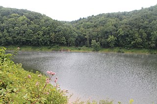
<span class="mw-page-title-main">Tionesta Township, Forest County, Pennsylvania</span> Township in Pennsylvania, United States

Tionesta Township is a township in Forest County, Pennsylvania, United States. The population was 666 at the time of the 2020 census, up from the total of 729 that was documented by the 2010, up from 610 at the 2000 census.

<span class="mw-page-title-main">Barkeyville, Pennsylvania</span> Borough in Pennsylvania, United States

Barkeyville is a borough in Venango County, Pennsylvania, United States. The population was 186 at the 2020 census.

<span class="mw-page-title-main">Clintonville, Pennsylvania</span> Borough in Pennsylvania, United States

Clintonville is a borough in Venango County, Pennsylvania, United States. The population was 437 at the 2020 census.

<span class="mw-page-title-main">Cooperstown, Pennsylvania</span> Borough in Pennsylvania, United States

Cooperstown is a borough in Venango County, Pennsylvania, United States. The population was 460 at the 2010 census.

<span class="mw-page-title-main">Rouseville, Pennsylvania</span> Borough in Pennsylvania, United States

Rouseville is a borough in Venango County, Pennsylvania, United States. The population was 456 at the 2020 census.

<span class="mw-page-title-main">Sugarcreek, Pennsylvania</span> Borough in Pennsylvania, United States

Sugarcreek is a borough in Venango County, Pennsylvania, United States. The population was 4,824 at the 2020 census. It is the largest borough by total area in all Venango County.

<span class="mw-page-title-main">Utica, Pennsylvania</span> Borough in Pennsylvania, United States

Utica is a borough that is located in Venango County, Pennsylvania, United States. The population was 184 at the time of the 2020 census.

References

  1. "2009 Libertarian Party of Pennsylvania Candidates". Libertarian Party . Retrieved December 26, 2016.
  2. "ArcGIS REST Services Directory". United States Census Bureau. Retrieved October 16, 2022.
  3. "Census Population API". United States Census Bureau. Retrieved October 12, 2022.
  4. 1 2 "City and Town Population Totals: 2020-2021". Census.gov. US Census Bureau. Retrieved July 17, 2022.
  5. Tribune, Meadville. "State announces plan to close Polk State Center in Venango County". Meadville Tribune. Retrieved February 18, 2022.
  6. Brubaker, Harold. "Residents sue Pennsylvania over closing of state centers for developmentally disabled". Philadelphia Inquirer. Retrieved April 15, 2022.
  7. "US Gazetteer files: 2010, 2000, and 1990". United States Census Bureau. February 12, 2011. Retrieved April 23, 2011.
  8. "Census of Population and Housing". U.S. Census Bureau. Retrieved December 11, 2013.
  9. 1 2 "U.S. Census website". United States Census Bureau . Retrieved January 31, 2008.
  10. "Incorporated Places and Minor Civil Divisions Datasets: Subcounty Resident Population Estimates: April 1, 2010 to July 1, 2012". Population Estimates. U.S. Census Bureau. Archived from the original on June 11, 2013. Retrieved December 11, 2013.