
New Hope is a borough in Bucks County, Pennsylvania, United States. The population was 2,612 at the 2020 census. New Hope is located approximately 30 mi (48 km) north of Philadelphia, and lies on the west bank of the Delaware River at its confluence with Aquetong Creek. New Hope and neighboring Solebury and Upper Makefield townships are part of the Philadelphia metropolitan area. The two-lane New Hope–Lambertville Bridge carries automobile and foot traffic across the Delaware to Lambertville, New Jersey, on the east bank. New Hope's primary industry is tourism.

State College is a home rule municipality in Centre County, Pennsylvania, United States. It is a college town, dominated economically, culturally, and demographically by the presence of the University Park campus of The Pennsylvania State University.

Downingtown is a borough in Chester County, Pennsylvania, United States, 33 miles (53 km) west of Philadelphia. As of the 2020 census, it had a population of 7,898. Downingtown was settled by European colonists in 1716 and has a number of historic buildings and structures.
Haverford Township is a home rule municipality township in Delaware County, Pennsylvania, United States. Haverford is named after the town of Haverfordwest in Wales. It is a commuting suburb located due west of Philadelphia and is officially known as the Township of Haverford. Despite being under a home rule charter since 1977, it continues to operate under a Board of Commissioners divided into wards, as do "First Class" townships that are still under the Pennsylvania Township Code. Haverford Township was founded in 1682 and incorporated in 1911.

Upper Darby Township, often shortened to Upper Darby, is a home rule township in Delaware County, Pennsylvania, United States. As of the 2020 census, the township had a total population of 85,681, making it the state's sixth-most populated municipality after Philadelphia, Pittsburgh, Allentown, Reading, and Erie. Upper Darby borders Philadelphia, the nation's sixth-most populous city, and constitutes part of the Delaware Valley, also known as the Philadelphia metropolitan area, the nation's seventh-largest metropolitan area.

Palmyra is a borough in Lebanon County, Pennsylvania, United States. It is part of the Lebanon, Pennsylvania Metropolitan Statistical Area. The population was 7,807 at the 2020 census.

Ardmore is an unincorporated community and census-designated place (CDP) spanning the border between Delaware and Montgomery counties in the U.S. state of Pennsylvania. The population was 12,455 at the time of the 2010 census and had risen to 13,566 in the 2020 census.
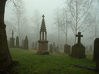
Kirkburton is a village, civil parish and ward in Kirklees in West Yorkshire, England. It is 5 miles (8 km) south-east of Huddersfield. Historically part of the West Riding of Yorkshire, the township comprised the villages of Kirkburton and Highburton and several hamlets, including Thunder Bridge, Thorncliffe, Storthes Hall and Linfit. According to the 2011 census the civil parish had a population of 26,439, while the village had a population of 4,299.

Stanstead is a town in the Memphrémagog Regional County Municipality in the Estrie region of Quebec, located on the Canada–United States border across from Derby Line, Vermont.
Messiah University is a private interdenominational evangelical Christian university in Mechanicsburg, Pennsylvania.

Mississippi Mills is a town in eastern Ontario, Canada, in Lanark County on the Mississippi River. It is made up of the former Townships of Ramsay and Pakenham, as well as the Town of Almonte. It is partly located within Canada's National Capital Region.

Manayunk is a neighborhood in the section of Lower Northwest Philadelphia in the state of Pennsylvania. Located adjacent to the neighborhoods of Roxborough and Wissahickon and also on the banks of the Schuylkill River, Manayunk contains the first canal begun in the United States.

Wayne is an unincorporated community centered in Delaware County, Pennsylvania, United States, on the Main Line, a series of highly affluent Philadelphia suburbs located along the railroad tracks of the Pennsylvania Railroad and one of the wealthiest areas in the nation. While the center of Wayne is in Radnor Township, Wayne extends into both Tredyffrin Township in Chester County and Upper Merion Township in Montgomery County. The center of Wayne was designated the Downtown Wayne Historic District in 2012. Considering the large area served by the Wayne post office, the community may extend slightly into Easttown Township, Chester County, as well.

Rosemont is a neighborhood and census-designated place in Pennsylvania, on the Philadelphia Main Line. Partly in Lower Merion Township in Montgomery County and partly in Radnor Township in Delaware County, it is best known as the home of Rosemont College. It is the location of the 1894 gothic-revival Anglo-Catholic Church of the Good Shepherd.

Edwardsburgh/Cardinal is a township in the United Counties of Leeds and Grenville of eastern Ontario, Canada. Edwardsburgh township was first surveyed in 1783, and incorporated in 1850. The township was part of the historical Grenville County before it merged with Leeds County to form the United Counties in the 19th century.

Augusta Township is a township in the United Counties of Leeds and Grenville, located in eastern Ontario, Canada. Augusta is situated along the Saint Lawrence River, and extends back into rural hamlets. The township is located between the city of Brockville to the west, and the town of Prescott to the east.
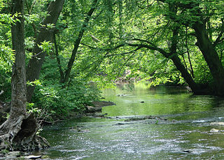
Carversville is an unincorporated community and geographically isolated area in Solebury Township, Bucks County, Pennsylvania, United States, approximately 45 miles north of Philadelphia. It was originally a Lenape gathering placed called Aquetong more than 300 years ago the area's land was granted to James Harrison and Joseph Pike by William Penn. The Paunacussing Creek also called Fleecydale runs through Carversville and meets the Delaware River at Lumberville.
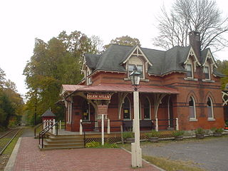
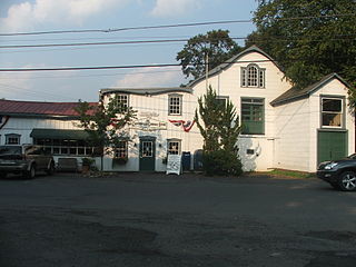
Glen Mills is an unincorporated community in Concord Township, Delaware County, Pennsylvania, United States, located approximately 27 miles west of Philadelphia. The ZIP Code for Glen Mills is 19342.

Parkwood is a neighborhood located in the Far Northeast section of Philadelphia, Pennsylvania, United States. The neighborhood's boundaries include the Byberry East Industrial Park to the north and northwest, Poquessing Creek to the east, Knights Road to the southeast and Woodhaven Road to the southwest. The neighborhood was developed by Hyman Korman in the 1960-1962 as a planned residential community. The predominant housing type is the brick row house. The Parkwood Shopping Center is a local shopping destination, while the Philadelphia Mills mall is a regional shopping destination on Knights Road to the east of Parkwood's residential area.

Green Park, an unincorporated village located in northeastern Tyrone Township, Perry County, Pennsylvania, United States, sits at the intersection of state routes 233 and 274. The name was given to a local land tract by James Baxter in the late 1700s and made popular as an unofficial moniker for mid- to late-1800s picnic and camp meeting grounds located at the upper end of Stambaugh Farm Run. The town serves as Perry County's midpoint between the Conococheague Mountain in the west and the Susquehanna River to the east.


