Nicholson, Pennsylvania

Last updated
Borough of Nicholson
TunkhannockViaductFromAir.jpg
Aerial view of Nicholson and Tunkhannock Viaduct
Motto: 
Population 1,000. Hospitality for 1,000,000
Wyoming County Pennsylvania Incorporated and Unincorporated areas Nicholson Highlighted.svg
Location of Nicholson in Wyoming County, Pennsylvania
USA Pennsylvania location map.svg
Red pog.svg
Nicholson
Location of Nicholson in Pennsylvania
Usa edcp location map.svg
Red pog.svg
Nicholson
Nicholson (the United States)
Coordinates: 41°37′30″N75°46′59″W / 41.62500°N 75.78306°W / 41.62500; -75.78306
CountryUnited States
StatePennsylvania
County Wyoming
FoundedAugust 23, 1875
Government
  MayorCharles H. Litwin Jr.
  Council PresidentDawn Bell
Area
[1]
  Total1.17 sq mi (3.04 km2)
  Land1.16 sq mi (3.00 km2)
  Water0.02 sq mi (0.04 km2)
Elevation
728 ft (222 m)
Population
 (2020) [2]
  Total696
  Density601.04/sq mi (231.99/km2)
Time zone UTC-5 (EST)
  Summer (DST) UTC-4 (EDT)
ZIP Code
18446
Area code 570
FIPS code 42-54400
Website www.nicholsonborough.org

Nicholson is a borough in Wyoming County, Pennsylvania. The population was 698 at the 2020 census. [3]

Contents

History

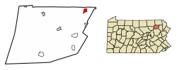
The borough of Nicholson was incorporated on August 23, 1875 and was named after John Nicholson, who had been Pennsylvania's comptroller general in the late 1700s. [4]

The town of Nicholson attracted national attention during the final week of July 1986, when an escaped Bengal tiger was hunted in the area for several days. [5] Despite air and ground searches by state police and zoo officials, the animal was never found. [6] [7]

Geography

Nicholson is located at 41°37′30″N75°46′59″W / 41.62500°N 75.78306°W / 41.62500; -75.78306 (41.624983, -75.783054). [8] According to the U.S. Census Bureau, the borough has a total area of 1.2 square miles (3.1 km2), of which 1.2 square miles (3.1 km2) is land and 0.01 square miles (0.026 km2) (0.83%) is water.

Demographics

Historical population
CensusPop.Note
1880 586
1890 73425.3%
1900 89321.7%
1910 852−4.6%
1920 842−1.2%
1930 93210.7%
1940 731−21.6%
1950 569−22.2%
1960 68620.6%
1970 87727.8%
1980 9457.8%
1990 857−9.3%
2000 713−16.8%
2010 7677.6%
2020 698−9.0%
2021 (est.)697 [3] −0.1%
Sources: [9] [10] [11] [2]

As of the census [12] of 2010, there were 767 people, 302 households, and 195 families residing in the borough. The population density was 639.2 inhabitants per square mile (246.8/km2). There were 343 housing units at an average density of 285.8 per square mile (110.3/km2). The racial makeup of the borough was 97% White, 0.1% African American, 0.1% Native American, 0.1% Pacific Islander, 0.1% some other race, and 2.5% from two or more races. Hispanic or Latino of any race were 1.4% of the population.

There were 302 households, out of which 29.1% had children under the age of 18 living with them, 48.7% were married couples living together, 11.3% had a female householder with no husband present, and 35.4% were non-families. 28.5% of all households were made up of individuals, and 16.9% had someone living alone who was 65 years of age or older. The average household size was 2.54 and the average family size was 3.15.

In the borough, the population was spread out, with 25% under the age of 18, 58.3% from 18 to 64, and 16.7% who were 65 years of age or older. The median age was 37 years.

The median income for a household in the borough was $38,650, and the median income for a family was $40,833. Males had a median income of $38,889 versus $27,813 for females. The per capita income for the borough was $21,449. About 24% of families and 24.8% of the population were below the poverty line, including 41% of those under age 18 and 10.5% of those age 65 or over.

Government

The town has a weak mayor - strong council form of government.

Mayor

Charles Litwin Jr.Republican

Council

Council MemberTerm ExpiresParty
Nathan Harpster2025Democratic
John Kiryluk2025Republican
John Decker2025Republican
Albert Olive2023Republican
Joan Irion Jenkins2025Republican
David Noakes2023Republican
John Bower2023Republican

Tunkhannock Viaduct

Aerial view of the Tunkhannock Viaduct Aerial View of Tunkhannock Viaduct.jpg
Aerial view of the Tunkhannock Viaduct

A local landmark, the Tunkhannock Viaduct, Tunkhannock Creek Viaduct or "Nicholson Bridge" has been a focal point of the Nicholson community since its completion in 1915. [13] Built by the Delaware, Lackawanna & Western Railroad between 1912 and 1915, the bridge has served many owners: DL&W, Erie Lackawanna, Conrail, Delaware & Hudson [also operated by Guilford Transportation, and New York Susquehanna & Western] before the current owner, Norfolk Southern Railway. Norfolk Southern trains operate over it daily between Binghamton and several other New York state locations, along with rail yards in Pennsylvania such as Scranton, Allentown and Harrisburg. Each year the town organizes a festival in honor of the bridge called Nicholson Bridge Day. The entire main street of the town is shut down and filled with vendors, entertainment, and more.


Notable people

Related Research Articles

<span class="mw-page-title-main">Wyoming County, Pennsylvania</span> County in Pennsylvania, United States

Wyoming County is a county in the Commonwealth of Pennsylvania. As of the 2020 census, the population was 26,069. Its county seat is Tunkhannock. It was created in 1842 from part of Luzerne County. The county is part of the Northeast Pennsylvania region of the state.

<span class="mw-page-title-main">Towanda, Pennsylvania</span> Borough in Pennsylvania, United States

Towanda is a borough in, and the county seat of, Bradford County in the U.S. state of Pennsylvania. It is part of Northeastern Pennsylvania and is located 66 miles (106 km) northwest of Wilkes-Barre, on the Susquehanna River. The name means "burial ground" in the Algonquian language. As of the 2020 census, the population of Towanda was 2,833.

<span class="mw-page-title-main">Curtin Township, Centre County, Pennsylvania</span> Township in Pennsylvania, United States

Curtin Township is a township in Centre County, Pennsylvania, United States. It is part of the State College, Pennsylvania Metropolitan Statistical Area. The population was 500 at the 2020 census.

<span class="mw-page-title-main">Clarks Green, Pennsylvania</span> Borough in Pennsylvania, United States

Clarks Green is a borough in Lackawanna County, Pennsylvania, United States. It is part of Northeastern Pennsylvania. The population was 1,529 at the 2020 census.

<span class="mw-page-title-main">Dalton, Pennsylvania</span> Borough in Pennsylvania, United States

Dalton is a borough in Lackawanna County, Pennsylvania, United States. It is part of Northeastern Pennsylvania and is located approximately eight miles north of the city of Scranton in a suburban area known as "the Abingtons." Dalton is also approximately three miles north of Clarks Summit, the hub of the Abington community. The population was 1,283 at the 2020 census.

<span class="mw-page-title-main">Dickson City, Pennsylvania</span> Borough in Lackawanna County, Pennsylvania, United States

Dickson City is a borough in Lackawanna County, Pennsylvania, 4 miles (6 km) north of Scranton. Coal mining was an important industry in the past. The borough's population peaked at 12,395 in 1930 and was 6,051 at the 2020 census.

Glenburn is a census-designated place (CDP) in Glenburn Township, Lackawanna County, Pennsylvania, United States. The population was 953 at the 2010 census. It is approximately 10 miles (16 km) north of downtown Scranton, in the growing suburban area known as the "Abingtons". Glenburn is located north of Clarks Summit and south of Dalton.

<span class="mw-page-title-main">Jermyn, Pennsylvania</span> Borough in Pennsylvania, United States

Jermyn, known as "The Birthplace of First Aid in America", is a borough which is located in Lackawanna County, Pennsylvania, United States. Located on the Lackawanna River, it is 12 miles (19 km) northeast of Scranton.

<span class="mw-page-title-main">Jessup, Pennsylvania</span> Borough in Pennsylvania, United States

Jessup is a borough in Lackawanna County, Pennsylvania, United States. The population was 4,532 at the 2020 census.

<span class="mw-page-title-main">Mayfield, Pennsylvania</span> Borough in Pennsylvania, United States

Mayfield is a borough in Lackawanna County, Pennsylvania, United States, approximately 14 miles (23 km) northeast of Scranton. In the past, it contained a silk mill and a coal mining industry. The population was 1,763 at the 2020 census.

<span class="mw-page-title-main">Moscow, Pennsylvania</span> Borough in Pennsylvania, United States

Moscow is a borough in Lackawanna County, Pennsylvania, United States. The population was 2,039 at the 2020 census. It is located 11 miles (18 km) southeast of Scranton and 24 miles (39 km) southwest of Honesdale.

<span class="mw-page-title-main">Olyphant, Pennsylvania</span> Borough in Pennsylvania, United States

Olyphant is a borough in Lackawanna County, Pennsylvania, United States. It is six miles (10 km) northeast of downtown Scranton, on the Lackawanna River in the heart of the anthracite region of the state. Its main source of employment was the mining and shipping of coal. It was the headquarters of the Lackawanna Coal Company. Other industries of the past were the manufacturing of blasting powder, iron and steel goods, cigars, and silks. Olyphant experienced a severe downturn in the 1950s. There was once a thriving garment industry with numerous dress factories in the downtown area. There was also a slaughterhouse. Until 2018, the biggest industry was Cinram the manufacture of compact discs (CD) and digital video discs (DVD). The population was 5,395 at the 2020 census.

<span class="mw-page-title-main">Scott Township, Lackawanna County, Pennsylvania</span> Place in Pennsylvania, United States

Scott Township is a township in the north central area of Lackawanna County, Pennsylvania, United States. As of the 2020 census, it had a population of 4,641.

<span class="mw-page-title-main">Taylor, Pennsylvania</span> Borough in Pennsylvania, United States

Taylor is a borough in Lackawanna County, Pennsylvania, United States, 3 miles (5 km) southwest of Scranton on the Lackawanna River. It was founded in 1790 by Cornelius Atherton. Silk manufacturing and coal mining were once practiced in the borough. Most of Taylor is built over abandoned mines. The Pennsylvania Turnpike Northeast Extension (I-476), accessible via the Keyser Avenue Interchange, passes through Taylor, going north to Clarks Summit and south to Philadelphia.

<span class="mw-page-title-main">Stoneboro, Pennsylvania</span> Borough in Pennsylvania, United States

Stoneboro is a borough in eastern Mercer County, Pennsylvania, United States. The population was 946 at the 2020 census. It is part of the Hermitage micropolitan area.

<span class="mw-page-title-main">Bridgewater Township, Pennsylvania</span> Township in Pennsylvania, United States

Bridgewater Township is a township in Susquehanna County, Pennsylvania, United States. The population was 2,582 at the 2020 census, but is now estimated to be 2,754.

<span class="mw-page-title-main">Susquehanna Depot, Pennsylvania</span> Borough in Pennsylvania, United States

Susquehanna Depot, often referred to simply as Susquehanna, is a borough in Susquehanna County, Pennsylvania, United States, located on the Susquehanna River 23 miles (37 km) southeast of Binghamton, New York. In the past, railroad locomotives and railroad cars were made here. It is also known for its Pennsylvania Bluestone quarries.

<span class="mw-page-title-main">Factoryville, Pennsylvania</span> Borough in Pennsylvania, United States

Factoryville is a borough in Wyoming County, Pennsylvania, United States. The population was 1,146 at the 2020 census.

<span class="mw-page-title-main">Tunkhannock, Pennsylvania</span> Borough in Pennsylvania, United States

Tunkhannock is a borough and county seat of Wyoming County, Pennsylvania, 31 miles northwest of Wilkes-Barre. In the past, lumbering was carried on extensively. Today, many residents are employed by the Procter & Gamble plant in nearby Washington Township. As of the 2020 census, the borough population was 1,766. Tunkhannock is in the Scranton–Wilkes-Barre–Hazleton, PA Metropolitan Statistical Area.

<span class="mw-page-title-main">Codorus Township, Pennsylvania</span> Township in Pennsylvania, United States

Codorus Township is a township in York County, Pennsylvania, United States. The population was 3,898 at the 2020 census.

References

  1. "ArcGIS REST Services Directory". United States Census Bureau. Retrieved October 12, 2022.
  2. 1 2 "Census Population API". United States Census Bureau. Retrieved Oct 12, 2022.
  3. 1 2 Bureau, US Census. "City and Town Population Totals: 2020—2021". Census.gov. US Census Bureau. Retrieved August 5, 2022.
  4. "Nicholson – Nicholson Heritage Association".
  5. Daily Herald (Chicago) "Bengal tiger on the loose," (July 28, 1986, p7); "Tiger loose in Pennsylvania mountains?" (July 29, 1986, p3)
  6. The Indiana (Pa.) Gazette "Tiger may be stray pet, caller says," (July 30, 1986, p29) "Calls, leads in Gibson tiger hunt die down," (July 31, 1986, p3)
  7. Tyrone (Pa.) Daily Herald (UPI) "Was The Loose Tiger A Pet Which Finally Went Home?" (August 1, 1986, p1).
  8. "US Gazetteer files: 2010, 2000, and 1990". United States Census Bureau. 2011-02-12. Retrieved 2011-04-23.
  9. "Census of Population and Housing". U.S. Census Bureau. Retrieved 11 December 2013.
  10. "U.S. Census website". United States Census Bureau . Retrieved 2008-01-31.
  11. "Incorporated Places and Minor Civil Divisions Datasets: Subcounty Resident Population Estimates: April 1, 2010 to July 1, 2012". Population Estimates. U.S. Census Bureau. Archived from the original on 11 June 2013. Retrieved 11 December 2013.
  12. "U.S. Census website". United States Census Bureau . Retrieved 2011-05-14.
  13. "Tunkhannock Creek Viaduct – Nicholson Heritage Association".