Tunkhannock, Pennsylvania

Last updated
Borough of Tunkhannock
Tunkhannock.png
Downtown Tunkhannock along U.S. Route 6, known locally as Tioga Street
Wyoming County Pennsylvania Incorporated and Unincorporated areas Tunkhannock Highlighted.svg
Location of Tunkhannock in Wyoming County, Pennsylvania
USA Pennsylvania location map.svg
Red pog.svg
Tunkhannock
Location of Tunkhannock in Pennsylvania
Usa edcp location map.svg
Red pog.svg
Tunkhannock
Tunkhannock (the United States)
Coordinates: 41°32′27″N75°56′52″W / 41.54083°N 75.94778°W / 41.54083; -75.94778
CountryUnited States
StatePennsylvania
County Wyoming
Founded1841
Government
  MayorStacy Huber
Area
[1]
  Total0.94 sq mi (2.45 km2)
  Land0.89 sq mi (2.30 km2)
  Water0.06 sq mi (0.14 km2)
Elevation
692 ft (211 m)
Population
 (2020) [2]
  Total1,766 Decrease2.svg
  Estimate 
(2021) [2]
1,759
  Density1,908.89/sq mi (737.27/km2)
Demonym Tunkhaknuckle (Tunk-uh-nuckle)
Time zone UTC-5 (EST)
  Summer (DST) UTC-4 (EDT)
ZIP code
18657
Area code 570
FIPS code 42-77784
Website Borough website
A Keystone Marker for Tunkhannock Creek in Tunkhannock Tunkhannock Creek Keystone Marker.jpg
A Keystone Marker for Tunkhannock Creek in Tunkhannock

Tunkhannock is a borough and county seat of Wyoming County, Pennsylvania, 31 miles (50 km) northwest of Wilkes-Barre. In the past, lumbering was carried on extensively. Today, many residents are employed by the Procter & Gamble plant in nearby Washington Township. As of the 2020 census, the borough population was 1,766. [2] [3] Tunkhannock is in the Scranton–Wilkes-Barre–Hazleton, PA Metropolitan Statistical Area.

Contents

The name Tunkhannock is derived from the Minsi-Len'api term Ptuk'hanna'unk, which means "Bend-in-river-place", especially to the town's west, upstream at the radical bend called "The Neck". [4] Modern Tunkhannock, Wyoming County, The Tunkhannock Historic District, bounded by Tioga, Pine, and Harrison Streets, and Wyoming Avenue, were added to the National Register of Historic Places in August 2005. [5]

Tunkhannock is 88 miles (142 km) northwest of Allentown and 141.7 miles (228.0 km) northwest of New York City.

General information

Geography

Tunkhannock is located at 41°32′27″N75°56′52″W / 41.54083°N 75.94778°W / 41.54083; -75.94778 (41.540836, -75.947703). [6]

According to the U.S. Census Bureau, the borough has a total area of 0.9 square mile (2.3 km2), all land.

Transportation

Skyhaven Airport is a public use airport located one nautical mile (1.85 km) south of the central business district of Tunkhannock, in neighboring Eaton Township. [7]

Demographics

Historical population
CensusPop.Note
1850 561
1860 63813.7%
1870 95349.4%
1880 1,11617.1%
1890 1,25312.3%
1900 1,3054.2%
1910 1,59822.5%
1920 1,7368.6%
1930 1,97313.7%
1940 2,1619.5%
1950 2,1700.4%
1960 2,2975.9%
1970 2,251−2.0%
1980 2,144−4.8%
1990 2,2515.0%
2000 1,911−15.1%
2010 1,836−3.9%
2020 1,766−3.8%
2021 (est.)1,759 [2] −0.4%
Sources: [8] [9] [10]

As of the census [11] of 2010, there were 1,836 people, 817 households, and 447 families residing in the borough. The population density was 2,040 inhabitants per square mile (790/km2). There were 871 housing units at an average density of 967.8 per square mile (373.7/km2). The racial makeup of the borough was 95.9% White, 0.9% African American, 0.2% Native American, 1.1% Asian, 0.1% Pacific Islander, 0.35% from other races, and 1.45% from two or more races. 1.3% of the population were Hispanic or Latino of any race.

There were 817 households, out of which 25.3% had children under the age of 18 living with them, 38.7% were married couples living together, 12% had a female householder with no husband present, and 45.3% were non-families. 40.4% of all households were made up of individuals, and 20% had someone living alone who was 65 years of age or older. The average household size was 2.15 and the average family size was 2.92.

In the borough the population was spread out, with 22.3% under the age of 18, 57% from 18 to 64, and 20.7% who were 65 years of age or older. The median age was 43.5 years.

The median income for a household in the borough was $37,071, and the median income for a family was $56,250. Males had a median income of $43,098 versus $31,313 for females. The per capita income for the borough was $23,110. 2.4% of the population and 6.9% of families were below the poverty line. Out of the total population, none of those under the age of 18 and 8.6% of those 65 and older were living below the poverty line.

Government

Wyoming County Courthouse Wyoming County Courthouse.jpg
Wyoming County Courthouse

The borough is represented by a council–manager government.

Executive

MayorStacy HuberRepublican

Council

Council MemberPartyBorough Ward
Ben BarzilowskiDemocratic2
Ron CoolbaughRepublican4
Dan GayRepublican1
David WigginsRepublican3
Robert K. RobinsonRepublican1
Lisa TeslukRepublican2
Ruth VincentiRepublican3
Mr. MeadeDemocratic4

Culture

The Wyoming County Historical Society and Genealogical Library offers a major source of research material. The collection includes numerous books on New England ancestry, newspapers dating back to 1797 and census records for Wyoming and surrounding counties from 1790 to 1930. Also on file are records for over 90 area cemeteries and other local history information.

In 1941 artist Ethel Ashton painted on oil on canvas mural, Defenders of the Wyoming Country-1778, for the local post office. It depicted a battle by American settlers and local Native American tribes during the year leading up to Sullivan's March. In 1998, the mural was restored and a documentary was made about it in 2009. [12]

Situated along the Susquehanna River, Tunkhannock was impacted by Hurricane Agnes in June 1972. [13]

Tunkhannock is the home of the Northern Tier Symphony Orchestra, under the direction of Conductor Robert Helmacy. [14] Tunkhannock is listed as one of the top 10 places to "get away from it all". [15]

Notable people

Related Research Articles

<span class="mw-page-title-main">Tioga County, New York</span> County in New York, United States

Tioga County is a county in the U.S. state of New York. As of the 2020 census, the population was 48,455. Its county seat is Owego. Tioga County is part of the Binghamton metropolitan area.

<span class="mw-page-title-main">Wyoming County, Pennsylvania</span> County in Pennsylvania, United States

Wyoming County is a county in the Commonwealth of Pennsylvania. It is part of Northeastern Pennsylvania. As of the 2020 census, the population was 26,069. Its county seat is Tunkhannock. It was created in 1842 from part of Luzerne County.

<span class="mw-page-title-main">Athens, Pennsylvania</span> Borough in Pennsylvania, United States

Athens is a borough in Bradford County, Pennsylvania, United States. It is part of Northeastern Pennsylvania and is located 2 miles (3 km) south of the New York state line on the Susquehanna and Chemung rivers. The population was 3,749 in 1900 and 3,796 in 1910. The population was 3,265 at the 2020 census. Athens is in a small area locally known as "The Valley", a group of four contiguous communities in Pennsylvania and New York: Waverly, New York; South Waverly, Pennsylvania; Sayre, Pennsylvania; and Athens. The Valley has a population near 30,000.

<span class="mw-page-title-main">South Waverly, Pennsylvania</span> Borough in Pennsylvania, United States

South Waverly is a borough in Bradford County, Pennsylvania, United States. It is part of Northeastern Pennsylvania. The population was 1,070 at the 2020 census. South Waverly is part of the Penn-York Valley, a group of four contiguous communities in New York and Pennsylvania: Waverly, New York, South Waverly, Sayre, and Athens, with a combined population near 30,000.

<span class="mw-page-title-main">Towanda, Pennsylvania</span> Borough in Pennsylvania, United States

Towanda is a borough and the county seat of Bradford County in the U.S. state of Pennsylvania. It is part of Northeastern Pennsylvania and is located 66 miles (106 km) northwest of Wilkes-Barre, on the Susquehanna River. The name means "burial ground" in the Algonquian language. As of the 2020 census, the population of Towanda was 2,833.

<span class="mw-page-title-main">Wyalusing, Pennsylvania</span> Borough in Pennsylvania, United States

Wyalusing is a borough in Bradford County, Pennsylvania, United States. It is part of Northeastern Pennsylvania. The population was 596 as of the 2010 census.

<span class="mw-page-title-main">West Wyoming, Pennsylvania</span> Borough in Pennsylvania, United States

West Wyoming is a borough that is located in Luzerne County, Pennsylvania, United States. The borough is part of the Greater Pittston metro area.

<span class="mw-page-title-main">Walnutport, Pennsylvania</span> Place in Pennsylvania, United States

Walnutport is a borough in Northampton County, Pennsylvania. It was first incorporated in 1909. The population of Walnutport was 2,067 at the 2020 census.

<span class="mw-page-title-main">Delmar Township, Tioga County, Pennsylvania</span> Township in Pennsylvania, United States

Delmar Township is a township in Tioga County, Pennsylvania, United States. The population was 2,796 at the 2020 census.

<span class="mw-page-title-main">Lawrence Township, Tioga County, Pennsylvania</span> Township in Pennsylvania, United States

Lawrence Township is a township in Tioga County, Pennsylvania, United States. The population was 1,613 at the 2020 census.

<span class="mw-page-title-main">Lawrenceville, Pennsylvania</span> Borough in Pennsylvania, United States

Lawrenceville is a borough in Tioga County, Pennsylvania. The population was 690 at the 2020 census.

<span class="mw-page-title-main">Liberty Township, Tioga County, Pennsylvania</span> Township in Pennsylvania, United States

Liberty Township is a township in Tioga County, Pennsylvania, United States. The population was 1,037 at the 2020 census.

<span class="mw-page-title-main">Mansfield, Pennsylvania</span> Borough in Pennsylvania, United States

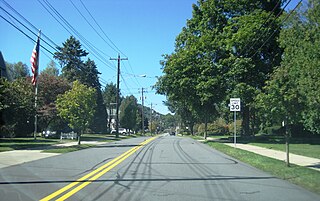
Mansfield is a borough located in east-central Tioga County, Pennsylvania, United States, in the Tioga River valley. It is situated at the intersection of U.S. Route 6 and U.S. Business Route 15, about 36 miles (58 km) southwest of Elmira, New York.

<span class="mw-page-title-main">Richmond Township, Tioga County, Pennsylvania</span> Township in Pennsylvania, United States

Richmond Township is a township in Tioga County, Pennsylvania, United States. The population was 2,164 at the 2020 census.

<span class="mw-page-title-main">Roseville, Pennsylvania</span> Borough in Pennsylvania, United States

Roseville is a borough in Tioga County, Pennsylvania, United States. The population was 177 at the 2020 census.

<span class="mw-page-title-main">Tioga, Pennsylvania</span> Borough in Pennsylvania, United States

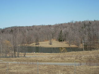
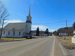
Tioga is a borough in Tioga County, Pennsylvania, United States. The population was 611 at the 2010 census. It is located north of Tioga and Hammond Lakes along the Tioga River.

<span class="mw-page-title-main">Tioga Township, Tioga County, Pennsylvania</span> Township in Pennsylvania, United States

Tioga Township is a township in Tioga County, Pennsylvania, United States. The population was 941 at the 2020 census.

<span class="mw-page-title-main">Wellsboro, Pennsylvania</span> Borough in Pennsylvania, United States

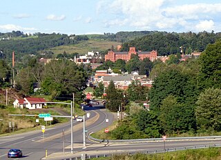
Wellsboro is a borough and county seat of Tioga County, Pennsylvania. The borough was founded by Benjamin Wistar Morris. It is located 52 miles (84 km) northwest of Williamsport. The population was 3,472 at the 2020 census.

<span class="mw-page-title-main">Nicholson, Pennsylvania</span> Borough in Pennsylvania, United States

Nicholson is a borough in Wyoming County, Pennsylvania. The population was 698 at the 2020 census.

<span class="mw-page-title-main">Tunkhannock Township, Wyoming County, Pennsylvania</span> Township in Pennsylvania, United States

Tunkhannock Township is a township in Wyoming County, Pennsylvania, United States. The population was 3,976 at the 2020 census.

References

  1. "2019 U.S. Gazetteer Files". United States Census Bureau. Retrieved July 28, 2020.
  2. 1 2 3 4 Bureau, US Census. "City and Town Population Totals: 2020—2021". Census.gov. US Census Bureau. Retrieved August 5, 2022.
  3. "Find a County". National Association of Counties. Retrieved 2011-06-07.
  4. Zeisberger, David. Indian Dictionary: English, German, Iroquois—The Onondaga and Algonquin—The Delaware. Harvard University Press, 1887. ISBN   1104253518, p. 22. “The Delaware” that Zeisberger translated was Minsi-Len’api.
  5. "National Register of Historic Places Listings". www.nps.gov.
  6. "US Gazetteer files: 2010, 2000, and 1990". United States Census Bureau. 2011-02-12. Retrieved 2011-04-23.
  7. FAA Airport Form 5010 for 76N PDF . Federal Aviation Administration. Effective 11 February 2010.
  8. "Census of Population and Housing". U.S. Census Bureau. Retrieved 11 December 2013.
  9. "U.S. Census website". United States Census Bureau . Retrieved 2008-01-31.
  10. "Incorporated Places and Minor Civil Divisions Datasets: Subcounty Resident Population Estimates: April 1, 2010 to July 1, 2012". Population Estimates. U.S. Census Bureau. Archived from the original on 11 June 2013. Retrieved 11 December 2013.
  11. "U.S. Census website". United States Census Bureau . Retrieved 2011-05-14.
  12. Rudolf, Michael. "Post office mural to be in documentary". archives.wcexaminer.com. Wyoming County Press Examiner. Retrieved 12 May 2016.
  13. "50th Anniversary of Hurricane Agnes".
  14. "Symphony debut concert on April 9," Archived 2012-07-17 at archive.today Wyoming County Press Examiner, March 30, 2011. Retrieved May 27, 2012.
  15. "Move To These 10 Towns In Pennsylvania If You Wanna Get Away From It All".