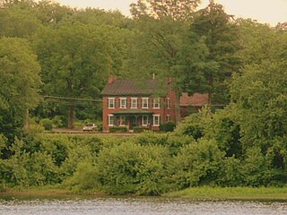
Marietta is a borough in Lancaster County, Pennsylvania, United States. The population was 2,633 at the 2020 census. It is located on the east bank of the Susquehanna River, northwest of Columbia.

Union County is a county in the Commonwealth of Pennsylvania. As of the 2020 census, the population was 42,681. Its county seat is Lewisburg. The county was created on March 22, 1813, from part of Northumberland County. Its name is an allusion to the federal Union. Mifflinburg was established by legislation as the first county seat until it was moved to New Berlin in 1815. Lewisburg became county seat in 1855 and has remained so since. Union County comprises the Lewisburg, PA Micropolitan Statistical Area, which is also included in the Bloomsburg-Berwick-Sunbury, PA Combined Statistical Area. The county is part of the Central Pennsylvania region of the state.

Athens is a borough in Bradford County, Pennsylvania, United States. It is part of Northeastern Pennsylvania and is located 2 miles (3 km) south of the New York state line on the Susquehanna and Chemung rivers. The population was 3,749 in 1900 and 3,796 in 1910. The population was 3,265 at the 2020 census. Athens is in a small area locally known as "The Valley", a group of four contiguous communities in Pennsylvania and New York: Waverly, New York; South Waverly, Pennsylvania; Sayre, Pennsylvania; and Athens. The Valley has a population near 30,000.

Benton is a borough in Columbia County, Pennsylvania, United States. It is part of Northeastern Pennsylvania. The population was 824 at the 2020 census. It is part of the Bloomsburg-Berwick micropolitan area.

Wormleysburg is a borough in Cumberland County, Pennsylvania, United States. The population was 3,070 at the 2010 census. It is part of the Harrisburg–Carlisle Metropolitan Statistical Area.

Halifax is a borough in Dauphin County, Pennsylvania, United States. Halifax was incorporated as a borough on May 29, 1785. It is situated at the confluence of Armstrong Creek and the Susquehanna River. The population was 795 at the 2020 census. It is part of the Harrisburg–Carlisle Metropolitan Statistical Area.
Middletown is a borough in Dauphin County, Pennsylvania, on the Susquehanna River, 10 miles (16 km) southeast of Harrisburg. As of the 2020 census, it had a population of 9,550. It is part of the Harrisburg–Carlisle Metropolitan Statistical Area.

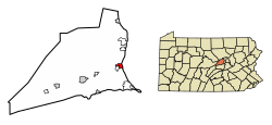
Millersburg is a borough in Dauphin County, Pennsylvania, United States. The population was 2,541 at the 2020 census. It is part of the Harrisburg–Carlisle Metropolitan Statistical Area.

West Pittston is a borough in the Greater Pittston area of Luzerne County, Pennsylvania, United States. It is located on the Susquehanna River. In 2020, the population was 4,644.

Muncy is a borough in Lycoming County, Pennsylvania, United States. The name Muncy comes from the Munsee Indians who once lived in the area. The population was 2,442 at the 2020 census. It is part of the Williamsport, Pennsylvania, Metropolitan Statistical Area. Muncy is located on the West Branch Susquehanna River, just south of the confluence of Muncy Creek with the river. Currently the borough president is Bill Scott and the mayor is Jon Ort.

Danville is a borough in and the county seat of Montour County, Pennsylvania, United States, along the North Branch of the Susquehanna River. The population was 4,221 at the 2020 census. Danville is part of the Bloomsburg-Berwick micropolitan area.

Sunbury is a city and the county seat of Northumberland County in Pennsylvania, United States. Located in the Susquehanna Valley, Sunbury is positioned on the east bank of the Susquehanna River.
Selinsgrove is the largest borough in Snyder County, Pennsylvania, United States. The population is estimated to be 5,761 for the 2020 Census.

Shamokin Dam is a borough in Snyder County, Pennsylvania, United States. The population was 1,647 at the 2020 census.

Forest City is a borough in Susquehanna County, Pennsylvania, United States, situated at the corner of Susquehanna, Lackawanna and Wayne counties and is designated by a marker which is located in the Forest City Industrial Park.
Susquehanna Depot, often referred to simply as Susquehanna, is a borough in Susquehanna County, Pennsylvania, United States, located on the Susquehanna River 23 miles (37 km) southeast of Binghamton, New York. In the past, railroad locomotives and railroad cars were made here. It is also known for its Pennsylvania Bluestone quarries.
East Buffalo Township is a township in Union County, Pennsylvania, United States. The population was 7,421 at the 2020 census. The township is home to Bucknell University, which lies mostly in East Buffalo Township and partly in the Borough of Lewisburg.

Kelly Township is a township in Union County, Pennsylvania, United States. The population was 3,993 at the 2020 census. The United States Penitentiary, Lewisburg is located in Kelly Township, and not in the nearby Borough of Lewisburg, whose post office serves most of the township.
Windsor Township is a township in York County, Pennsylvania, United States. The population was 17,839 at the 2020 census.

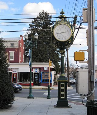
Market Street is a downtown street in Lewisburg, Pennsylvania, United States. It runs for around 1.6 miles (2.6 km), from Main Street, at the Union County/Northumberland County line, in the east to North Fairground Road in the west. It is part of Pennsylvania Route 45. West of its intersection with Derr Drive, it is named West Market Street. From the West Branch Susquehanna River inland, Market Street's cross streets are numbered 2 through 8, with Front Street replacing what was originally 1st Street. These cross streets are named "North" or "South" depending on their location relative to Market Street. Lewisburg's street layout was designed by Ludwig Derr in 1785, and is believed to have been inspired by that of Philadelphia.


 Campus Theatre (1939) built in the Streamline Moderne style.
 Beaver Memorial Methodist Church (1890) one of four Victorian Gothic churches in Lewisburg.
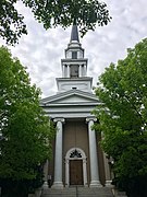 Entrance to the First Presbyterian Church (1856) in the Greek Revival style.