Laurelton, Pennsylvania | |
|---|---|
 Interactive map of Laurelton, Pennsylvania | |
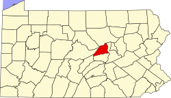
| Country | United States |
| State | Pennsylvania |
| County | Union |
| Township | Hartley |
| Area | |
• Total | 0.57 sq mi (1.48 km2) |
| • Land | 0.57 sq mi (1.48 km2) |
| • Water | 0 sq mi (0.00 km2) |
| Population | |
• Total | 217 |
| • Density | 380.4/sq mi (146.89/km2) |
| Time zone | UTC-5 (Eastern (EST)) |
| • Summer (DST) | UTC-4 (EDT) |
| FIPS code | 42-41856 |
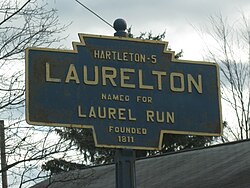
Laurelton is a census-designated place [3] located in Hartley Township, Union County in the state of Pennsylvania. It is located in western Union County along Pennsylvania Route 235. As of the 2010 census [4] the population was 221 residents.