Hartleton, Pennsylvania

Last updated
Hartleton, Pennsylvania
Hartleton Main Street.jpg
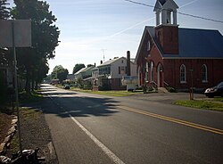
Pennsylvania Route 45 passes through Hartleton
Union County Pennsylvania Incorporated and Unincorporated areas Hartleton Highlighted.svg
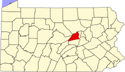
Location of Hartleton in Union County, Pennsylvania.
USA Pennsylvania location map.svg
Red pog.svg
Hartleton
Location within the U.S. state of Pennsylvania
Usa edcp location map.svg
Red pog.svg
Hartleton
Hartleton (the United States)
Coordinates: 40°54′01″N77°09′19″W / 40.90028°N 77.15528°W / 40.90028; -77.15528 Coordinates: 40°54′01″N77°09′19″W / 40.90028°N 77.15528°W / 40.90028; -77.15528
Country United States
State Pennsylvania
County Union
Settled 17751798-1799 town laid out
Incorporated (borough)September 18,1858
Area
[1]
  Total0.91 sq mi (2.35 km2)
  Land0.91 sq mi (2.35 km2)
  Water0.00 sq mi (0.00 km2)
Elevation
[2] (center of borough)
650 ft (200 m)
Highest elevation
[2] (western borough boundary by Harleton Cemetery)
760 ft (230 m)
Lowest elevation
[2] (Cold Run at southeast borough boundary)
610 ft (190 m)
Population
 (2020) [3]
  Total251
  Density276.43/sq mi (106.69/km2)
Time zone Eastern (EST)
  Summer (DST)EDT
Zip code
17829
Area code 570
FIPS code 42-32936

Hartleton is a borough in Union County, Pennsylvania, United States. The population was 247 at the 2020 census. [4] The borough, as well as the adjoining township of Hartley, are both named for Colonel Thomas Hartley, American politician and Revolutionary War leader, and local landowner. An alternative name was Hartleyton and later shortened to the present name. The original name was Kester's (akin to Keister today), and named for Peter Kester who was the first tenant of Hartley. Kester's was at the intersection of "great Reuben Haines road" from Northumberland through Dry Valley, New Berlin and the Penns Valley Narrows, and the first public road laid out in the area by Northumberland County court from Northumberland through Derrstown (Lewisburg) and Mifflinburg (this road from Derrstown through the Penns Valley Narrows eventually became what is known as the turnpike). Hartley never lived there, as his home was in York, PA. Hartley acquired the land in 1784 from original purchaser Colonel Philip Cole after Cole left the area because of the "Big Runaway" of 1778. Cole purchased the land in 1773, and was living there in 1775. Hartley laid out a town as early as 1798, and the first lot sold in 1799.

Contents

Geography

Hartleton is located at 40°54′1″N77°9′19″W / 40.90028°N 77.15528°W / 40.90028; -77.15528 (40.900148, -77.155229). [5]

According to the United States Census Bureau, the borough has a total area of 0.9 square miles (2.3 km2), all land.

Demographics

Historical population
CensusPop.
1870 292
1880 3002.7%
1890 261−13.0%
1900 237−9.2%
1910 160−32.5%
1920 1610.6%
1930 1695.0%
1940 20823.1%
1950 24015.4%
1960 234−2.5%
1970 223−4.7%
1980 220−1.3%
1990 24611.8%
2000 2605.7%
2010 2838.8%
2020 247−12.7%
2021 (est.)248 [4] 0.4%
Sources: [6] [7] [8] [3]

As of the census [7] of 2000, there were 260 people, 89 households, and 71 families residing in the borough. The population density was 286.4 people per square mile (110.3/km2). There were 91 housing units at an average density of 100.2 per square mile (38.6/km2). The racial makeup of the borough was 97.31% White, and 2.69% from two or more races. Hispanic or Latino of any race were 0.38% of the population.

There were 89 households, out of which 33.7% had children under the age of 18 living with them, 65.2% were married couples living together, 10.1% had a female householder with no husband present, and 20.2% were non-families. 19.1% of all households were made up of individuals, and 14.6% had someone living alone who was 65 years of age or older. The average household size was 2.72 and the average family size was 3.11.

In the borough the population was spread out, with 27.7% under the age of 18, 6.2% from 18 to 24, 26.9% from 25 to 44, 26.2% from 45 to 64, and 13.1% who were 65 years of age or older. The median age was 37 years. For every 100 females there were 104.7 males. For every 100 females age 18 and over, there were 97.9 males.

The median income for a household in the borough was $40,938, and the median income for a family was $42,188. Males had a median income of $31,250 versus $19,375 for females. The per capita income for the borough was $14,714. None of the families and 1.1% of the population were living below the poverty line.

Related Research Articles

<span class="mw-page-title-main">Union County, Pennsylvania</span> County in Pennsylvania, United States

Union County is a county located in the U.S. state of Pennsylvania. As of the 2010 census, the population was 44,947. Its county seat is Lewisburg. The county was created on March 22, 1813, from part of Northumberland County. Its name is an allusion to the federal Union. Mifflinburg was established by legislation as the first county seat until it was moved to New Berlin in 1815. Lewisburg became county seat in 1855 and has remained so since. Union County comprises the Lewisburg, PA Micropolitan Statistical Area, which is also included in the Bloomsburg-Berwick-Sunbury, PA Combined Statistical Area.

<span class="mw-page-title-main">Daisytown, Pennsylvania</span> Borough in Pennsylvania, United States

Daisytown is a borough in Cambria County, Pennsylvania, United States. It is part of the Johnstown, Pennsylvania Metropolitan Statistical Area. The population was 326 at the 2010 census.

<span class="mw-page-title-main">Townville, Pennsylvania</span> Borough in Pennsylvania, United States

Townville is a borough in Crawford County, Pennsylvania, United States. The population was 328 at the 2020 census, up from 323 at the 2010 census.

<span class="mw-page-title-main">Mifflin, Pennsylvania</span> Borough in Pennsylvania, United States

Mifflin is a borough in Juniata County, Pennsylvania, United States. The population was 534 at the 2020 census.

<span class="mw-page-title-main">Thompsontown, Pennsylvania</span> Borough in Pennsylvania, United States

Thompsontown is a borough in Juniata County, Pennsylvania, United States. The population was 629 at the 2020 census.

<span class="mw-page-title-main">Wampum, Pennsylvania</span> Borough in Pennsylvania, United States

Wampum is a borough in Lawrence County, Pennsylvania, United States. The population was 557 at the 2020 census. It is part of the New Castle micropolitan area.

<span class="mw-page-title-main">Herndon, Pennsylvania</span> Borough in Pennsylvania, United States

Herndon, formerly Trevorton Junction, is a borough along the Susquehanna River in Northumberland County, Pennsylvania, United States. Herndon was first founded by Robert A. Parrish in 1840. The town was later named for Naval commander William Lewis Herndon, who died in 1857 while trying to rescue passengers from his sinking ship. The population was 324 at the 2010 census.

<span class="mw-page-title-main">Kulpmont, Pennsylvania</span> Borough in Pennsylvania, United States

Kulpmont is a borough in Northumberland County, Pennsylvania, United States. The population was 2,924 at the 2010 census.

<span class="mw-page-title-main">Marion Heights, Pennsylvania</span> Borough in Pennsylvania, United States

Marion Heights is a borough in Northumberland County, Pennsylvania, United States. The population was 611 at the 2010 census.

<span class="mw-page-title-main">McEwensville, Pennsylvania</span> Borough in Pennsylvania, United States

McEwensville is a borough in Northumberland County, Pennsylvania, United States. The population was 314 at the 2000 census.

<span class="mw-page-title-main">Northumberland, Pennsylvania</span> Borough in Pennsylvania, United States

Northumberland is a borough in Northumberland County, Pennsylvania, United States. The population was 3,804 at the 2010 census.

<span class="mw-page-title-main">Riverside, Pennsylvania</span> Borough in Pennsylvania, United States

Riverside is a borough in Northumberland County, Pennsylvania, United States. The population was 1,932 at the 2010 census. The current mayor is John LaMotte.

<span class="mw-page-title-main">Snydertown, Northumberland County, Pennsylvania</span> Borough in Pennsylvania, United States

Snydertown is a borough in Northumberland County, Pennsylvania, United States. As of the 2010 census, the borough population was 339.

<span class="mw-page-title-main">Watsontown, Pennsylvania</span> Borough in Pennsylvania, United States

Watsontown is a borough in Northumberland County, Pennsylvania, United States. The population was 2,351 at the 2010 census. It was named for John Watson, an early settler.

<span class="mw-page-title-main">Blain, Pennsylvania</span> Borough in Pennsylvania, United States

Blain is a borough in Perry County, Pennsylvania, United States. The population was 227 at the 2020 census. It is part of the Harrisburg–Carlisle Metropolitan Statistical Area. Blain is located in a valley region known as Sherman's Valley.

<span class="mw-page-title-main">Landisburg, Pennsylvania</span> Borough in Pennsylvania, United States

Landisburg is a borough in Perry County, Pennsylvania, United States. The population was 220 at the 2010 census. It is part of the Harrisburg–Carlisle Metropolitan Statistical Area.

<span class="mw-page-title-main">Millerstown, Pennsylvania</span> Borough in Pennsylvania, United States

Millerstown is a borough in northern Perry County, Pennsylvania located 29 miles (47 km) northwest of Harrisburg and 29 miles (47 km) southwest of Selinsgrove. The population was 688 at the 2020 Census. The borough is part of the Harrisburg–Carlisle Metropolitan Statistical Area.

<span class="mw-page-title-main">Newport, Pennsylvania</span> Borough in Pennsylvania, United States

Newport is a borough in Perry County, Pennsylvania, United States. The population was 1,487 at the 2020 census. It is part of the Harrisburg–Carlisle Metropolitan Statistical Area.

<span class="mw-page-title-main">Galeton, Pennsylvania</span> Borough in Pennsylvania, United States

Galeton is a borough in Potter County, Pennsylvania, United States, 50 miles (80 km) southeast of Bradford. Light industries such as knitting mills and a tannery have existed in Galeton. The population declined to 993 people in 2020.

<span class="mw-page-title-main">New Berlin, Pennsylvania</span> Borough in Pennsylvania, United States

New Berlin is a borough in Union County, Pennsylvania, United States. The population was 791 at the 2020 census.

References

  1. "ArcGIS REST Services Directory". United States Census Bureau. Retrieved October 12, 2022.
  2. 1 2 3 "Laurel Run Topo Map, Union County PA (Beavertown Area)". TopoZone. Locality, LLC. Retrieved 27 November 2019.
  3. 1 2 "Census Population API". United States Census Bureau. Retrieved Oct 12, 2022.
  4. 1 2 Bureau, US Census. "City and Town Population Totals: 2020-2021". Census.gov. US Census Bureau. Retrieved 14 July 2022.
  5. "US Gazetteer files: 2010, 2000, and 1990". United States Census Bureau. 2011-02-12. Retrieved 2011-04-23.
  6. "Census of Population and Housing". U.S. Census Bureau. Retrieved 11 December 2013.
  7. 1 2 "U.S. Census website". United States Census Bureau . Retrieved 2008-01-31.
  8. "Incorporated Places and Minor Civil Divisions Datasets: Subcounty Resident Population Estimates: April 1, 2010 to July 1, 2012". Population Estimates. U.S. Census Bureau. Archived from the original on 11 June 2013. Retrieved 11 December 2013.