Mifflinburg, Pennsylvania

Last updated
Mifflinburg, Pennsylvania
Flickr - Nicholas T - Side Street.jpg
First Presbyterian Church
Union County Pennsylvania Incorporated and Unincorporated areas Mifflinburg Highlighted.svg
Location of Mifflinburg in Union County, Pennsylvania.
USA Pennsylvania location map.svg
Red pog.svg
Mifflinburg
Location in the state of Pennsylvania
Usa edcp location map.svg
Red pog.svg
Mifflinburg
Mifflinburg (the United States)
Coordinates: 40°55′08″N77°02′48″W / 40.91889°N 77.04667°W / 40.91889; -77.04667
Country United States
State Pennsylvania
County Union
Settled1792
Incorporated (borough)1827
Area
[1]
  Total1.80 sq mi (4.67 km2)
  Land1.80 sq mi (4.67 km2)
  Water0.00 sq mi (0.00 km2)
Elevation
[2] (borough benchmark)
583 ft (178 m)
Highest elevation
[2] (two hills at southern end of borough)
800 ft (200 m)
Lowest elevation
[2] (Buffalo Creek)
530 ft (160 m)
Population
 (2020) [3]
  Total3,485
  Density1,931.82/sq mi (745.86/km2)
Time zone Eastern (EST)
  Summer (DST)EDT
ZIP code
17844
Area code(s) 570 and 272
FIPS code 42-49288
Website Borough of Mifflinburg

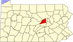
Mifflinburg is a borough in Union County, located in the Susquehanna River Valley of central Pennsylvania, United States. Mifflinburg was first settled in 1792 by Elias and Catharina Jungman (later Youngman) and their two children. They divided the land into 60' by 120' plots that were sold to other settlers, many of them German, and the village of Youngmanstown was formed.

Contents

A few years later, George Rote (Rhoade) laid out a village just east of Youngmanstown, known as Greenville or Rotestown, after his death. Eventually, the two settlements merged at Third Street. In 1827, the two villages combined and were incorporated, the combined village was named Mifflinburg, in honor of Thomas Mifflin, the first Governor of Pennsylvania after the 1790 Constitution. Historically the town was known for the manufacture of horse-drawn vehicles, known as buggies.

As of the 2010 census, [4] there were 3,540 people, 1,506 households, and 1,028 families living in the borough. The population density was 1,976.0 inhabitants per square mile (762.9/km2). There were 1,605 housing units at an average density of 882.4 per square mile (340.7/km2). As of 2010, the racial makeup of the borough was 97.5% White alone, 0.9% Hispanic, 0.6% Black alone, 0.5% two or more races, 0.3% Asian alone, 0.08% Hawaiian or Pacific Islander alone, 0.06% other race alone, and 0.03% American Indian alone.

Major tourist attractions include

History

The borough is situated on lands that were originally granted in 1769 to the veteran officers who served under Colonel Henry Bouquet during Pontiac's War (1763-1766) in lieu of payment for their service and ultimate victory at the Battle of Bushy Run just east of Pittsburgh. In 1792, Elias and Catharina Jungman (Youngman) and their two children, came from Fort Augusta (now Sunbury) Pennsylvania to the Buffalo Valley to settle on land given to them by Catharina's father. They divided the land into 60' by 120' plots that were sold to other adventurous settlers, many of them German, and the village of Youngmanstown was formed. A few years later George Rote (Rhoade) laid out a village just east of Youngmanstown, known as Greenville or Rotestown, after George's death. Eventually, the two settlements merged at Third Street. In 1827, the two villages combined and were incorporated. The combined village was named Mifflinburg, in honor of Thomas Mifflin, the first Governor of Pennsylvania after the 1790 Constitution. The merged towns were known as Mifflinburg before 1827 however, because when Union County was formed from Northumberland County on March 22, 1813, that PA legislative act also established Mifflinburg as the seat of government of the newly formed county, with the first courthouse located at 406 Green Street and other government offices located in various other buildings throughout the town. It remained the county seat until 1815 when it was moved to New Berlin, and then to Lewisburg in 1855 where it remains today.

In 1845, George Swentzel set up Mifflinburg's first buggy business. Soon other buggy manufacturers set up their own shops in Mifflinburg, and by 1855, with a population of 800, Mifflinburg hosted thirteen coachmakers. By the 1880s, with more than fifty buggy and sleigh factories, Mifflinburg became known as “Buggy Town” because its buggy makers produced more horse-drawn vehicles per capita than any other town in the state.

The Mifflinburg Historic District, Hassenplug Bridge, and William A. Heiss House and Buggy Shop are listed on the National Register of Historic Places. [7]

Geography

Mifflinburg is located at 40°55′8″N77°2′48″W / 40.91889°N 77.04667°W / 40.91889; -77.04667 (40.918939, -77.046800), [8] approximately 25 miles (40 km) southwest of Williamsport.

According to the United States Census Bureau, the borough has a total area of 1.8 square miles (4.7 km2), all land.

Climate

Climate data for Mifflinburg, Pennsylvania
MonthJanFebMarAprMayJunJulAugSepOctNovDecYear
Average high °F (°C)37
(3)
42
(6)
52
(11)
65
(18)
76
(24)
83
(28)
87
(31)
85
(29)
77
(25)
66
(19)
52
(11)
41
(5)
64
(18)
Average low °F (°C)17
(−8)
20
(−7)
27
(−3)
37
(3)
46
(8)
55
(13)
59
(15)
58
(14)
51
(11)
39
(4)
31
(−1)
22
(−6)
39
(4)
Average precipitation inches (mm)3.18
(81)
2.90
(74)
3.52
(89)
3.54
(90)
4.20
(107)
4.77
(121)
4.17
(106)
3.76
(96)
4.52
(115)
3.40
(86)
3.76
(96)
3.14
(80)
44.86
(1,139)
Source: The Weather Channel [9]

Demographics

Historical population
CensusPop.Note
1850 783
1860 86510.5%
1870 9115.3%
1880 1,16828.2%
1890 1,41721.3%
1900 1,4361.3%
1910 1,5598.6%
1920 1,74411.9%
1930 1,95912.3%
1940 2,0906.7%
1950 2,2598.1%
1960 2,4769.6%
1970 2,6075.3%
1980 3,15120.9%
1990 3,48010.4%
2000 3,5943.3%
2010 3,540−1.5%
2020 3,424−3.3%
2021 (est.)3,404 [10] −0.6%
Sources: [4] [11] [12] [3]

As of the census [4] of 2000, there were 3,594 people, 1,506 households, and 1,028 families living in the borough. The population density was 1,976.0 inhabitants per square mile (762.9/km2). There were 1,605 housing units at an average density of 882.4 per square mile (340.7/km2). As of 2010, the racial makeup of the borough was 97.5% White alone, 0.9% Hispanic, 0.6% Black alone, 0.5% two or more races, 0.3% Asian alone, 0.08% Hawaiian or Pacific Islander alone, 0.06% other race alone, and 0.03% American Indian alone.

There were 1,506 households, out of which 32.1% had children under the age of 18 living with them, 55.5% were married couples living together, 9.6% had a female householder with no husband present, and 31.7% were non-families. 27.7% of all households were made up of individuals, and 13.7% had someone living alone who was 65 years of age or older. The average household size was 2.39 and the average family size was 2.91.

In the borough the population was spread out, with 25.3% under the age of 18, 7.6% from 18 to 24, 28.6% from 25 to 44, 21.9% from 45 to 64, and 16.6% who were 65 years of age or older. The median age was 38 years. For every 100 females there were 87.4 males. For every 100 females age 18 and over, there were 85.5 males.

The median income for a household in the borough was $34,906, and the median income for a family was $43,520. Males had a median income of $30,568 versus $21,315 for females. The per capita income for the borough was $17,161. About 7.6% of families and 9.9% of the population were below the poverty line, including 13.7% of those under age 18 and 8.7% of those age 65 or over.

Economy and tourism

The Mifflinburg Christkindl market in 2012 Mifflinburg, Pennsylvania Christkindl market.JPG
The Mifflinburg Christkindl market in 2012

Major employers include Weis Markets (a supermarket), Mifflinburg Area School District, CVS, Cole's Hardware, Ritz-Craft (a manufacturer of modular homes), and Yorktowne (a cabinetry manufacturer). In 2005, Yorktowne management made the decision to move most of the Mifflinburg operations to Danville, Virginia, rather than comply with new air pollution regulations in Pennsylvania. [13]

Major tourist attractions include

Transportation

Highway

Mifflinburg's business district is centered on Pennsylvania Route 45.
U.S. Route 15, the primary north/south highway through central Pennsylvania, is located nine miles to the east.
The most direct route to the nearest interstate highway exit involves going over Sand Mountain on an unpaved road to reach Interstate 80, exit 192. Most westbound drivers will opt for exit 185 instead, while eastbound drivers will use exit 210.

Bus

A Fullington Trailways station is located nine miles east.

Rail

Mifflinburg was once served by the Lewisburg and Tyrone Railroad. Today, the closest passenger rail access is the Lewistown Amtrak station.

Air

Although Williamsport Regional Airport (IATA: IPT) is the closest airport with scheduled airline service, travelers often seek out the lower fares at Trenton–Mercer Airport (IATA: TTN), Philadelphia International Airport (IATA: PHL), or Washington Dulles International Airport (IATA: IAD).
The general-aviation Penn Valley Airport (IATA: SEG) is located 15 miles southeast, and features an Avis car rental facility. [15]

Related Research Articles

<span class="mw-page-title-main">Union County, Pennsylvania</span> County in Pennsylvania, United States

Union County is a county in the Commonwealth of Pennsylvania. As of the 2020 census, the population was 42,681. Its county seat is Lewisburg. The county was created on March 22, 1813, from part of Northumberland County. Its name is an allusion to the federal Union. Mifflinburg was established by legislation as the first county seat until it was moved to New Berlin in 1815. Lewisburg became county seat in 1855 and has remained so since. Union County comprises the Lewisburg, PA Micropolitan Statistical Area, which is also included in the Bloomsburg-Berwick-Sunbury, PA Combined Statistical Area.

Mar-Mac is a census-designated place (CDP) in Wayne County, North Carolina, United States. The population was 3,011 at the 2007 census. It is included in the Goldsboro, North Carolina Metropolitan Statistical Area.

<span class="mw-page-title-main">Chalfant, Pennsylvania</span> Borough in Pennsylvania, United States

Chalfant is a borough in Allegheny County, Pennsylvania, United States. The population was 748 at the 2020 census.

<span class="mw-page-title-main">East McKeesport, Pennsylvania</span> Borough in Pennsylvania, United States

East McKeesport is a borough in Allegheny County, Pennsylvania, United States, and is part of the Pittsburgh Metro Area. The population was 2,076 at the 2020 census.

<span class="mw-page-title-main">Rankin, Pennsylvania</span> Borough in Pennsylvania, United States

Rankin is a borough in Allegheny County, Pennsylvania, United States, 8 miles (13 km) south of Pittsburgh on the Monongahela River. The borough was named after Thomas Rankin, a local landowner. Early in the 20th century, Rankin specialized in manufacturing steel and wire goods. The population increased from 3,775 in 1900 to 7,470 in 1940, and has since declined to 1,896 as of the 2020 census.

<span class="mw-page-title-main">West Kittanning, Pennsylvania</span> Borough in Pennsylvania, United States

West Kittanning is a borough in Armstrong County, Pennsylvania, United States. The population was 1,192 at the 2020 census.

<span class="mw-page-title-main">Bally, Pennsylvania</span> Borough in Pennsylvania, United States

Bally is a borough in Berks County, Pennsylvania, United States. The population was 1,090 at the 2010 census.

<span class="mw-page-title-main">Driftwood, Pennsylvania</span> Borough in Pennsylvania, United States

Driftwood is a borough in Cameron County, Pennsylvania, United States. The population was 36 at the 2020 census.

<span class="mw-page-title-main">Kennett Square, Pennsylvania</span> Borough in Pennsylvania, United States

Kennett Square is a borough in Chester County, Pennsylvania, United States. As of the 2020 U.S. census, Kennett Square had a population of 5,943.

<span class="mw-page-title-main">Ramey, Pennsylvania</span> Borough in Pennsylvania, United States

Ramey is a borough in Clearfield County, Pennsylvania, United States. The population was 436 at the 2020 census.

<span class="mw-page-title-main">Benton, Columbia County, Pennsylvania</span> Borough in Pennsylvania, United States

Benton is a borough in Columbia County, Pennsylvania, United States. It is part of Northeastern Pennsylvania. The population was 824 at the 2020 census. It is part of the Bloomsburg-Berwick micropolitan area.

<span class="mw-page-title-main">McConnellsburg, Pennsylvania</span> Borough in Pennsylvania, United States

McConnellsburg is a borough in Fulton County, Pennsylvania, United States. The population was 1,150 at the 2020 census. It is the county seat of Fulton County.

<span class="mw-page-title-main">Smicksburg, Pennsylvania</span> Borough in Pennsylvania, United States

Smicksburg is a borough in Indiana County, Pennsylvania, United States. The population was 57 at the 2020 census, and it is one of the smallest incorporated boroughs in Pennsylvania. It was founded by the Reverend J. George Schmick.

<span class="mw-page-title-main">Bear Creek Village, Pennsylvania</span> Borough in Pennsylvania, United States

Bear Creek Village is a borough in Luzerne County, Pennsylvania, United States. The population was 290 at the 2020 census.

<span class="mw-page-title-main">Wyoming, Pennsylvania</span> Borough in Luzerne County, Pennsylvania, US

Wyoming is a borough in the Greater Pittston area of Luzerne County, Pennsylvania, United States. It is located 5 miles (8 km) north of Wilkes-Barre, along the Susquehanna River. The population was 3,097 as of the 2020 census.

<span class="mw-page-title-main">Pen Argyl, Pennsylvania</span> Borough in Pennsylvania, United States

Pen Argyl is a borough in Northampton County, Pennsylvania. The borough's population was 3,510 as of the 2020 census.

Linntown is a census-designated place (CDP) in East Buffalo Township, Union County, Pennsylvania, United States. The population was 1,489 at the 2010 census.

<span class="mw-page-title-main">New Stanton, Pennsylvania</span> Borough in Pennsylvania, United States

New Stanton is a borough in Westmoreland County, Pennsylvania, United States. The population was 2,339 at the 2020 census. New Stanton is often used as a control city in western parts of Pennsylvania, as I-70 joins the Pennsylvania Turnpike (I-76) eastbound towards Breezewood in New Stanton, and is a free highway westbound.

<span class="mw-page-title-main">Factoryville, Pennsylvania</span> Borough in Pennsylvania, United States

Factoryville is a borough in Wyoming County, Pennsylvania, United States. The population was 1,146 at the 2020 census.

<span class="mw-page-title-main">Fairview Township, York County, Pennsylvania</span> Township in Pennsylvania, United States

Fairview Township is a township in York County, Pennsylvania, United States. The population was 17,436 at the 2020 census.

References

  1. "ArcGIS REST Services Directory". United States Census Bureau. Retrieved October 12, 2022.
  2. 1 2 3 "Mifflinburg Topo Map, Union County PA (Mifflinburg Area)". TopoZone. Locality, LLC. Retrieved November 26, 2019.
  3. 1 2 "Census Population API". United States Census Bureau. Retrieved Oct 12, 2022.
  4. 1 2 3 "U.S. Census website". United States Census Bureau . Retrieved 2008-01-31.
  5. 1 2 Mifflinburg Buggy Museum website, buggymuseum.org. Accessed January 28, 2023.
  6. Mifflinburg Christkindl Market website, mifflinburgchristkindlmarket.com. Accessed January 28, 2023.
  7. "National Register Information System". National Register of Historic Places . National Park Service. July 9, 2010.
  8. "US Gazetteer files: 2010, 2000, and 1990". United States Census Bureau. 2011-02-12. Retrieved 2011-04-23.
  9. "Monthly Averages for Mifflinburg, PA". Weather.com. 2010. Retrieved 2010-06-10.
  10. Bureau, US Census. "City and Town Population Totals: 2020-2021". Census.gov. US Census Bureau. Retrieved 15 July 2022.
  11. "Census of Population and Housing". U.S. Census Bureau. Retrieved 11 December 2013.
  12. "Incorporated Places and Minor Civil Divisions Datasets: Subcounty Resident Population Estimates: April 1, 2010 to July 1, 2012". Population Estimates. U.S. Census Bureau. Retrieved 11 December 2013.
  13. 2005, Yorktowne management moves most of the Mifflinburg operations to Danville, Virginia, dailyitem.com. Accessed January 28, 2023.
  14. "Mifflinburg Christkindl Market". Mifflinburg Christkindl Market. Retrieved September 19, 2021.
  15. "Selinsgrove Car Rentals - Penn Valley Apo/Heritage Aviation - Avis" . Retrieved 29 April 2015.