Laureldale, Pennsylvania

Last updated

Laureldale, Pennsylvania
Rosedale United Church of Christ, Laureldale PA 01.JPG
Rosedale United Church, built in Laureldale in 1928
Laureldale.png
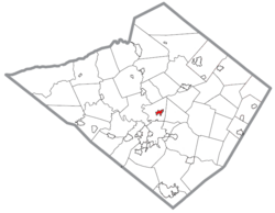
Location of Laureldale in Berks County, Pennsylvania
USA Pennsylvania location map.svg
Red pog.svg
Laureldale
Location in Pennsylvania
Usa edcp location map.svg
Red pog.svg
Laureldale
Location in the United States
Coordinates: 40°23′21″N75°54′51″W / 40.38917°N 75.91417°W / 40.38917; -75.91417
CountryUnited States
StatePennsylvania
County Berks
Area
[1]
  Total
0.81 sq mi (2.10 km2)
  Land0.81 sq mi (2.10 km2)
  Water0.00 sq mi (0.00 km2)
Elevation
400 ft (100 m)
Population
 (2020) [2]
  Total
4,277
  Density5,280.25/sq mi (2,039.80/km2)
Time zone UTC-5 (EST)
  Summer (DST) UTC-4 (EDT)
ZIP Code
19605
Area codes 610 and 484
FIPS code 42-41768
Website www.laureldaleboro.org

Laureldale is a borough in Berks County, Pennsylvania, United States. The population was 4,277 at the 2020 census.

Contents

Geography

According to the U.S. Census Bureau, the borough has a total area of 0.8 square miles (2.1 km2), all land.

Demographics

Historical population
CensusPop.Note
1940 3,397
1950 3,5855.5%
1960 4,05113.0%
1970 4,51911.6%
1980 4,047−10.4%
1990 3,726−7.9%
2000 3,7590.9%
2010 3,9114.0%
2020 4,2779.4%
Sources: [3] [4] [5] [2]

At the 2010 census there were 3,911 people living in the borough. The racial makeup of the borough was 86.8% White, 2.5% African American, 0.4% Native American, 0.9% Asian, 0.0% Pacific Islander, 6.8% from other races, and 2.7% from two or more races. Hispanic or Latino of any race were 16.1%. [4]

Infrastructure

Transportation

As of 2006, there were 15.08 miles (24.27 km) of public roads in Laureldale, of which 1.91 miles (3.07 km) were maintained by the Pennsylvania Department of Transportation (PennDOT) and 13.17 miles (21.20 km) were maintained by the borough. [6]

No numbered highways pass directly through Laureldale. The main thoroughfares in the borough include Kutztown Road and Elizabeth Avenue, which intersect near the center of town. The nearest numbered highway is U.S. Route 222 Business, which passes just west of the borough.

References

  1. "ArcGIS REST Services Directory". United States Census Bureau. Retrieved October 12, 2022.
  2. 1 2 "Census Population API". United States Census Bureau. Retrieved October 12, 2022.
  3. "Census of Population and Housing". U.S. Census Bureau. Retrieved December 11, 2013.
  4. 1 2 "U.S. Census website". United States Census Bureau . Retrieved January 31, 2008.
  5. "Incorporated Places and Minor Civil Divisions Datasets: Subcounty Resident Population Estimates: April 1, 2010 to July 1, 2012". Population Estimates. U.S. Census Bureau. Archived from the original on June 11, 2013. Retrieved December 11, 2013.
  6. "Laureldale Borough map" (PDF). PennDOT. Retrieved March 13, 2023.