Dale, The Dale, Dales or The Dales may refer to:
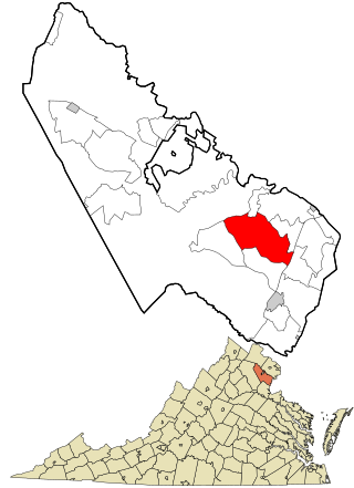
Dale City is a census-designated place (CDP) in Prince William County, Virginia, United States, located 25 miles (40 km) south west of Washington, D.C. It is an annex of Woodbridge, Virginia. As of 2020, the total population was 72,088.

Glen Dale is a city in Marshall County, West Virginia, United States, along the Ohio River. It is part of the Wheeling, West Virginia Metropolitan Statistical Area. The population was 1,514 at the 2020 census. Glen Dale was incorporated in 1924. It is in the northwest part of the county, which is above the Mason–Dixon line and forms the base of the Northern Panhandle of West Virginia.
Laurel Hill may refer to:
Pleasant Dale is an unincorporated community in Hampshire County in the U.S. state of West Virginia. Pleasant Dale is located between Capon Bridge and Augusta on the Northwestern Turnpike. Tearcoat Creek flows through Pleasant Dale and offers whitewater rafting in the Spring from the U.S. Route 50 bridge to its confluence with the North River.
Back Creek is a 59.5-mile-long (95.8 km) tributary of the Potomac River that flows north from Frederick County, Virginia, to Berkeley County in West Virginia's Eastern Panhandle. Back Creek originates along Frederick County's border with Hampshire County, West Virginia, at Farmer's Gap in the Great North Mountain. Its name reflects its location to the west of North Mountain. The perspective of colonists from the east in the 18th century led them to call it "Back Creek", because it lay to the back of North Mountain.
Jesse is an unincorporated community in Wyoming County, West Virginia, United States, along the Laurel Fork.
Slatyfork is an unincorporated community in Pocahontas County, West Virginia, United States. Slatyfork is located along U.S. Route 219, 13.5 miles (21.7 km) north of Marlinton.
Spring Dale is an unincorporated community in Fayette County, West Virginia, United States. Spring Dale is located on West Virginia Route 20, 3 miles (4.8 km) northeast of Meadow Bridge. Spring Dale has a post office with ZIP code 25986.

Layland is an unincorporated community in Fayette County, West Virginia, United States. Layland is located on West Virginia Route 41, 6.5 miles (10.5 km) west-northwest of Meadow Bridge. Layland has a post office with ZIP code 25864.
Beckwith is an unincorporated community in Fayette County, West Virginia, United States. Beckwith is located on West Virginia Route 16 and Laurel Creek, 4.1 miles (6.6 km) northwest of Fayetteville. Beckwith had a post office, which closed on October 3, 1998. The community has the name of P. D. Beckwith.
Laurel Junction was an unincorporated community in Wood County, West Virginia, United States.
Laurel Point is an unincorporated community in Monongalia County, West Virginia, United States.
Laurel was an unincorporated community in Barbour County, West Virginia, United States.
Coe is an unincorporated community in Nicholas County, West Virginia, United States. Coe is located on County Route 7/6, 5.4 miles (8.7 km) east of Craigsville.
Laurel Creek is an unincorporated community and coal town in Fayette County, West Virginia, United States.

The Laurel Fork is a 15.7-mile-long (25.3 km) stream in Virginia and West Virginia, United States. The stream flows north from Highland County, Virginia, where its source and the majority of its length is located, to its mouth in Pendleton County, West Virginia. Laurel Fork is a tributary to the North Fork South Branch Potomac River, making it a part of the Potomac River watershed. The area surrounding Laurel Fork is home to several plant and animal species found nowhere else in Virginia, and is a prime example of a northern boreal forest in the state.
Dale is an unincorporated community in Tyler County, in the U.S. state of West Virginia.


