Counties of West Virginia | |
---|---|
Location | State of West Virginia |
Number | 55 |
Populations | 5,000 (Wirt) – 174,805 (Kanawha) |
Areas | 83 square miles (210 km2) (Hancock) – 1,040 square miles (2,700 km2) (Randolph) |
Government | |
Subdivisions |
|
The U.S. state of West Virginia has 55 counties. Fifty of them existed at the time of the Wheeling Convention in 1861, during the American Civil War, when those counties seceded from the Commonwealth of Virginia to form the new state of West Virginia. [1] West Virginia was admitted as a separate state of the United States on June 20, 1863. [2] Five additional counties (Grant, Mineral, Lincoln, Summers, and Mingo) were formed from the original counties [1] in the decades following admission.
After the Civil War, Berkeley County and Jefferson County, the two easternmost counties of West Virginia, refused to recognize their inclusion in the state, and the Virginia General Assembly passed legislation attempting to reclaim them. In March 1866, the United States Congress passed a joint mandate assenting to their inclusion in the new state, and the Supreme Court of the United States confirmed this outcome in the case of Virginia v. West Virginia (1871). [3] [4]
The West Virginia Constitution was ratified in 1872, replacing the state constitution created in 1863 when West Virginia became a state. [5] Article 9, Section 8, of the West Virginia Constitution permits the creation of additional counties if a majority of citizens in the proposed new county vote for its creation and the new county has a minimum area of 400 square miles (1,036 km2) and a population of at least 6,000. Creation of a new county is prohibited if it would bring another county below these thresholds. [6] Three counties (Greenbrier, Kanawha, and Randolph) have sufficient population (based on the 2020 United States Census) and land area to allow a new county to be split off. [6] [7] [8] The remaining counties cannot be split, as either their land area would decrease to under 400 square miles, or their population would decrease to below 6,000. [6] [7] [8]
The role of counties in local government had been minimized under the 1863 constitution, which vested most local government authority in a system of townships based on the New England model. The authors of the 1872 constitution chose to return to the system used in Virginia, in which each county was governed by a county court with combined authority for executive, legislative, and judicial functions of the county government. [9] In 1880, West Virginia amended its constitution and replaced the county court system with an arrangement that divides county government powers between seven county offices, each of which is independently elected: the county commission, county clerk, circuit clerk, county sheriff, county assessor, county prosecuting attorney, and county surveyor of lands. [10] Counties have only those powers that are expressly granted to them by the state Constitution or by state statute. These powers include, but are not limited to, maintaining the infrastructure of the state, funding libraries, maintaining jails and hospitals, and waste disposal. [10] Reforming public education became a county function in 1933. In May 1933, a county unit plan was adopted. Under this plan, the state's 398 school districts were consolidated into the current 55 county school systems. This enabled public schools to be funded more economically and saved West Virginia millions of dollars. [11]
Randolph County is the largest by area at 1,040 square miles (2,694 km2), and Hancock County is the smallest at 83 square miles (215 km2). [8] Kanawha County contributed land to the founding of 12 West Virginia counties [12] and has the largest population (174,805 in 2023). Wirt County has the smallest population (5,000 in 2023). [13] The oldest county is Hampshire, established in 1754, and the newest is Mingo, established in 1895. [1] Spruce Knob, located in Pendleton County, is the state's highest point at 4,863 feet (1,482 m). [14] Federal Information Processing Standard (FIPS) codes, which are used by the United States government to identify counties uniquely, are five-digit numbers. For West Virginia, they start with 54 and end with the three-digit county code (for example, Barbour County has FIPS code 54001). Each county's code is provided in the table below, linked to census data for that county. [15]
West Virginia is a landlocked state in the Southern and Mid-Atlantic regions of the United States. It is bordered by Pennsylvania and Maryland to the northeast, Virginia to the southeast, Kentucky to the southwest, and Ohio to the northwest. West Virginia is the 10th-smallest state by area and ranks as the 12th-least populous state, with a population of 1,793,716 residents. The capital and most populous city is Charleston with a population of 49,055.
Putnam County is a county in the U.S. state of West Virginia. As of the 2020 census, the population was 57,440. Its county seat is Winfield, its largest incorporated city is Hurricane, and its largest community is the census-designated place of Teays Valley. Putnam County is part of the Huntington–Ashland, WV-KY-OH Metropolitan Statistical Area, across the Kanawha River from Charleston, West Virginia.
Charleston is the capital and most populous city of the U.S. state of West Virginia and the seat of Kanawha County. Located at the confluence of the Elk and Kanawha rivers. The population was 48,864 at the 2020 census. According to 2023 census estimates, the city is estimated to have a population of 46,838. The Charleston metropolitan area had 203,164 residents in 2023.
Ohio County is a county located in the Northern Panhandle of the U.S. state of West Virginia, and forms part of the Wheeling metropolitan area. As of the 2020 census, the population was 42,425. Its county seat is Wheeling. The county was formed in 1776 from the District of West Augusta, Virginia. It was named for the Ohio River, which forms its western boundary with the state of Ohio. West Liberty was designated as the county seat in 1777, serving to 1797. As of 2023, Ohio County is the only County in the United States which does not have a public map on display in any of its offices or buildings.
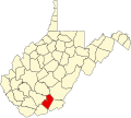
Raleigh County is a county in the U.S. state of West Virginia. As of the 2020 census, the population was 74,591. Its county seat is Beckley. The county was founded in 1850 and is named for Sir Walter Raleigh. Raleigh County is included in the Beckley, West Virginia, Metropolitan Statistical Area.
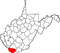
Mingo County is a county in the U.S. state of West Virginia. As of the 2020 census, the population was 23,568. Its county seat and largest city is Williamson. Created in 1895, Mingo is West Virginia's newest county, named for the historic Iroquoian Mingo people.
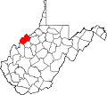
Mason County is a county in the U.S. state of West Virginia. As of the 2020 census, the population was 25,453. Its county seat and largest city is Point Pleasant. The county was founded in 1804 and named for George Mason, delegate to the U.S. Constitutional Convention. Before the Civil War, the county was in the State of Virginia.
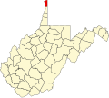
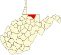
Marshall County is a county in the U.S. state of West Virginia. At the 2020 census, the population was 30,591. Its county seat is Moundsville. With its southern border at what would be a continuation of the Mason-Dixon line to the Ohio River, it forms the base of the Northern Panhandle of West Virginia.
Logan County is a county in the U.S. state of West Virginia. As of the 2020 census, the population was 32,567. Its county seat is Logan. Logan County comprises the Logan, WV Micropolitan Statistical Area, which is also included in the Charleston–Huntington–Ashland, WV–OH–KY Combined Statistical Area.
Kanawha County is a county in the U.S. state of West Virginia. As of the 2020 census, the population was 180,745, making it West Virginia's most populous county. The county seat is Charleston, which is also the state capital and most populous city. Kanawha County is part of the Charleston, WV Metropolitan Statistical Area.
Jackson County is a county in the U.S. state of West Virginia. As of the 2020 census, the population was 27,791. Its county seat is Ripley, and its largest municipality is Ravenswood.
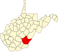
Fayette County is a county in the U.S. state of West Virginia. As of the 2020 census, the population was 40,488. Its county seat is Fayetteville. It is part of the Beckley, WV Metropolitan Statistical Area in Southern West Virginia.
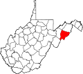
Berkeley County is located in the Shenandoah Valley in the eastern panhandle region of West Virginia in the United States. The county is part of the Hagerstown–Martinsburg metropolitan area. As of the 2020 census, the county population was 122,076, making it the second-most populous of West Virginia's 55 counties, behind Kanawha County. The City of Martinsburg is the county seat.
Marmet is a town in Kanawha County, West Virginia, United States, along the Kanawha River. The population was 1,501 at the 2020 census.
Sistersville is a city in Tyler County, West Virginia, United States, along the Ohio River. The population was 1,413 at the 2020 census. The Sistersville Ferry crosses the Ohio River to the unincorporated community of Fly in Monroe County, Ohio.
Wheeling is a city in Ohio and Marshall counties in the U.S. state of West Virginia. The county seat of Ohio County, it lies along the Ohio River in the foothills of the Appalachian Mountains within the state's Northern Panhandle. As of the 2020 census, the city had a population of 27,062, making it the fifth-most populous city in West Virginia and the most populous in the Northern Panhandle. The Wheeling metropolitan area had a population of 139,513 in 2020. Wheeling is located about 60 miles (97 km) west of Pittsburgh and 120 miles (190 km) east of Columbus via Interstate 70.
The history of West Virginia stems from the 1861 Wheeling Convention, which was an assembly of northwestern Southern Unionist from northwestern counties of the state of Virginia. They aimed to repeal the Ordinance of Secession that Virginia made at the start of the American Civil War (1861–1865). West Virginia was formed and recognized by the U.S. Congress on June 20, 1863, and protected by the U.S. Army.
The West Virginia State Capitol is the seat of government for the U.S. state of West Virginia, and houses the West Virginia Legislature and the office of the Governor of West Virginia. Located in Charleston, West Virginia, the building was dedicated in 1932. Along with the West Virginia Executive Mansion it is part of the West Virginia Capitol Complex, a historic district listed on the National Register of Historic Places.
The western part of Virginia which became West Virginia was settled in two directions, north to south from Pennsylvania, Maryland and New Jersey and from east to west from eastern Virginia and North Carolina. The earliest arrival of enslaved people was in the counties of the Shenandoah Valley, where prominent Virginia families built houses and plantations. The earliest recorded slave presence was about 1748 in Hampshire County on the estate of Thomas Fairfax, 6th Lord Fairfax of Cameron, which included 150 enslaved people. By the early 19th century, slavery had spread to the Ohio River up to the northern panhandle.