Preston County, West Virginia

Last updated

Preston County
Bicentennial Flag of Preston County, West Virginia.svg
Seal of Preston County, West Virginia.svg
Map of West Virginia highlighting Preston County.svg
Location of Preston County in West Virginia
West Virginia in United States.svg
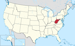
West Virginia's location within the U.S.
Coordinates: 39°28′N79°40′W / 39.47°N 79.67°W / 39.47; -79.67
Country Flag of the United States.svg  United States
State Flag of West Virginia.svg  West Virginia
FoundedJanuary 19, 1818
Named for James Patton Preston
Seat Kingwood
and Largest city
Government
  Commission PresidentSamantha Stone (R) [1]
  County CommissionDon Smith (R) [2]
Hunter Thomas (R) [3]
Area
  Total1,690 km2 (651 sq mi)
  Land1,680 km2 (649 sq mi)
  Water7 km2 (2.6 sq mi)  0.4%
  Rank 8th
Population
 (2020)
  Total34,216
  Estimate 
(2021)
34,358 Increase2.svg
  Rank 15th
  Density20/km2 (53/sq mi)
Time zone UTC−5 (Eastern)
  Summer (DST) UTC−4 (EDT)
Area code(s) 304, 681
Congressional district 2nd
Senate district 14th
House of Delegates district 83rd, 84th
Website http://www.prestoncountywv.org/

Preston County is a county located in the U.S. state of West Virginia. As of the 2020 Census, the population was 34,216. [4] Its county seat is Kingwood. [5] The county was formed from Monongalia County in 1818 and named for Virginia Governor James Patton Preston. [6]

Contents

Preston County is part of the Morgantown, WV Metropolitan Statistical Area, and is the southernmost county of the Pittsburgh media market. It is the home of The Buckwheat Festival, a county fair known for making buckwheat pancakes. [7]

History

Native Americans lived in (and traveled through) what would one day become Preston County; they crossed-over from the Ohio River watershed, which drains into the Mississippi River, into the Chesapeake Bay watershed. From 1736, European traders and explorers lived in the County, and one boundary stone was laid in 1746—the Fairfax Stone marking the limits of the North Branch of the River. Larger numbers of white settlers began arriving in 1766, with even more coming to the region after the American Revolutionary War. Traveling by foot or horseback, settlers built their own log cabins. Further development followed from 1818, when the National Road was built slightly to the north. When the earliest railroads came, in 1851, all land passed into private ownership, the population increased 70% in a decade, and industrialization truly began. [8]

During the American Civil War, more Preston County men enlisted in Union service than with the Confederacy. There were relatively few slave owners in Preston County, and naturally, few slaves. There were virtually none within a half-hour’s walk from the old Clarksburg-Winchester Road, dated to the late colonial era. The United States Census indicates that Preston County’s all-time slavery peak occurred in 1830, with 125 slaves accounted for, alongside 27 free colored persons. [9]

On June 20, 1863, Preston was one of 50 Virginia counties that were admitted to the Union as the State of West Virginia. Later that year, the counties were divided into civil townships, with the intention of encouraging local government. This proved impractical in the heavily rural state of West Virginia, and the townships were converted into magisterial districts in 1872. [10] Preston County was divided into eight districts: Grant, Kingwood, Lyon, Pleasant, Portland, Reno, Union, and Valley. These remained largely unchanged until the 1990s, when they were consolidated into five new magisterial districts: First, Second, Third, Fourth, and Fifth. [11]

Geography

According to the United States Census Bureau, the county has a total area of 651 square miles (1,690 km2), of which 649 square miles (1,680 km2) is land and 2.6 square miles (6.7 km2) (0.4%) is water. [12]

In West Virginia's coldest month of January 1977, Terra Alta in Preston County saw a statewide record snowfall of 104 inches (2.64 m). [13]

Major highways

Adjacent counties

National protected area

State parks

Demographics

Historical population
CensusPop.Note
1820 3,422
1830 5,14450.3%
1840 6,86633.5%
1850 11,70870.5%
1860 13,31213.7%
1870 14,5559.3%
1880 19,09131.2%
1890 20,3556.6%
1900 22,72711.7%
1910 26,34115.9%
1920 27,9966.3%
1930 29,0433.7%
1940 30,4164.7%
1950 31,3993.2%
1960 27,233−13.3%
1970 25,455−6.5%
1980 30,46019.7%
1990 29,037−4.7%
2000 29,3341.0%
2010 33,52014.3%
2020 34,2162.1%
2021 (est.)34,358 [14] 0.4%
U.S. Decennial Census [15]
1790–1960 [16] 1900–1990 [17]
1990–2000 [18] 2010–2020 [4]

2020 census

As of the 2020 census, there were 34,216 people and 12,510 households residing in the county. There were 15,174 housing units in Preston. The racial makeup of the county was 90.1% White, 6% African American, 0.2% Asian, 0.2% Native American, 0.2% from other races, and 3.3% from two or more races. Hispanics or Latinos of any race were 2% of the population.

Of the 12,510 households, 56.8% were married couples living together, 22.7% had a female householder with no spouse present, 14.4% had a male householder with no spouse present.The average household and family size was 3.04. The median age in the county was 43.5 years with 19% of the population under 18. The median income for a household was $55,755 and the poverty rate was 14.4%. [19]

2010 census

As of the 2010 United States census, there were 33,520 people, 12,895 households, and 9,038 families residing in the county. [20] The population density was 51.7 inhabitants per square mile (20.0/km2). There were 15,097 housing units at an average density of 23.3 per square mile (9.0/km2). [21] The racial makeup of the county was 97.6% white, 1.1% black or African American, 0.2% American Indian, 0.1% Asian, 0.2% from other races, and 0.8% from two or more races. Those of Hispanic or Latino origin made up 0.7% of the population. [20] In terms of ancestry, 29.4% were German, 14.3% were Irish, 9.5% were American, and 8.9% were English. [22]

Of the 12,895 households, 29.0% had children under the age of 18 living with them, 56.1% were married couples living together, 9.1% had a female householder with no husband present, 29.9% were non-families, and 24.6% of all households were made up of individuals. The average household size was 2.42 and the average family size was 2.84. The median age was 42.0 years. [20]

The age distribution was 19.55% under the age of 18, 7.36% from 18 to 24, 27.58% from 25 to 44, 29.83% from 45 to 64, and 15.68% who were 65 years of age or older. The median age was 42.0 years. For every 100 females, there were 106.63 males. For every 100 females age 18 and over, there were 106.48 males.

The median income for a household in the county was $40,753 and the median income for a family was $46,622. Males had a median income of $38,713 versus $25,808 for females. The per capita income for the county was $19,329. About 10.1% of families and 13.9% of the population were below the poverty line, including 19.0% of those under age 18 and 9.9% of those age 65 or over. [23]

Politics and government

Federal politics

Preston County lies within West Virginia's 2nd congressional district. The current representative of the district is Alex Mooney (R).

Generally speaking, most of the State of West Virginia has become a Republican bastion in the 21st century, after having leaned heavily Democratic between the New Deal and Bill Clinton). However, Preston County has seemingly always been a Republican stronghold, if not quite as ‘rock-ribbed’ as its neighbor, Grant County, or nearby Garrett County, Maryland, two counties that have historically never voted for a Democrat in the post-Civil War years. Preston County has, by comparison, voted Democratic on at least one occasion, during Lyndon Johnson’s 1964 landslide election; however, Johnson's win over Barry Goldwater was much more decisive than his narrow victory in analogous Upshur County, and Bill Clinton came within 20 votes in 1996.

Voter Registration and Party Enrollment of Preston County< [24]
PartyTotalPercentage
Democratic 4,30222.25%
Republican 10,26453.10%
Independents, unaffiliated, and other4,76524.65%
Total19,371100.00%
United States presidential election results for Preston County, West Virginia [25]
Year Republican Democratic Third party
No.%No.%No.%
2020 11,19076.79%3,16321.70%2201.51%
2016 9,53874.73%2,47019.35%7565.92%
2012 7,88970.54%2,93126.21%3633.25%
2008 7,32562.10%4,20535.65%2662.26%
2004 7,85565.85%3,96333.22%1110.93%
2000 6,60763.29%3,51533.67%3173.04%
1996 4,25741.31%4,23741.11%1,81217.58%
1992 4,42942.20%3,93337.47%2,13320.32%
1988 5,80456.92%4,35742.73%350.34%
1984 6,95563.05%4,05436.75%220.20%
1980 5,82854.23%4,31740.17%6015.59%
1976 5,71950.55%5,59549.45%00.00%
1972 7,80772.39%2,97727.61%00.00%
1968 5,63655.16%4,02039.35%5615.49%
1964 4,01539.06%6,26460.94%00.00%
1960 6,90862.07%4,22137.93%00.00%
1956 7,95370.27%3,36529.73%00.00%
1952 8,05965.32%4,27834.68%00.00%
1948 6,02062.73%3,52736.75%490.51%
1944 6,78569.36%2,99730.64%00.00%
1940 8,21363.46%4,73036.54%00.00%
1936 7,55358.11%5,41041.62%340.26%
1932 6,35956.05%4,87242.94%1151.01%
1928 7,78376.18%2,35523.05%780.76%
1924 6,39668.22%2,44526.08%5345.70%
1920 6,72974.73%2,15023.88%1251.39%
1916 3,83868.09%1,69430.05%1051.86%
1912 1,46124.70%1,84531.20%2,60844.10%

State politics

Preston County is represented by two Senators in the West Virginia Senate. Senate members Jay Taylor (R), and Randy Smith (R) both serve in West Virginia's 14th Senate district. [26] The county is also represented in the West Virginia House of Delegates by two Delegates. The Delegates for Preston County are George Street (R) for district 83 and D. Rolland Jennings (R) for district 84. [27]

County government

Preston County is governed by a County Commission. The commission is made up of the Commission President and Commissioners whom wield administrative powers of the county's government. Samantha Stone (R) is the current President of the County Commission.

The Preston County Commission consists of two members. The current members of the County Commission are Don Smith (R) and Hunter Thomas (R). [28]

Communities

City

Towns

Magisterial districts

Current

  • First
  • Second
  • Third
  • Fourth
  • Fifth

Historic

  • Grant
  • Kingwood
  • Lyon
  • Pleasant
  • Portland
  • Reno
  • Union
  • Valley

Census-designated place

Unincorporated communities

See also

Related Research Articles

<span class="mw-page-title-main">Washington County, Maryland</span> County in Maryland, United States

Washington County is located in the western part of the U.S. state of Maryland. As of the 2020 census, the population was 154,705. It is the most populous county in the Western Maryland region and its county seat is Hagerstown.

<span class="mw-page-title-main">Putnam County, West Virginia</span> County in West Virginia, United States

Putnam County is a county in the U.S. state of West Virginia. As of the 2020 census, the population was 57,440. Its county seat is Winfield, its largest incorporated city is Hurricane, and its largest community is the census-designated place of Teays Valley. Putnam County is part of the Huntington–Ashland, WV-KY-OH Metropolitan Statistical Area, across the Kanawha River from Charleston, West Virginia.

<span class="mw-page-title-main">Clay County, West Virginia</span> County in West Virginia, United States

Clay County is a county in the U.S. state of West Virginia. As of the 2020 census, the population was 8,051. Its county seat is Clay. The county was founded in 1858 and named in honor of Henry Clay, famous American statesman, member of the United States Senate from Kentucky and United States Secretary of State in the 19th century.

<span class="mw-page-title-main">Tucker County, West Virginia</span> County in West Virginia, United States

Tucker County is a county in the U.S. state of West Virginia. As of the 2020 census, the population was 6,762, making it West Virginia's fourth-least populous county. Its county seat is Parsons. The county was created in 1856 from a part of Randolph County, then part of Virginia. In 1871, a small part of Barbour County, was transferred to Tucker County. The county was named after Henry St. George Tucker, Sr., a judge and Congressman from Williamsburg, Virginia.

<span class="mw-page-title-main">Ritchie County, West Virginia</span> County in West Virginia, United States

Ritchie County is a county in the U.S. state of West Virginia. As of the 2020 census, the population was 8,444. Its county seat is Harrisville. The county was created in 1843 by the Virginia General Assembly and named for Richmond newspaper publisher Thomas Ritchie.

<span class="mw-page-title-main">Pleasants County, West Virginia</span> County in West Virginia, United States

Pleasants County is a county located in the U.S. state of West Virginia. At the 2020 census, the population was 7,653. Its county seat is St. Marys.

<span class="mw-page-title-main">Nicholas County, West Virginia</span> County in West Virginia, United States

Nicholas County is a county located in the central region of U.S. state of West Virginia. As of the 2020 census, the population was 24,604. Its county seat is Summersville. The county was created in 1818 by the Virginia General Assembly and named for Virginia Governor Wilson Cary Nicholas.

<span class="mw-page-title-main">Monroe County, West Virginia</span> County in West Virginia, United States

Monroe County is a county in the U.S. state of West Virginia. As of the 2020 census, the population was 12,376. Its county seat is Union.

<span class="mw-page-title-main">Mineral County, West Virginia</span> County in West Virginia, United States

Mineral County is a county in the U.S. state of West Virginia. It is part of the Cumberland metropolitan area, together with Cumberland, Maryland. As of the 2020 census, the population was 26,938. Its county seat is Keyser. The county was founded in 1866.

<span class="mw-page-title-main">Grant County, West Virginia</span> County in West Virginia, United States

Grant County is a county in the U.S. state of West Virginia. As of the 2020 census, the population was 10,976. Its county seat is Petersburg. The county was created from Hardy County in 1866 and named for Civil War General and the 18th president of the United States Ulysses S. Grant.

<span class="mw-page-title-main">Calhoun County, West Virginia</span> County in West Virginia, United States

Calhoun County is a county in the U.S. state of West Virginia. As of the 2020 census, the population was 6,229, making it the third-least populous county in West Virginia. Its county seat is Grantsville. The county was founded in 1856 and named for South Carolina politician John C. Calhoun.

<span class="mw-page-title-main">Kingwood Township, New Jersey</span> Township in Hunterdon County, New Jersey, United States

Kingwood Township is a township in Hunterdon County, in the U.S. state of New Jersey, located on the Hunterdon Plateau. As of the 2020 United States census, the township's population was 3,802, a decrease of 43 (−1.1%) from the 2010 census count of 3,845, which in turn reflected an increase of 63 (+1.7%) from the 3,782 counted in the 2000 census.

<span class="mw-page-title-main">Bayard, West Virginia</span> Town in West Virginia, United States

Bayard is a town in Grant County, West Virginia, United States. The population was 200 at the 2020 census. Bayard was incorporated in 1893 and named in honor of Thomas F. Bayard, Jr., who later became a United States senator from Delaware (1923–1929). Bayard was founded on the West Virginia Central and Pittsburgh Railroad as a coal mining community. Coal mining has remained the town's chief industry.

<span class="mw-page-title-main">New Cumberland, West Virginia</span> City in West Virginia, United States

New Cumberland is a city in and the county seat of Hancock County, West Virginia, United States, along the Ohio River. The population was 1,020 as of the 2020 census. It is part of the Weirton–Steubenville metropolitan area and is located near the Mountaineer Casino, Racetrack and Resort.

<span class="mw-page-title-main">Weston, West Virginia</span> City in West Virginia, United States

Weston is a city in and the county seat of Lewis County, West Virginia, United States. The population was 3,943 at the 2020 census. It is home to the Museum of American Glass in West Virginia and the Trans-Allegheny Lunatic Asylum.

<span class="mw-page-title-main">Kermit, West Virginia</span> Town in West Virginia, United States

Kermit is a town in Mingo County, West Virginia, United States. The population was 406 at the 2010 census. Kermit is located along the Tug Fork, opposite Warfield, Kentucky. The Norfolk Southern Railway's Kenova District runs through town.

<span class="mw-page-title-main">Durbin, West Virginia</span> Town in West Virginia, United States

Durbin is a town in Pocahontas County, West Virginia, United States. The population was 235 at the 2020 census.

<span class="mw-page-title-main">Kingwood, West Virginia</span> City in West Virginia, United States

Kingwood is a city in and the county seat of Preston County, West Virginia, United States. The population was 2,980 at the 2020 census. The city sits within the Allegheny Mountains above the Cheat River valley. It is part of the Morgantown metropolitan area.

<span class="mw-page-title-main">Tunnelton, West Virginia</span> Town in West Virginia, United States

Tunnelton is a town in southwestern Preston County, West Virginia, United States. The population was 307 at the 2020 census. It is part of the Morgantown metropolitan area.

<span class="mw-page-title-main">Hinton, West Virginia</span> City in West Virginia, United States

Hinton is a city in and the county seat of Summers County, West Virginia, United States. The population was 2,266 at the 2020 census. Hinton was established in 1873 and chartered in 1897. Hinton was named after John "Jack" Hinton, the original owner of the town site. Much of Hinton's downtown was placed on the National Register of Historic Places in 1984. In 1994, part of Paramount's film Lassie was shot in Hinton. In the 1990s, Hinton's downtown experienced economic decline after a hospital moved away and Interstate 64 bypassed the town. In 2007, Hinton native and business owner Ken Allman founded MountainPlex Properties, which since then has worked to preserve and revitalize the Hinton Historic District.

References

  1. "Preston swears in new commissioner". The Dominion Post. Retrieved October 25, 2023.
  2. "2020 General Election Results: Preston County". WBOY-TV. Retrieved October 24, 2023.
  3. "Summary Results Report WV Preston County Results". Preston County Clerk. Retrieved October 24, 2023.
  4. 1 2 "State & County QuickFacts". United States Census Bureau. Retrieved October 20, 2022.
  5. "Find a County". National Association of Counties. Retrieved June 7, 2011.
  6. West Virginia Counties Archived September 23, 2001, at the Wayback Machine . Wvculture.org. Retrieved on July 24, 2013.
  7. "Preston County Buckwheat Festival". VisitMountaineerCountry.com. Retrieved January 18, 2022.
  8. Oren Morton, A History of Preston County, part 1 (Kingwood W.Va., Journal Publishing Company 1914) pp. 9-11
  9. Morton p. 138
  10. Otis K. Rice & Stephen W. Brown, West Virginia: A History, 2nd ed., University Press of Kentucky, Lexington (1993), p. 240.
  11. United States Census Bureau, U.S. Decennial Census, Tables of Minor Civil Divisions in West Virginia, 1870–2010.
  12. "2010 Census Gazetteer Files". United States Census Bureau. August 22, 2012. Retrieved July 30, 2015.
  13. West Virginia encyclopedia; The Weather
  14. "Annual Estimates of the Resident Population for Counties: April 1, 2020 to July 1, 2021" . Retrieved October 20, 2022.
  15. "U.S. Decennial Census". United States Census Bureau. Retrieved January 11, 2014.
  16. "Historical Census Browser". University of Virginia Library. Retrieved January 11, 2014.
  17. "Population of Counties by Decennial Census: 1900 to 1990". United States Census Bureau. Retrieved January 11, 2014.
  18. "Census 2000 PHC-T-4. Ranking Tables for Counties: 1990 and 2000" (PDF). United States Census Bureau. Archived (PDF) from the original on October 9, 2022. Retrieved January 11, 2014.
  19. "Explore Census Data". data.census.gov. Retrieved March 30, 2023.
  20. 1 2 3 "DP-1 Profile of General Population and Housing Characteristics: 2010 Demographic Profile Data". United States Census Bureau. Archived from the original on February 13, 2020. Retrieved April 3, 2016.
  21. "Population, Housing Units, Area, and Density: 2010 - County". United States Census Bureau. Archived from the original on February 13, 2020. Retrieved April 3, 2016.
  22. "DP02 SELECTED SOCIAL CHARACTERISTICS IN THE UNITED STATES – 2006-2010 American Community Survey 5-Year Estimates". United States Census Bureau. Archived from the original on February 13, 2020. Retrieved April 3, 2016.
  23. "DP03 SELECTED ECONOMIC CHARACTERISTICS – 2006-2010 American Community Survey 5-Year Estimates". United States Census Bureau. Archived from the original on February 13, 2020. Retrieved April 3, 2016.
  24. "West Virginia Voter Registration" (PDF). West Virginia Secretary of State. July 31, 2023. Retrieved October 24, 2023.
  25. Leip, David. "Dave Leip's Atlas of U.S. Presidential Elections". uselectionatlas.org. Retrieved March 28, 2018.
  26. "Senate District Map". West Virginia Legislature.
  27. "House Select Committee on Redistricting". West Virginia Legislature.
  28. "COUNTY COMMISSION". Preston County Commission.

Further reading