Martinsburg, West Virginia

Last updated

Martinsburg, West Virginia
MartinsburgWV HistoricDistrict.jpg
Flag of Martinsburg, West Virginia.svg
Martinsburg, WV Seal.png
Martinsburg, West Virginia
Interactive map of Martinsburg
USA West Virginia relief location map.svg
Red pog.svg
Martinsburg
Usa edcp relief location map.png
Red pog.svg
Martinsburg
Coordinates: 39°27′13″N77°59′44″W / 39.45361°N 77.99556°W / 39.45361; -77.99556
CountryUnited States
State West Virginia
County Berkeley
Government
   Mayor Kevin Knowles (D) [1]
Area
[2]
   City 6.65 sq mi (17.22 km2)
  Land6.63 sq mi (17.17 km2)
  Water0.02 sq mi (0.04 km2)
Elevation
[3]
495 ft (151 m)
Population
 (2020) [4]
   City 18,773
  Estimate 
(2019) [5]
18,835
  Density2,632.18/sq mi (1,016.31/km2)
   Urban
43,441
   Metro
260,070 (US: 167th)
Time zone UTC−5 (EST)
  Summer (DST) UTC−4 (EDT)
ZIP codes
25401–25405
Area code 304 681
FIPS code 54-52060
GNIS feature ID2390615 [3]
Website City of Martinsburg

Martinsburg is a city in and the county seat of Berkeley County, West Virginia, United States. [6] The population was 18,773 at the 2020 census, making Martinsburg the largest city in the Eastern Panhandle of West Virginia and the sixth-largest city in the state. It is a principal city of the Hagerstown–Martinsburg metropolitan area extending into Maryland, which had 293,844 residents in 2020.

Contents

History

Martinsburg was established by an act [7] of the Virginia General Assembly that was adopted in December 1778 [8] during the American Revolutionary War. Founder Major General Adam Stephen named the gateway town to the Shenandoah Valley along Tuscarora Creek in honor of Colonel Thomas Bryan Martin, a nephew of Thomas Fairfax, 6th Lord Fairfax of Cameron. [9]

Aspen Hall, a Georgian mansion, is the oldest house in the city.[ citation needed ] Part was built in 1745 by Edward Beeson, Sr. Aspen Hall, and its wealthy residents had key roles in the agricultural, religious, transportation, and political history of the region. Significant events related to the French and Indian War, the Revolution, and the Civil War took place on the property. Three original buildings are still standing, including the rare blockhouse of Mendenhall's Fort.

The first United States post office in what is now West Virginia was established at Martinsburg in 1792. At that time, Martinsburg and the larger territory were still part of Virginia.

The Baltimore and Ohio Railroad (B&O) reached Martinsburg in 1842. The Baltimore and Ohio Railroad Martinsburg Shops were constructed in 1849 and rebuilt after the American Civil War.[ citation needed ]

According to William Still, "The Father of the Underground Railroad" and its historian: Mr Robert Brown, alias Thomas Jones, escaped from slavery in Martinsburg on Christmas night in 1856. He rode a horse and had it swim across the freezing Potomac River. After riding forty miles, he walked in cold wet clothes for two days, to Harrisburg, Pennsylvania. He received assistance there from the Underground Railroad and traveled by train to Philadelphia, and the office of William Still with the Pennsylvania Anti-Slavery Society. Brown's wife and four children had been sold; he sought help to find them. He had a likeness of his wife, and locks of hair from each of them.[ citation needed ]

Civil war

The Baltimore and Ohio Railroad's Martinsburg Shops three years before the Civil War Baltimore and Ohio employees magazine (1912) (14575208137).jpg
The Baltimore and Ohio Railroad's Martinsburg Shops three years before the Civil War

In 1854, ten-year-old Isabelle Boyd, known as "Belle" and later a noted spy for the Confederacy, moved to Martinsburg with her family, where her father Benjamin operated a general merchandise store. After the Civil War began, Benjamin joined the Second Virginia Infantry, which was part of the Stonewall Brigade. His wife Mary was thus in charge of the Boyd home when Union forces under General Robert Patterson took Martinsburg. When a group of Patterson's men tried to raise a Union flag over the Boyd home, Mary refused. One of the soldiers, Frederick Martin, threatened Mary, and Belle shot him. She was acquitted.

She soon became involved in espionage, sending information to Confederate generals Thomas "Stonewall" Jackson and J.E.B. "Jeb" Stuart. Often she was helped by Eliza Corsey, a Boyd family slave whom Belle had taught to read and write. In 1863, Belle was arrested in Martinsburg by the Union Army and imprisoned. Boyd's Greek Revival home, which he had built in 1853 and sold in 1855, had numerous owners over the decades. In 1992 it was purchased by the Berkeley County Historical Society. The historical society renovated the building and now operates it as the Berkeley County Museum. It is also known as the Belle Boyd House.

Reconstruction

Residents of West Virginia were split in their allegiance during the war, with half of its soldiers serving in the Confederate army. [10] The vote to create a new state in western Virginia was very low, but statehood was approved by Congress and President Lincoln, and the new state was admitted to the Union on June 20, 1863. [11]

The city of Martinsburg was incorporated by an act of the new West Virginia Legislature on March 30, 1868.

Blockade of engines during the Great Railroad Strike of 1877 Harpers 8 11 1877 Blockade of Engines at Martinsburg W VA.jpg
Blockade of engines during the Great Railroad Strike of 1877

Martinsburg became a center of the railroad industry and its workers. The Great Railroad Strike of 1877 began July 14, 1877, in this city at the Baltimore and Ohio Railroad Martinsburg Shops. [12] After several unsuccessful attempts to quell the protests, Governor Henry M. Mathews called for federal troops. By the time these troops had restored order, the protest of the rail company had spread across the country. [13]

Telephone service was established in Martinsburg in 1883. In 1889, electricity began to be furnished to Martinsburg as part of a franchise granted to the United Edison Manufacturing Company of New York.[ citation needed ]

The Interwoven Mills began operations in Martinsburg in 1891. [14]

Construction of the Apollo Civic Theatre was completed in 1913. [15]

World War I and beyond

An engineer waves from a passing B&O freight train in 1969. The B&O's shops employed many locals throughout its 130 years of operation. 3 B&O Freight Train Photos at Martinsburg, W. VA. (27437398010).jpg
An engineer waves from a passing B&O freight train in 1969. The B&O's shops employed many locals throughout its 130 years of operation.

Over one thousand (1,039) men from Berkeley County participated in World War I. Of these, forty-one were killed, and twenty-one were wounded in battle. A monument to those who fell in battle was erected in Martinsburg in 1925.

During World War II, the Newton D. Baker Hospital in Martinsburg treated thousands of soldiers wounded in the war. In 1946 this military hospital became a part of the Veterans Administration (VA). The VA Medical Center in Martinsburg still provides care to United States veterans.

Due to restructuring beginning in the late 1940s and continuing through the 1970s, many of the mills and factories operating in Martinsburg shut down and went out of business, dealing a major blow to the local economy. Jobs were moved to the Deep South and later offshore.
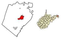
Geography

Location and topography

Martinsburg is approximately 18 miles (29 km) southwest of Hagerstown, 73 miles (117 km) west of Baltimore, 63 miles (101 km) northwest of Washington, D.C., and 134 miles (216 km) east of Morgantown. U.S. Route 11 runs through the center of town, and Interstate 81 passes along the northern side of the town.

Martinsburg is 212 miles (341 km) distant from the state capital of Charleston. However, it is closer to no less than five other state capitals: Harrisburg PA - 80 miles (130 km), Annapolis MD - 85 miles (137 km), Dover DE - 132 miles (212 km), Richmond VA - 135 miles (217 km), and Trenton NJ - 179 miles (288 km).

According to the United States Census Bureau, the city has a total area of 6.67 square miles (17.28 km2), of which 6.65 square miles (17.22 km2) is land and 0.02 square miles (0.05 km2) is water. [16]

Climate

Martinsburg lies in the transitional area between humid subtropical climate (Köppen Cfa) and humid continental climatic zones (Köppen Dfa), with four distinct seasons. Winters are cool to cold, with a January daily mean temperature of 32.4 °F (0.2 °C) and an average annual snowfall of 26.1 inches (66 cm), while summers are hot and humid with a July daily mean temperature of 75.7 °F (24.3 °C) and 27 days of 90 °F (32 °C)+ readings annually. Precipitation is moderate, with winter being the driest period and May thru July the wettest. Extreme temperatures at Eastern West Virginia Regional Airport range from −18 °F (−28 °C) on January 21, 1994, up to 112 °F (44 °C) on July 11, 1936; an even colder −19 °F (−28 °C) was recorded in the city on January 14, 1912.

Climate data for Martinsburg, West Virginia (Eastern West Virginia Regional Airport), 1991−2020 normals, [lower-alpha 1] extremes 1891−present [lower-alpha 2]
MonthJanFebMarAprMayJunJulAugSepOctNovDecYear
Record high °F (°C)80
(27)
83
(28)
90
(32)
101
(38)
100
(38)
110
(43)
112
(44)
108
(42)
103
(39)
98
(37)
86
(30)
78
(26)
112
(44)
Mean maximum °F (°C)64.0
(17.8)
65.9
(18.8)
76.0
(24.4)
85.1
(29.5)
89.7
(32.1)
93.8
(34.3)
96.6
(35.9)
94.3
(34.6)
90.6
(32.6)
83.6
(28.7)
73.7
(23.2)
64.7
(18.2)
97.4
(36.3)
Mean daily maximum °F (°C)41.3
(5.2)
44.7
(7.1)
53.5
(11.9)
65.4
(18.6)
74.0
(23.3)
82.4
(28.0)
86.9
(30.5)
85.0
(29.4)
78.1
(25.6)
66.7
(19.3)
55.1
(12.8)
44.8
(7.1)
64.8
(18.2)
Daily mean °F (°C)32.4
(0.2)
35.0
(1.7)
42.8
(6.0)
53.6
(12.0)
62.5
(16.9)
71.1
(21.7)
75.7
(24.3)
73.8
(23.2)
66.7
(19.3)
55.2
(12.9)
44.6
(7.0)
36.0
(2.2)
54.1
(12.3)
Mean daily minimum °F (°C)23.5
(−4.7)
25.3
(−3.7)
32.2
(0.1)
41.8
(5.4)
51.0
(10.6)
59.8
(15.4)
64.5
(18.1)
62.5
(16.9)
55.3
(12.9)
43.7
(6.5)
34.2
(1.2)
27.1
(−2.7)
43.4
(6.3)
Mean minimum °F (°C)4.3
(−15.4)
9.5
(−12.5)
15.5
(−9.2)
27.2
(−2.7)
36.6
(2.6)
46.7
(8.2)
53.7
(12.1)
52.2
(11.2)
41.3
(5.2)
29.2
(−1.6)
19.3
(−7.1)
12.0
(−11.1)
2.1
(−16.6)
Record low °F (°C)−19
(−28)
−13
(−25)
−3
(−19)
19
(−7)
26
(−3)
36
(2)
41
(5)
38
(3)
29
(−2)
17
(−8)
6
(−14)
−12
(−24)
−19
(−28)
Average precipitation inches (mm)2.60
(66)
2.14
(54)
3.42
(87)
3.36
(85)
4.05
(103)
3.85
(98)
3.78
(96)
3.02
(77)
4.03
(102)
2.99
(76)
2.73
(69)
3.00
(76)
38.97
(990)
Average snowfall inches (cm)9.0
(23)
7.2
(18)
4.6
(12)
0.4
(1.0)
0.0
(0.0)
0.0
(0.0)
0.0
(0.0)
0.0
(0.0)
0.0
(0.0)
0.0
(0.0)
1.1
(2.8)
3.8
(9.7)
26.1
(66)
Average precipitation days (≥ 0.01 in)10.08.911.011.013.011.310.69.19.49.08.59.5121.3
Average snowy days (≥ 0.1 in)3.72.11.70.20.00.00.00.00.00.00.52.110.3
Source: NOAA (snow 1981–2010) [17] [18] [19]

Demographics

Historical population
CensusPop.Note
1850 2,190
1860 3,36453.6%
1870 4,86344.6%
1880 6,33530.3%
1890 7,22614.1%
1900 7,5644.7%
1910 10,69841.4%
1920 12,51517.0%
1930 14,85718.7%
1940 15,0631.4%
1950 15,6213.7%
1960 15,179−2.8%
1970 14,626−3.6%
1980 13,063−10.7%
1990 14,0737.7%
2000 14,9726.4%
2010 17,22715.1%
2020 18,7739.0%
U.S. Decennial Census [20]

2020 census

As of the census [21] of 2020, there were 18,777 people residing in the city, living in 7,179 total households. The population density was 2,591.7 inhabitants per square mile. The racial makeup of the city was 79.9% White, 13.9% African American, 0.1% Native American, 1.3% Asian, 0.0% Pacific Islander, and 3.1% two or more races. Hispanic or Latino of any race was 4.8% of the population.

The median household income (in 2019 dollars) was $42,835. The per capita income was $24,970. 29.5% of the population is recorded as being in poverty. 88.5% of households had a computer, with 77.9% having access to broadband internet.

2010 census

As of the census [22] of 2010, there were 17,227 people, 7,293 households, and 4,106 families residing in the city. The population density was 2,590.5 inhabitants per square mile (1,000.2/km2). There were 8,408 housing units at an average density of 1,264.4 per square mile (488.2/km2). The racial makeup of the city was 77.5% White, 14.9% African American, 0.4% Native American, 1.2% Asian, 0.1% Pacific Islander, 2.3% from other races, and 3.7% from two or more races. Hispanic or Latino of any race were 6.2% of the population.

There were 7,293 households, of which 29.6% had children under the age of 18 living with them, 35.3% were married couples living together, 15.0% had a female householder with no husband present, 6.0% had a male householder with no wife present, and 43.7% were non-families. Of all households, 35.4% were made up of individuals, and 12.6% had someone living alone who was 65 years of age or older. The average household size was 2.32 and the average family size was 3.00.

The median age in the city was 37 years. 23.3% of residents were under the age of 18; 8.6% were between the ages of 18 and 24; 28.3% were from 25 to 44; 26.3% were from 45 to 64; and 13.4% were 65 years of age or older. The gender makeup of the city was 48.8% male and 51.2% female.

2000 census

As of the census [23] of 2000, there were 14,972 people, 6,684 households, and 3,689 families residing in the city. The population density was 2,977.4 inhabitants per square mile (1,149.6/km2). There were 7,432 housing units at an average density of 1,478.0 per square mile (570.7/km2). The racial makeup of the city was 83.9% White, 11.6% African American, 0.4% Native American, 0.9% Asian, 0% Pacific Islander, 1.3%% from other races, and 2.2% from two or more races. Hispanic or Latino of any race were 2.9% of the population.

There were 6,684 households, out of which 24.9% had children under the age of 18 living with them, 36.7% were married couples living together, 13.7% had a female householder with no husband present, and 44.8% were non-families. 37.6% of all households were made up of individuals, and 15.2% had someone living alone who was 65 years of age or older. The average household size was 2.21 and the average family size was 2.92.

In the city, the population was spread out, with 23.1% under the age of 18, 9.6% from 18 to 24, 28.7% from 25 to 44, 22.3% from 45 to 64, and 16.4% who were 65 years of age or older. The median age was 37 years. For every 100 females, there were 91.0 males. For every 100 females age 18 and over, there were 88.6 males.

The median income for a household in the city was $29,495, and the median income for a family was $36,954. Males had a median income of $29,697 versus $22,212 for females. The per capita income for the city was $16,314. About 14.7% of families and 20.0% of the population were below the poverty line, including 28.8% of those under age 18 and 15.1% of those age 65 or over.

Economy

Berkeley County Courthouse 2016-08-25 14 11 33 The Berkeley County Courthouse on U.S. Route 11 (King Street) in Martinsburg, Berkeley County, West Virginia.jpg
Berkeley County Courthouse

Major private employers in and around Martinsburg include Quad/Graphics, Ecolab, Orgill, Macy's, and FedEx. In February 2015, it was announced that Procter & Gamble planned to build a $500 million facility near the city. [24]

The city also has numerous federal government employers, including the Internal Revenue Service (IRS), U.S. Coast Guard C5ISC-Kearneysville, U.S. Coast Guard National Maritime Center, Bureau of Alcohol, Tobacco, Firearms, and Explosives, and the Martinsburg VA Medical Center.

The Martinsburg IRS Facility, one of the two Enterprise Computing Centers of the Internal Revenue Service (the other is in Memphis, Tennessee), processes most of the country's electronically filed tax documents from businesses, and about one-third of electronically filed tax returns.

The area is also home to the 167th Airlift Wing of the West Virginia Air National Guard, based in Eastern WV Regional Airport.

Martinsburg had its own automobile company from 1912 to 1922, called Norwalk, which assembled the longest-made known cars to be built in the state of West Virginia. [25]

Sports

Major League Baseball Hall of Famer [26] Hack Wilson began his storied professional career in his adopted hometown with the Martinsburg Blue Sox, a low-level minor-league baseball team. Wilson would go on to set the yet-to-be-broken major league record for RBI in a season (191) with the Chicago Cubs [27] in 1930.

After his playing career ended in 1935, Hack went back home to Martinsburg, played some ball with the town's semipro team and opened a recreation and pool hall in town with a partner. He later moved to Baltimore in 1941 where he later died November 23, 1948. Originally scheduled to be interred in Baltimore, Wilson was buried — in a donated plot — in Martinsburg, [28]

Education

Martinsburg High School Martinsburg High School entrance WV 2022-08-06 10-49-16.jpg
Martinsburg High School

Elementary and intermediate schools

Middle schools

High schools

Colleges and universities

Media

Print

Martinsburg has one daily community newspaper, The Journal and also is regionally covered by The Herald-Mail out of Hagerstown, Maryland. Martinsburg has a bi-monthly magazine, Around the Panhandle magazine.

Radio

The city is home to WEPM/1340 AM, WRNR/740 AM, WICL/95.9 FM, WLTF/97.5 FM, and WVEP/88.9 FM radio stations.

Television

Martinsburg is home to W08EE-D Channel 8 (West Virginia Public Broadcasting) and WWPX 60 (ION), all part of the Hagerstown sub-market that is further grouped under the Nielsen-designated Washington, D.C.-Hagerstown, Md. market, the ninth largest market in the nation. [29]

Martinsburg was the setting of the X-Files episode "Small Potatoes" (Season 4, episode 20). However, the filming did not take place in the vicinity. Martinsburg was also the setting for the reality television series Gypsy Sisters on TLC .

Transportation

Roads and highways

I-81 southbound in Martinsburg 2019-07-10 10 10 43 View south along Interstate 81 from the overpass for Berkeley County Route 15 (King Street) in Martinsburg, Berkeley County, West Virginia.jpg
I-81 southbound in Martinsburg

Martinsburg is served by several significant highways. The most prominent of these is Interstate 81, which is the main north–south highway through the region. I-81 connects northward to Hagerstown and Harrisburg, and continues southward to Winchester and Roanoke. U.S. Route 11, the former primary regional north–south highway, now serves as a local service road to I-81, and travels through downtown Martinsburg. The main highway serving regional east–west travel is West Virginia Route 9. From Martinsburg eastwards, WV 9 follows an expressway, connecting the city to Charles Town and Leesburg. WV 9 follows US 11 through downtown Martinsburg. To the west, WV 9 continues to Berkeley Springs and Paw Paw. West Virginia Route 45 is the other state highway serving Martinsburg. WV 45 extends westward into rural areas of western Berkeley County, and continues eastward to Shepherdstown.

Mass transportation

Baltimore and Ohio Railroad Martinsburg Shops Martinsburg roundhouse 220575.jpg
Baltimore and Ohio Railroad Martinsburg Shops

Amtrak provides service to Martinsburg on its Washington-Chicago Capitol Limited route. The city's passenger rail station is located downtown at 229 East Martin Street. MARC, Maryland's commuter rail system, operates trains on weekdays on its Brunswick Line which terminates in Martinsburg. Service is provided to Union Station in Washington, D.C.

Eastern Panhandle Transit Authority (EPTA) operates public bus transit routes in Martinsburg, surrounding Berkeley County, and neighboring Jefferson County, West Virginia. [30]

Eastern WV Regional Airport, south of the city, handles general aviation and Shepherd Field Air National Guard Base is located at this airport. The closest airport with commercial air service is Hagerstown Regional Airport, that is about 25 miles (40 km) driving distance north. The closest international airport is Washington Dulles International Airport near D.C., which is about 60 miles (97 km) driving distance east.

Healthcare

Martinsburg is home to two hospitals, namely the Berkeley Medical Center and the Martinsburg Veterans Affairs Medical Center.

Notable people

Related Research Articles

<span class="mw-page-title-main">Washington County, Maryland</span> County in Maryland, United States

Washington County is located in the western part of the U.S. state of Maryland. As of the 2020 census, the population was 154,705. It is the most populous county in the Western Maryland region and its county seat is Hagerstown.

<span class="mw-page-title-main">Morgan County, West Virginia</span> County in West Virginia, United States

Morgan County is a county located in the U.S. state of West Virginia. As of the 2020 census, the population was 17,063. Its county seat is Berkeley Springs. The county was formed in 1820 from parts of Hampshire and Berkeley Counties and named in honor of General Daniel Morgan, prominent soldier of the American Revolutionary War. The county and town of Bath are considered an excellent jumping off point for exploring the Potomac and Cacapon Rivers valleys just to the north and west. Along with also being a tourist destination hosting numerous local artists, mineral water spas, and a large amount of outdoor recreation that includes fishing, boating, wildlife, hunting, and mountain scenery. The region is known for the famed Apple Butter Festival held annually in October. Morgan County is also the home of an important silica mine, part of U.S. Silica.

<span class="mw-page-title-main">Boone County, West Virginia</span> County in West Virginia, United States

Boone County is a county in the U.S. state of West Virginia. As of the 2020 census, the population was 21,809. Its county seat is Madison. Boone County is part of the Charleston, WV Metropolitan Statistical Area. Leading industries and chief agricultural products in Boone County include coal, lumber, natural gas, tobacco, and strawberries.

<span class="mw-page-title-main">Berkeley County, West Virginia</span> County in West Virginia, United States

Berkeley County is located in the Shenandoah Valley in the eastern panhandle region of West Virginia in the United States. The county is part of the Hagerstown–Martinsburg metropolitan area. As of the 2020 census, the county population was 122,076, making it the second-most populous of West Virginia's 55 counties, behind Kanawha County. The City of Martinsburg is the county seat.

<span class="mw-page-title-main">Inez, Kentucky</span> City in Kentucky, United States

Inez is a home rule-class city in and the county seat of Martin County, Kentucky, United States. The population was 546 at the 2020 census.

<span class="mw-page-title-main">Cambridge, Ohio</span> City in Ohio, United States

Cambridge (CAM-bridge) is a city in and the county seat of Guernsey County, Ohio, United States. It lies in southeastern Ohio, in the Appalachian Plateau of the Appalachian Mountains about 75 miles (121 km) east of Columbus and approximately 124 miles (200 km) south of Cleveland. The population was 10,089 at the 2020 census. It is the principal city of the Cambridge micropolitan area and is located adjacent to the intersection of Interstates 70 and 77.

<span class="mw-page-title-main">Boyce, Virginia</span> Town in Virginia

Boyce is a small incorporated town in Clarke County, Virginia, United States. The population was 749 at the 2020 census, up from 589 at the 2010 census.

<span class="mw-page-title-main">Hedgesville, West Virginia</span> Town in West Virginia, United States

Hedgesville is a town in Berkeley County, West Virginia, United States, in the state's Eastern Panhandle region. The population was 318 at the 2010 census. The town sits on WV 9, roughly 13 miles east of Berkeley Springs. In addition to its legal definition, Hedgesville has come to be the common name for the large and sparsely inhabited area of West Virginia's Eastern Panhandle bordered by the Potomac River to the North and East, a southern border defined roughly by an imaginary line from the city of Martinsburg to the tip of Virginia, and Berkeley Springs to the West.

<span class="mw-page-title-main">Bridgeport, West Virginia</span> City in West Virginia, United States

Bridgeport is a city in eastern Harrison County, West Virginia, United States. The population was 9,325 at the 2020 census. It is part of the Clarksburg micropolitan area in North Central West Virginia. Bridgeport had its beginning in pre-American Revolutionary War times. In 1764, John Simpson entered the area and gave his name to Simpson Creek. Bridgeport was chartered in 1816.

<span class="mw-page-title-main">Charles Town, West Virginia</span> City in West Virginia, United States

Charles Town is a city in and the county seat of Jefferson County, West Virginia, United States. The population was 6,534 at the 2020 census. The city is named for its founder Charles Washington, youngest brother of President George Washington. It is part of the northwestern fringes of the Washington metropolitan area.

<span class="mw-page-title-main">Clendenin, West Virginia</span> Town in West Virginia, United States

Clendenin is a town in Kanawha County, West Virginia, United States, situated along the Elk River. The population was 850 at the 2020 census.

<span class="mw-page-title-main">Morgantown, West Virginia</span> City in West Virginia

Morgantown is a city in and the county seat of Monongalia County, West Virginia, United States, situated along the Monongahela River. The most populous city in North Central West Virginia and the third-most populous city in the state, Morgantown is best known as the home of West Virginia University. The population was 30,347 at the 2020 census. The city serves as the anchor of the Morgantown metropolitan area, which had a population of 138,176 in 2020.

<span class="mw-page-title-main">Berkeley Springs, West Virginia</span> Town in West Virginia, United States

Berkeley Springs is a town in, and the county seat of, Morgan County, West Virginia, United States, in the state's Eastern Panhandle. Berkeley Springs is also commonly used to refer to the area in and around the Town of Bath. In 1776, the Virginia Legislature incorporated a town around the springs and named it Bath. Since 1802, it has been referred to by the name of its original post office, Berkeley Springs. The population was 758 at the 2020 census. It is part of the Hagerstown–Martinsburg metropolitan area.

<span class="mw-page-title-main">Paw Paw, West Virginia</span> Town in West Virginia, United States

Paw Paw is a town in Morgan County, West Virginia, United States. The population was 410 at the 2020 census. The town is known for the nearby Paw Paw Tunnel. Paw Paw was incorporated by the Circuit Court of Morgan County on April 8, 1891, and named after pawpaw, a wild fruit that grows in abundance throughout this region. Paw Paw is the westernmost incorporated community in Morgan County, and the Hagerstown-Martinsburg, MD-WV Metropolitan Statistical Area.

<span class="mw-page-title-main">Richwood, West Virginia</span> City in West Virginia, United States

Richwood is a city in Nicholas County, West Virginia, United States. In 2020, the census showed Richwood with a population of 1,661. During the 19th and early 20th century Richwood was a booming coal and lumber town. Richwood has a very rich history, including the formation of the Cherry River Navy civic organization to draw attention to issues important to the community. Richwood has also become known statewide as the "Ramp Capital of the World". Each year, in April, the city hosts a large festival that draws visitors from around the country.

<span class="mw-page-title-main">Buckhannon, West Virginia</span> City in West Virginia, United States

Buckhannon is the only incorporated city in, and the county seat of, Upshur County, West Virginia, United States. Located along the Buckhannon River, the population was 5,299 as of the 2020 census. The city is 46 miles (74 km) southwest of Morgantown, 88 miles (142 km) northeast of the capital city of Charleston, and 100 miles (160 km) south of Pittsburgh, Pennsylvania. It is home to West Virginia Wesleyan College and the West Virginia Strawberry Festival, held annually during the third week of May.

<span class="mw-page-title-main">Parkersburg, West Virginia</span> City in West Virginia, United States

Parkersburg is a city in and the county seat of Wood County, West Virginia, United States. Located at the confluence of the Ohio and Little Kanawha rivers, it is the state's fourth-most populous city and the center of the Parkersburg–Vienna metropolitan area. The city's population was 29,749 at the 2020 census, and its metro population was 89,490. The city is about 14 miles (23 km) south of Marietta, Ohio.

The Hagerstown–Martinsburg metropolitan area, officially designated by the United States Office of Management and Budget (OMB) as Hagerstown–Martinsburg, Maryland–West Virginia Metropolitan Statistical Area (MSA), constitutes the primary cities of Hagerstown, Maryland; Martinsburg, West Virginia; and surrounding areas in three counties: Washington County, Maryland; Berkeley County, West Virginia; and Morgan County, West Virginia. The metro area lies mainly within the rich, fertile Cumberland and Shenandoah valleys, and is approximately a 60–90 minute drive from Washington, D.C.; Baltimore, Maryland; and Harrisburg, Pennsylvania; Hagerstown is approximately 75 miles (121 km) driving distance from all three cities. The population of the metropolitan area as of 2008 is 263,753.

<span class="mw-page-title-main">Hagerstown, Maryland</span> City in Maryland, United States

Hagerstown is a city in and the county seat of Washington County, Maryland, United States. The population was 43,527 at the 2020 census. Hagerstown ranks as Maryland's sixth-most populous incorporated city and is the most populous city in the Maryland Panhandle.

<span class="mw-page-title-main">Charles J. Faulkner</span> American politician

Charles James Faulkner was a politician, planter, and lawyer from Berkeley County, Virginia who served in both houses of the Virginia General Assembly and as a U.S. Congressman.

References

  1. Mean monthly maxima and minima (i.e. the expected highest and lowest temperature readings at any point during the year or given month) calculated based on data at said location from 1991 to 2020.
  2. Records have been kept at Eastern WV Regional Airport since 1926.
  1. "KEVIN JAMES KNOWLES". Voteref. Retrieved January 30, 2023.
  2. "2019 U.S. Gazetteer Files". United States Census Bureau. Retrieved August 7, 2020.
  3. 1 2 U.S. Geological Survey Geographic Names Information System: Martinsburg, West Virginia
  4. "City and Town Population Totals: 2020-2021". Census.gov. US Census Bureau. Retrieved July 3, 2022.
  5. "Population and Housing Unit Estimates". United States Census Bureau. May 24, 2020. Retrieved May 27, 2020.
  6. "Find a County". National Association of Counties. Archived from the original on May 31, 2011. Retrieved June 7, 2011.
  7. "An act for establishing the town of Martinsburg, in the County of Berkeley, and for other purposes". VAGenWeb. Vol. 9, Chapter XXXII. Retrieved March 4, 2017.{{cite web}}: CS1 maint: location (link)
  8. "Journal of the Senate of the Commonwealth of Virginia". The Online Books Page. 1828. p. 71. Retrieved March 4, 2017.
  9. Gannett, Henry (1905). The Origin of Certain Place Names in the United States. U.S. Government Printing Office. p.  201.
  10. Snell, Mark A., West Virginia and the Civil War, History Press, 2011, pg. 28, ISBN   978-1-59629-888-0
  11. "Chapter Ten Statehood Referendum". Archived from the original on May 18, 2012. Retrieved March 3, 2020.
  12. "Martinsburg Roundhouse – 304-260-4141". martinsburgroundhouse.com. Retrieved March 5, 2017.
  13. Bellesiles, Michael A. (2010). 1877: America's Year of Living Violently. New Press. ISBN   978-1-59558-441-0.
  14. Jenrette, Jerra. "Interwoven Mills". e-WV.
  15. "About". Apollo Civic Theatre. Retrieved March 30, 2020.
  16. "US Gazetteer files 2010". United States Census Bureau. Archived from the original on January 12, 2012. Retrieved January 24, 2013.
  17. "NowData - NOAA Online Weather Data". National Oceanic and Atmospheric Administration. Retrieved June 13, 2021.
  18. "Station: Martinsburg E WV RGNL AP, WV". U.S. Climate Normals 2020: U.S. Monthly Climate Normals (1991-2020). National Oceanic and Atmospheric Administration. Retrieved June 13, 2021.
  19. "Station: Martinsburg Eastern West Virginia Regional Airport, WV". U.S. Monthly Climate Normals (1981-2010). National Oceanic and Atmospheric Administration. Retrieved June 13, 2021.
  20. United States Census Bureau. "Census of Population and Housing" . Retrieved August 27, 2013.
  21. "QuickFacts Martinsburg city, West Virginia". US Census Bureau QuickFacts. United States Census. Retrieved January 20, 2022.
  22. "U.S. Census website". United States Census Bureau . Retrieved January 24, 2013.
  23. "U.S. Census website". United States Census Bureau . Retrieved January 31, 2008.
  24. "Procter & Gamble to bring $500M plant to Berkeley County". The Journal . February 10, 2015. Retrieved February 10, 2015.
  25. The Norwalk: Martinsburg's Motor Car
  26. "Hack Wilson". National Baseball Hall of Fame. Retrieved March 5, 2017.
  27. "Lewis Robert "Hack" Wilson (1926-31)". Chicago Cubs. Retrieved March 5, 2017.
  28. Thomas E Schott. "Hack Wilson". Society for American Baseball Research. Retrieved March 5, 2017.
  29. Local Television Market Universe Estimates, Nielsen, September 27, 2008. Retrieved November 2, 2008.
  30. EPTA
  31. "Ensign Frazer, Hugh Carroll". Congressional Medal of Honor Society. Retrieved 2014-August-23