Harman, West Virginia

Last updated

Harman, West Virginia
Randolph County West Virginia Incorporated and Unincorporated areas Harman Highlighted.svg
Location of Harman in Randolph County, West Virginia.
Coordinates: 38°55′16″N79°31′31″W / 38.92111°N 79.52528°W / 38.92111; -79.52528
Country United States
State West Virginia
County Randolph
Government
  MayorCaitlin Marie Fladung (2019)
Area
[1]
  Total0.32 sq mi (0.84 km2)
  Land0.32 sq mi (0.84 km2)
  Water0.00 sq mi (0.00 km2)
Elevation
[2]
2,359 ft (719 m)
Population
 (2020) [3]
  Total96
  Estimate 
(2021) [3]
95
  Density430.34/sq mi (165.99/km2)
Time zone UTC-5 (Eastern (EST))
  Summer (DST) UTC-4 (EDT)
ZIP code
26270
Area code 304
FIPS code 54-35092 [4]
GNIS feature ID1551361 [2]
Website https://local.wv.gov/harman/Pages/default.aspx

Harman is a town in Randolph County, West Virginia, United States. The population was 96 at the 2020 census. [3]

Contents

History

The community was named for Rev. Asa Harman, the original owner of the land on which the town is now located. [5] The Day-Vandevander Mill was listed on the National Register of Historic Places in 1987. [6]

Geography

Harman is located in the Potomac Highlands at 38°55′16″N79°31′31″W / 38.921025°N 79.525336°W / 38.921025; -79.525336 (38.921025, -79.525336). [7] The town sits in a valley at the intersection of Route 33/55, which runs east–west, and Route 32 which starts at Harman and heads north to the Canaan Valley area.

According to the United States Census Bureau, the town has a total area of 0.32 square miles (0.83 km2), all land. [8]

Demographics

Historical population
CensusPop.Note
1910 149
1920 100−32.9%
1930 11414.0%
1940 18461.4%
1950 146−20.7%
1960 128−12.3%
1970 14210.9%
1980 18127.5%
1990 128−29.3%
2000 126−1.6%
2010 14313.5%
2020 96−32.9%
2021 (est.)95 [3] −1.0%
U.S. Decennial Census [9]

2010 census

At the 2010 census there were 143 people, 64 households, and 37 families living in the town. The population density was 446.9 inhabitants per square mile (172.5/km2). There were 91 housing units at an average density of 284.4 per square mile (109.8/km2). The racial makeup of the town was 100.0% White. [10] Of the 64 households 28.1% had children under the age of 18 living with them, 40.6% were married couples living together, 12.5% had a female householder with no husband present, 4.7% had a male householder with no wife present, and 42.2% were non-families. 32.8% of households were one person and 14.1% were one person aged 65 or older. The average household size was 2.23 and the average family size was 2.86.

The median age in the town was 43.4 years. 21% of residents were under the age of 18; 7.7% were between the ages of 18 and 24; 25.2% were from 25 to 44; 32.9% were from 45 to 64; and 13.3% were 65 or older. The gender makeup of the town was 45.5% male and 54.5% female.

2000 census

At the 2000 census there were 126 people, 54 households, and 38 families living in the town. The population density was 387.1 inhabitants per square mile (147.4/km2). There were 74 housing units at an average density of 227.3 per square mile (86.6/km2). The racial makeup of the town was 99.21% White, and 0.79% from two or more races. [4] Of the 54 households 29.6% had children under the age of 18 living with them, 50.0% were married couples living together, 13.0% had a female householder with no husband present, and 29.6% were non-families. 25.9% of households were one person and 11.1% were one person aged 65 or older. The average household size was 2.33 and the average family size was 2.74.

The age distribution was 21.4% under the age of 18, 6.3% from 18 to 24, 39.7% from 25 to 44, 15.9% from 45 to 64, and 16.7% 65 or older. The median age was 38 years. For every 100 females there were 75.0 males. For every 100 females age 18 and over, there were 80.0 males.

The median household income was $21,136 and the median family income was $31,563. Males had a median income of $21,875 versus $15,714 for females. The per capita income for the town was $13,619. There were 5.4% of families and 13.3% of the population living below the poverty line, including 12.9% of under eighteens and 13.6% of those over 64.

Notable person

Country musician and Grand Ole Opry member Stoney Cooper was born in Harman in 1918.

Related Research Articles

<span class="mw-page-title-main">Grand Isle, Maine</span> Town in the state of Maine, United States

Grand Isle is a town in Aroostook County, Maine, United States. The population was 366 at the 2020 census. The village of Grand Isle is in the northwestern part of the town.

<span class="mw-page-title-main">New Canada, Maine</span> Town in the state of Maine, United States

New Canada is a town in Aroostook County, Maine, United States. The population was 310 at the 2020 census.

<span class="mw-page-title-main">Portage Lake, Maine</span> Town in the state of Maine, United States

Portage Lake is a town in Aroostook County, Maine, United States. The population was 359 at the 2020 census.

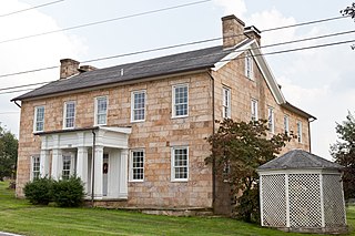
Chester is a town in Penobscot County, Maine, United States. The population was 549 at the 2020 census.

Springfield is a town in Penobscot County, Maine, United States. The population was 293 at the 2020 census.

Cooper is a town in Washington County, Maine, United States. The community was named after General John Cooper, a landowner. The population was 168 at the 2020 census.

<span class="mw-page-title-main">Kitzmiller, Maryland</span> Town in Maryland, United States

Kitzmiller is a town in Garrett County, Maryland, United States. The population was 321 at the 2010 census.

<span class="mw-page-title-main">Junior, West Virginia</span> Town in West Virginia, United States

Junior is a town in Barbour County, West Virginia, United States, situated along the Tygart Valley River. The population was 384 at the 2020 census.

<span class="mw-page-title-main">Pratt, West Virginia</span> Town in West Virginia, United States

Pratt is a town in Kanawha County, West Virginia, United States, along the Kanawha River. The population was 482 at the 2020 census.

<span class="mw-page-title-main">Albright, West Virginia</span> Town in West Virginia, United States

Albright is a town in central Preston County, West Virginia, United States, along the Cheat River. The population was 260 at the 2020 census. A former coal town, it is part of the Morgantown metropolitan area.

<span class="mw-page-title-main">Brandonville, West Virginia</span> Town in West Virginia, United States

Brandonville is a town in northern Preston County, West Virginia, United States. The population was 136 at the 2020 census. It is part of the Morgantown metropolitan area.

<span class="mw-page-title-main">Tunnelton, West Virginia</span> Town in West Virginia, United States

Tunnelton is a town in southwestern Preston County, West Virginia, United States. The population was 307 at the 2020 census. It is part of the Morgantown metropolitan area.

<span class="mw-page-title-main">Huttonsville, West Virginia</span> Town in West Virginia, United States

Huttonsville is a town in Randolph County, West Virginia, United States, along the Tygart Valley River. The population was 163 at the 2020 census.

<span class="mw-page-title-main">Mill Creek, West Virginia</span> Town in West Virginia, United States

Mill Creek is a town in Randolph County, West Virginia, United States, along the Tygart Valley River. The population was 563 at the 2020 census.

<span class="mw-page-title-main">Montrose, West Virginia</span> Town in West Virginia, United States

Montrose is a town in Randolph County, West Virginia, United States. The population was 141 at the 2020 census.

<span class="mw-page-title-main">Womelsdorf (Coalton), West Virginia</span> Town in West Virginia, United States

Womelsdorf (Coalton) is a town in Randolph County, West Virginia, United States. The population was 190 at the 2020 census.

<span class="mw-page-title-main">Reedy, West Virginia</span> Town in West Virginia, United States

Reedy is a town in Roane County, West Virginia, United States. The population was 152 at the 2020 census.

<span class="mw-page-title-main">Hambleton, West Virginia</span> Town in West Virginia, United States

Hambleton is a town in Tucker County, West Virginia, United States. The population was 216 at the 2020 census. Hambleton was established in 1889, but not incorporated until 1905. It was named by then United States Senator Stephen B. Elkins in honor of a stockholder by this name in the West Virginia Central Railroad Company. The town was previously known as Hulings.

<span class="mw-page-title-main">Camden-on-Gauley, West Virginia</span> Town in West Virginia, United States

Camden-on-Gauley is a town in Webster County, West Virginia, United States, along the Gauley River. The population was 126 at the 2020 census.

<span class="mw-page-title-main">St. Albans, Maine</span> Town in the state of Maine, United States

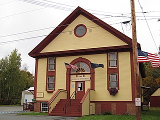
St. Albans is a town in Somerset County, Maine, United States. The population was 2,045 at the 2020 census.

References

  1. "2019 U.S. Gazetteer Files". United States Census Bureau. Retrieved August 7, 2020.
  2. 1 2 U.S. Geological Survey Geographic Names Information System: Harman, West Virginia
  3. 1 2 3 4 Bureau, US Census. "City and Town Population Totals: 2020-2021". Census.gov. US Census Bureau. Retrieved July 3, 2022.
  4. 1 2 "U.S. Census website". United States Census Bureau . Retrieved January 31, 2008.
  5. Kenny, Hamill (1945). West Virginia Place Names: Their Origin and Meaning, Including the Nomenclature of the Streams and Mountains. Piedmont, WV: The Place Name Press. p. 298.
  6. "National Register Information System". National Register of Historic Places . National Park Service. July 9, 2010.
  7. "US Gazetteer files: 2010, 2000, and 1990". United States Census Bureau. February 12, 2011. Retrieved April 23, 2011.
  8. "US Gazetteer files 2010". United States Census Bureau . Retrieved January 24, 2013.
  9. "Census of Population and Housing". Census.gov. Retrieved June 4, 2015.
  10. "U.S. Census website". United States Census Bureau . Retrieved January 24, 2013.