
Elkhorn is an unincorporated community in McDowell County, West Virginia, United States. Elkhorn lies on U.S. Route 52 and takes its name from the creek that flows through the community.

Uneeda is an unincorporated community on the Pond Fork River in Boone County in the U.S. state of West Virginia. The town lies along West Virginia Route 85.
Millwood is an unincorporated community in northwestern Jackson County, West Virginia, United States, along the Ohio River at the mouth of Mill Creek. It lies along West Virginia Routes 2 and 62 northwest of the city of Ripley, the county seat of Jackson County. Its elevation is 577 feet (176 m). Although Millwood is unincorporated, it has a post office, with the ZIP code of 25262.
Belva is an unincorporated community and census-designated place in west Nicholas County and north Fayette County, West Virginia, United States; while the CDP only includes the Nicholas County portion, the Fayette County portion is considered part of the community. The town is situated at the bottomland surrounding the convergence of Bells Creek with Twentymile Creek and, subsequently, Twenty Mile Creek with the Gauley River. Belva is also the location of the convergence of two state highways: West Virginia Route 16 and West Virginia Route 39.
Neola is an unincorporated community in northeastern Greenbrier County, West Virginia, United States. It lies along West Virginia Route 92 north of the city of White Sulphur Springs. Its elevation is 2,037 feet (621 m).
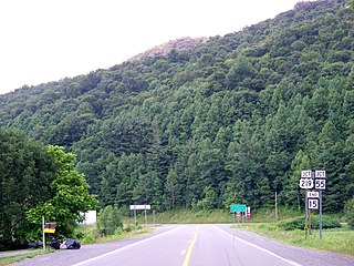
Rock View is an unincorporated community in Wyoming County, West Virginia, United States.
Arbovale is an unincorporated community in Pocahontas County, West Virginia, United States. Arbovale is 12 miles (19 km) south of Durbin. Arbovale had a post office, which closed on March 3, 2007.
Paynesville is an unincorporated community in McDowell County, West Virginia, United States. Paynesville is located along West Virginia Route 83 at the Virginia border. Paynesville has a post office with ZIP code 24873.
Dellslow is an unincorporated community in Monongalia County, West Virginia, United States. Dellslow was established in 1798 and is located along West Virginia Route 7 near the southern border of Brookhaven. Dellslow has a post office with ZIP code 26531.
Valley Head is a census-designated place (CDP) in Randolph County, West Virginia, United States. Valley Head is located on U.S. Route 219, 12 miles (19 km) south-southwest of Huttonsville. Valley Head has a post office with ZIP code 26294. As of the 2010 census, its population was 267.
Pickens is a census-designated place (CDP) in Randolph County, West Virginia, United States. Pickens is 13 miles (21 km) west-southwest of Huttonsville. It is the home of the Cunningham-Roberts Museum. Pickens has a post office with ZIP code 26230. As of the 2010 census, its population was 66.
Hico is a census-designated place (CDP) in Fayette County, West Virginia, United States. Hico is located at the junction of U.S. routes 19 and 60, 7 miles (11 km) northeast of Fayetteville. Hico has a post office with ZIP code 25854. As of the 2010 census, its population was 272.
Sprague is an unincorporated community and coal town in Raleigh County, West Virginia, United States. Sprague is located on West Virginia Route 16, 1 mile (1.6 km) north of downtown Beckley. Sprague has a post office with ZIP code 25926.
Frost is an unincorporated community in eastern Pocahontas County, West Virginia, United States. Frost is also home to Mountain Quest Institute.
Redstar is an unincorporated community in Fayette County, West Virginia, United States. Redstar is 2.5 miles (4.0 km) south of Oak Hill. Redstar had a post office with ZIP code 25914, which closed on January 20, 2007.
Dry Creek is an unincorporated community in Raleigh County, West Virginia, United States. Dry Creek is located on West Virginia Route 3 16 miles (26 km) west-northwest of Beckley. Dry Creek has a post office with ZIP code 25062.
Procious is an unincorporated community in Clay County, West Virginia, United States. Procious is located on the Elk River and West Virginia Route 4, 7 miles (11 km) west-northwest of Clay. Procious has a post office with ZIP code 25164.

Cora is an unincorporated community in Logan County, West Virginia, United States. Cora is 2 miles (3 km) southwest of Logan, along the Copperas Mine Fork. Cora has a post office with ZIP code 25614. It is part of the Mount Gay-Shamrock census-designated place.
Elk Run Junction is an unincorporated community in Boone County, West Virginia, United States.
Alpena is an unincorporated community in Randolph County, West Virginia, United States.


