Randolph County, West Virginia

Last updated

Randolph County
Seal of Randolph County, West Virginia.png
Map of West Virginia highlighting Randolph County.svg
Location of Randolph County in West Virginia
West Virginia in United States.svg
West Virginia's location within the U.S.
Coordinates: 38°47′N79°52′W / 38.78°N 79.87°W / 38.78; -79.87
Country Flag of the United States.svg  United States
State Flag of West Virginia.svg  West Virginia
FoundedOctober 16, 1787
Named for Edmund Jennings Randolph
Seat Elkins
and largest city seatlargestcity
Government
  Commission PresidentDavid Kesling (D) [1] , [2]
  County CommissionCris Siler (R) [3]
Chris See (D) [4]
Area
  Total2,700 km2 (1,040 sq mi)
  Land2,700 km2 (1,040 sq mi)
  Water0.8 km2 (0.3 sq mi)  0.03%
  Rank 1st
Population
 (2020)
  Total27,932
  Estimate 
(2021)
27,806 Decrease2.svg
  Rank 21st
  Density10/km2 (27/sq mi)
Time zone UTC−5 (Eastern)
  Summer (DST) UTC−4 (EDT)
Area code(s) 304, 681
Congressional district 2nd
Website https://randolphcountycommissionwv.org/

Randolph County is a county located in the U.S. state of West Virginia. As of the 2020 census, the population was 27,932. [5] Its county seat is Elkins. [6] The county was founded in 1787 and is named for Edmund Jennings Randolph. [7]

Contents

Randolph County comprises the Elkins, West Virginia, Micropolitan Statistical Area.

History

The first attempt by Europeans to settle in present-day Randolph County came in 1752 or '53 when David Tygart — for whom the Tygart Valley River was named — and Robert Foyle (later called Files) located (separately) with their families in the vicinity of present-day Beverly. Although there had been no recent history of conflicts between Europeans and Native Americans in that immediate area, that summer a party of Native Americans traveling the Shawnee Trail discovered the Foyle cabin and killed seven members of the family. One son escaped and alerted the Tygart family, allowing all to escape. (The Tygart-Foyle settlements were the first European settlements attempted anywhere within the Monongahela River watershed in present-day West Virginia.) No other European settlement was attempted in present Randolph County until 1772. [8] [9]

Thomas Skidmore (ca. 1733–1807), born in Maryland, obtained a title to 400 acres of land (“by virtue of a settlement”) in the future Elkins area before 1778. This land, on the east side of the Tygart Valley River, was surveyed by John Poage in 1780 and included the land that is now most of downtown Elkins. Thus, Skidmore was probably the first European settler in what became Elkins. [10]

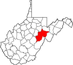
When Randolph County, Virginia (now West Virginia) was created out of the vast Harrison County on October 16, 1787, it included not only present-day Randolph County, but parts of what are now eight other counties. [11] It took its name from the surname of the then Governor of Virginia. The name of the new county seat, originally Randolph Court House, or Edmundton (the latter from the Governor's given name), was changed to Beverly by 1790. [12] Beverly remained the county seat until 1890 when county government was moved to Elkins.

Minor actions of the American Civil War which took place in Randolph County include the Battle of Rich Mountain and a part of the Battle of Cheat Mountain, both in 1861. These operations came in the course of the Western Virginia Campaign.

Randolph was one of fifty Virginia counties that were admitted to the Union as the state of West Virginia on June 20, 1863. Later that year, the new state's counties were divided into civil townships, with the intention of encouraging local government. This proved impractical in the heavily rural state, and in 1872 the townships were converted into magisterial districts. [13] Randolph County was divided into nine districts: Beverly, Clarke, Clay, Dry Fork, Green, Mingo Flats, Reynolds, Scott, and Union. Several of these were renamed during the 1870s: Clark became Valley Bend, Clay became New Interest, Green became Leadsville, Mingo Flats was abbreviated to Mingo, Reynolds became Huttonsville, Scott became Roaring Creek, and Union became Middle Fork. [14]

Geography

Wildflowers add a splash of color to grazing fields near Osceola in July. RandolphCounty.wmg.jpg
Wildflowers add a splash of color to grazing fields near Osceola in July.
Fall in the forest FallForest WV USA.JPG
Fall in the forest

According to the United States Census Bureau, the county has a total area of 1,040 square miles (2,700 km2), of which 1,040 square miles (2,700 km2) is land and 0.3 square miles (0.78 km2) (0.03%) is water. [15] It is the largest county in West Virginia by area.

Rivers

Mountains

Caves and caverns

National Natural Landmarks

Major highways

Adjacent counties

National protected area

Demographics

Historical population
CensusPop.Note
1790 951
1800 1,82692.0%
1810 2,85456.3%
1820 3,35717.6%
1830 5,00048.9%
1840 6,20824.2%
1850 5,243−15.5%
1860 4,990−4.8%
1870 5,56311.5%
1880 8,10245.6%
1890 11,63343.6%
1900 17,67051.9%
1910 26,02847.3%
1920 26,0840.2%
1930 25,049−4.0%
1940 30,25920.8%
1950 30,5581.0%
1960 26,349−13.8%
1970 24,596−6.7%
1980 28,73416.8%
1990 27,803−3.2%
2000 28,2621.7%
2010 29,4054.0%
2020 27,932−5.0%
2021 (est.)27,806 [16] −0.5%
U.S. Decennial Census [17]
1790–1960 [18] 1900–1990 [19]
1990–2000 [20] 2010–2020 [5]

2020 census

As of the 2020 census, there were 27,932 people and 10,065 households residing in the county. There were 13,035 housing units in Randolph county. The racial makeup of the county was 93.6% White, 1.6% African American, 0.4% Asian, 0.2% Native American, 0.5% from other races, and 3.8% from two or more races. Hispanics or Latinos of any race were 1.1% of the population.

There were 10,065 households, of which 44.8% were married couples living together, 30.2% had a female householder with no spouse present, 19% had a male householder with no spouse present.The average household and family size was 3.36. The median age in the county was 44.7 years with 19% of the population being under 18. The median income for a household in the city was $47,343 and the poverty rate was 15.2% [21]

2010 census

As of the 2010 United States census, there were 29,405 people, 11,695 households, and 7,753 families living in the county. [22] The population density was 28.3 inhabitants per square mile (10.9/km2). There were 14,189 housing units at an average density of 13.6 per square mile (5.3/km2). [23] The racial makeup of the county was 97.3% white, 1.2% black or African American, 0.3% Asian, 0.2% American Indian, 0.1% from other races, and 0.8% from two or more races. Those of Hispanic or Latino origin made up 0.7% of the population. [22] In terms of ancestry, 26.3% were German, 15.9% were Irish, 12.0% were English, 10.2% were American, and 5.4% were Italian. [24]

Of the 11,695 households, 27.1% had children under the age of 18 living with them, 51.0% were married couples living together, 10.5% had a female householder with no husband present, 33.7% were non-families, and 28.4% of all households were made up of individuals. The average household size was 2.32 and the average family size was 2.81. The median age was 43.4 years. [22]

The median income for a household in the county was $36,176 and the median income for a family was $47,071. Males had a median income of $34,903 versus $25,988 for females. The per capita income for the county was $18,472. About 12.7% of families and 17.1% of the population were below the poverty line, including 26.1% of those under age 18 and 11.4% of those age 65 or over. [25]

2000 census

As of the census of 2000, there were 28,262 people, 11,072 households, and 7,661 families living in the county. The population density was 27 people per square mile (10 people/km2). There were 13,478 housing units at an average density of 13 per square mile (5.0/km2). The racial makeup of the county was 97.69% White, 1.07% Black or African American, 0.16% Native American, 0.38% Asian, 0.01% Pacific Islander, 0.16% from other races, and 0.53% from two or more races. 0.68% of the population were Hispanic or Latino of any race.

There were 11,072 households, out of which 29.80% had children under the age of 18 living with them, 54.70% were married couples living together, 9.80% had a female householder with no husband present, and 30.80% were non-families. 26.30% of all households were made up of individuals, and 11.90% had someone living alone who was 65 years of age or older. The average household size was 2.41 and the average family size was 2.89.

In the county, the population was spread out, with 22.30% under the age of 18, 8.70% from 18 to 24, 28.50% from 25 to 44, 25.40% from 45 to 64, and 15.10% who were 65 years of age or older. The median age was 39 years. For every 100 females there were 101.30 males. For every 100 females age 18 and over, there were 99.70 males.

The median income for a household in the county was $27,299, and the median income for a family was $32,632. Males had a median income of $24,751 versus $17,819 for females. The per capita income for the county was $14,918. About 13.40% of families and 18.00% of the population were below the poverty line, including 24.30% of those under age 18 and 12.90% of those age 65 or over.

Politics

United States presidential election results for Randolph County, West Virginia [26]
Year Republican Democratic Third party
No.%No.%No.%
2020 8,67371.09%3,36227.56%1651.35%
2016 7,62969.55%2,73524.93%6055.52%
2012 6,16063.00%3,34234.18%2762.82%
2008 6,06055.94%4,53941.90%2342.16%
2004 6,51256.68%4,89242.58%860.75%
2000 5,24855.00%4,02842.21%2662.79%
1996 3,34833.18%5,46954.21%1,27212.61%
1992 3,49634.20%5,09749.86%1,62915.94%
1988 4,74647.38%5,23352.24%380.38%
1984 6,10055.64%4,83944.14%250.23%
1980 4,37440.05%5,93754.36%6105.59%
1976 4,82239.89%7,26560.11%00.00%
1972 6,92364.51%3,80935.49%00.00%
1968 4,50841.11%5,56250.72%8978.18%
1964 2,98427.14%8,01272.86%00.00%
1960 5,01841.79%6,98958.21%00.00%
1956 5,44848.88%5,69751.12%00.00%
1952 5,45243.87%6,97656.13%00.00%
1948 3,80236.52%6,58663.25%240.23%
1944 3,68136.88%6,29963.12%00.00%
1940 4,19633.14%8,46566.86%00.00%
1936 3,71131.34%8,10968.48%220.19%
1932 3,41831.29%7,39767.72%1080.99%
1928 4,43646.22%5,08552.99%760.79%
1924 3,52636.59%5,31455.14%7978.27%
1920 4,15846.11%4,67651.85%1842.04%
1916 2,16539.78%3,02455.57%2534.65%
1912 75614.82%2,56350.25%1,78234.93%

Communities

View from atop Yokum Knob, Randolph County, West Virginia YokumKnobView.JPG
View from atop Yokum Knob, Randolph County, West Virginia

City

Towns

Magisterial districts

  • Beverly
  • Dry Fork
  • Huttonsville
  • Leadsville
  • Middle Fork
  • Mingo
  • New Interest
  • Roaring Creek
  • Valley Bend

Census-designated places

Unincorporated communities

Notable people

See also

Related Research Articles

<span class="mw-page-title-main">Barbour County, West Virginia</span> County in West Virginia, United States

Barbour County is a county in north central West Virginia, United States. At the 2020 census, the population was 15,465. The county seat is Philippi, which was chartered in 1844. Both county and city were named for Philip P. Barbour (1783–1841), a U.S. Congressman from Virginia and Associate Justice of the U.S. Supreme Court. The county was formed in 1843 when the region was still part of the state of Virginia. In 1871, a small part of Barbour County was transferred to Tucker County, West Virginia.

<span class="mw-page-title-main">Shelby County, Ohio</span> County in Ohio, United States

Shelby County is a county in the western portion of the U.S. state of Ohio. As of the 2020 United States Census, the population was 48,230. Its county seat is Sidney. Its name honors Isaac Shelby, first governor of Kentucky.

<span class="mw-page-title-main">Wyoming County, West Virginia</span> County in West Virginia, United States

Wyoming County is a county in the U.S. state of West Virginia. As of the 2020 census, the population was 21,382. Its county seat is Pineville. The county was created in 1850 from Logan County and named for the Lenape word meaning "large plains".

<span class="mw-page-title-main">Wood County, West Virginia</span> County in West Virginia, United States

Wood County is a county in the U.S. state of West Virginia. As of the 2020 census, the population was 84,296, making it West Virginia's fifth-most populous county. Its county seat is Parkersburg. The county was formed in 1798 from the western part of Harrison County and named for James Wood, governor of Virginia from 1796 to 1799.

<span class="mw-page-title-main">Webster County, West Virginia</span> County in West Virginia, United States

Webster County is a county in the U.S. state of West Virginia. As of the 2020 census, the population was 8,378. Its county seat is Webster Springs. The county was founded in 1860 and named for Daniel Webster.

<span class="mw-page-title-main">Tucker County, West Virginia</span> County in West Virginia, United States

Tucker County is a county in the U.S. state of West Virginia. As of the 2020 census, the population was 6,762, making it West Virginia's fourth-least populous county. Its county seat is Parsons. The county was created in 1856 from a part of Randolph County, then part of Virginia. In 1871, a small part of Barbour County, was transferred to Tucker County. The county was named after Henry St. George Tucker, Sr., a judge and Congressman from Williamsburg, Virginia.

<span class="mw-page-title-main">Pocahontas County, West Virginia</span> County in West Virginia, United States

Pocahontas County is a county located in the eastern part of the U.S. state of West Virginia. As of the 2020 census, the population was 7,869. Its county seat is Marlinton. The county was established in 1821. It is named after the daughter of the Powhatan chief of the Native Americans in the United States who came from Jamestown, Virginia. She married an English settler, and their children became ancestors of many of the First Families of Virginia.

<span class="mw-page-title-main">Mingo County, West Virginia</span> County in West Virginia, United States

Mingo County is a county in the U.S. state of West Virginia. As of the 2020 census, the population was 23,568. Its county seat and largest city is Williamson. Created in 1895, Mingo is West Virginia's newest county, named for the historic Iroquoian Mingo people.

<span class="mw-page-title-main">Sand Fork, West Virginia</span> Town in West Virginia, United States

Sand Fork is a town in Gilmer County, West Virginia, United States. The population was 182 at the 2020 census. It is located along the Little Kanawha River, at the mouth of the Sand Fork.

<span class="mw-page-title-main">Jane Lew, West Virginia</span> Town in West Virginia, United States

Jane Lew is a town in Lewis County, West Virginia, United States. The population was 409 at the time of the 2020 census.

<span class="mw-page-title-main">Delbarton, West Virginia</span> Town in West Virginia, United States

Delbarton is a town in Mingo County, West Virginia, United States. The population was 522 at the 2020 census.

<span class="mw-page-title-main">Gilbert, West Virginia</span> Town in West Virginia, United States

Gilbert is a town in Mingo County, West Virginia, United States, along the Guyandotte River. The population was 333 at the 2020 census. Gilbert was incorporated in 1918 and named for Gilbert Creek, which derives its name from the name of an early traveler in the area who was killed by Native Americans. Gilbert is known nationwide for the Hatfield-McCoy ATV Trails that are located in the area. There are a number of lodges and restaurants in Gilbert.

<span class="mw-page-title-main">Kermit, West Virginia</span> Town in West Virginia, United States

Kermit is a town in Mingo County, West Virginia, United States. The population was 406 at the 2010 census. Kermit is located along the Tug Fork, opposite Warfield, Kentucky. The Norfolk Southern Railway's Kenova District runs through town.

<span class="mw-page-title-main">Williamson, West Virginia</span> City in West Virginia, United States

Williamson is a city in Mingo County, West Virginia, United States, situated along the Tug Fork River. The population was 3,042 at the 2020 census. It is the county seat of Mingo County, and is the county's largest and most populous city. Williamson is home to Southern West Virginia Community and Technical College. The Tug Fork River separates Williamson from South Williamson, Kentucky.

<span class="mw-page-title-main">Beverly, West Virginia</span> Town in West Virginia, United States

Beverly is a town in Randolph County, West Virginia, United States. Founded in 1787, it is the oldest settlement in the Tygart River Valley. It had a population of 628 at the 2020 census. Beverly was the county seat of Randolph County for over a century—from 1790 until 1899—after which the nearby settlement of Elkins assumed that role following an intense local political "war".

<span class="mw-page-title-main">Elkins, West Virginia</span> City in West Virginia, United States

Elkins is a city in and the county seat of Randolph County, West Virginia, United States, along the Tygart Valley River. The community was incorporated in 1890 and named in honor of Stephen Benton Elkins, a U.S. Senator from West Virginia. The population was 6,950 at the 2020 census and estimated at 6,895 in 2021. Elkins is home to Davis and Elkins College and the Mountain State Forest Festival, held in early October every year.

<span class="mw-page-title-main">Huttonsville, West Virginia</span> Town in West Virginia, United States

Huttonsville is a town in Randolph County, West Virginia, United States, along the Tygart Valley River. The population was 163 at the 2020 census.

<span class="mw-page-title-main">Mill Creek, West Virginia</span> Town in West Virginia, United States

Mill Creek is a town in Randolph County, West Virginia, United States, along the Tygart Valley River. The population was 563 at the 2020 census.

<span class="mw-page-title-main">Parsons, West Virginia</span> City in West Virginia, United States

Parsons is the largest city in and county seat of Tucker County, West Virginia, United States. The population was 1,322 at the 2020 census. Parsons is located at the confluence of the Shavers Fork and the Black Fork, forming the head of the Cheat River.

<span class="mw-page-title-main">Tygart Valley River</span> River in West Virginia, United States

The Tygart Valley River — also known as the Tygart River — is a principal tributary of the Monongahela River, approximately 135 miles (217 km) long, in east-central West Virginia in the United States. Via the Monongahela and Ohio rivers, it is part of the watershed of the Mississippi River, draining an area of 1,329 square miles (3,440 km2) in the Allegheny Mountains and the unglaciated portion of the Allegheny Plateau.

References

  1. "Candidates' list balloons in Randolph". The Inter-Mountain. Retrieved October 25, 2023.
  2. "County Commission". Randolph County Commission. Retrieved October 25, 2023.
  3. "Randolph County 2022 General Election Results". WBOY-TV. Retrieved October 25, 2023.
  4. "2020 General Election Results: Randolph County". WBOY-TV. Retrieved October 25, 2023.
  5. 1 2 "State & County QuickFacts". United States Census Bureau. Retrieved October 19, 2022.
  6. "Find a County". National Association of Counties. Retrieved June 7, 2011.
  7. "Randolph County history sources". Archived from the original on October 29, 2013. Retrieved November 26, 2014.
  8. It has been thought that Tygart was again among those settling then, but this is not certain.
  9. Maxwell, Hu (1899). The History of Barbour County, From its Earliest Exploration and Settlement to the Present Time, The Acme Publishing Company, Morgantown, W.Va. (Reprinted, McClain Printing Company, Parsons, W.Va., 1968). pp. 180–181.
  10. “He obtained a clear title to 400 acres of land by virtue of a settlement made before 1778 on the east side of the Tygart Valley River, adjoining the land of Robert Cunningham. It was surveyed by John Poage on 14 November 1780, who with his chain carriers set off the tract as 288 acres, and on 1 June 1782 a perfected title to the land was returned to him from the Land Office. It included the land that is now most of downtown Elkins, the park, the Wees Addition, both sides of the river from roughly the rear entrance of McDonald's Restaurant to Porter Avenue, South Elkins north of 11th Street, and all of Diamond and Wees Street. David Armstrong, who has made a careful study of the early land titles in Elkins, thinks that his cabin stood on the west side of Randolph Avenue at its intersection with Henry Avenue where St. Brendan's Catholic School was later located. He credits Thomas Skidmore with being the first European settler in central Elkins. He does not seem to have made an immediate settlement at Elkins however, for he appears in 1784 on a tax list taken on the South Branch in Pendleton County where he headed a family of seven white souls.” (Skidmore, Warren (2010), Thomas Skidmore (Scudamore), 1605-1684, of Westerleigh, Gloucestershire, and Fairfield, Connecticut; his ancestors, and descendants to the ninth generation; Akron, Ohio; Sixth Edition; pg 143.)
  11. These current counties are Upshur, Braxton, Pocohontas, Preston, Barbour, Tucker, Lewis and Webster.
  12. Kenny, Hamill (1945). West Virginia Place Names: Their Origin and Meaning, Including the Nomenclature of the Streams and Mountains. Piedmont, WV: The Place Name Press. p. 110.
  13. Otis K. Rice & Stephen W. Brown, West Virginia: A History, 2nd ed., University Press of Kentucky, Lexington (1993), p. 240.
  14. United States Census Bureau, U.S. Decennial Census, Tables of Minor Civil Divisions in West Virginia, 1870–2010.
  15. "2010 Census Gazetteer Files". United States Census Bureau. August 22, 2012. Retrieved July 30, 2015.
  16. "Annual Estimates of the Resident Population for Counties: April 1, 2020 to July 1, 2021" . Retrieved October 19, 2022.
  17. "U.S. Decennial Census". United States Census Bureau. Retrieved January 11, 2014.
  18. "Historical Census Browser". University of Virginia Library. Retrieved January 11, 2014.
  19. "Population of Counties by Decennial Census: 1900 to 1990". United States Census Bureau. Retrieved January 11, 2014.
  20. "Census 2000 PHC-T-4. Ranking Tables for Counties: 1990 and 2000" (PDF). United States Census Bureau. Archived (PDF) from the original on October 9, 2022. Retrieved January 11, 2014.
  21. "Explore Census Data". data.census.gov. Retrieved March 9, 2023.
  22. 1 2 3 "DP-1 Profile of General Population and Housing Characteristics: 2010 Demographic Profile Data". United States Census Bureau. Archived from the original on February 13, 2020. Retrieved April 3, 2016.
  23. "Population, Housing Units, Area, and Density: 2010 - County". United States Census Bureau. Archived from the original on February 13, 2020. Retrieved April 3, 2016.
  24. "DP02 SELECTED SOCIAL CHARACTERISTICS IN THE UNITED STATES – 2006-2010 American Community Survey 5-Year Estimates". United States Census Bureau. Archived from the original on February 13, 2020. Retrieved April 3, 2016.
  25. "DP03 SELECTED ECONOMIC CHARACTERISTICS – 2006-2010 American Community Survey 5-Year Estimates". United States Census Bureau. Archived from the original on February 13, 2020. Retrieved April 3, 2016.
  26. Leip, David. "Dave Leip's Atlas of U.S. Presidential Elections". uselectionatlas.org. Retrieved March 28, 2018.