Cabell County, West Virginia

Last updated

Cabell County
The Cabell County Courthouse in Huntington, West Virginia LCCN2015631821.tif
Map of West Virginia highlighting Cabell County.svg
Location within the U.S. state of West Virginia
West Virginia in United States.svg
West Virginia's location within the U.S.
Coordinates: 38°25′N82°14′W / 38.42°N 82.24°W / 38.42; -82.24
CountryFlag of the United States.svg United States
StateFlag of West Virginia.svg  West Virginia
FoundedJanuary 2, 1809
Named for William H. Cabell
Seat Huntington
Largest cityHuntington
Area
  Total288 sq mi (750 km2)
  Land281 sq mi (730 km2)
  Water7.0 sq mi (18 km2)  2.4%
Population
 (2020)
  Total94,350
  Estimate 
(2021)
93,418 Decrease2.svg
  Density330/sq mi (130/km2)
Time zone UTC−5 (Eastern)
  Summer (DST) UTC−4 (EDT)
Congressional district 1st
Website www.cabellcounty.org

Cabell County is located in the U.S. state of West Virginia. As of the 2020 census, the population was 94,350, [1] making it West Virginia's fourth most-populous county. Its county seat is Huntington. [2] The county was organized in 1809 and named for William H. Cabell, the Governor of Virginia from 1805 to 1808. [3] Cabell County is part of the Huntington–Ashland, WV–KY–OH Metropolitan Statistical Area.

Contents

History

Cabell County was created by an act of the Virginia General Assembly on January 2, 1809 out of Kanawha County. The county was named in honor of William H. Cabell, who served as Governor of Virginia from 1805 to 1808.

First Settlers

Many of the first settlers in Cabell County were the Mound Builders, also referred to as the Adena people. Later, many Hurons occupied the area until they were driven out by the Iroquois Confederacy. By the 1700's the area of Cabell County was mostly used as hunting grounds by the native populations in the area. [4]

European Settlement

The first European to set foot in present-day Cabell County was most likely Robert Cavelier de La Salle, who sailed down the Ohio River in 1669. The first English explorers were probably Thomas Batts and Robert Fallam, who explored the area in September 1671. While they explored the area, they found tree markings with the letters MANI and MA, signifying to them that other Englishmen that been there before.

The Savage Grant of 1772 was made to John Savage and 60 others for service during the French and Indian War. William Buffington purchased lot 42 of this grant and willed it to his tow sons, Thomas and William Buffington. Thomas and his brother Jonathan came to present-day Cabell County in 1796 and found Thomas Hannon. Hannon is regarded as the first settler in Cabell County. [4]

1800's

Cabell County's location along the Ohio River made it a natural resting place and port for westward travelers. Areas such as Guyandotte and Holderby's Landing (present-day Huntington) became ferrying points. The James River and Kanawha Turnpike was extended to Barboursville in 1814. In 1837, Marshall Academy was formed at Holdby's Landing. The school was named after Chief Justice John Marshall, friend of local lawyer John Laidley. The academy was incorporated in 1838 by the Virginia State Legislature. In 1867, Marshall Academy was created as the State Normal School of Marshall College to train teachers. Marshall College gained University status in 1961. [5]

Civil War

Prior to the outbreak of conflict, the citizens of Cabell County were largely divided on the issue secession. The arrival of Eli Thayer and his Ceredo Experiment caused an uproar in the county. After the election of Abraham Lincoln as President of the United States, a militia was formed called the Border Rangers led by Albert Gallatin Jenkins. The first engagement of the Civil War in Cabell County was the Battle of Barboursville in 1861. Later that same year, the town of Guyandotte was raided and eventually burned by the Union Army. The county's economy suffered greatly after the burning of Guyandotte, but the proximity to the Ohio River and arrival of the railroad boasted the county. In 1871, railroad magnate Collis P. Huntington laid out and founded the city of Huntington, near Holdby's Landing, as the western terminus of the C&O Railroad. [6]

1900's

Several industries entered Cabell County as a result of the establishment of Huntington. This influx of industry boast the economy, which saw a boom period until the Ohio River Flood of 1937. Huntington saw the introduction of the state's first radio station in 1923 and the state's first television station in 1949. The construction of Interstate 64 in the 1960's also saw a growth in the local economy. [7]

Geography

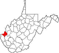
According to the United States Census Bureau, the county has an area of 288 square miles (750 km2), of which 281 square miles (730 km2) is land and 7.0 square miles (18 km2) (2.4%) is water. [8]

In 1863, West Virginia's counties were divided into civil townships, with the intention of encouraging local government. This proved impractical in the heavily rural state, and in 1872 the townships were converted into magisterial districts. [9] Cabell County was divided into five districts: Barboursville, Grant, Guyandotte, McComas, and Union. Two additional districts, Gideon and Kyle, were established between 1920 and 1930. Between 1980 and 1990, the county was redivided into five districts: District 1, District 2, District 3, District 4, and District 5. The names and boundaries of the historic districts were preserved in the form of tax and assessment districts. [10]

Major highways

Adjacent counties

Demographics

Historical population
CensusPop.Note
1810 2,717
1820 4,78976.3%
1830 5,88422.9%
1840 8,16338.7%
1850 6,299−22.8%
1860 8,02027.3%
1870 6,429−19.8%
1880 13,744113.8%
1890 23,59571.7%
1900 29,25224.0%
1910 46,68559.6%
1920 65,74640.8%
1930 90,78638.1%
1940 97,4597.4%
1950 108,03510.9%
1960 108,2020.2%
1970 106,918−1.2%
1980 106,835−0.1%
1990 96,827−9.4%
2000 96,7840.0%
2010 96,319−0.5%
2020 94,350−2.0%
2021 (est.)93,418 [11] −1.0%
U.S. Decennial Census [12]
1790–1960 [13] 1900–1990 [14]
1990–2000 [15] 2010–2020 [1]
The Cabell County Court House in Huntington, the building that houses most of the county's administrative offices. CabellCountyWVCH.jpg
The Cabell County Court House in Huntington, the building that houses most of the county's administrative offices.

2000 census

As of the census [16] of 2000, there were 96,784 people, 41,180 households, and 25,490 families living in the county. The population density was 344 inhabitants per square mile (133/km2). There were 45,615 housing units at an average density of 162 units per square mile (63 units/km2). The racial makeup of the county was 93.37% White, 4.29% Black or African American, 0.18% Native American, 0.77% Asian, 0.04% Pacific Islander, 0.20% from other races, and 1.14% from two or more races. 0.68% of the population were Hispanic or Latino of any race.

There were 41,180 households, out of which 25.20% had children under the age of 18 living with them, 47.10% were married couples living together, 11.60% had a female householder with no husband present, and 38.10% were non-families. 31.30% of all households were made up of individuals, and 12.50% had someone living alone who was 65 years of age or older. The average household size was 2.27 and the average family size was 2.85.

In the county, the population was spread out, with 20.00% under the age of 18, 13.50% from 18 to 24, 26.80% from 25 to 44, 23.60% from 45 to 64, and 16.00% who were 65 years of age or older. The median age was 38 years. For every 100 females there were 91.40 males. For every 100 females age 18 and over, there were 88.50 males.

The median income for a household in the county was $28,479, and the median income for a family was $37,691. Males had a median income of $31,780 versus $22,243 for females. The per capita income for the county was $17,638. About 13.70% of families and 19.20% of the population were below the poverty line, including 24.60% of those under age 18 and 10.80% of those age 65 or over.

2010 census

As of the 2010 United States Census, there were 96,319 people, 41,223 households, and 24,308 families living in the county. [17] The population density was 342.8 inhabitants per square mile (132.4/km2). There were 46,169 housing units at an average density of 164.3 per square mile (63.4/km2). [18] The racial makeup of the county was 91.6% white, 5.0% black or African American, 1.0% Asian, 0.2% American Indian, 0.3% from other races, and 2.0% from two or more races. Those of Hispanic or Latino origin made up 1.1% of the population. [17] In terms of ancestry, 17.2% were Irish, 16.5% were English, 15.9% were German, and 10.7% were American. [19]

Of the 41,223 households, 26.1% had children under the age of 18 living with them, 42.3% were married couples living together, 12.3% had a female householder with no husband present, 41.0% were non-families, and 33.5% of all households were made up of individuals. The average household size was 2.24 and the average family size was 2.85. The median age was 38.7 years. [17]

The median income for a household in the county was $34,492 and the median income for a family was $48,323. Males had a median income of $39,523 versus $28,952 for females. The per capita income for the county was $21,907. About 15.3% of families and 20.6% of the population were below the poverty line, including 29.0% of those under age 18 and 10.7% of those age 65 or over. [20]

Communities

City

Town

Village

Magisterial districts

Census-designated places

Unincorporated communities

Politics

For most of its history, Cabell County was a swing county, voting for the national winner in every presidential election from 1892 to 2004, aside from 1924 and 1960. However, similar to the rest of West Virginia, it has become a Republican stronghold, with Donald Trump winning the county by a margin of 25 percent over Hillary Clinton in 2016 and by a margin of 18 percent over Joe Biden in 2020.

United States presidential election results for Cabell County, West Virginia [21]
Year Republican Democratic Third party
No.%No.%No.%
2020 21,72158.14%14,99440.13%6451.73%
2016 19,85059.09%11,44734.08%2,2946.83%
2012 17,98555.93%13,56842.19%6051.88%
2008 18,79354.11%15,29244.03%6471.86%
2004 21,03555.43%16,58343.70%3320.87%
2000 16,44051.03%14,89646.24%8802.73%
1996 13,17940.48%16,27749.99%3,1049.53%
1992 13,20339.16%15,11144.82%5,40116.02%
1988 17,19752.65%15,36847.05%970.30%
1984 21,81558.26%15,51341.43%1170.31%
1980 19,48249.21%17,73244.79%2,3746.00%
1976 19,64448.56%20,81151.44%00.00%
1972 29,58267.39%14,31232.61%00.00%
1968 19,41845.05%19,01844.12%4,66610.83%
1964 16,95737.36%28,43762.64%00.00%
1960 26,98856.34%20,91143.66%00.00%
1956 28,88261.07%18,40838.93%00.00%
1952 27,46155.32%22,17944.68%00.00%
1948 18,59943.86%23,68055.84%1310.31%
1944 19,86146.32%23,02053.68%00.00%
1940 21,02742.78%28,12557.22%00.00%
1936 19,00340.95%27,31958.87%870.19%
1932 17,99942.91%23,49856.01%4531.08%
1928 21,09157.65%15,34041.93%1520.42%
1924 15,58147.26%16,21149.17%1,1773.57%
1920 13,17050.11%12,84548.87%2681.02%
1916 5,72846.18%6,44651.97%2291.85%
1912 1,79817.49%4,79346.62%3,69035.89%

Notable people

See also

Related Research Articles

<span class="mw-page-title-main">Putnam County, West Virginia</span> County in West Virginia, United States

Putnam County is a county in the U.S. state of West Virginia. As of the 2020 census, the population was 57,440. Its county seat is Winfield, its largest incorporated city is Hurricane, and its largest community is the census-designated place of Teays Valley. Putnam County is part of the Huntington–Ashland, WV-KY-OH Metropolitan Statistical Area, across the Kanawha River from Charleston, West Virginia.

<span class="mw-page-title-main">Wyoming County, West Virginia</span> County in West Virginia, United States

Wyoming County is a county in the U.S. state of West Virginia. As of the 2020 census, the population was 21,382. Its county seat is Pineville. The county was created in 1850 from Logan County and named for the Lenape word meaning "large plains".

<span class="mw-page-title-main">Wayne County, West Virginia</span> County in West Virginia, United States

Wayne County is the westernmost county in the U.S. state of West Virginia. As of the 2020 census, the population was 38,982. Its county seat is Wayne. The county was founded in 1842 and named for General "Mad" Anthony Wayne.

<span class="mw-page-title-main">Logan County, West Virginia</span> County in West Virginia, United States

Logan County is a county in the U.S. state of West Virginia. As of the 2020 census, the population was 32,567. Its county seat is Logan. Logan County comprises the Logan, WV Micropolitan Statistical Area, which is also included in the Charleston–Huntington–Ashland, WV–OH–KY Combined Statistical Area.

<span class="mw-page-title-main">Lincoln County, West Virginia</span> County in West Virginia, United States

Lincoln County is a county in the U.S. state of West Virginia. As of the 2020 census, the population was 20,463. Its county seat is Hamlin. The county was created in 1867 and named for Abraham Lincoln.

<span class="mw-page-title-main">Burlington, Ohio</span> Census-designated place in Ohio, United States

Burlington is an unincorporated community and census-designated place in Lawrence County, Ohio, United States, along the Ohio River. The population was 2,416 at the 2020 census. Connected to neighboring Huntington, West Virginia and connected via the West Huntington Bridge over the Ohio River, it is part of the Huntington–Ashland metropolitan area. Burlington was once the leading community of Lawrence County, being the first county seat and the location of the county's first post office.

<span class="mw-page-title-main">Chesapeake, Ohio</span> Village in Ohio, United States

Chesapeake is a village in Lawrence County, Ohio, United States. The population was 691 as of the 2020 census. It lies across the Ohio River from Huntington, West Virginia, at the mouth of Symmes Creek.

<span class="mw-page-title-main">Barboursville, West Virginia</span> Village in West Virginia, United States

Barboursville is a village in Cabell County, West Virginia, United States. The population was 4,456 at the 2020 census. It is part of the Huntington–Ashland metropolitan area.

<span class="mw-page-title-main">Milton, West Virginia</span> Town in West Virginia, United States

Milton is a town in Cabell County, West Virginia, United States. The population was 2,831 at the 2020 census. It is part of the Huntington–Ashland metropolitan area.

<span class="mw-page-title-main">Pea Ridge, West Virginia</span> Census-designated place in West Virginia, United States

Pea Ridge is a census-designated place in Cabell County, West Virginia, United States. As of the 2020 census, the population was 6,602. It is part of the Huntington–Ashland metropolitan area.

<span class="mw-page-title-main">Harts, West Virginia</span> Census-designated place in West Virginia, United States

Harts is a census-designated place (CDP) at the mouth of Big Harts Creek in Lincoln County, West Virginia, United States, situated along the Guyandotte River. As of the 2010 census, its population was 656. Harts is a part of the Huntington-Ashland, WV-KY-OH, Metropolitan Statistical Area (MSA). The Harts CDP includes the unincorporated communities of Harts, Atenville, Ferrellsburg, and Sand Creek.

<span class="mw-page-title-main">West Hamlin, West Virginia</span> Town in West Virginia, United States

West Hamlin is a town in Lincoln County, West Virginia, United States, along the Guyandotte River. The population was 519 at the 2020 census, and is now down to 509, according to the 2021 census. West Hamlin is a part of the Huntington-Ashland, WV-KY-OH, Metropolitan Statistical Area (MSA). West Hamlin is west of the county seat at Hamlin, hence the name.

<span class="mw-page-title-main">Chapmanville, West Virginia</span> Town in West Virginia, United States

Chapmanville is a town in Logan County, West Virginia, United States. The population was 1,025 at the 2020 census. Chapmanville is named for Ned Chapman, an early settler who operated a store and post office. It was incorporated in 1947.

<span class="mw-page-title-main">Mallory, West Virginia</span> Census-designated place in West Virginia, United States

Mallory is a census-designated place (CDP) in Logan County, West Virginia, United States. The population was 1,654 at the 2010 census. The CDP contains the unincorporated communities, from west to east, of Huff Junction, Mallory, Davin, Mineral City, Claypool, Combs Addition, and Gillman Bottom.

<span class="mw-page-title-main">Switzer, West Virginia</span> Census-designated place in West Virginia, United States

Switzer is an unincorporated community and census-designated place (CDP) in Logan County, West Virginia, United States. The CDP includes the neighboring unincorporated community of Micco. The total CDP population was 595 at the 2010 census.

<span class="mw-page-title-main">West Logan, West Virginia</span> Town in West Virginia, United States

West Logan is a town along the Guyandotte River in Logan County, West Virginia, United States. The population was 400 at the 2020 census. For unknown reasons, some sources report West Logan to lay west of the county seat at Logan, attributing to this fact the name.

<span class="mw-page-title-main">Ceredo, West Virginia</span> Town in West Virginia, United States

Ceredo is a town in Wayne County, West Virginia, United States, situated along the Ohio River. The population was 1,408 at the 2020 census. Ceredo is a part of the Huntington-Ashland, WV-KY-OH Metropolitan Statistical Area (MSA). As of the 2000 census, the MSA had a population of 288,649.

<span class="mw-page-title-main">Pineville, West Virginia</span> Town in West Virginia, United States

Pineville is a town in and the county seat of Wyoming County, West Virginia, United States, situated along the Guyandotte River. The population was 648 at the 2020 census.

<span class="mw-page-title-main">Culloden, West Virginia</span> Census-designated place in West Virginia, United States

Culloden is a census-designated place in Cabell and Putnam counties in the U.S. state of West Virginia. As of the 2020 census, the population was 3,016. It is part of the Huntington–Ashland metropolitan area.

<span class="mw-page-title-main">Guyandotte River</span> River in West Virginia, United States

The Guyandotte River is a tributary of the Ohio River, approximately 166 mi (267 km) long, in southwestern West Virginia in the United States. It was named after the French term for the Wendat Native Americans. It drains an area of the unglaciated Allegheny Plateau south of the Ohio between the watersheds of the Kanawha River to the northeast and Twelvepole Creek and the Big Sandy River to the southwest. Via the Ohio River, it is part of the Mississippi River watershed.

References

  1. 1 2 "State & County QuickFacts". United States Census Bureau. Retrieved July 6, 2022.
  2. "Find a County". National Association of Counties. Archived from the original on May 31, 2011. Retrieved June 7, 2011.
  3. "Cabell County history sources". wvculture.org. Archived from the original on October 29, 2015. Retrieved March 8, 2017.
  4. 1 2 Wallace, George Selden (1997). Cabell County Annals and Families (2nd ed.). Clearfield Company. p. 3.
  5. "Welcome to Cabell County". www.cabellcounty.org. Retrieved March 12, 2024.
  6. Geiger Jr., Joe (2020). Disorder on the Board: Civil Warfare in Cabell and Wayne Counties, West Virginia, 1856 - 1870. 35th Star Publisher. pp. 26–353.
  7. "Welcome to Cabell County". www.cabellcounty.org. Retrieved March 12, 2024.
  8. "2010 Census Gazetteer Files". United States Census Bureau. August 22, 2012. Retrieved July 23, 2015.
  9. Otis K. Rice & Stephen W. Brown, West Virginia: A History, 2nd ed., University Press of Kentucky, Lexington (1993), p. 240.
  10. United States Census Bureau, U.S. Decennial Census, Tables of Minor Civil Divisions in West Virginia, 1870–2010.
  11. "Annual Estimates of the Resident Population for Counties: April 1, 2020 to July 1, 2021" . Retrieved July 6, 2022.
  12. "U.S. Decennial Census". United States Census Bureau. Retrieved January 9, 2014.
  13. "Historical Census Browser". University of Virginia Library. Retrieved January 9, 2014.
  14. "Population of Counties by Decennial Census: 1900 to 1990". United States Census Bureau. Retrieved January 9, 2014.
  15. "Census 2000 PHC-T-4. Ranking Tables for Counties: 1990 and 2000" (PDF). United States Census Bureau. Archived (PDF) from the original on October 9, 2022. Retrieved January 9, 2014.
  16. "U.S. Census website". United States Census Bureau . Retrieved May 14, 2011.
  17. 1 2 3 "DP-1 Profile of General Population and Housing Characteristics: 2010 Demographic Profile Data". United States Census Bureau. Archived from the original on February 13, 2020. Retrieved April 3, 2016.
  18. "Population, Housing Units, Area, and Density: 2010 - County". United States Census Bureau. Archived from the original on February 13, 2020. Retrieved April 3, 2016.
  19. "DP02 SELECTED SOCIAL CHARACTERISTICS IN THE UNITED STATES – 2006-2010 American Community Survey 5-Year Estimates". United States Census Bureau. Archived from the original on February 13, 2020. Retrieved April 3, 2016.
  20. "DP03 SELECTED ECONOMIC CHARACTERISTICS – 2006-2010 American Community Survey 5-Year Estimates". United States Census Bureau. Archived from the original on February 13, 2020. Retrieved April 3, 2016.
  21. Leip, David. "Dave Leip's Atlas of U.S. Presidential Elections". uselectionatlas.org. Retrieved March 27, 2018.
  22. Averill, James P. 1882. History of Gallia County. H. H. Hardesty & Co. Publishers: Chicago. Deeds and wills.
  23. Laidley, W.S. 1901. "The West End of West Virginia." The West Virginia Historical Magazine Quarterly 1:5-41. The West Virginia Historical and Antiquarian Society.
  24. Miller, Thomas Condit, and Hu Maxwell. 1913. West Virginia and Its People. New York: Lewis Historical Publishing Company.
  25. Brant, Fuller, & Co. 1891. History of the Great Kanawha Valley: With Family History and Biographical Sketches. Madison, Wisconsin.
  26. "Sampson Sanders". cabellcountydoorstothepast.com. Retrieved September 6, 2022.
  27. "Sampson Sanders". WVPB. Retrieved September 6, 2022.
  28. "North Dakota Governor Eli C. D. Shortridge". National Governors Association. Retrieved September 29, 2012.

38°25′N82°14′W / 38.42°N 82.24°W / 38.42; -82.24