Wayne County, West Virginia

Last updated

Wayne County
Joseph S. Miller House at Kenova.jpg
Seal of Wayne County, West Virginia.png
Map of West Virginia highlighting Wayne County.svg
Location within the U.S. state of West Virginia
West Virginia in United States.svg
West Virginia's location within the U.S.
Coordinates: 38°09′N82°26′W / 38.15°N 82.43°W / 38.15; -82.43
CountryFlag of the United States.svg United States
StateFlag of West Virginia.svg  West Virginia
FoundedJanuary 18, 1842
Named for Anthony Wayne
Seat Wayne
Largest city Kenova
Area
  Total512 sq mi (1,330 km2)
  Land506 sq mi (1,310 km2)
  Water6.1 sq mi (16 km2)  1.2%
Population
 (2020)
  Total38,982
  Estimate 
(2021)
38,498 Decrease2.svg
  Density76/sq mi (29/km2)
Time zone UTC−5 (Eastern)
  Summer (DST) UTC−4 (EDT)
Congressional district 1st
Website www.waynecountywv.org

Wayne County is the westernmost county in the U.S. state of West Virginia. As of the 2020 census, the population was 38,982. [1] Its county seat is Wayne. [2] The county was founded in 1842 and named for General "Mad" Anthony Wayne. [3]

Contents

Wayne County is part of the Huntington–Ashland, WV–KY–OH Metropolitan Statistical Area.

History

Wayne County, West Virginia was originally Wayne County, Virginia, which was created from part of Cabell County in 1842. The county was named for General "Mad" Anthony Wayne.

Settlement

Due to the constant threat of Indian attack, there were no European settlers in the area that became Wayne County until after 1794. The area was made safe for European settlers in 1794 through the defeat of the Shawnee at the Battle of Fallen Timbers by General "Mad" Anthony Wayne.

When the first permanent European settlers came to Wayne County around the year 1800, the area was part of Kanawha County. Most of the original pioneer settlers were self-sufficient farmers. They raised their own food, sheep for wool clothing, and made their buildings, furnishings and tools out of the surrounding forest. A few trading posts provided the manufactured goods the pioneers could not make for themselves. Later, grist mills at Wayne, Dickson, south of East Lynn and at Lavalette ground their corn into meal and their wheat into flour.

On June 20, 1863, at the height of the Civil War, Wayne was one of fifty Virginia counties that were admitted to the Union as the state of West Virginia. Later that year, the counties were divided into civil townships, with the intention of encouraging local government. This proved impractical in the heavily rural state, and in 1872 the townships were converted into magisterial districts. [4] Wayne County was divided into five districts: Butler, Ceredo, Grant, Lincoln, and Union. A sixth district, Stonewall, was formed from part of Grant District in 1878. In the 1920s, Westmoreland was created as the county's seventh magisterial district. Grant District was discontinued between 1960 and 1970, followed by Lincoln in the 1980s. [5]

Geography

According to the United States Census Bureau, the county has a total area of 512 square miles (1,330 km2), of which 506 square miles (1,310 km2) is land and 6.1 square miles (16 km2) (1.2%) is water. [6]

Rivers and lakes

Major highways

Adjacent counties

Wayne County is one of three counties (along with Apache County, Arizona and Cook County, Illinois) to border two counties of the same name, neither of which are in the same state as the county itself (Lawrence County, Ohio and Lawrence County, Kentucky).

Demographics

Historical population
CensusPop.Note
1850 4,760
1860 6,74741.7%
1870 7,85216.4%
1880 14,73987.7%
1890 18,65226.5%
1900 23,61926.6%
1910 24,0812.0%
1920 26,0128.0%
1930 31,20620.0%
1940 35,56614.0%
1950 38,6968.8%
1960 38,9770.7%
1970 37,581−3.6%
1980 46,02122.5%
1990 41,636−9.5%
2000 42,9033.0%
2010 42,481−1.0%
2020 38,982−8.2%
2021 (est.)38,498 [7] −1.2%
U.S. Decennial Census [8]
1790–1960 [9] 1900–1990 [10]
1990–2000 [11] 2010–2020 [1]

2000 census

As of the census of 2000, there were 42,903 people, 17,239 households, and 12,653 families living in the county. The population density was 85 inhabitants per square mile (33/km2). There were 19,107 housing units at an average density of 38 per square mile (15/km2). The racial makeup of the county was 98.79% White, 0.13% Black or African American, 0.23% Native Americans, 0.20% Asian, 0.02% Pacific Islander, 0.08% from other races, and 0.56% from two or more races. 0.47% of the population were Hispanic or Latino of any race.

There were 17,239 households, out of which 31.20% had children under the age of 18 living with them, 59.20% were married couples living together, 10.80% had a female householder with no husband present, and 26.60% were non-families. 24.10% of all households were made up of individuals, and 11.10% had someone living alone who was 65 years of age or older. The average household size was 2.48 and the average family size was 2.92.

In the county, the population was spread out, with 23.40% under the age of 18, 8.70% from 18 to 24, 27.70% from 25 to 44, 25.30% from 45 to 64, and 14.90% who were 65 years of age or older. The median age was 38 years. For every 100 females there were 95.80 males. For every 100 females age 18 and over, there were 91.80 males.

The median income for a household in the county was $27,352, and the median income for a family was $32,458. Males had a median income of $31,554 versus $20,720 for females. The per capita income for the county was $14,906. About 16.20% of families and 19.60% of the population were below the poverty line, including 25.50% of those under age 18 and 15.20% of those age 65 or over.

2010 census

As of the 2010 United States census, there were 42,481 people, 17,347 households, and 12,128 families living in the county. [12] The population density was 84.0 inhabitants per square mile (32.4/km2). There were 19,227 housing units at an average density of 38.0 per square mile (14.7/km2). [13] The racial makeup of the county was 98.6% white, 0.3% American Indian, 0.2% black or African American, 0.2% Asian, 0.1% from other races, and 0.8% from two or more races. Those of Hispanic or Latino origin made up 0.5% of the population. [12] In terms of ancestry, 18.1% were Irish, 16.9% were English, 13.0% were American, and 11.8% were German. [14]

Of the 17,347 households, 30.9% had children under the age of 18 living with them, 53.2% were married couples living together, 11.7% had a female householder with no husband present, 30.1% were non-families, and 26.4% of all households were made up of individuals. The average household size was 2.43 and the average family size was 2.92. The median age was 41.3 years. [12]

The median income for a household in the county was $35,079 and the median income for a family was $44,886. Males had a median income of $40,233 versus $25,765 for females. The per capita income for the county was $18,410. About 16.4% of families and 20.2% of the population were below the poverty line, including 23.2% of those under age 18 and 15.0% of those age 65 or over. [15]

Ancestry/Ethnicity

As of 2017 the largest self-identified ancestry groups in Wayne County were:

Largest ancestries (2015)Percent
English 23.7%
Irish 13.7%
"American" 12.2%
German 9.5%
Italian 2.2%
Scottish 2.1%
Scots-Irish 2.0%
French (except Basque) 1.0%
Polish 0.7%

[16]

Politics

Prior to 2000, Wayne County was strongly Democratic in presidential elections, with only four Republican candidates winning the county from 1872 to 1996, all as a part of a national landslide win for the party. Since 2000, the county has swung to becoming strongly Republican similar to the rest of West Virginia, so strongly that Donald Trump won the county in 2016 by a margin of over 50 percent.

United States presidential election results for Wayne County, West Virginia [17]
Year Republican Democratic Third party
No.%No.%No.%
2020 12,58574.26%4,08824.12%2741.62%
2016 11,15272.67%3,35721.87%8385.46%
2012 8,68862.02%4,93135.20%3902.78%
2008 8,94757.98%6,13739.77%3462.24%
2004 10,07054.11%8,41145.20%1280.69%
2000 7,99349.21%7,94048.89%3081.90%
1996 5,49235.49%8,30053.63%1,68410.88%
1992 5,72935.05%8,39251.35%2,22313.60%
1988 7,12345.15%8,62154.65%310.20%
1984 8,81151.12%8,37848.61%470.27%
1980 7,54145.10%8,68751.96%4912.94%
1976 6,00937.63%9,95862.37%00.00%
1972 9,77560.99%6,25139.01%00.00%
1968 6,00436.79%8,22750.41%2,08812.79%
1964 5,34031.56%11,57868.44%00.00%
1960 8,12847.07%9,14052.93%00.00%
1956 8,42952.41%7,65547.59%00.00%
1952 7,05944.85%8,67955.15%00.00%
1948 4,39436.52%7,61863.32%190.16%
1944 4,51640.53%6,62759.47%00.00%
1940 5,70137.20%9,62662.80%00.00%
1936 5,60338.41%8,95461.38%310.21%
1932 4,68234.89%8,64864.44%900.67%
1928 5,63051.89%5,17747.72%420.39%
1924 3,99939.03%5,87057.29%3783.69%
1920 3,75445.54%4,49054.46%00.00%
1916 2,21542.21%2,98956.97%430.82%
1912 1,46529.41%2,63452.88%88217.71%

Transportation

Rail

Air

The public Tri-State Airport, the major airport serving the Huntington–Ashland area, is located in Wayne County south of Interstate 64. The airport is accessible from Interstate 64 via Exit 1. Commercial air service is provided by Allegiant Air and American Airlines.

Notable people

Communities

Cities

Towns

Magisterial districts

Current

  • Butler
  • Ceredo
  • Stonewall
  • Union
  • Westmoreland

Historic

  • Grant
  • Lincoln

Census-designated place

Unincorporated communities

The following books take place in Wayne County:

See also

Related Research Articles

<span class="mw-page-title-main">Putnam County, West Virginia</span> County in West Virginia, United States

Putnam County is a county in the U.S. state of West Virginia. As of the 2020 census, the population was 57,440. Its county seat is Winfield, its largest incorporated city is Hurricane, and its largest community is the census-designated place of Teays Valley. Putnam County is part of the Huntington–Ashland, WV-KY-OH Metropolitan Statistical Area, across the Kanawha River from Charleston, West Virginia.

<span class="mw-page-title-main">Ohio County, West Virginia</span> County in West Virginia, United States

Ohio County is a county located in the Northern Panhandle of the U.S. state of West Virginia. As of the 2020 census, the population was 42,425. Its county seat is Wheeling. The county was formed in 1776 from the District of West Augusta, Virginia. It was named for the Ohio River, which forms its western boundary with the state of Ohio. West Liberty was designated as the county seat in 1777, serving to 1797.

<span class="mw-page-title-main">Braxton County, West Virginia</span> County in West Virginia, United States

Braxton County is a county in the central part of the U.S. state of West Virginia. As of the 2020 census, the population was 12,447. The county seat is Sutton. The county was formed in 1836 from parts of Lewis, Kanawha, and Nicholas counties and named for Carter Braxton, a Virginia statesman and signer of the Declaration of Independence.

<span class="mw-page-title-main">Wood County, West Virginia</span> County in West Virginia, United States

Wood County is a county in the U.S. state of West Virginia. As of the 2020 census, the population was 84,296, making it West Virginia's fifth-most populous county. Its county seat is Parkersburg. The county was formed in 1798 from the western part of Harrison County and named for James Wood, governor of Virginia from 1796 to 1799.

<span class="mw-page-title-main">Mason County, West Virginia</span> County in West Virginia, United States

Mason County is a county in the U.S. state of West Virginia. As of the 2020 census, the population was 25,453. Its county seat and largest city is Point Pleasant. The county was founded in 1804 and named for George Mason, delegate to the U.S. Constitutional Convention. Before the Civil War, the county was in the State of Virginia.

<span class="mw-page-title-main">Lincoln County, West Virginia</span> County in West Virginia, United States

Lincoln County is a county in the U.S. state of West Virginia. As of the 2020 census, the population was 20,463. Its county seat is Hamlin. The county was created in 1867 and named for Abraham Lincoln.

<span class="mw-page-title-main">Cabell County, West Virginia</span> County in West Virginia, United States

Cabell County is located in the U.S. state of West Virginia. As of the 2020 census, the population was 94,350, making it West Virginia's fourth most-populous county. Its county seat is Huntington. The county was organized in 1809 and named for William H. Cabell, the Governor of Virginia from 1805 to 1808. Cabell County is part of the Huntington–Ashland, WV–KY–OH Metropolitan Statistical Area.

<span class="mw-page-title-main">Boone County, West Virginia</span> County in West Virginia, United States

Boone County is a county in the U.S. state of West Virginia. As of the 2020 census, the population was 21,809. Its county seat is Madison. Boone County is part of the Charleston, WV Metropolitan Statistical Area. Leading industries and chief agricultural products in Boone County include coal, lumber, natural gas, tobacco, and strawberries.

<span class="mw-page-title-main">Lawrence County, Ohio</span> County in Ohio, United States

Lawrence County is the southernmost county located in the U.S. state of Ohio. As of the 2020 census, the population was 58,240. Its county seat is Ironton. The county was created in 1815 and later organized in 1817. It is named for James Lawrence, the naval officer famous for the line "do not give up the ship". Lawrence County is part of the Huntington–Ashland metropolitan area.

<span class="mw-page-title-main">Gallia County, Ohio</span> County in Ohio, United States

Gallia County is a county located in the U.S. state of Ohio. As of the 2020 census, the population was 29,220. Its county seat and largest village is Gallipolis.

<span class="mw-page-title-main">Burlington, Ohio</span> Census-designated place in Ohio, United States

Burlington is an unincorporated community and census-designated place in Lawrence County, Ohio, United States, along the Ohio River. The population was 2,416 at the 2020 census. Connected to neighboring Huntington, West Virginia and connected via the West Huntington Bridge over the Ohio River, it is part of the Huntington–Ashland metropolitan area. Burlington was once the leading community of Lawrence County, being the first county seat and the location of the county's first post office.

<span class="mw-page-title-main">Barboursville, West Virginia</span> Village in West Virginia, United States

Barboursville is a village in Cabell County, West Virginia, United States. The population was 4,456 at the 2020 census. It is part of the Huntington–Ashland metropolitan area.

<span class="mw-page-title-main">Chesapeake, West Virginia</span> Town in West Virginia, United States

Chesapeake is a town in Kanawha County, West Virginia, United States. The population was 1,336 at the 2020 census. The town is situated on the Kanawha River.

<span class="mw-page-title-main">Handley, West Virginia</span> Town in West Virginia, United States

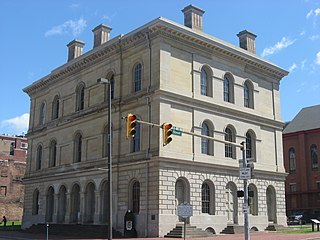
Handley is a town in Kanawha County, West Virginia, United States. The population was 224 at the 2020 census. Handley was first established in 1877 and known as Upper Creek until July 29, 1881, when its name was changed to Handley for pioneer settlers who farmed the area. Handley has the distinction of bearing a name like no other town in the United States. The town was incorporated November 1972.

<span class="mw-page-title-main">Point Pleasant, West Virginia</span> City in West Virginia, United States

Point Pleasant is a city in and the county seat of Mason County, West Virginia, United States, at the confluence of the Ohio and Kanawha Rivers. The population was 4,101 at the 2020 census. It is the principal city of the Point Pleasant micropolitan area extending into Ohio. The town is best known for the Mothman, a purported humanoid creature reportedly sighted in the area that has become a part of West Virginia folklore.

<span class="mw-page-title-main">Ceredo, West Virginia</span> Town in West Virginia, United States

Ceredo is a town in Wayne County, West Virginia, United States, situated along the Ohio River. The population was 1,408 at the 2020 census. Ceredo is a part of the Huntington-Ashland, WV-KY-OH Metropolitan Statistical Area (MSA). As of the 2000 census, the MSA had a population of 288,649.

<span class="mw-page-title-main">Kenova, West Virginia</span> City in West Virginia, United States

Kenova is a city in Wayne County, West Virginia, United States, situated at the confluence of the Ohio and Big Sandy rivers. The city's name is a portmanteau of Kentucky, Ohio, and Virginia (Va), owing to its location where the three states met before the creation of West Virginia. The population was 3,030 at the 2020 census. It is part of the Huntington–Ashland metropolitan area.

<span class="mw-page-title-main">Wayne, West Virginia</span> Town in West Virginia, United States

Wayne is a town in and the county seat of Wayne County, West Virginia, United States. The population was 1,441 at the 2020 census. It is part of the Huntington–Ashland metropolitan area.

<span class="mw-page-title-main">Montgomery, West Virginia</span> City in West Virginia

Montgomery is a city in West Virginia, along the Kanawha River. Most of the city is in Fayette County, with the remainder in Kanawha County. The population was 1,280 at the 2020 census.

The Huntington–Ashland metropolitan area is a metropolitan area in the Appalachian Plateau region of the United States. Referred to locally as the "Tri-State area," and colloquially as "Kyova", the region spans seven counties in the three states of Kentucky, Ohio, and West Virginia. With a population of 361,580, the Tri-State area is nestled along the banks of the Ohio River. The region offers a diverse range of outdoor activities.

References

  1. 1 2 "State & County QuickFacts". United States Census Bureau. Retrieved October 20, 2022.
  2. "Find a County". National Association of Counties. Retrieved June 7, 2011.
  3. "Archived copy". Archived from the original on September 23, 2001. Retrieved February 4, 2013.{{cite web}}: CS1 maint: archived copy as title (link)
  4. Otis K. Rice & Stephen W. Brown, West Virginia: A History, 2nd ed., University Press of Kentucky, Lexington (1993), p. 240.
  5. United States Census Bureau, U.S. Decennial Census, Tables of Minor Civil Divisions in West Virginia, 1870–2010.
  6. "2010 Census Gazetteer Files". United States Census Bureau. August 22, 2012. Retrieved July 31, 2015.
  7. "Annual Estimates of the Resident Population for Counties: April 1, 2020 to July 1, 2021" . Retrieved October 20, 2022.
  8. "U.S. Decennial Census". United States Census Bureau. Retrieved January 16, 2014.
  9. "Historical Census Browser". University of Virginia Library. Retrieved January 16, 2014.
  10. "Population of Counties by Decennial Census: 1900 to 1990". United States Census Bureau. Retrieved January 16, 2014.
  11. "Census 2000 PHC-T-4. Ranking Tables for Counties: 1990 and 2000" (PDF). United States Census Bureau. Archived (PDF) from the original on October 9, 2022. Retrieved January 16, 2014.
  12. 1 2 3 "DP-1 Profile of General Population and Housing Characteristics: 2010 Demographic Profile Data". United States Census Bureau. Archived from the original on February 13, 2020. Retrieved April 3, 2016.
  13. "Population, Housing Units, Area, and Density: 2010 - County". United States Census Bureau. Archived from the original on February 13, 2020. Retrieved April 3, 2016.
  14. "DP02 SELECTED SOCIAL CHARACTERISTICS IN THE UNITED STATES – 2006-2010 American Community Survey 5-Year Estimates". United States Census Bureau. Archived from the original on February 13, 2020. Retrieved April 3, 2016.
  15. "DP03 SELECTED ECONOMIC CHARACTERISTICS – 2006-2010 American Community Survey 5-Year Estimates". United States Census Bureau. Archived from the original on February 13, 2020. Retrieved April 3, 2016.
  16. "American FactFinder - Results". Archived from the original on February 13, 2020.
  17. Leip, David. "Dave Leip's Atlas of U.S. Presidential Elections". uselectionatlas.org. Retrieved February 22, 2021.

38°09′N82°26′W / 38.15°N 82.43°W / 38.15; -82.43