Wetzel County, West Virginia

Last updated

Wetzel County
2006-10-05 10-41-03newmartinsvillecourthouse.JPG
Wetzel County Courthouse
Seal of Wetzel County, West Virginia.png
Map of West Virginia highlighting Wetzel County.svg
Location within the U.S. state of West Virginia
West Virginia in United States.svg
West Virginia's location within the U.S.
Coordinates: 39°37′N80°38′W / 39.61°N 80.64°W / 39.61; -80.64
CountryFlag of the United States.svg United States
StateFlag of West Virginia.svg  West Virginia
FoundedJanuary 10, 1846
Named for Lewis Wetzel
Seat New Martinsville
Largest cityNew Martinsville
Area
  Total361 sq mi (930 km2)
  Land358 sq mi (930 km2)
  Water3.3 sq mi (9 km2)  0.9%
Population
 (2020)
  Total14,442
  Estimate 
(2021)
14,170 Decrease2.svg
  Density40/sq mi (15/km2)
Time zone UTC−5 (Eastern)
  Summer (DST) UTC−4 (EDT)
Congressional district 1st
Website www.wetzelwv.com

Wetzel County is a county in the U.S. state of West Virginia. As of the 2020 census, the population was 14,442. [1] Its county seat is New Martinsville. [2] The county, founded in 1846, is named for Lewis Wetzel, a famous frontiersman and Indian fighter. [3] Its northern border aligns with the Mason-Dixon line, but is to the west of the line's western terminus.

Contents

History

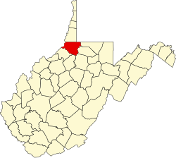
Wetzel County was formed in 1846 from part of Tyler County, Virginia. On June 20, 1863, at the height of the Civil War, Wetzel was one of fifty Virginia counties admitted to the Union as the state of West Virginia.

Later that year, West Virginia's counties were divided into civil townships, with the intention of encouraging local government. This proved impractical in the heavily rural state, and in 1872 the townships were converted into magisterial districts. [4] Wetzel County was divided into six districts: Center, [lower-roman 1] Church, Grant, Green, Magnolia, and Proctor. A seventh district, Clay, was formed in the 1880s. New Martinsville, the county seat, was in Magnolia District. Except for minor adjustments, the seven historic magisterial districts remained largely unchanged for a century, until the 1980s, when they were consolidated into three new districts: District 1, District 2, and District 3. [5]

Geography

According to the United States Census Bureau, the county has a total area of 361 square miles (930 km2), of which 358 square miles (930 km2) is land and 3.3 square miles (8.5 km2) (0.9%) is water. [6]

Major highways

Adjacent counties

National protected area

Demographics

Historical population
CensusPop.Note
1850 4,284
1860 6,70356.5%
1870 8,59528.2%
1880 13,89661.7%
1890 16,84121.2%
1900 22,88035.9%
1910 23,8554.3%
1920 23,069−3.3%
1930 22,334−3.2%
1940 22,3420.0%
1950 20,154−9.8%
1960 19,347−4.0%
1970 20,3145.0%
1980 21,8747.7%
1990 19,258−12.0%
2000 17,693−8.1%
2010 16,583−6.3%
2020 14,442−12.9%
2021 (est.)14,170 [7] −1.9%
U.S. Decennial Census [8]
1790–1960 [9] 1900–1990 [10]
1990–2000 [11] 2010–2020 [1]

2020 census

As of the 2020 census, there were 14,442 people and 5,603 households residing in the county. There were 7,254 housing units in Wetzel. The racial makeup of the county was 95.2% White, 0.3% Asian, 0.2% African American, 0.1% Native American, 0.3% from other races, and 3.7% from two or more races. Hispanics or Latinos of any race were 1% of the population.

Of the 9,912 households, 47.2% were married couples living together, 27.2% had a female householder with no spouse present, 19.4% had a male householder with no spouse present. The average household and family size was 3.25. The median age in the county was 46.4 years with 20.4% of the population under 18. The median income for a household was $47,611 and the poverty rate was 18.8%. [12]

2010 census

As of the 2010 United States census, there were 16,583 people, 6,968 households, and 4,768 families living in the county. [13] The population density was 46.3 inhabitants per square mile (17.9/km2). There were 8,173 housing units at an average density of 22.8 units per square mile (8.8 units/km2). [14] The racial makeup of the county was 98.7% white, 0.2% Asian, 0.1% American Indian, 0.1% black or African American, 0.2% from other races, and 0.6% from two or more races. Those of Hispanic or Latino origin made up 0.5% of the population. [13] In terms of ancestry, 27.5% were German, 16.0% were Irish, 12.8% were American, and 12.4% were English. [15]

Of the 6,968 households, 28.1% had children under the age of 18 living with them, 53.4% were married couples living together, 10.4% had a female householder with no husband present, 31.6% were non-families, and 27.4% of all households were made up of individuals. The average household size was 2.36 and the average family size was 2.83. The median age was 44.8 years. [13]

The median income for a household in the county was $36,636 and the median income for a family was $48,523. Males had a median income of $45,833 versus $25,033 for females. The per capita income for the county was $19,899. About 13.1% of families and 17.5% of the population were below the poverty line, including 26.5% of those under age 18 and 13.7% of those age 65 or over. [16]

2000 census

As of the census of 2000, there were 17,693 people, 7,164 households, and 5,079 families living in the county. The population density was 49 people per square mile (19 people/km2). There were 8,313 housing units at an average density of 23 units per square mile (8.9 units/km2). The racial makeup of the county was 98.92% White, 0.08% Black or African American, 0.10% Native American, 0.32% Asian, 0.02% Pacific Islander, 0.03% from other races, and 0.53% from two or more races. 0.42% of the population were Hispanic or Latino of any race.

There were 7,164 households, out of which 30.20% had children under the age of 18 living with them, 57.70% were married couples living together, 9.30% had a female householder with no husband present, and 29.10% were non-families. 25.70% of all households were made up of individuals, and 12.80% had someone living alone who was 65 years of age or older. The average household size was 2.45 and the average family size was 2.92.

In the county, the population was spread out, with 23.80% under the age of 18, 6.80% from 18 to 24, 26.50% from 25 to 44, 26.80% from 45 to 64, and 16.20% who were 65 years of age or older. The median age was 40 years. For every 100 females there were 94.30 males. For every 100 females age 18 and over, there were 91.20 males.

The median income for a household in the county was $30,935, and the median income for a family was $36,793. Males had a median income of $37,296 versus $19,339 for females. The per capita income for the county was $16,818. About 15.30% of families and 19.80% of the population were below the poverty line, including 26.60% of those under age 18 and 15.20% of those age 65 or over.

Politics

Wetzel County was a rarity among northern West Virginia counties in supporting secession at the Virginia Secession Convention, [17] and it reliably supported Democratic presidential candidates for the next ninety years. [18] The first Republican to carry Wetzel County was Herbert Hoover in 1928 due to anti-Catholicism, but the county afterwards stayed Democratic until 1952. [18] Since that time Wetzel County has followed the politics of West Virginia: a Democratic-leaning state up to the Clinton Era, after which the Democratic Party's consistent shift to social-liberal positions and support of green policies – an antithesis to the region's traditional economy – have caused Wetzel County to trend rapidly toward the Republican Party.

United States presidential election results for Wetzel County, West Virginia [19]
Year Republican Democratic Third party
No.%No.%No.%
2020 4,99374.87%1,53923.08%1372.05%
2016 4,51971.59%1,35921.53%4346.88%
2012 3,47359.11%2,21737.74%1853.15%
2008 3,34251.78%2,94245.58%1702.63%
2004 3,65651.95%3,33047.31%520.74%
2000 3,23951.51%2,84945.31%2003.18%
1996 2,03732.45%3,20951.12%1,03116.43%
1992 2,27129.89%3,75349.40%1,57320.71%
1988 3,38146.00%3,92853.44%410.56%
1984 4,62656.37%3,54943.24%320.39%
1980 3,58844.77%4,03550.34%3924.89%
1976 3,79342.93%5,04257.07%00.00%
1972 6,04664.86%3,27635.14%00.00%
1968 4,12246.06%4,03845.12%7898.82%
1964 3,21534.01%6,23965.99%00.00%
1960 5,14954.27%4,33845.73%00.00%
1956 5,02456.88%3,80943.12%00.00%
1952 4,47650.57%4,37549.43%00.00%
1948 3,32642.48%4,47757.18%260.33%
1944 3,60445.40%4,33554.60%00.00%
1940 4,44344.28%5,59055.72%00.00%
1936 3,77036.74%6,46362.98%290.28%
1932 3,35135.10%6,11864.08%780.82%
1928 4,42851.86%4,05247.45%590.69%
1924 3,45839.60%4,99857.24%2763.16%
1920 3,61946.37%4,10352.58%821.05%
1916 1,91039.92%2,79758.47%771.61%
1912 1,09223.24%2,71057.68%89619.07%

Local lore

In the mid-to-late 19th century a band similar to the James Gang of legend existed that was known as the Jennings Gang. A number of robberies and murders were accounted to this gang. They were known to be located near the head of Doolin Run near Tarpan Ridge. The home they occupied was found to have an escape tunnel that had been used to escape capture on several occasions. A local group of citizens known as the "Redmen" ultimately cornered the gang at this home and a number of the members were killed. A detailed description exists in the Wetzel County History written approximately in 1900.

The oldest oil well location known is of one drilled on Long Run near Doolin Run which reached oil at a depth about 360 ft.

Wetzel County has a long history in the Oil and Gas producing industry. During the Oil boom of the 19th century it is reported that the Proctor Creek watershed had 12 saloons and numerous livery/hotels to accommodate the hundreds of logging and oil field workers.

Communities

Cities

Towns

Magisterial districts

Current

  • District 1
  • District 2
  • District 3

Historic

  • Center
  • Church
  • Clay
  • Grant
  • Green
  • Magnolia
  • Proctor

Census-designated places

Unincorporated communities

See also

39°37′N80°38′W / 39.61°N 80.64°W / 39.61; -80.64

Footnotes

  1. Initially spelled "Centre".

Related Research Articles

<span class="mw-page-title-main">Putnam County, West Virginia</span> County in West Virginia, United States

Putnam County is a county in the U.S. state of West Virginia. As of the 2020 census, the population was 57,440. Its county seat is Winfield, its largest incorporated city is Hurricane, and its largest community is the census-designated place of Teays Valley. Putnam County is part of the Huntington–Ashland, WV-KY-OH Metropolitan Statistical Area, across the Kanawha River from Charleston, West Virginia.

<span class="mw-page-title-main">Braxton County, West Virginia</span> County in West Virginia, United States

Braxton County is a county in the central part of the U.S. state of West Virginia. As of the 2020 census, the population was 12,447. The county seat is Sutton. The county was formed in 1836 from parts of Lewis, Kanawha, and Nicholas counties and named for Carter Braxton, a Virginia statesman and signer of the Declaration of Independence.

<span class="mw-page-title-main">Wood County, West Virginia</span> County in West Virginia, United States

Wood County is a county in the U.S. state of West Virginia. As of the 2020 census, the population was 84,296, making it West Virginia's fifth-most populous county. Its county seat is Parkersburg. The county was formed in 1798 from the western part of Harrison County and named for James Wood, governor of Virginia from 1796 to 1799.

<span class="mw-page-title-main">Tyler County, West Virginia</span> County in West Virginia, United States

Tyler County is a county in the U.S. state of West Virginia. As of the 2020 census, the population was 8,313. Its county seat is Middlebourne. The county was founded in 1814 and is named after John Tyler, Sr., father of President John Tyler.

<span class="mw-page-title-main">Taylor County, West Virginia</span> County in West Virginia, United States

Taylor County is a county in the U.S. state of West Virginia. As of the 2020 census, the population was 16,705. Its county seat is Grafton. The county was formed in 1844 and named for Senator John Taylor of Caroline.

<span class="mw-page-title-main">Pleasants County, West Virginia</span> County in West Virginia, United States

Pleasants County is a county located in the U.S. state of West Virginia. At the 2020 census, the population was 7,653. Its county seat is St. Marys.

<span class="mw-page-title-main">Nicholas County, West Virginia</span> County in West Virginia, United States

Nicholas County is a county located in the central region of U.S. state of West Virginia. As of the 2020 census, the population was 24,604. Its county seat is Summersville. The county was created in 1818 by the Virginia General Assembly and named for Virginia Governor Wilson Cary Nicholas.

<span class="mw-page-title-main">Monongalia County, West Virginia</span> County in West Virginia, United States

Monongalia County, known locally as Mon County, is located in the U.S. state of West Virginia. As of the 2020 census, the population was 105,822, making it West Virginia's third-most populous county. Its county seat is Morgantown. The county was founded in 1776. Monongalia County is included in the Morgantown, WV Metropolitan Statistical Area, and is the largest county in North-Central West Virginia. It is part of the Pittsburgh media market.

<span class="mw-page-title-main">Marshall County, West Virginia</span> County in West Virginia, United States

Marshall County is a county in the U.S. state of West Virginia. At the 2020 census, the population was 30,591. Its county seat is Moundsville. With its southern border at what would be a continuation of the Mason-Dixon line to the Ohio River, it forms the base of the Northern Panhandle of West Virginia.

<span class="mw-page-title-main">Marion County, West Virginia</span> County in West Virginia, United States

Marion County is a county in the U.S. state of West Virginia. As of the 2020 census, the population was 56,205. Its county seat is Fairmont. The county was named in honor of General Francis Marion, known to history as "The Swamp Fox".

<span class="mw-page-title-main">Logan County, West Virginia</span> County in West Virginia, United States

Logan County is a county in the U.S. state of West Virginia. As of the 2020 census, the population was 32,567. Its county seat is Logan. Logan County comprises the Logan, WV Micropolitan Statistical Area, which is also included in the Charleston–Huntington–Ashland, WV–OH–KY Combined Statistical Area.

<span class="mw-page-title-main">Kanawha County, West Virginia</span> County in West Virginia, United States

Kanawha County is a county in the U.S. state of West Virginia. As of the 2020 census, the population was 180,745, making it West Virginia's most populous county. The county seat is Charleston, which is also the state capital and most populous city. Kanawha County is part of the Charleston, WV Metropolitan Statistical Area.

<span class="mw-page-title-main">Hancock County, West Virginia</span> County in West Virginia, United States

Hancock County is a county in the U.S. state of West Virginia. As of the 2020 census, the population was 29,095. Its county seat is New Cumberland and its largest city is Weirton. The county was created from Brooke County in 1848 and named for John Hancock, first signer of the Declaration of Independence. Located at the tip of the state's Northern Panhandle, Hancock County is the northernmost point in both West Virginia and, by some definitions, the Southern United States. Hancock County is part of the Weirton-Steubenville, WV-OH Metropolitan Statistical Area, which is also included in the Pittsburgh-New Castle-Weirton, PA-WV-OH Combined Statistical Area.

<span class="mw-page-title-main">Calhoun County, West Virginia</span> County in West Virginia, United States

Calhoun County is a county in the U.S. state of West Virginia. As of the 2020 census, the population was 6,229, making it the third-least populous county in West Virginia. Its county seat is Grantsville. The county was founded in 1856 and named for South Carolina politician John C. Calhoun.

<span class="mw-page-title-main">Brooke County, West Virginia</span> County in West Virginia, United States

Brooke County is a county in the Northern Panhandle of the U.S. state of West Virginia. As of the 2020 census, the population was 22,559. Its county seat is Wellsburg. The county was created in 1797 from part of Ohio County and named in honor of Robert Brooke, Governor of Virginia from 1794 to 1796. Brooke County is part of the Weirton-Steubenville, WV-OH Metropolitan Statistical Area, which is also included in the Pittsburgh-New Castle-Weirton, PA-WV-OH Combined Statistical Area.

<span class="mw-page-title-main">Littleton, West Virginia</span> Census-designated place in West Virginia, United States

Littleton is a census-designated place (CDP) in Wetzel County, West Virginia, United States. The population was 198 at the 2010 census.

<span class="mw-page-title-main">New Martinsville, West Virginia</span> City in West Virginia, United States

New Martinsville is a city in and the county seat of Wetzel County, West Virginia, United States, along the Ohio River. The population was 5,186 at the 2020 census.

<span class="mw-page-title-main">Pine Grove, West Virginia</span> Town in West Virginia, United States

Pine Grove is a town in Wetzel County, West Virginia, United States. The population was 363 at the 2020 census. The community was named for a grove of pine trees near the original town site.

<span class="mw-page-title-main">Smithfield, West Virginia</span> Town in West Virginia, United States

Smithfield is a town in Wetzel County, West Virginia, United States. The population was 103 at the 2020 census.

<span class="mw-page-title-main">Paden City, West Virginia</span> City in West Virginia, United States

Paden City is a city in Tyler and Wetzel counties in the U.S. state of West Virginia, along the Ohio River. It was founded in 1902. The population was 2,550 at the 2020 census.

References

  1. 1 2 "State & County QuickFacts". United States Census Bureau. Retrieved October 18, 2022.
  2. "Find a County". National Association of Counties. Retrieved June 7, 2011.
  3. "Archived copy". Archived from the original on September 23, 2001. Retrieved February 4, 2013.{{cite web}}: CS1 maint: archived copy as title (link)
  4. Otis K. Rice & Stephen W. Brown, West Virginia: A History, 2nd ed., University Press of Kentucky, Lexington (1993), p. 240.
  5. United States Census Bureau, U.S. Decennial Census, Tables of Minor Civil Divisions in West Virginia, 1870–2010.
  6. "2010 Census Gazetteer Files". United States Census Bureau. August 22, 2012. Retrieved July 31, 2015.
  7. "Annual Estimates of the Resident Population for Counties: April 1, 2020 to July 1, 2021" . Retrieved October 18, 2022.
  8. "U.S. Decennial Census". United States Census Bureau. Retrieved January 16, 2014.
  9. "Historical Census Browser". University of Virginia Library. Retrieved January 16, 2014.
  10. "Population of Counties by Decennial Census: 1900 to 1990". United States Census Bureau. Retrieved January 16, 2014.
  11. "Census 2000 PHC-T-4. Ranking Tables for Counties: 1990 and 2000" (PDF). United States Census Bureau. Archived (PDF) from the original on October 9, 2022. Retrieved January 16, 2014.
  12. "Explore Census Data". data.census.gov. Retrieved April 10, 2023.
  13. 1 2 3 "DP-1 Profile of General Population and Housing Characteristics: 2010 Demographic Profile Data". United States Census Bureau. Archived from the original on February 13, 2020. Retrieved April 3, 2016.
  14. "Population, Housing Units, Area, and Density: 2010 - County". United States Census Bureau. Archived from the original on February 13, 2020. Retrieved April 3, 2016.
  15. "DP02 SELECTED SOCIAL CHARACTERISTICS IN THE UNITED STATES – 2006-2010 American Community Survey 5-Year Estimates". United States Census Bureau. Archived from the original on February 13, 2020. Retrieved April 3, 2016.
  16. "DP03 SELECTED ECONOMIC CHARACTERISTICS – 2006-2010 American Community Survey 5-Year Estimates". United States Census Bureau. Archived from the original on February 13, 2020. Retrieved April 3, 2016.
  17. ‘How Virginia Convention Delegates Voted on Secession, April 4 and April 17, 1861, and Whether They Signed a Copy of the Ordinance of Secession’
  18. 1 2 Menendez, Albert J.; The Geography of Presidential Elections in the United States, 1868-2004, pp. 334-337 ISBN   0786422173
  19. Leip, David. "Dave Leip's Atlas of U.S. Presidential Elections". uselectionatlas.org. Retrieved March 28, 2018.