Northern Virginia FC is an American soccer club from Leesburg, Virginia competing in USL League Two, USL W League, Eastern Premier Soccer League and the Major Arena Soccer League 3.
Foggy Bottom is a neighborhood of Washington, D.C., located in Northwest D.C. Stretching west of the White House towards the Potomac River, the neighborhood is home to numerous federal agencies and international institutions, while the core of the neighborhood is occupied by George Washington University.
Wagoner is an unincorporated community in Mineral County, West Virginia, United States. Wagoner lies along the North Branch Potomac River at Round Bottom Hollow between the communities of Dans Run and Green Spring. Wagoner is located at the northern terminus of West Virginia Secondary Route 15/2.
Bottom Creek is an unincorporated community located in McDowell County, West Virginia, United States. Bottom Creek lies along U.S. Route 52 between the towns of Kimball and Vivian. It takes its name from the stream that runs through the community.

Albert Gallatin Jenkins was an American attorney, planter, politician and military officer who fought for the Confederate States of America during the American Civil War. He served in the United States Congress and later the First Confederate Congress. After Virginia's secession from the Union, Jenkins raised a company of partisan rangers and rose to become a brigadier general in the Confederate States Army, commanding a brigade of cavalry. Wounded at the Battle of Gettysburg and again during the Confederate defeat at the Battle of Cloyd's Mountain, during which he was captured, Jenkins died just 12 days after his arm was amputated by Union Army surgeons as he was unable to recover. His former home is now operated by the United States Army Corps of Engineers.

Pipestem Resort State Park is a 4,050-acre (1,640 ha) state park located in southern West Virginia, on the border between Mercer and Summers counties. The park was built with grants provided by the Area Redevelopment Administration of the U.S. Department of Commerce under the administration of President John F. Kennedy. It is located in the gorge of the Bluestone River.

The Chesapeake Bay deadrise or deadrise workboat is a type of traditional fishing boat used in the Chesapeake Bay. Watermen use these boats year round for everything from crabbing and oystering to catching fish or eels.
Sharon is an unincorporated community and coal town in southeastern Kanawha County, West Virginia, United States, located along the West Virginia Turnpike.

Green Bottom Wildlife Management Area is located on former plantation lands of U.S. Congressman and Confederate General Albert G. Jenkins. The 1,096 acres (444 ha) in Cabell County and Mason County are located along the banks of the Ohio River about 16 miles (26 km) north of Huntington, West Virginia. The Green Bottom WMA land is a mixture of farmland, mixed hardwood forest, wetlands, and open water. The Jenkins Plantation Museum is located on Corps of Engineers land adjacent to the WMA. The museum is located in the original 1835 Green Bottom Plantation House, and is operated by the West Virginia Division of Culture and History.

Kay Moor, also known as Kaymoor, is the site of an abandoned coal mine, coal-processing plant, and coal town near Fayetteville, West Virginia. The town site is located in the New River Gorge at Kaymoor Bottom (38°03′00″N81°03′17″W). It is linked to the mine portal 560 feet (170 m) above on Sewell Bench (38°02′52″N81°03′58″W) in the wall of the Gorge by conveyors.
Mercers Bottom is an unincorporated community in Mason County, West Virginia, United States. It is situated on the east bank of the Ohio River along West Virginia Route 2, some 13.5 miles (21.7 km) south of Point Pleasant.

Superior Bottom is an unincorporated community in Logan County, West Virginia, United States. Superior Bottom is located along West Virginia Route 44 and Island Creek, 7 miles (11 km) south of Logan.
Gillman Bottom is an unincorporated community in Logan County, West Virginia, United States. Gillman Bottom is located along Huff Creek and West Virginia Route 10, 4.7 miles (7.6 km) east-southeast of Man. It is part of the Mallory census-designated place.
Black Bottom is an unincorporated community in Logan County, West Virginia, United States. Black Bottom is located along West Virginia Route 73, 0.6 miles (0.97 km) west of Logan. It is part of the Mount Gay-Shamrock census-designated place.
Pettry Bottom is an unincorporated community in Raleigh County, West Virginia, United States.
Muses Bottom is an unincorporated community in Jackson County, West Virginia, United States. Muses Bottom is located on the Ohio River and West Virginia Route 68, 6.5 miles (10.5 km) north of Ravenswood. Muses Bottom once had a post office, which is now closed.
Youngs Bottom is an unincorporated community in Kanawha County, West Virginia, United States.
McKeefrey is an unincorporated community in Marshall County, West Virginia, United States. It was also known as Round Bottom and Chestnut Hill.
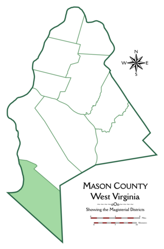
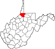
Hannan Magisterial District is one of ten magisterial districts in Mason County, West Virginia, United States. The district was originally established as a civil township in 1863, and converted into a magisterial district in 1872. In 2020, Clendenin District was home to 2,688 people.