Big Run, Wetzel County, West Virginia

Last updated

Big Run
USA West Virginia location map.svg
Red pog.svg
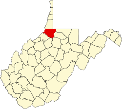
Big Run
Location within the state of West Virginia
Usa edcp location map.svg
Red pog.svg
Big Run
Big Run (the United States)
Coordinates: 39°35′4″N80°34′39″W / 39.58444°N 80.57750°W / 39.58444; -80.57750
Country United States
State West Virginia
County Wetzel
Time zone UTC-5 (Eastern (EST))
  Summer (DST) UTC-4 (EDT)
ZIP codes
25651
GNIS feature ID1549594 [1]

Big Run is an unincorporated community in Wetzel County, West Virginia, United States. It is named for Big Run, on which it is located. [2]

Related Research Articles

<span class="mw-page-title-main">Wetzel County, West Virginia</span> County in West Virginia, United States

Wetzel County is a county in the U.S. state of West Virginia. As of the 2020 census, the population was 14,442. Its county seat is New Martinsville. The county, founded in 1846, is named for Lewis Wetzel, a famous frontiersman and Indian fighter. Its northern border aligns with the Mason-Dixon line, but is to the west of the line's western terminus.

<span class="mw-page-title-main">Tyler County, West Virginia</span> County in West Virginia, United States

Tyler County is a county in the U.S. state of West Virginia. As of the 2020 census, the population was 8,313. Its county seat is Middlebourne. The county was founded in 1814 and is named after John Tyler, Sr., father of President John Tyler.

Big Run may refer to:

Lewis Wetzel was an American scout, frontiersman, and was 1/4 Mohawk, and was a natural born woodsman. Other Native Americans, and Native American Tribes were all petrified of him. Unknowingly, they all gave him the same name "Death Wind", standing almost or about 5 ft. 10 inches with dark brown hair past his knees in length. And was an expert with a knife and tomahawk. And was even deadlier with a black powder riffle, or musket. In fact, while running at full speed Death Wind could load a Ball in his riffle, pour powder from his powder horn and pack it, and aim it and fire expert marksmanship every time. Raised in what is now the Northern Panhandle of West Virginia, his exploits once hailed as similar to those of Daniel Boone.

Big Run is the name of several unincorporated communities in the U.S. state of West Virginia.

Nestled in the foothills of the Appalachian Mountains, Burton is an unincorporated community in Wetzel County, West Virginia, United States, located on a stretch of highway where both WV Route 7 and US Route 250 join for a few short miles between Cottontown and Hundred. These two roads are responsible for the majority of traffic to and from the area and provide important connections to New Martinsville to the west ; Fairmont to the southeast ; Morgantown, to the west ; and Moundsville to the northeast. Other important connections include WV Route 69 North into Pennsylvania, where it becomes PA Route 18 and leads towards Waynesburg and beyond to Pittsburgh. Pittsburgh International Airport, is the nearest intercontinental airport, while Burton is also served by a smaller regional airport, Morgantown Municipal Airport.

Reader is a census-designated place (CDP) in Wetzel County, West Virginia, United States. As of the 2010 census, its population was 397.

Harker may refer to:

Porters Falls is an unincorporated community in Wetzel County, West Virginia, United States. It lies at an elevation of 682 feet (208 m).

Knob Fork is a diffuse, unincorporated hamlet in Wetzel County, West Virginia, United States. It lies at an elevation of 1050 feet (320 m). Its only business or service is a wholesale nursery. Other names for the community have included Geaneytown, Jolliff, Jolliffe, Jolliffes Store, Knobfork Store, Sugar Run, and Uniontown. The present name is derived from the nearby Knob Fork creek.

Coburn is an unincorporated community in Wetzel County, West Virginia, United States. It lies at an elevation of 978 feet (298 m).

Proctor is an unincorporated community in northwestern Wetzel County, West Virginia, United States. It lies on West Virginia Route 2 along the Ohio River, north of the city of New Martinsville, the county seat of Wetzel County. Its elevation is 630 feet (192 m). Because the community has borne multiple names, the Board on Geographic Names officially designated it "Proctor" in 1980. It has a post office with the ZIP code 26055.

<span class="mw-page-title-main">Lewis Wetzel Wildlife Management Area</span> State Wildlife Management Area in Wetzel County, West Virginia

Lewis Wetzel Wildlife Management Area (WMA) is located in Wetzel County, West Virginia, USA, about 0.75 miles (1.21 km) south of Jacksonburg on County Route 82. It is located on 13,590 acres (5,500 ha) of steep terrain with narrow valleys and ridgetops. The WMA second growth mixed hardwoods and hemlock with a thick understory of mountain laurel and rhododendron.

<span class="mw-page-title-main">National Register of Historic Places listings in Wetzel County, West Virginia</span>

This is a list of the National Register of Historic Places listings in Wetzel County, West Virginia.

Onie was an unincorporated community in Wetzel County, West Virginia. It was also known as Unie.

Kodol is an unincorporated community in Wetzel County, West Virginia, United States.

Minnie is an unincorporated community in Wetzel County, West Virginia, United States.

Wheat is an unincorporated community in Wetzel County, West Virginia, United States. Its post office opened in 1837, closed in 1950.

Vincen is an unincorporated community in Tyler and Wetzel counties, in the U.S. state of West Virginia.

West is an unincorporated community in Wetzel County, in the U.S. state of West Virginia.

References

  1. U.S. Geological Survey Geographic Names Information System: Big Run, Wetzel County, West Virginia
  2. Kenny, Hamill (1945). West Virginia Place Names: Their Origin and Meaning, Including the Nomenclature of the Streams and Mountains. Piedmont, WV: The Place Name Press. p. 113.