Four Mile, West Virginia

Last updated
Four Mile
USA West Virginia location map.svg
Red pog.svg
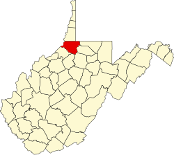
Four Mile
Location within the state of West Virginia
Usa edcp location map.svg
Red pog.svg
Four Mile
Four Mile (the United States)
Coordinates: 39°35′13″N80°37′3″W / 39.58694°N 80.61750°W / 39.58694; -80.61750 Coordinates: 39°35′13″N80°37′3″W / 39.58694°N 80.61750°W / 39.58694; -80.61750
Country United States
State West Virginia
County Wetzel
Elevation
797 ft (243 m)
Time zone UTC-5 (Eastern (EST))
  Summer (DST) UTC-4 (EDT)
GNIS ID 1539174 [1]

Four Mile is an unincorporated community in Wetzel County, West Virginia, United States.

Related Research Articles

West Virginia State of the United States of America

West Virginia is a state in the Appalachian, Mid-Atlantic and Southeastern regions of the United States. It is bordered by Pennsylvania to the northeast, Maryland to the east and northeast, Virginia to the southeast, Kentucky to the southwest, and Ohio to the northwest. West Virginia is the 41st-largest state by area and ranks 38th in population, with a population of 1,795,045 residents. The capital and largest city is Charleston.

Interstate 81 (I-81) is a north–south Interstate Highway in the eastern part of the United States. Its southern terminus is at I-40 in Dandridge, Tennessee; its northern terminus is on Wellesley Island at the Canadian border, where the Thousand Islands Bridge connects it to Highway 401, the main Ontario freeway connecting Detroit via Toronto to Montreal. The major metropolitan areas that I-81 connects to include the Tri-Cities of Tennessee, Roanoke in Virginia, Harrisburg and the Wyoming Valley in Pennsylvania and Syracuse in New York.

Mineral County, West Virginia U.S. county in West Virginia

Mineral County is a county in the U.S. state of West Virginia. It is part of the Cumberland, MD-WV Metropolitan Statistical Area. As of the 2010 census, the population was 28,212. Its county seat is Keyser. The county was founded in 1866.

Brooke County, West Virginia U.S. county in West Virginia

Brooke County is a county in the Northern Panhandle of the U.S. state of West Virginia. As of the 2010 census, the population was 24,069. Its county seat is Wellsburg. The county was created in 1797 from part of Ohio County and named in honor of Robert Brooke, Governor of Virginia from 1794 to 1796. Brooke County is part of the Weirton-Steubenville, WV-OH Metropolitan Statistical Area, which is also included in the Pittsburgh-New Castle-Weirton, PA-WV-OH Combined Statistical Area.

Huntington, West Virginia City in West Virginia, United States

Huntington is a city in Cabell and Wayne Counties in the U.S. state of West Virginia. It is the county seat of Cabell County, and largest city in the Huntington-Ashland, WV-KY-OH Metropolitan Statistical Area, sometimes referred to as the Tri-State Area. A historic and bustling city of commerce and heavy industry, Huntington has benefited from its location on the Ohio River at the mouth of the Guyandotte River. It is home to the Port of Huntington Tri-State, the second-busiest inland port in the United States.

Morgantown, West Virginia City in West Virginia, United States

Morgantown is the county seat of Monongalia County, West Virginia, United States, situated along the Monongahela River. West Virginia University is located in the city. The population was 29,660 at the 2010 Census Bureau, making Morgantown the largest city in North-Central West Virginia. The Morgantown metropolitan area has a population of 138,176.

U.S. Route 21 Highway in the United States

U.S. Route 21 or U.S. Highway 21 (US 21) is a north–south United States Numbered Highway in the Southeastern United States that travels 394 miles (634 km). The southern terminus is in Hunting Island State Park, South Carolina, 14.4 miles (23.2 km) of US 21 Business and South Carolina Highway 802 (SC 802) in Beaufort. The northern terminus is in Wytheville, Virginia at an interchange with Interstate 81 (I-81) and US 52. It travels through the states of South Carolina, North Carolina, and Virginia. It also connects through major Southeastern cities such as Columbia, South Carolina and Charlotte, North Carolina. The northern portion of the road travels parallel to I-77 in northern South Carolina and North Carolina. The road also has three interchanges with I-26 in Lexington and Calhoun counties in South Carolina.

U.S. Route 33

U.S. Route 33 (US 33) is a United States Numbered Highway that runs northwest–southeast for 709 miles (1,141 km) from northern Indiana to Richmond, Virginia, passing through Ohio and West Virginia en route. Although most odd-numbered U.S. routes are north–south, US 33 is labeled east–west throughout its route, except in Indiana where it is labeled north–south. It roughly follows a historic trail used by Native Americans from Chesapeake Bay to Lake Michigan.

U.S. Route 119 Highway in the United States

U.S. Route 119 (US 119) is a spur of US 19. It is a north–south route that was an original United States highway of 1926. It is Corridor G of the Appalachian Development Highway System (ADHS) east of US 23 and KY 80 in Kentucky to Interstate 64 at Charleston, West Virginia.

U.S. Route 48 (US 48), also known as the incomplete Corridor H of the Appalachian Development Highway System, extends from Interstate 79 (I-79) in Weston, West Virginia eastward across the crest of the Allegheny Mountains to I-81 in Strasburg, Virginia. It is planned to extend 157 miles (253 km) from west northern Virginia to central West Virginia.

West Virginia Route 9

West Virginia Route 9 (WV 9) is a major east–west state highway located in the eastern extents of West Virginia's Eastern Panhandle. The western terminus of the route is at the Maryland state line north of Paw Paw, where WV 9 becomes Maryland Route 51 (MD 51) upon crossing the Potomac River. The eastern terminus is at the Virginia state line at Keyes Gap near Mannings, West Virginia, where WV 9 continues onward as Virginia State Route 9 (SR 9).

West Virginia Route 10

West Virginia Route 10 is a north–south route from Cabell County to Mercer County in the western and southern regions of West Virginia. Mostly a two-lane, winding highway with no shoulders, Route 10 is considered to be one of substandard design when compared to modern standards. Nevertheless, it serves as a major arterial highway in the state, carrying a substantial amount of traffic volume. Tractor-trailers have a particularly difficult time negotiating many of the route's sharp, hairpin curves.

McConnell, West Virginia Census-designated place in West Virginia, United States

McConnell is an unincorporated community and census-designated place (CDP) in Logan County, West Virginia, United States, on the Guyandotte River. As of the 2010 census, its population was 514. It was established in 1933.

U.S. Route 52 in West Virginia

U.S. Route 52 (US 52) skirts the western fringes of the U.S. state of West Virginia. It runs from the Virginia state line near Bluefield, where it is concurrent with Interstate 77 (I-77), in a general northwest and north direction to I-64 at Kenova. There it turns east, overlapping I-64 for five miles (8.0 km) before splitting off onto the West Huntington Expressway into Ohio via the West Huntington Bridge. Despite having an even number, US 52 is signed north–south in West Virginia. In some other states along its route, it is signed east-west. The West Virginia segment is signed such that US 52 north corresponds to the general westward direction of the highway, and vice versa. For a while, US 52 parallels US 23, which is on the other side of the Big Sandy River in Kentucky. This continues into Ohio, where US 52 travels on the Ohio side of the Ohio River while US 23 travels on the Kentucky side.

Great North Mountain

Great North Mountain is a 50-mile (80 km) long mountain ridge within the Ridge-and-valley Appalachians in the U.S. states of Virginia and West Virginia. The ridge is located west of the Shenandoah Valley and Massanutten Mountain in Virginia, and east of the Allegheny Mountains and Cacapon River in West Virginia.

U.S. Route 220 in Virginia

In the U.S. state of Virginia, U.S. Route 220 (US 220) is a major north-south state highway that extends from the North Carolina state line through Roanoke to the West Virginia state line. South of Roanoke, US 220 is a four-lane highway within the proposed Interstate 73 (I-73) corridor. US 220 narrows to two lanes north of Roanoke, connecting to I-64 near Clifton Forge and then paralleling the Appalachian Mountains north-northeasterly in the direction of Cumberland, Maryland.

Neibert, West Virginia Census-designated place in West Virginia, United States

Neibert is an unincorporated community and census-designated place (CDP) in Logan County, West Virginia, United States. Its population was 183 as of the 2010 census.

Earling, West Virginia Census-designated place in West Virginia, United States

Earling is an unincorporated community and census-designated place (CDP) in Logan County, West Virginia, United States. It was first listed as a CDP prior to the 2020 census. The Earling post office closed on July 1, 1989. The town now shares ZIP Code 25632 with Lyburn and Taplin.

References