Onie, West Virginia

Last updated

Onie
USA West Virginia location map.svg
Red pog.svg
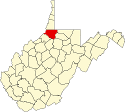
Onie
Location within the state of West Virginia
Usa edcp location map.svg
Red pog.svg
Onie
Onie (the United States)
Coordinates: 39°37′11″N80°37′51″W / 39.61972°N 80.63083°W / 39.61972; -80.63083
Country United States
State West Virginia
County Wetzel
Elevation
902 ft (275 m)
Time zone UTC-5 (Eastern (EST))
  Summer (DST) UTC-4 (EDT)
GNIS ID 1717809 [1]

Onie was an unincorporated community in Wetzel County, West Virginia. It was also known as Unie.

Near Wileyville, Onie was located at the mouth of Honey Run which is a tributary of Little Fishing Creek. [2] Although this town appeared on a few maps, Onie disappeared shortly after it first appeared. According to local memories, Onie had a bar, a blacksmith, and a hotel. [2]

Around 1900, Onie was an oil boom town. Oil production peaked in West Virginia by 1900, when the state ranked second in oil production, and Onie declined after that. [2] As of 2008, East Resources still had a field office and wells at this location, but the fields had been used for hay instead of oil for a long time after Onie vanished.

Related Research Articles

<span class="mw-page-title-main">History of the petroleum industry in the United States</span>

The history of the petroleum industry in the United States goes back to the early 19th century, although the indigenous peoples, like many ancient societies, have used petroleum seeps since prehistoric times; where found, these seeps signaled the growth of the industry from the earliest discoveries to the more recent.

<span class="mw-page-title-main">Wetzel County, West Virginia</span> County in West Virginia, United States

Wetzel County is a county in the U.S. state of West Virginia. As of the 2020 census, the population was 14,442. Its county seat is New Martinsville. The county, founded in 1846, is named for Lewis Wetzel, a famous frontiersman and Indian fighter. Its northern border aligns with the Mason-Dixon line, but is to the west of the line's western terminus.

<span class="mw-page-title-main">Doddridge County, West Virginia</span> County in West Virginia, United States

Doddridge County is a county in the U.S. state of West Virginia. As of the 2020 census, the population was 7,808. Its county seat is West Union.

<span class="mw-page-title-main">Moran, Texas</span> City in Texas, United States

Moran is a city in southeast Shackelford County, Texas, United States. The population was 270 at the 2010 census.

<span class="mw-page-title-main">Clendenin, West Virginia</span> Town in West Virginia, United States

Clendenin is a town in Kanawha County, West Virginia, United States, situated along the Elk River. The population was 850 at the 2020 census.

<span class="mw-page-title-main">Sistersville, West Virginia</span> City in West Virginia, United States

Sistersville is a city in Tyler County, West Virginia, United States, along the Ohio River. The population was 1,413 at the 2020 census. The Sistersville Ferry crosses the Ohio River to the unincorporated community of Fly in Monroe County, Ohio.

Nestled in the foothills of the Appalachian Mountains, Burton is an unincorporated community in Wetzel County, West Virginia, United States, located on a stretch of highway where both WV Route 7 and US Route 250 join for a few short miles between Cottontown and Hundred. These two roads are responsible for the majority of traffic to and from the area and provide important connections to New Martinsville to the west ; Fairmont to the southeast ; Morgantown, to the west ; and Moundsville to the northeast. Other important connections include WV Route 69 North into Pennsylvania, where it becomes PA Route 18 and leads towards Waynesburg and beyond to Pittsburgh. Pittsburgh International Airport, is the nearest intercontinental airport, while Burton is also served by a smaller regional airport, Morgantown Municipal Airport.

<span class="mw-page-title-main">History of the petroleum industry</span> Aspect of history

While the local use of oil goes back many centuries, the modern petroleum industry along with its outputs and modern applications are of a recent origin. Petroleum's status as a key component of politics, society, and technology has its roots in the coal and kerosene industry of the late 19th century. One of the earliest instances of this is the refining of paraffin from crude oil. Abraham Gesner, developed a process to refine a liquid fuel from coal, bitumen and oil shale, it burned more cleanly and was cheaper than whale oil. James Young in 1847 noticed a natural petroleum seepage when he distilled a light thin oil suitable for use as lamp oil, at the same time obtaining a thicker oil suitable for lubricating machinery. The world's first refineries and modern oil wells were established in the mid-19th century. While petroleum industries developed in several countries during the nineteenth century, the two giants were the United States and the Russian Empire, specifically that part of it that today forms the territory of independent Azerbaijan. Together, these two countries produced 97% of the world's oil over the course of the nineteenth century.

<span class="mw-page-title-main">Bakken Formation</span> Geological rock formation known for crude oil and gas production

The Bakken Formation is a rock unit from the Late Devonian to Early Mississippian age occupying about 200,000 square miles (520,000 km2) of the subsurface of the Williston Basin, underlying parts of Montana, North Dakota, Saskatchewan and Manitoba. The formation was initially described by geologist J. W. Nordquist in 1953. The formation is entirely in the subsurface, and has no surface outcrop. It is named after Henry O. Bakken (1901–1982), a farmer in Tioga, North Dakota, who owned the land where the formation was initially discovered while drilling for oil.

Hastings is an unincorporated community in Wetzel County, West Virginia, United States. It lies at an elevation of 755 feet (230 m).

<span class="mw-page-title-main">Indiana gas boom</span>

The Indiana gas boom was a period of active drilling and production of natural gas in the Trenton Gas Field, in the US state of Indiana and the adjacent northwest part of Ohio. The boom began in the early 1880s and lasted into the early 20th century.

<span class="mw-page-title-main">Shale gas in the United States</span>

Shale gas in the United States is an available source of unconventional natural gas. Led by new applications of hydraulic fracturing technology and horizontal drilling, development of new sources of shale gas has offset declines in production from conventional gas reservoirs, and has led to major increases in reserves of U.S. natural gas. Largely due to shale gas discoveries, estimated reserves of natural gas in the United States in 2008 were 35% higher than in 2006.

<span class="mw-page-title-main">Petroleum industry in Ohio</span>

The petroleum industry in Ohio dates from 1859. Ohio continues to produce significant quantities of oil and gas, having produced more than 1 billion barrels of oil and 9 trillion cubic feet of natural gas since 1860. Unconventional resources, primarily in eastern Ohio, are likely to increase production in Ohio.

<span class="mw-page-title-main">Texas oil boom</span> Period of change and economic growth in Texas

The Texas oil boom, sometimes called the gusher age, was a period of dramatic change and economic growth in the U.S. state of Texas during the early 20th century that began with the discovery of a large petroleum reserve near Beaumont, Texas. The find was unprecedented in its size (worldwide) and ushered in an age of rapid regional development and industrialization that has few parallels in U.S. history. Texas quickly became one of the leading oil-producing states in the U.S., along with Oklahoma and California; soon the nation overtook the Russian Empire as the top producer of petroleum. By 1940 Texas had come to dominate U.S. production. Some historians even define the beginning of the world's Oil Age as the beginning of this era in Texas.

<span class="mw-page-title-main">Los Angeles City Oil Field</span> Oil field in Los Angeles, California

The Los Angeles City Oil Field is a large oil field north of Downtown Los Angeles. Long and narrow, it extends from immediately south of Dodger Stadium west to Vermont Avenue, encompassing an area of about four miles long by a quarter-mile across. Its former productive area amounts to 780 acres (3.2 km2).

Richardson is an unincorporated community in Calhoun County, West Virginia, United States.

<span class="mw-page-title-main">History of oil in California through 1930</span>

The story of oil production in California began in the late 19th century. In 1903, California became the leading oil-producing state in the US, and traded the number one position back-and forth with Oklahoma through the year 1930. As of 2022, California produced 3% of the crude oil of the nation, behind Texas, New Mexico, North Dakota, Alaska, Colorado, and Oklahoma. In the past century, California's oil industry grew to become the state's number one GDP export and one of the most profitable industries in the region. The history of oil in the state of California, however, dates back much earlier than the 19th century. For thousands of years prior to European settlement in America, Native Americans in the California territory excavated oil seeps. By the mid-19th century, American geologists discovered the vast oil reserves in California and began mass drilling in the Western Territory. While California's production of excavated oil increased significantly during the early 20th century, the accelerated drilling resulted in an overproduction of the commodity, and the federal government unsuccessfully made several attempts to regulate the oil market.

<span class="mw-page-title-main">Washington oil field</span>

The Washington oil field is an oil field and in Washington County, Pennsylvania. It also produced natural gas.

Saint Joseph is an unincorporated community in Marshall County, in the U.S. state of West Virginia.

<span class="mw-page-title-main">Glenn Pool Oil Reserve</span> First large oil reserve found in Oklahoma, US

The discovery of the Glenn Pool Oil Reserve in 1905 brought the first major oil pipelines into Oklahoma, and instigated the first large scale oil boom in the state. Located near what was—at the time—the small town of Tulsa, Oklahoma, the resultant establishment of the oil fields in the area contributed greatly to the early growth and success of the city, as Tulsa became the petroleum and transportation center of the state, and the world.

References

  1. U.S. Geological Survey Geographic Names Information System: Onie, West Virginia
  2. 1 2 3 Dorsey, Brenda. "It's A Gasser: The First Wetzel Oil and Gas Boom", The Wetzel Chronicle (April 2, 2008).