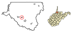
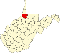
Pine Grove | |
---|---|
Town | |
![]() Location of Pine Grove in Wetzel County, West Virginia | |
Coordinates: 39°33′44″N80°40′52″W / 39.56222°N 80.68111°W | |
Country | United States |
State | West Virginia |
County | Wetzel |
Area | |
• Total | 0.38 sq mi (0.98 km2) |
• Land | 0.35 sq mi (0.91 km2) |
• Water | 0.03 sq mi (0.07 km2) |
Population | |
• Total | 363 |
• Estimate (2021) [2] | 353 |
• Density | 1,369.32/sq mi (528.64/km2) |
Time zone | UTC-5 (Eastern (EST)) |
• Summer (DST) | UTC-4 (EDT) |
FIPS code | 54-63892 |
Website | local |
Pine Grove is a town in Wetzel County, West Virginia, United States. The population was 363 at the 2020 census. [2] The community was named for a grove of pine trees near the original town site. [3]
The town is one mile north of Dominion Energy's large Hastings Extraction Station, which separates natural gas into various subproducts such as butane. The Hastings plant is unique in that there are traffic signals approximately 0.75 mile away from the plant in either direction to stop traffic in case of an emergency. Pine Grove is also home to Valley High School.
Pine Grove is located at 39°33′44″N80°40′52″W / 39.56222°N 80.68111°W (39.562255, -80.681154). [4]
According to the United States Census Bureau, the town has a total area of 0.38 square miles (0.98 km2), of which 0.35 square miles (0.91 km2) is land and 0.03 square miles (0.08 km2) is water. [5]
Census | Pop. | Note | %± |
---|---|---|---|
1910 | 474 | — | |
1920 | 797 | 68.1% | |
1930 | 820 | 2.9% | |
1940 | 841 | 2.6% | |
1950 | 877 | 4.3% | |
1960 | 760 | −13.3% | |
1970 | 630 | −17.1% | |
1980 | 767 | 21.7% | |
1990 | 701 | −8.6% | |
2000 | 571 | −18.5% | |
2010 | 552 | −3.3% | |
2020 | 363 | −34.2% | |
2021 (est.) | 638 | [2] | 75.8% |
U.S. Decennial Census [6] |
At the 2010 census there were 552 people, 223 households, and 152 families living in the town. The population density was 1,577.1 inhabitants per square mile (608.9/km2). There were 245 housing units at an average density of 700.0 per square mile (270.3/km2). The racial makeup of the town was 98.9% White, 0.2% Native American, 0.7% from other races, and 0.2% from two or more races. Hispanic or Latino people of any race were 0.7%. [7]
Of the 223 households 34.5% had children under the age of 18 living with them, 50.7% were married couples living together, 13.0% had a female householder with no husband present, 4.5% had a male householder with no wife present, and 31.8% were non-families. 27.4% of households were one person and 12.5% were one person aged 65 or older. The average household size was 2.48 and the average family size was 2.98.
The median age in the town was 41.2 years. 23.4% of residents were under the age of 18; 10.2% were between the ages of 18 and 24; 23.1% were from 25 to 44; 31.5% were from 45 to 64; and 12% were 65 or older. The gender makeup of the town was 49.1% male and 50.9% female.
At the 2000 census, [8] there were 571 people, 233 households, and 165 families living in the town. The population density was 1,480.6 inhabitants per square mile (565.3/km2). There were 251 housing units at an average density of 650.8 per square mile (248.5/km2). The racial makeup of the town was 99.30% White, 0.18% Asian, and 0.53% from two or more races.
Of the 233 households 30.9% had children under the age of 18 living with them, 55.4% were married couples living together, 10.7% had a female householder with no husband present, and 28.8% were non-families. 24.9% of households were one person and 12.9% were one person aged 65 or older. The average household size was 2.45 and the average family size was 2.90.
The age distribution was 25.0% under the age of 18, 8.8% from 18 to 24, 25.7% from 25 to 44, 25.0% from 45 to 64, and 15.4% 65 or older. The median age was 39 years. For every 100 females, there were 86.6 males. For every 100 females age 18 and over, there were 83.7 males.
The median household income was $25,769 and the median family income was $30,227. Males had a median income of $36,250 versus $23,750 for females. The per capita income for the town was $13,699. About 19.5% of families and 22.6% of the population were below the poverty line, including 28.7% under the age of 18 and 4.4% ages 65 or older.
St. James City is an unincorporated community and census-designated place (CDP) on Pine Island in Lee County, Florida, United States. The population was 3,876 at the 2020 census, up from 3,784 at the 2010 census. It is part of the Cape Coral-Fort Myers, Florida Metropolitan Statistical Area.
Pendergrass is a city in Jackson County, Georgia, United States. The population was 1692 at the time of the 2020 census.
Town of Pines is a town in Pine Township, Porter County, in the U.S. state of Indiana. The population was 708 at the 2010 census.
Spring Grove is a town in Wayne Township, Wayne County, in the U.S. state of Indiana. The population was 344 at the 2010 census.
Mulberry is a city in Crawford County, Kansas, United States. As of the 2020 census, the population of the city was 409.
Neodesha is a city in Wilson County, Kansas, United States. As of the 2020 census, the population of the city was 2,275. The name is derived from the Osage Indian word, Ni-o-sho-de, and is translated as The-Water-Is-Smoky-With-Mud.
Carney is an unincorporated community and census-designated place in Baltimore County, Maryland, United States. The population was 29,941 at the 2010 census.
Rives is a town in Dunklin County, Missouri, United States. The population was 63 at the 2010 census.
Middletown is a city in Montgomery County, Missouri, United States. The population was 171 at the 2020 census.
West Milford is a town in Harrison County, West Virginia, United States. The population was 452 at the 2020 census.
Glasgow is a town in Kanawha County, West Virginia, United States, situated along the Kanawha River. The population was 708 at the 2020 census. Glasgow was incorporated on June 20, 1920. Folk etymology derives its name from a combination of the word "glass" with the word "company" for a glass factory that was built there many years ago, but the presence of many Scottish immigrants to this part of Appalachia, particularly from the Strathclyde region, indicates that the town was most likely named after the Scottish city of Glasgow in Strathclyde. Other Virginia and West Virginia locations named for places in Strathclyde include Dumbarton, Argyle, Loudoun County, Hamilton in Loudoun County, Lanark and Renfrew.
Cowen is a town in Webster County, West Virginia, United States. The population was 488 at the 2020 census.
Elizabeth is a town in and the county seat of Wirt County, West Virginia, United States, situated along the Little Kanawha River. The population was 724 as of the 2020 census.
Ledgeview is a town in Brown County in the U.S. state of Wisconsin. The population was 6,555 as of the 2010 census, up from 3,363 at the 2000 census.
Pine Valley is a town in Clark County in the U.S. state of Wisconsin. The population was 1,121 at the 2000 census. The unincorporated community of Sidney is located in the town.
Lima is a town in Grant County, Wisconsin, United States. The population was 721 at the 2000 census. The unincorporated communities of Arthur and Union are located in the town.
Cooperstown is a town in Manitowoc County, Wisconsin, in the United States. As of the 2000 census, the town population was 1,403.
Pine Haven is a town in Crook County, Wyoming, United States. The population was 493 at the 2020 census.
Pine Bluffs is a town in eastern Laramie County, Wyoming, United States. It is located on the county's border with Nebraska. Pine Bluffs is part of the Cheyenne, Wyoming, Metropolitan Statistical Area. The population was 1,129 at the 2010 census. It was first known as Rock Ranch, but the name was changed by railroad officials for the pines on the nearby bluffs.
Patch Grove is a village in Grant County, Wisconsin, United States. The population was 198 at the 2010 census. The village is located within the Town of Patch Grove.