Ellenboro, West Virginia

Last updated

Ellenboro, West Virginia
Ellenboro West Virginia.jpg
Buildings along Route 16 in Ellenboro in 2007
Ritchie County West Virginia Incorporated and Unincorporated areas Ellenboro Highlighted.svg
Location of Ellenboro in Ritchie County, West Virginia.
Coordinates: 39°16′4″N81°3′5″W / 39.26778°N 81.05139°W / 39.26778; -81.05139
Country United States
State West Virginia
County Ritchie
Area
[1]
  Total1.13 sq mi (2.91 km2)
  Land1.13 sq mi (2.91 km2)
  Water0.00 sq mi (0.00 km2)
Elevation
810 ft (247 m)
Population
 (2020) [2]
  Total222
  Estimate 
(2021) [2]
233
  Density322.67/sq mi (124.60/km2)
Time zone UTC-5 (Eastern (EST))
  Summer (DST) UTC-4 (EDT)
ZIP code
26346
Area code 304
FIPS code 54-24844 [3]
GNIS feature ID1538665 [4]
Website local.wv.gov/Ellenboro/Pages/default.aspx

Ellenboro is a town in Ritchie County, West Virginia, United States. The population was 222 at the 2020 census. [2] The town is located at the junction of U.S. Route 50 and West Virginia Route 16; the North Bend Rail Trail also passes through the town. [5] The town was named for Ellen Mariah Williamson, the eldest daughter of the family that granted a right of way for the Baltimore and Ohio Railroad to build their line through the town; an earlier name for the community was Shumley. [6] Ellenboro was incorporated in 1903. [7]

Contents

Geography

Ellenboro is located at 39°16′4″N81°3′5″W / 39.26778°N 81.05139°W / 39.26778; -81.05139 (39.267702, -81.051299). [8]

According to the United States Census Bureau, the town has a total area of 1.13 square miles (2.93 km2), all land. [9]

Hushers Run flows through the town.

Demographics

Historical population
CensusPop.Note
1910 204
1920 28640.2%
1930 33015.4%
1940 277−16.1%
1950 30710.8%
1960 34010.7%
1970 267−21.5%
1980 35733.7%
1990 45326.9%
2000 373−17.7%
2010 363−2.7%
2020 222−38.8%
2021 (est.)233 [2] 5.0%
U.S. Decennial Census [10]

Ellenboro once had a glass factory and at a much earlier time a very well known resort. However, both have ceased operation. The town was created in the early 1900s and was named after the postmaster's daughter.

2010 census

As of the census [11] of 2010, there were 363 people, 160 households, and 109 families living in the town. The population density was 321.2 inhabitants per square mile (124.0/km2). There were 179 housing units at an average density of 158.4 per square mile (61.2/km2). The racial makeup of the town was 100.0% White.

There were 160 households, of which 24.4% had children under the age of 18 living with them, 49.4% were married couples living together, 13.8% had a female householder with no husband present, 5.0% had a male householder with no wife present, and 31.9% were non-families. 28.8% of all households were made up of individuals, and 10% had someone living alone who was 65 years of age or older. The average household size was 2.27 and the average family size was 2.69.

The median age in the town was 48.4 years. 19.3% of residents were under the age of 18; 6.3% were between the ages of 18 and 24; 20% were from 25 to 44; 39.3% were from 45 to 64; and 14.9% were 65 years of age or older. The gender makeup of the town was 54.5% male and 45.5% female.

2000 census

As of the census [3] of 2000, there were 373 people, 158 households, and 103 families living in the town. The population density was 477.0 inhabitants per square mile (184.2/km2). There were 181 housing units at an average density of 231.5 per square mile (89.4/km2). The racial makeup of the town was 98.66% White, 0.27% African American, and 1.07% from two or more races.

There were 158 households, out of which 27.8% had children under the age of 18 living with them, 49.4% were married couples living together, 12.7% had a female householder with no husband present, and 34.2% were non-families. 27.8% of all households were made up of individuals, and 14.6% had someone living alone who was 65 years of age or older. The average household size was 2.36 and the average family size was 2.89.

In the town, the population was spread out, with 19.3% under the age of 18, 11.8% from 18 to 24, 28.4% from 25 to 44, 26.8% from 45 to 64, and 13.7% who were 65 years of age or older. The median age was 41 years. For every 100 females, there were 97.4 males. For every 100 females age 18 and over, there were 91.7 males.

The median income for a household in the town was $22,500, and the median income for a family was $26,563. Males had a median income of $21,111 versus $20,417 for females. The per capita income for the town was $17,418. About 26.7% of families and 30.7% of the population were below the poverty line, including 49.3% of those under age 18 and 18.0% of those age 65 or over.

Related Research Articles

<span class="mw-page-title-main">West Milford, West Virginia</span> Town in West Virginia, United States

West Milford is a town in Harrison County, West Virginia, United States. The population was 452 at the 2020 census.

<span class="mw-page-title-main">Barrackville, West Virginia</span> Town in West Virginia, United States

Barrackville is a town in Marion County, West Virginia, United States. The population was 1,211 at the 2020 census.

<span class="mw-page-title-main">Glen Dale, West Virginia</span> Town in West Virginia

Glen Dale is a city in Marshall County, West Virginia, United States, along the Ohio River. It is part of the Wheeling, West Virginia Metropolitan Statistical Area. The population was 1,514 at the 2020 census. Glen Dale was incorporated in 1924. It is in the northwest part of the county, which is above the Mason–Dixon line and forms the base of the Northern Panhandle of West Virginia.

<span class="mw-page-title-main">Davy, West Virginia</span> Town in West Virginia, United States

Davy is a town in McDowell County, West Virginia, United States. The population was 420 at the 2010 census. Founded in 1873, the town was originally called Hallsville but the name would change to Davy by 1901. Davy was officially incorporated in 1948. It is a mostly residential community in a coal mining district along the main line of the Norfolk Southern Railway.

<span class="mw-page-title-main">Peterstown, West Virginia</span> Town in West Virginia, United States

Peterstown is a town in Monroe County, West Virginia, United States. The population was 456 at the 2020 census.

<span class="mw-page-title-main">Newburg, West Virginia</span> Town in West Virginia, United States

Newburg is a town in western Preston County, West Virginia, United States. The population was 275 at the 2020 census. It is part of the Morgantown metropolitan area.

<span class="mw-page-title-main">Reedsville, West Virginia</span> Town in West Virginia, United States

Reedsville is a town in western Preston County, West Virginia, United States. The population was 530 at the 2020 census. It is part of the Morgantown metropolitan area.

<span class="mw-page-title-main">Rowlesburg, West Virginia</span> Town in West Virginia, United States

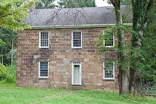
Rowlesburg is a town in southern Preston County, West Virginia, United States, along the Cheat River. The population was 438 at the 2020 census. It is part of the Morgantown metropolitan area. A former railroad town, it is home to the Downtown Rowlesburg Historic District, and was the site of action during the American Civil War.

<span class="mw-page-title-main">Tunnelton, West Virginia</span> Town in West Virginia, United States

Tunnelton is a town in southwestern Preston County, West Virginia, United States. The population was 307 at the 2020 census. It is part of the Morgantown metropolitan area.

<span class="mw-page-title-main">Sophia, West Virginia</span> Town in West Virginia, United States

Sophia is a town in Raleigh County, West Virginia, United States. It was incorporated in 1912. The population was 1,124 at the 2020 census.

<span class="mw-page-title-main">Huttonsville, West Virginia</span> Town in West Virginia, United States

Huttonsville is a town in Randolph County, West Virginia, United States, along the Tygart Valley River. The population was 163 at the 2020 census.

<span class="mw-page-title-main">Montrose, West Virginia</span> Town in West Virginia, United States

Montrose is a town in Randolph County, West Virginia, United States. The population was 141 at the 2020 census.

<span class="mw-page-title-main">Auburn, West Virginia</span> Town in West Virginia, United States

Auburn is a town in Ritchie County, West Virginia, United States. The population was 80 at the 2020 census.

<span class="mw-page-title-main">Cairo, West Virginia</span> Town in West Virginia, United States

Cairo is a town in Ritchie County, West Virginia, United States, along West Virginia Route 31, the North Fork of the Hughes River, and the North Bend Rail Trail. The population was 174 at the 2020 census.

<span class="mw-page-title-main">Pennsboro, West Virginia</span> City in West Virginia, United States

Pennsboro is a city in Ritchie County, West Virginia, United States. The population was 1,050 at the 2020 census. The city is located at the junction of U.S. Route 50 and West Virginia Route 74; the North Bend Rail Trail also passes through the city.

<span class="mw-page-title-main">Reedy, West Virginia</span> Town in West Virginia, United States

Reedy is a town in Roane County, West Virginia, United States. The population was 152 at the 2020 census.

<span class="mw-page-title-main">Davis, West Virginia</span> Town in West Virginia, United States

Davis is a town in Tucker County, West Virginia, United States, situated along the Blackwater River. The population was 595 at the 2020 census.

<span class="mw-page-title-main">Hambleton, West Virginia</span> Town in West Virginia, United States

Hambleton is a town in Tucker County, West Virginia, United States. The population was 216 at the 2020 census. Hambleton was established in 1889, but not incorporated until 1905. It was named by then United States Senator Stephen B. Elkins in honor of a stockholder by this name in the West Virginia Central Railroad Company. The town was previously known as Hulings.

<span class="mw-page-title-main">Hendricks, West Virginia</span> Town in West Virginia, United States

Hendricks is a town in Tucker County, West Virginia, United States. The population was 226 at the 2020 census. The Blackwater River and the Dry Fork join at Hendricks to form the Black Fork, a principal tributary of the Cheat River.

<span class="mw-page-title-main">North Hills, West Virginia</span> Town in West Virginia, United States

North Hills is a town in Wood County, West Virginia, United States. It is a suburb of Parkersburg. The population was 837 at the 2020 census. North Hills was incorporated on February 15, 1979.

References

  1. "2019 U.S. Gazetteer Files". United States Census Bureau. Retrieved August 7, 2020.
  2. 1 2 3 4 "City and Town Population Totals: 2020-2021". Census.gov. US Census Bureau. Retrieved July 3, 2022.
  3. 1 2 "U.S. Census website". United States Census Bureau . Retrieved January 31, 2008.
  4. "US Board on Geographic Names". United States Geological Survey. October 25, 2007. Retrieved January 31, 2008.
  5. DeLorme (1997). West Virginia Atlas & Gazetteer. Yarmouth, Maine: DeLorme. ISBN   0-89933-246-3.
  6. Kenny, Hamill (1945). West Virginia Place Names: Their Origin and Meaning, Including the Nomenclature of the Streams and Mountains. Piedmont, West Virginia: The Place Name Press. p. 228.
  7. West Virginia Blue Book. Published annually by the Clerk's Office of the West Virginia Senate.
  8. "US Gazetteer files: 2010, 2000, and 1990". United States Census Bureau. February 12, 2011. Retrieved April 23, 2011.
  9. "US Gazetteer files 2010". United States Census Bureau. Archived from the original on January 25, 2012. Retrieved January 24, 2013.
  10. "Census of Population and Housing". Census.gov. Retrieved June 4, 2015.
  11. "U.S. Census website". United States Census Bureau . Retrieved January 24, 2013.