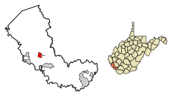
Delbarton, West Virginia | |
---|---|
Coordinates: 37°42′31″N82°11′2″W / 37.70861°N 82.18389°W | |
Country | United States |
State | West Virginia |
County | Mingo |
Area | |
• Total | 1.99 sq mi (5.15 km2) |
• Land | 1.99 sq mi (5.15 km2) |
• Water | 0.00 sq mi (0.00 km2) |
Elevation | 764 ft (233 m) |
Population | |
• Total | 579 |
• Estimate (2019) [3] | 497 |
• Density | 250.13/sq mi (96.57/km2) |
Time zone | UTC-5 (Eastern (EST)) |
• Summer (DST) | UTC-4 (EDT) |
ZIP code | 25670 |
Area code | 304 |
FIPS code | 54-20980 [4] |
GNIS feature ID | 1538117 [5] |
Website | Town of Delbarton |
Delbarton is a town in Mingo County, West Virginia, United States. The population was 522 at the 2020 census.
Delbarton was incorporated September 6, 1946, by the Mingo County Circuit Court.
The name Delbarton comes from the New Jersey country estate of Luther Kountze, a Wall Street financier and part owner of the United Thacker Land Company, a large coal mining company. Currently a Catholic high school with the same moniker, the Delbarton School, is located on this site. The estate and town and school all derive their name from a portmanteau of syllables in the names of Kountze's three children (DELancey, BARclay and LivingsTON). [6]
Prior to being incorporated as a town, Delbarton was a coal camp built and owned by the Thacker company. Thacker needed such camps; soon after, in 1909, acting for the company, Luther Kountze arranged the purchase of thousands of acres in the area from Jane Hatfield, a woman widowed by the murder of her husband, Ellison Hatfield in the famed Hatfield-McCoy Feud. Jane required money for herself and her children and sold cheaply, unaware of the fantastic mineral wealth she was losing out on. After this acquisition of land Delbarton, was created for the needed miners who were recruited and brought in to work the soon to be opened coal mines. [6]
The town is located in the heart of the richest coal area of the state, the Williamson Coalfield. [7]
Poverty is endemic in the town of Delbarton, as it is in Mingo County where it is located. US Census Bureau estimates as of 2018 put the residents living below the poverty line percentages at 36.5% for Delbarton and 28.7% for Mingo County. These rates compare to 17.8% for West Virginia and 15% for the USA overall. [8] Economists attribute the most significant cause of this high level of poverty to be the drastic decline in the number of jobs in the local coal mining industry. The loss of such employment which has been going on for several decades is blamed on two factors: the reduction in the amount of coal being extracted in the area and the ever increasing use of less labor intensive removal methods for what coal is still mined. [9]
Some commercial buildings in town, no longer needed for their original purposes of retail or mining administration, are now used to cater to the growing tourist industry.
According to the United States Census Bureau, the town has a total area of 2.01 square miles (5.21 km2), all land. [10]
Census | Pop. | Note | %± |
---|---|---|---|
1950 | 1,353 | — | |
1960 | 1,122 | −17.1% | |
1970 | 903 | −19.5% | |
1980 | 981 | 8.6% | |
1990 | 705 | −28.1% | |
2000 | 474 | −32.8% | |
2010 | 579 | 22.2% | |
2020 | 522 | −9.8% | |
U.S. Decennial Census [11] |
As of the census [2] of 2010, there were 579 people, 260 households, and 150 families living in the town. The population density was 288.1 inhabitants per square mile (111.2/km2). There were 326 housing units at an average density of 162.2 per square mile (62.6/km2). The racial makeup of the town was 96.4% White, 0.7% African American, 0.2% Native American, 0.2% Asian, and 2.6% from two or more races.
There were 260 households, of which 27.7% had children under the age of 18 living with them, 43.1% were married couples living together, 10.0% had a female householder with no husband present, 4.6% had a male householder with no wife present, and 42.3% were non-families. 39.2% of all households were made up of individuals, and 11.6% had someone living alone who was 65 years of age or older. The average household size was 2.23 and the average family size was 2.99.
The median age in the town was 39.3 years. 22.1% of residents were under the age of 18; 7.2% were between the ages of 18 and 24; 29.1% were from 25 to 44; 29.8% were from 45 to 64; and 11.6% were 65 years of age or older. The gender makeup of the town was 54.1% male and 45.9% female.
As of the census [4] of 2000, there were 474 people, 190 households, and 125 families living in the town. The population density was 239.8 inhabitants per square mile (92.4/km2). There were 239 housing units at an average density of 120.9 per square mile (46.6/km2). The racial makeup of the town was 98.31% White, 0.21% African American, 0.63% Native American, and 0.84% from two or more races. Hispanic or Latino of any race were 0.21% of the population.
There were 190 households, out of which 35.8% had children under the age of 18 living with them, 44.7% were married couples living together, 14.7% had a female householder with no husband present, and 33.7% were non-families. 31.6% of all households were made up of individuals, and 15.3% had someone living alone who was 65 years of age or older. The average household size was 2.49 and the average family size was 3.17.
In the town, the population was spread out, with 26.2% under the age of 18, 11.6% from 18 to 24, 26.8% from 25 to 44, 21.5% from 45 to 64, and 13.9% who were 65 years of age or older. The median age was 36 years. For every 100 females there were 100.8 males. For every 100 females age 18 and over, there were 93.4 males.
The median income for a household in the town was $21,875, and the median income for a family was $26,625. Males had a median income of $28,750 versus $20,250 for females. The per capita income for the town was $11,237. Although Delbarton is located in the heart of the richest coal area of West Virginia, about 30.1% of families and 34.3% of the population live below the poverty line, including 48.8% of those under age 18 and 7.1% of those age 65 or over.
Mingo County is a county in the U.S. state of West Virginia. As of the 2020 census, the population was 23,568. Its county seat and largest city is Williamson. Created in 1895, Mingo is West Virginia's newest county, named for the historic Iroquoian Mingo people.
Logan County is a county in the U.S. state of West Virginia. As of the 2020 census, the population was 32,567. Its county seat is Logan. Logan County comprises the Logan, WV Micropolitan Statistical Area, which is also included in the Charleston–Huntington–Ashland, WV–OH–KY Combined Statistical Area.
Mingo is a city in Jasper County, Iowa, United States. The population was 302 at the time of the 2020 census.
Madison is a city and former coal town in Boone County, West Virginia, United States. The population was 2,911 at the 2020 census. It is the county seat of Boone County.
Sylvester is a town in Boone County, West Virginia, United States, along the Big Coal River. The population was 166 at the 2020 census. Sylvester was incorporated on April 11, 1952, by the Boone County Circuit Court. Sylvester bears the name of a family of settlers.
Whitesville is a town and former coal town in Boone County, West Virginia, United States, along the Big Coal River. The population was 361 at the 2020 census. Whitesville was incorporated on August 15, 1935, by the Boone County Circuit Court. The town derives its name from B. W. White, a pioneer settler. Whitesville was formerly known as Jarrold's Valley and Pritchard City.
Bayard is a town in Grant County, West Virginia, United States. The population was 200 at the 2020 census. Bayard was incorporated in 1893 and named in honor of Thomas F. Bayard, Jr., who later became a United States senator from Delaware (1923–1929). Bayard was founded on the West Virginia Central and Pittsburgh Railroad as a coal mining community. Coal mining has remained the town's chief industry.
Marmet is a town in Kanawha County, West Virginia, United States, along the Kanawha River. The population was 1,501 at the 2020 census.
Hamlin is a town in and the county seat of Lincoln County, West Virginia, United States, along the Mud River. The population was recorded as 1,040 at the 2020 census. It is part of the Huntington–Ashland metropolitan area.
Chapmanville is a town in Logan County, West Virginia, United States. The population was 1,025 at the 2020 census. Chapmanville is named for Ned Chapman, an early settler who operated a store and post office. It was incorporated in 1947.
Logan is a city in Logan County, West Virginia, United States, along the Guyandotte River. The population was 1,438 at the 2020 census. It is the county seat of Logan County.
Grant Town is a town in Marion County, West Virginia, in the eastern United States. The population was 690 at the 2020 census.
Davy is a town in McDowell County, West Virginia, United States. The population was 420 at the 2010 census. Founded in 1873, the town was originally called Hallsville but the name would change to Davy by 1901. Davy was officially incorporated in 1948. It is a mostly residential community in a coal mining district along the main line of the Norfolk Southern Railway.
Bramwell is a town in Mercer County, West Virginia, United States, along the Bluestone River. The population was 277 at the 2020 census. It is part of the Bluefield, WV-VA micropolitan area which has a population of 107,578.
Gilbert is a town in Mingo County, West Virginia, United States, along the Guyandotte River. The population was 333 at the 2020 census. Gilbert was incorporated in 1918 and named for Gilbert Creek, which derives its name from the name of an early traveler in the area who was killed by Native Americans. Gilbert is known nationwide for the Hatfield-McCoy ATV Trails that are located in the area. There are a number of lodges and restaurants in Gilbert.
Kermit is a town in Mingo County, West Virginia, United States. The population was 406 at the 2010 census. Kermit is located along the Tug Fork, opposite Warfield, Kentucky. The Norfolk Southern Railway's Kenova District runs through town.
Matewan is a town in Mingo County, West Virginia, United States at the confluence of the Tug Fork River and Mate Creek. The population was 412 at the 2020 census, down from 499 in 2010. The Norfolk Southern Railway's Pocahontas District passes through the town. It was a key site of the Coal Wars and the location of the Battle of Matewan in 1920.
Williamson is a city in Mingo County, West Virginia, United States, situated along the Tug Fork River. The population was 3,042 at the 2020 census. It is the county seat of Mingo County, and is the county's largest and most populous city. Williamson is home to Southern West Virginia Community and Technical College. The Tug Fork River separates Williamson from South Williamson, Kentucky.
Albright is a town in central Preston County, West Virginia, United States, along the Cheat River. The population was 260 at the 2020 census. A former coal town, it is part of the Morgantown metropolitan area.
Lester is a town in Raleigh County, West Virginia, United States. The population was 337 at the 2020 census. The community was named after Champ Lester, a local pioneer.