Nassau Village-Ratliff is a census-designated place (CDP) in Nassau County, Florida, United States. The population was 5,337 at the 2010 census.

Williamsburg is a census-designated place (CDP) in Orange County, Florida, United States. The population was 7,646 at the 2010 census. It is part of the Orlando–Kissimmee Metropolitan Statistical Area.

Riva is a census-designated place (CDP) in Anne Arundel County, Maryland, United States. The population was 4,076 at the 2010 census. The area is scenic, especially where the two-lane Riva Road crosses the South River on a bridge. The area is growing with large new homes as the suburbs of Annapolis grow outward. Riva is bordered by Annapolis to the north, Edgewater to the east, and Davidsonville to the west.

West Chatham is a census-designated place (CDP) in the town of Chatham in Barnstable County, Massachusetts, United States. The population was 1,410 at the 2010 census.

South Miami Heights is a census-designated place (CDP), originally known as Eureka, in Miami-Dade County, within the U.S. state of Florida. The population was 35,696 as of the 2010 census.

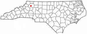
Millers Creek is a census-designated place (CDP) in Wilkes County, North Carolina, United States. The population was 2,112 at the 2010 census. West Wilkes High School, one of the four public high schools in Wilkes County, is located in Millers Creek.

Garden View is a census-designated place (CDP) in Lycoming County, Pennsylvania, United States. The population was 2,503 at the 2010 census. It is part of the Williamsport Metropolitan Statistical Area.

Lake Wynonah was built by the J-Boys and is a census-designated place (CDP) in Schuylkill County, Pennsylvania, United States. The population was 1,961 at the 2000 census, and 2,640 at the 2010 census. Lake Wynonah is a gated community with two lakes, Fawn Lake and Lake Wynonah, and as of July 2008, there are over 1200 homes and 1500 members. It is in South Manheim and Wayne Townships.

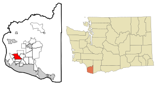
Salmon Creek is a census-designated place (CDP) in Clark County, Washington, United States. The population was 19,686 at the 2010 census, up from 16,767 at the 2000 census.

Fairlea is a census-designated place (CDP) in Greenbrier County, West Virginia, United States. The population was 1,747 at the 2010 census. Fairlea is the location of the annual West Virginia State Fair, held in August.

Coal Fork is an unincorporated census-designated place (CDP) in Kanawha County, West Virginia, United States. It is part of a larger unincorporated community known as Campbells Creek, approximately 10 minutes east of Charleston, West Virginia. The population was 1,233 at the 2010 census.

Mallory is a census-designated place (CDP) in Logan County, West Virginia, United States. The population was 1,654 at the 2010 census. The CDP contains the unincorporated communities, from west to east, of Huff Junction, Mallory, Davin, Mineral City, Claypool, Combs Addition, and Gillman Bottom.

Bradley is a census-designated place (CDP) in Raleigh County, West Virginia, United States, named in honor of General Omar Bradley, a field commander in North Africa and Europe during World War II and a General of the Army. The population was 2,040 at the 2010 census.

Coal City is a census-designated place (CDP) in Raleigh County, West Virginia, United States. The population was 1,815 at the 2010 census. Coal City's population is composed of other surrounding unincorporated communities.

Piney View is a census-designated place (CDP) in Raleigh County, West Virginia, United States. The population was 989 at the 2010 census.

Prosperity is a census-designated place (CDP) in Raleigh County, West Virginia, United States. The population was 1,498 at the 2010 census.

Stanaford is a census-designated place (CDP) and coal town in Raleigh County, West Virginia, United States. The population was 1,350 at the 2010 census.

Mineralwells, also known as Mineral Wells, is a census-designated place (CDP) in Wood County, West Virginia, United States. It is part of the Parkersburg-Marietta-Vienna, WV-OH Metropolitan Statistical Area. The population was 1,950 at the 2010 census.

Wien is a town in Marathon County, Wisconsin, United States. It is part of the Wausau, Wisconsin Metropolitan Statistical Area. The population was 825 at the 2010 census. The unincorporated community of Wien is located in the town.

Sandwich is a village and census-designated place (CDP) in the town of Sandwich in Barnstable County, Massachusetts, United States. The population was 2,962 at the 2010 census, out of a total 20,675 people in the town of Sandwich.


