Isaban | |
---|---|
Unincorporated community | |
Coordinates: 37°31′48″N81°53′17″W / 37.53000°N 81.88806°W Coordinates: 37°31′48″N81°53′17″W / 37.53000°N 81.88806°W | |
Country | United States |
State | West Virginia |
County | McDowell |
Time zone | Eastern (EST) (UTC-5) |
• Summer (DST) | EDT (UTC-4) |
ZIP codes | 24846 |
Area code(s) | 304 |
GNIS feature ID | 1554783 [1] |
Isaban is an unincorporated community located on Fourpole Creek, in McDowell and Mingo counties in the U.S. state of West Virginia.
In law, an unincorporated area is a region of land that is not governed by a local municipal corporation; similarly an unincorporated community is a settlement that is not governed by its own local municipal corporation, but rather is administered as part of larger administrative divisions, such as a township, parish, borough, county, city, canton, state, province or country. Occasionally, municipalities dissolve or disincorporate, which may happen if they become fiscally insolvent, and services become the responsibility of a higher administration. Widespread unincorporated communities and areas are a distinguishing feature of the United States and Canada. In most other countries of the world, there are either no unincorporated areas at all, or these are very rare; typically remote, outlying, sparsely populated or uninhabited areas.
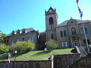
McDowell County is a county in the U.S. state of West Virginia. As of the 2010 census, the population was 22,113. Its county seat is Welch. McDowell county is the southernmost county in the state. It was created in 1858 by the Virginia General Assembly and named for Virginia Governor James McDowell. It became a part of West Virginia in 1863, when several counties seceded from the state of Virginia during the American Civil War.
Mingo County is a county in the U.S. state of West Virginia. As of the 2010 census, the population was 26,839. Its county seat is Williamson. Created in 1895, Mingo is West Virginia's newest county, named for the historic Iroquoian Mingo people.
The community's name is an amalgamation of the names Isabel and Ann. [2]
Cold Stream is an unincorporated community in Hampshire County in the U.S. state of West Virginia. Cold Stream is located north of Capon Bridge on Cold Stream Road. Referred to as Edwards Run in its past, the community of Cold Stream is in proximity to where Edwards Run empties into the Cacapon River. The community most likely took its name from a nearby stream of the same name noted for the cold water it contains. Their post office has been closed.
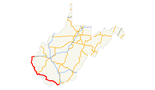
U.S. Route 52 (US 52) skirts the western fringes of the U.S. state of West Virginia. It runs from the Virginia state line near Bluefield, where it is concurrent with Interstate 77 (I-77), in a general northwest and north direction to I-64 at Kenova. There it turns east, overlapping I-64 for five miles (8.0 km) before splitting off onto the West Huntington Expressway into Ohio via the West Huntington Bridge. Despite having an even number, US 52 is signed north–south in West Virginia. In some other states along its route, it is signed east-west. The West Virginia segment is signed such that US 52 north corresponds to the general westward direction of the highway, and vice versa. For a while, US 52 parallels US 23, which is on the other side of the Big Sandy River in Kentucky. This continues into Ohio, where US 52 travels on the Ohio side of the Ohio River while US 23 travels on the Kentucky side.
Quick is a small unincorporated community in Kanawha County, West Virginia, United States. It is located along Indian Creek Road. The community is where Whitoak Fork and Blue Creek come together and meet. It is also where the abandoned railroad that follows Blue Creek joins the road, and follows it all the way to the community of Hitop, along Pond Fork. Its post office is closed.
Edmond is an unincorporated community in Fayette County, in the U.S. state of West Virginia.
Dickinson, also known as Quincy, is an unincorporated community in Kanawha County, West Virginia, United States. Dickinson is located on the north bank of the Kanawha River 3 miles (4.8 km) southeast of Belle. The community is served by U.S. Route 60.
Deerwalk is an unincorporated community in Wood County, West Virginia, United States. Deerwalk is located on West Virginia Route 31 north of its junction with U.S. Route 50, 12.5 miles (20.1 km) east of Parkersburg.
Pedlar is an unincorporated community in Monongalia County, West Virginia. Its Post Office has been closed.
Olcott is an unincorporated community and coal town in Kanawha County, West Virginia, United States. Its post office is closed.
Wickham is an unincorporated community in Raleigh County, West Virginia, United States. Its post office is closed.
Sattes is an unincorporated community in Kanawha County, West Virginia. Its post office is closed.
Weir is an unincorporated community in Kanawha County, West Virginia, United States. Its post office is called Falling Rock.
Legg is an unincorporated community in Kanawha County, West Virginia, United States. Its post office is closed.
Copenhaver was an unincorporated community in Kanawha County, West Virginia, United States. Its post office is closed.
Rensford is an unincorporated community in Kanawha County, West Virginia, United States. Its post office is closed. It was also known as Point Lick.
Maynor is an unincorporated community in Raleigh County, West Virginia, United States. Its post office is closed.
Wevaco is an unincorporated community and former coal town in Kanawha County, West Virginia, United States. Its post office is closed.
Clifty is an unincorporated community in Fayette County, in the U.S. state of West Virginia.
Gatewood is an unincorporated community in Fayette County, in the U.S. state of West Virginia.
This article about a location in McDowell County, West Virginia is a stub. You can help Wikipedia by expanding it. |
This article about a location in Mingo County, West Virginia is a stub. You can help Wikipedia by expanding it. |