
Pocahontas is a town in Tazewell County, Virginia, United States. It was named for Chief Powhatan's daughter, Pocahontas, who lived in the 17th-century Jamestown Settlement. The town was founded as a company mining town by the Southwest Virginia Improvement Company in 1881. It was the first company mining town in Virginia. The post office was established on June 30, 1882.

Whitby is an unincorporated community and coal town in the Winding Gulf Coalfield of southern West Virginia within Raleigh County, United States.
Caretta is an unincorporated community located in McDowell County, West Virginia, United States. Caretta was named for the transposed syllables in the name of Mrs. Etta Carter, the wife of George Lafayette Carter. It is the only place in the United States with this name.

Switchback is an unincorporated community in McDowell County, West Virginia, United States. Switchback had its own high school in operation from 1923 to 1953.

Algoma is an unincorporated community in McDowell County, West Virginia, United States. Algoma is located adjacent to the town of Northfork. Its post office was established in 1891 and discontinued in 1988. Algoma most likely was derived from the Algonquin language.

Pocahontas Coalfield, which is also known as the Flat Top-Pocahontas Coalfield, is located in Mercer County/McDowell County, West Virginia and Tazewell County, Virginia. The earliest mining of coal in the coalfield was in Pocahontas, Virginia in 1883 at Pocahontas Mine No. 1, now on the National Register of Historic Places.
Landgraff is an unincorporated community in McDowell County, West Virginia, United States. It is located along U.S. Route 52 and Elkhorn Creek, approximately 6.4 miles (10.3 km) east of the county seat of Welch.

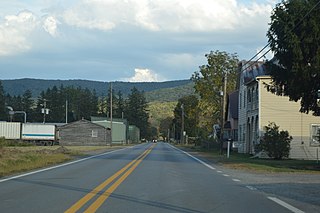
Itmann is a census-designated place (CDP) and former mining town located in Wyoming County, West Virginia, United States, between Pineville and Mullens off West Virginia Route 16. As of the 2010 census, its population was 293; it had 138 homes, 119 of which were occupied.
Maybeury is a census-designated place (CDP) in McDowell County, West Virginia, United States, located on U.S. Route 52 between Northfork and Bramwell. As of the 2010 census, its population was 234.

Kay Moor, also known as Kaymoor, is the site of an abandoned coal mine, coal-processing plant, and coal town near Fayetteville, West Virginia. The town site is located in the New River Gorge at Kaymoor Bottom (38°03′00″N81°03′17″W). It is linked to the mine portal 560 feet (170 m) above on Sewell Bench (38°02′52″N81°03′58″W) in the wall of the Gorge by conveyors.
Bartow is a census-designated place (CDP) in Pocahontas County, West Virginia, United States. The population was 111 at the 2010 census.
Spice is an unincorporated community in Pocahontas County, West Virginia, United States. Spice is located on U.S. Route 219, 3.5 miles (5.6 km) southwest of Hillsboro.
Vivian is a census-designated place (CDP) in McDowell County, West Virginia, United States. Vivian is located along U.S. Route 52, 1 mile (1.6 km) southeast of Kimball. As of the 2010 census, its population was 82.

Pocahontas Fuel Company Store and Office Buildings are a historic company store and an office building located at Jenkinjones, McDowell County, West Virginia. Both buildings were designed by architect Alex B. Mahood and built in 1917. They were listed on the National Register of Historic Places in 1992.

Pocahontas Fuel Company Store, also known as Norfolk Coal & Coke Company Store and Henderson Market, was a historic Pocahontas Fuel Company company store building located at Maybeury, McDowell County, West Virginia. It was built before 1903, and was a one- to two-story wood-frame building on a stone foundation. It featured a pyramidal roof in one corner.

Alexander Blount Mahood was a Bluefield, West Virginia-based architect.
Nuttallburg was an unincorporated community located in Fayette County, West Virginia, named by English pioneer John Nuttall who discovered coal in the area. Nuttallburg had a post office until 1955. It is no longer inhabited and is just outside Winona.
Ward is an unincorporated community and coal town in Kanawha County, West Virginia, United States. Its post office is closed. Ward is approximately 3 miles (4.8 km) northeast of Cedar Grove, along Kellys Creek.
Wevaco is an unincorporated community and former coal town in Kanawha County, West Virginia, United States. Its post office is closed.

Pocahontas Fuel Company operated mines in the state of Virginia in Boissevain and Amonate, and in West Virginia at Jenkinjones, Bishop, and Itmann. Pocahontas Fuel Company founded the Pocahontas Consolidated Collieries Company in 1907. In 1956 Pocahontas was acquired by the Consolidation Coal Company. Consolidation Coal Company became Consol Energy in 1991. Consol Energy mines coal at Amonate. Pocahontas Fuel Company used the Norfolk & Western Railway bring the coal to ports for shipment.


