Berkeley Springs, West Virginia

Last updated

Berkeley Springs, West Virginia
Town of Bath
Fairfax St and N Washington St Berkeley Springs WV 2022-08-05 13-14-17.jpg
Town square in Berkeley Springs
Seal of Berkeley Springs, West Virginia.png
Motto: 
"America's First Spa"
Morgan County West Virginia Incorporated and Unincorporated areas Bath (Berkeley Springs) Highlighted.svg
Location of Bath (Berkeley Springs) in Morgan County, West Virginia.
Coordinates: 39°37′32″N78°13′37″W / 39.62556°N 78.22694°W / 39.62556; -78.22694
Country United States
State West Virginia
County Morgan
IncorporationDecember 1776
Government
  Type Mayor–council
Area
[1]
  Total0.34 sq mi (0.87 km2)
  Land0.34 sq mi (0.87 km2)
  Water0.00 sq mi (0.00 km2)
Elevation
[2]
656 ft (200 m)
Population
 (2020) [3]
  Total758
  Estimate 
(2021) [3]
755
  Density1,773.81/sq mi (685.65/km2)
Time zone UTC-5 (Eastern (EST))
  Summer (DST) UTC-4 (EDT)
ZIP code
25411
Area code 304
FIPS code 54-04876
GNIS feature ID1877535 [2]
Website https://townofbath.org/government/

Berkeley Springs is a town in, and the county seat of, Morgan County, West Virginia, United States, in the state's Eastern Panhandle. [4] Berkeley Springs is also commonly used to refer to the area in and around the Town of Bath. In 1776, the Virginia Legislature incorporated a town around the springs and named it Bath. Since 1802, it has been referred to by the name of its original post office, Berkeley Springs. The population was 758 at the 2020 census. It is part of the Hagerstown–Martinsburg metropolitan area.

Contents

The area contains mineral water springs frequented by Native Americans indigenous to the area, possibly for thousands of years. After settlement by Europeans, the mineral springs drew many visitors from urban areas. Notable colonial visitors to the area included George Washington and James Rumsey. Berkeley Springs remained a popular resort area during the United States' early years. It is the home of the Berkeley Springs International Water Tasting, [5] the longest-running and largest such event in the world. Another local tradition is the famed Apple Butter Festival, started by a group of local business owners in 1974, with overwhelming support from then-Mayor Frank Heiner.[ citation needed ] The area continues to be a popular resort area, with tourism the primary industry in the county and six full-service spas using mineral water.

History

The Samuel Taylor Suit Cottage overlooks the town BerkeleyCastle WestVirginia.jpg
The Samuel Taylor Suit Cottage overlooks the town

During colonial times in 1748, George Washington, then just 16 years old, was part of the team that surveyed the Eastern Panhandle region for Thomas Fairfax, 6th Lord Fairfax of Cameron. Washington returned several times over the next several years with his half-brother, Lawrence, who was ill, hoping that the warm springs might improve his health. The springs, and their rumored medicinal benefits, attracted numerous Native Americans and Europeans to the area.[ citation needed ]

While vacationing in the area in 1767, Washington noted how busy the colonial town had become. Lord Fairfax had built a summer home there and a "private bath", making the area a popular destination for Virginia's social elite. With the advent of independence, An act for establishing a town at the Warm Springs in the county of Berkeley [6] was adopted by the Virginia General Assembly in December 1776. Officially, the town was named Bath, in honor of England's spa city Bath.

"Bathtub" used by George Washington George Washington's Bathtub.jpg
"Bathtub" used by George Washington

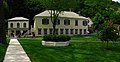
George Washington, his family members, and several colonial elites were among the town's first landowners. The town's main north-south street was named Washington, and the main east-west street was named Fairfax. Also, four acres were set aside for "suffering humanity." The area around the springs always was public land known as The Grove and overseen by a state-appointed group of Beth Trustees. This would become Berkeley Springs State Park with its springs and bathhouses, which was made part of the West Virginia state park system in 1925. Nearby, Cacapon State Park was opened in 1933. The mountain that gives its name to the park has an elevation of 2,320 feet (710 m) above sea level.[ citation needed ]

Bath's population increased during and immediately after the Revolutionary War as wounded soldiers and others came to the area believing that the warm springs had medicinal qualities.[ citation needed ]

Chronology of names

In 1772, the springs were part of the newly formed Berkeley County, named after its colonial governor, Norborne Berkeley. The waters became known as Berkeley Springs because the existing protocol was to name springs after the colonial Virginia county in which they were located. Previously, the area had been called Warm Springs and Medicinal Springs among other names.

Bath became known permanently to the world as Berkeley Springs in 1802 when the Virginia postal system was established in the new nation, and there already was a Bath, Virginia, in Bath County.

In 1861, many residents of Virginia were opposed to Virginia's secession from the United States, some calling the act of secession treasonous. Following the Wheeling Conventions of 1861, a referendum was held in 41 mostly northwestern Virginia counties on whether to secede from Virginia and seek admission to the United States as a new state. An overwhelming majority of voters in these counties voted in favor of the proposal. Confederates commanded by Stonewall Jackson captured Bath during the Romney Expedition in January 1862, and ransacked the homes of local unionists. [7] The United States admitted the State of West Virginia on June 20, 1863. Berkeley Springs remained the conventional name used for the town. Its sister city is Bath, England.

Geography

Berkeley Springs is located in the Appalachian Mountains. The town lies in the Eastern Panhandle of West Virginia 26 miles (42 km) northwest of Martinsburg, West Virginia and 36 miles (58 km) west of Hagerstown, Maryland. Berkeley Springs is the county seat of Morgan County. Morgan County makes up one of the western counties in the Eastern Panhandle.

According to the United States Census Bureau, the incorporated town of Bath has a total area of 0.34 square miles (0.88 km2), all land. [8]

There are two rivers in Morgan County. The Potomac makes up the northern border, and the Cacapon River cuts through the center of the county connecting with the Potomac at Great Cacapon. The Cacapon and Sleepy Creek Mountains are the two most notable mountains in the county. Berkeley Springs is nestled in the extreme northern Shenandoah Valley at an elevation of approximately 499 feet (152 m). Warm Spring Run cuts through the center of the town and eventually connects with the Potomac River near the Hancock Station. Sleepy Creek connects with the Potomac along River Road north and east of the town.

Demographics

Historical population
CensusPop.Note
1850 77
1860 2,9823,772.7%
1870 407−86.4%
1880 53431.2%
1900 781
1910 86410.6%
1920 98013.4%
1930 1,0396.0%
1940 1,14510.2%
1950 1,2135.9%
1960 1,138−6.2%
1970 944−17.0%
1980 789−16.4%
1990 735−6.8%
2000 663−9.8%
2010 624−5.9%
2020 75821.5%
2021 (est.)755 [3] −0.4%
U.S. Decennial Census [9]

2010 census

As of the census [10] of 2010, there were 624 people, 314 households, and 158 families residing in the incorporated town of Bath. The population density was 1,835.3 inhabitants per square mile (708.6/km2). There were 416 housing units at an average density of 1,223.5 per square mile (472.4/km2). The racial makeup of the town was 96.5% White, 0.5% Native American, 0.3% Asian, 1.0% from other races, and 1.8% from two or more races. Hispanic or Latino of any race were 2.7% of the population.

There were 314 households, of which 23.9% had children under the age of 18 living with them, 31.8% were married couples living together, 14.6% had a female householder with no husband present, 3.8% had a male householder with no wife present, and 49.7% were non-families. 43.0% of all households were made up of individuals, and 17.5% had someone living alone who was 65 years of age or older. The average household size was 1.99, and the average family size was 2.74.

The median age in the town was 42.9 years. 21.2% of residents were under the age of 18; 6.5% were between the ages of 18 and 24; 25.1% were from 25 to 44; 27% were from 45 to 64; and 19.9% were 65 years of age or older. The gender makeup of the town was 47.8% male and 52.2% female.

2000 census

As of the census [11] of 2000, there were 663 people, 331 households, and 160 families residing in the town. The population density was 2,706.0 inhabitants per square mile (1,044.8/km2). There were 379 housing units at an average density of 1,546.9 per square mile (597.3/km2). The racial makeup of the town was 97.1% White, 1.7% African American, 0.2% Native American, 0.3% from other races, and 0.8% from two or more races. Hispanic or Latino of any race were 0.6% of the population.

There were 331 households, out of which 20.5% had children under the age of 18 living with them, 35.6% were married couples living together, 10.0% had a female householder with no husband present, and 51.4% were non-families. 46.5% of all households were made up of individuals, and 25.1% had someone living alone who was 65 years of age or older. The average household size was 1.98, and the average family size was 2.85.

In the town, the population was spread out, with 19.5% under 18, 11.0% from 18 to 24, 23.4% from 25 to 44, 22.3% from 45 to 64, and 23.8% who were 65 years or older. The median age was 41 years. For every 100 females, there were 80.2 males. For every 100 females age 18 and over, there were 77.4 males.

The median income for a household in the town was $24,934, and the median income for a family was $33,333. Males had a median income of $25,156 versus $23,611 for females. The per capita income for the town was $14,917. About 13.4% of families and 18.7% of the population were below the poverty line, including 26.8% of those under age 18 and 15.7% of those age 65 or over.

Transportation

US 522 northbound and WV 9 westbound in Berkeley Springs 2016-06-25 15 19 21 View north along U.S. Route 522 and west along West Virginia State Route 9 (Washington Street) between Market Street and Warren Street in Berkeley Springs (Bath), Morgan County, West Virginia.jpg
US 522 northbound and WV 9 westbound in Berkeley Springs

Two main highways serve Berkeley Springs. The most prominent of these is U.S. Route 522. US 522 traverses the region in a general north-northeast to south-southwest direction. To the north, US 522 connects Berkeley Springs to Interstate 70 and Interstate 68 near Hancock, Maryland, while heading south provides a connection to Interstate 81 near Winchester, Virginia. The other primary highway serving Berkeley Springs is West Virginia Route 9, oriented in a general northwest-to-southeast alignment. WV 9 heads westward to Paw Paw and continues east to Martinsburg. The two highways run concurrently for a short stretch along Main Street in Berkeley Springs.

Notable people

A location in the online multiplayer game Fallout 76 was named and inspired by Berkeley Springs. [12] [ better source needed ]

Related Research Articles

<span class="mw-page-title-main">Frederick County, Virginia</span> County in Virginia, United States

Frederick County is located in the Commonwealth of Virginia. As of the 2020 census, the population was 91,419. Its county seat is Winchester. The county was formed in 1743 by the splitting of Orange County. It is Virginia's northernmost county. Frederick County is included in the Winchester, VA-WV Metropolitan Statistical Area, which is also included in the Washington-Baltimore-Northern Virginia, DC-MD-VA-WV-PA Combined Statistical Area.

<span class="mw-page-title-main">Washington County, Maryland</span> County in Maryland, United States

Washington County is located in the western part of the U.S. state of Maryland. As of the 2020 census, the population was 154,705. It is the most populous county in the Western Maryland region and its county seat is Hagerstown.

<span class="mw-page-title-main">Morgan County, West Virginia</span> County in West Virginia, United States

Morgan County is a county located in the U.S. state of West Virginia. As of the 2020 census, the population was 17,063. Its county seat is Berkeley Springs. The county was formed in 1820 from parts of Hampshire and Berkeley Counties and named in honor of General Daniel Morgan, prominent soldier of the American Revolutionary War. The county and town of Bath are considered an excellent jumping off point for exploring the Potomac and Cacapon Rivers valleys just to the north and west. Along with also being a tourist destination hosting numerous local artists, mineral water spas, and a large amount of outdoor recreation that includes fishing, boating, wildlife, hunting, and mountain scenery. The region is known for the famed Apple Butter Festival held annually in October. Morgan County is also the home of an important silica mine, part of U.S. Silica.

<span class="mw-page-title-main">Mineral County, West Virginia</span> County in West Virginia, United States

Mineral County is a county in the U.S. state of West Virginia. It is part of the Cumberland metropolitan area, together with Cumberland, Maryland. As of the 2020 census, the population was 26,938. Its county seat is Keyser. The county was founded in 1866.

<span class="mw-page-title-main">Jefferson County, West Virginia</span> County in West Virginia, United States

Jefferson County is located in the Shenandoah Valley in the Eastern Panhandle of West Virginia. It is the easternmost county of the U.S. state of West Virginia. As of the 2020 census, the population was 57,701. Its county seat is Charles Town. The county was founded in 1801, and today is part of the Washington metropolitan area.

<span class="mw-page-title-main">Hampshire County, West Virginia</span> County in West Virginia, United States

Hampshire County is a county in the U.S. state of West Virginia. As of the 2020 census, the population was 23,093. Its county seat is Romney, West Virginia's oldest town (1762). The county was created by the Virginia General Assembly in 1754, from parts of Frederick and Augusta Counties (Virginia) and is the state's oldest county. The county lies in both West Virginia's Eastern Panhandle and Potomac Highlands regions.

<span class="mw-page-title-main">Berkeley County, West Virginia</span> County in West Virginia, United States

Berkeley County is located in the Shenandoah Valley in the eastern panhandle region of West Virginia in the United States. The county is part of the Hagerstown–Martinsburg metropolitan area. As of the 2020 census, the county population was 122,076, making it the second-most populous of West Virginia's 55 counties, behind Kanawha County. The City of Martinsburg is the county seat.

<span class="mw-page-title-main">Belle Haven, Fairfax County, Virginia</span> Census-designated place in Virginia, United States

Belle Haven is a census-designated place (CDP) in Fairfax County, Virginia, United States. Nearby CDPs are Huntington (northwest), Groveton (southwest) and Fort Hunt (south). The population of Belle Haven was 6,851 at the 2020 census.

<span class="mw-page-title-main">Fort Hunt, Virginia</span> Census-designated place in Virginia, United States

Fort Hunt is a census-designated place (CDP) in Fairfax County, Virginia, United States. The area is named after Fort Hunt, which was built on the bank of the Potomac River in 1897 to defend Washington, D.C. from naval attack and is now a public park. The area is also notable for its high population of senior citizens and for being one of the first suburbs in wealthy Fairfax County. The population was 17,231 at the 2020 census.

<span class="mw-page-title-main">Great Falls, Virginia</span> Census-designated place in Virginia, United States

Great Falls is a census-designated place in Fairfax County, Virginia, United States. The population at the 2020 census was 15,953.

<span class="mw-page-title-main">Hedgesville, West Virginia</span> Town in West Virginia, United States

Hedgesville is a town in Berkeley County, West Virginia, United States, in the state's Eastern Panhandle region. The population was 318 at the 2010 census. The town sits on WV 9, roughly 13 miles east of Berkeley Springs. In addition to its legal definition, Hedgesville has come to be the common name for the large and sparsely inhabited area of West Virginia's Eastern Panhandle bordered by the Potomac River to the North and East, a southern border defined roughly by an imaginary line from the city of Martinsburg to the tip of Virginia, and Berkeley Springs to the West.

<span class="mw-page-title-main">Martinsburg, West Virginia</span> City in West Virginia, United States

Martinsburg is a city in and the county seat of Berkeley County, West Virginia, United States. The population was 18,773 at the 2020 census, making Martinsburg the largest city in the Eastern Panhandle of West Virginia and the sixth-largest city in the state. It is a principal city of the Hagerstown–Martinsburg metropolitan area extending into Maryland, which had 293,844 residents in 2020.

<span class="mw-page-title-main">Romney, West Virginia</span> Town in West Virginia, United States

Romney is a town in and the county seat of Hampshire County, West Virginia, United States. The population was 1,722 at the 2020 census. It is part of the Winchester, Virginia metropolitan area. The town was established in 1762 along with Shepherdstown; together, they are the two oldest towns in West Virginia.

<span class="mw-page-title-main">Wardensville, West Virginia</span> Town in West Virginia, United States

Wardensville is a town in Hardy County, West Virginia, United States. The population was 265 at the 2020 census. Originally named Trout Run, Wardensville was chartered in Virginia in 1832 and incorporated in West Virginia in 1879. Wardensville is located west of the Great North Mountain range, which separates it from the Shenandoah Valley. The town lies on the east bank of the Cacapon River at its confluence with Trout Run. The George Washington and Jefferson National Forests border the town to its east and south.

<span class="mw-page-title-main">Shepherdstown, West Virginia</span> Town in West Virginia, United States

Shepherdstown is a town in Jefferson County, West Virginia, United States, located in the lower Shenandoah Valley along the Potomac River. Home to Shepherd University, the town's population was 1,531 at the time of the 2020 census. The town was established in 1762 along with Romney; they are the oldest towns in West Virginia.

<span class="mw-page-title-main">Ridgeley, West Virginia</span> Town in West Virginia, United States

Ridgeley is a town in Mineral County, West Virginia, United States, and part of the Cumberland Metropolitan Statistical Area. The population was 590 at the 2020 census.

<span class="mw-page-title-main">Paw Paw, West Virginia</span> Town in West Virginia, United States

Paw Paw is a town in Morgan County, West Virginia, United States. The population was 410 at the 2020 census. The town is known for the nearby Paw Paw Tunnel. Paw Paw was incorporated by the Circuit Court of Morgan County on April 8, 1891, and named after pawpaw, a wild fruit that grows in abundance throughout this region. Paw Paw is the westernmost incorporated community in Morgan County, and the Hagerstown-Martinsburg, MD-WV Metropolitan Statistical Area.

<span class="mw-page-title-main">Eastern panhandle of West Virginia</span> Place

The eastern panhandle is one of the two panhandles in the U.S. state of West Virginia; the other is the northern panhandle. It is a small stretch of territory in the northeast of the state, bordering Maryland and Virginia. Some sources and regional associations only identify the eastern panhandle as being composed of Morgan, Berkeley, and Jefferson counties. Berkeley and Jefferson counties are geographically located in the Shenandoah Valley. West Virginia is the only U.S. state with two panhandles.

<span class="mw-page-title-main">Great Cacapon, West Virginia</span> Census-designated place in West Virginia, United States

Great Cacapon is a census-designated place (CDP) in Morgan County in the U.S. state of West Virginia's Eastern Panhandle. As of the 2010 census, its population was 386.

The Hagerstown–Martinsburg metropolitan area, officially designated by the United States Office of Management and Budget (OMB) as Hagerstown–Martinsburg, Maryland–West Virginia Metropolitan Statistical Area (MSA), constitutes the primary cities of Hagerstown, Maryland; Martinsburg, West Virginia; and surrounding areas in three counties: Washington County, Maryland; Berkeley County, West Virginia; and Morgan County, West Virginia. The metro area lies mainly within the rich, fertile Cumberland and Shenandoah valleys, and is approximately a 60–90 minute drive from Washington, D.C.; Baltimore, Maryland; and Harrisburg, Pennsylvania; Hagerstown is approximately 75 miles (121 km) driving distance from all three cities. The population of the metropolitan area as of 2008 is 263,753.

References

  1. "2019 U.S. Gazetteer Files". United States Census Bureau. Retrieved August 7, 2020.
  2. 1 2 U.S. Geological Survey Geographic Names Information System: Berkeley Springs, West Virginia
  3. 1 2 3 "City and Town Population Totals: 2020-2021". Census.gov. US Census Bureau. Retrieved July 3, 2022.
  4. "Find a County". National Association of Counties. Archived from the original on May 31, 2011. Retrieved June 7, 2011.
  5. Berkeley Springs International Water Tasting
  6. "Hening's Statutes at Large". vagenweb.org. Retrieved March 5, 2017.
  7. Cozzens, Peter (2008). Shenandoah 1862: Stonewall Jackson's Valley Campaign. Civil War America. Chapel Hill, NC: University of North Carolina Press. ISBN   978-0-8078-3200-4.
  8. "US Gazetteer files 2010". United States Census Bureau. Archived from the original on July 2, 2012. Retrieved January 24, 2013.
  9. United States Census Bureau. "Census of Population and Housing" . Retrieved August 30, 2013.
  10. "U.S. Census website". United States Census Bureau . Retrieved January 24, 2013.
  11. "U.S. Census website". United States Census Bureau . Retrieved January 31, 2008.
  12. Berkeley Springs - Fallout 76 Wiki Guide - IGN , retrieved April 7, 2020