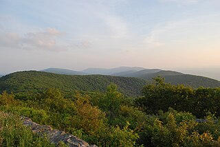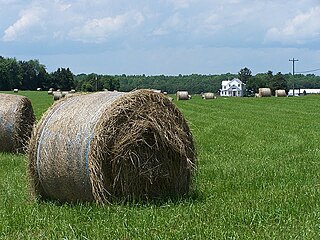
The Shenandoah Valley is a geographic valley and cultural region of western Virginia and the Eastern Panhandle of West Virginia in the United States. The valley is bounded to the east by the Blue Ridge Mountains, to the west by the eastern front of the Ridge-and-Valley Appalachians, to the north by the Potomac River and to the south by the James River. The cultural region covers a larger area that includes all of the valley plus the Virginia highlands to the west, and the Roanoke Valley to the south. It is physiographically located within the Ridge and Valley province and is a portion of the Great Appalachian Valley.

Lehew is an unincorporated community in Hampshire County, West Virginia on the Virginia line. Lehew is located on Timber Ridge along West Virginia Route 259 at its crossroads with H.G. Brill Road and White Pine Ridge Road.

Rada is an unincorporated community in Hampshire County in the U.S. state of West Virginia. Rada is located on U.S. Highway 220/West Virginia Route 28 between Junction and Purgitsville in southwest Hampshire County along Mill Creek. It lies at an intersection of US 220/WV 28 with Rada Road.

Ridersville is an unincorporated community between Berkeley Springs and Stohrs Crossroads along Martinsburg Road in Morgan County, West Virginia. It is located on Pious Ridge (804 ft) where Pious Ridge Road and Peter Yost Road intersect with WV 9. Ridersville sprang up in the 19th century as a small farming community along the Martinsburg Road with a general store. It had its own operating post office until it was closed in 1903 due to the community's proximity to Berkeley Springs. During its period as an independent agrarian town, it was known as Friendship, Rider Store, Riderville, and finally as Ridersville. Today, it is merely a growing residential area of Berkeley Springs.

White Hall is an unincorporated farming community in northern Frederick County, Virginia, established in the late 1810s and located near the crossroads of Apple Pie Ridge Road with Green Spring and White Hall Roads, astride Apple Pie Ridge.

Kabletown is an unincorporated community in Jefferson County, West Virginia, United States. The town lies along a spring-fed stream called Bullskin Run near the Shenandoah River on Kabletown Road, very close to the border with Virginia. Kabletown's population was 10,073 in 2000.

Shanghai is an unincorporated community in Berkeley County, West Virginia. The town is nestled in Back Creek Valley between Leading Ridge and North Mountain. Shanghai lies at the junction of West Virginia Secondary Route 7 and Secondary Route 18.

U.S. Route 50 is a transcontinental highway which stretches from Ocean City, Maryland to West Sacramento, California. In the U.S. state of Virginia, US 50 extends 86 miles (138 km) from the border with Washington DC at a Potomac River crossing at Rosslyn in Arlington County to the West Virginia state line near Gore in Frederick County.

Reddish Knob of Shenandoah Mountain is one of the highest points in Virginia, rising 4,397 feet (1,340 m). A narrow, paved road reaches the summit from Harrisonburg, Virginia.

North Mountain is a mountain ridge within the Ridge-and-valley Appalachians in the U.S. states of Virginia and West Virginia.

U.S. Route 221 is a part of the U.S. Highway System that runs from Perry, Florida to Lynchburg, Virginia. In Virginia, the U.S. Highway runs 149.61 miles (240.77 km) from the North Carolina state line near Independence north to its northern terminus at US 29 Business, US 460 Business, and US 501 Business in Lynchburg. US 221 connects Independence, Galax, and Hillsville in Southwest Virginia while running concurrently with US 58. The U.S. Highway connects those communities with Roanoke via Floyd County, within which US 221 is the main east–west highway. The U.S. Highway also runs concurrently with US 460 from Roanoke to Bedford and parallels that U.S. Highway from Bedford to Lynchburg.

Sand Ridge is an unincorporated community in Calhoun County, West Virginia, United States. It lies along U.S. Route 33 to the south of the town of Grantsville, the county seat of Calhoun County. Its elevation is 1,168 feet.

Smoot is an unincorporated community in western Greenbrier County, West Virginia, United States. It lies south of the interchange of Interstate 64 and U.S. Route 60 northwest of the city of Lewisburg, the county seat of Greenbrier County. Its elevation is 2,480 feet (756 m). Although it is unincorporated, it has a post office, with the ZIP code of 24977.

Ranger is an unincorporated community in western Lincoln County, West Virginia, United States. It lies along West Virginia Route 10 southwest of the town of Hamlin, the county seat of Lincoln County. Its elevation is 614 feet (187 m). Although it is unincorporated, it has a post office, with the ZIP code of 25557. Ranger is served by the Guyan River VFD.

Rock Castle is an unincorporated community in southwestern Jackson County, West Virginia, United States. It lies along Rock Castle Road south of the city of Ripley, the county seat of Jackson County. Its elevation is 705 feet (215 m).

Kentuck is an unincorporated community in southeastern Jackson County, West Virginia, United States. It lies along Kentuck Road southeast of the city of Ripley, the county seat of Jackson County. Its elevation is 922 feet (281 m).

Advent is an unincorporated community in southeastern Jackson County, West Virginia, United States. It lies along Advent Road southeast of the city of Ripley, the county seat of Jackson County, and near Jackson County's borders with Kanawha and Roane counties. Its elevation is 791 feet (241 m). Advent had a post office, which closed on December 25, 2010.

Beards Fork is a census-designated place (CDP) and coal town in Fayette County, West Virginia, United States that was founded as a coal town. As of the 2010 census, its population was 199.

Arlington Ridge is an unincorporated community in Arlington County, Virginia, United States. It is bordered on the north by The Pentagon, on the west by the Army Navy Country Club, and on the south the City of Alexandria. The main thoroughfare is the eponymous Arlington Ridge Road, a mansion-lined boulevard that, due to its high elevation, offers picturesque views of Washington D.C. and the surrounding areas. Also known simply as "The Ridge", this community is home to two historical points of interest: the Hume School, currently the site of the Arlington Country Historical Society and Museum, and Fort Scott, currently the site of Fort Scott Park.

Somerville is an unincorporated community in Fauquier County, in the U.S. Commonwealth of Virginia. Somerville, two miles (3 km) west of the remote southwest corner of Marine Corps Base Quantico, can be said to lie at the center of a 225-square-mile (580 km2) diamond-shaped area of mostly countryside bordered by routes US 15, 17, I-95, and SR 234. The tongue-in-cheek label "Downtown Somerville" appears on the front of the only retail establishment anywhere near the rural intersection of Midland Road and Bristersburg Road—Groves Store and Somerville Post Office. No other mailboxes lie within ZIP code 22739. No other occupied dwellings are in sight, and it is over six miles (10 km) to the nearest main road, US 17 at Morrisville. In its undated leaflet "Fauquier County Towns, Villages, and Communities", the Fauquier Historical Society says "[o]riginally Somerville was at Ensor's Shop but presently is nearby at what was once called White Ridge". That name survives today as White Ridge Farm. How and when this place was first called Somerville may be unknown, but family names are a common source of place names. Wikipedia says elsewhere that "Sir Gualtier de Somerville was one of William the Conqueror's knights... in 1066. The name most likely comes from 'Saint-Omer,' a town about 20 miles south of Dunkirk at the North of France." Almost eight centuries of this noble family's history were documented in a book edited by Sir Walter Scott in 1815. Over 100 Somerville family graves are known in Virginia. Although none has been identified in Somerville, almost half are in the adjacent county, Culpeper, dating from the 17th century through present times. A James Somerville, who died in 1798 and lies buried in the Masonic Cemetery at Fredericksburg, was born in Glasgow, Scotland, and was known locally as a landowner in Culpeper and Orange counties. His gravestone identifies his nephew and heir as James Somerville, 1774–1858, the husband of Mary Atwell of Fauquier.


