
The Potomac River is a major river in the Mid-Atlantic region of the United States that flows from the Potomac Highlands in West Virginia to the Chesapeake Bay in Maryland. It is 405 miles (652 km) long, with a drainage area of 14,700 square miles (38,000 km2), and is the fourth-largest river along the East Coast of the United States and the 21st-largest in the United States. Over 5 million people live within its watershed.

McLean is an unincorporated community and census-designated place (CDP) in Fairfax County in Northern Virginia. McLean is home to many diplomats, military, members of Congress, and high-ranking government officials partially due to its proximity to Washington, D.C., the Pentagon and the Central Intelligence Agency. It is the location of Hickory Hill, the former home of Ethel Kennedy, the widow of Robert F. Kennedy. It is also the location of Salona, the former home of Light-Horse Harry Lee, the Revolutionary War hero.

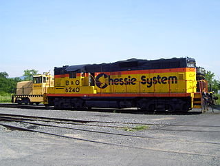
Point of Rocks is an unincorporated community and census-designated place (CDP) in Frederick County, Maryland, United States. As of the 2010 census it had a population of 1,466. It is named for the striking rock formation on the adjacent Catoctin Mountain, which was formed by the Potomac River cutting through the ridge in a water gap, a typical formation in the Appalachian Mountains. The formation is not visible from the town and can only be seen from boats on the river, or from the southern bank of the river in Virginia.

U.S. Route 340 is a spur route of US 40, and runs from Greenville, Virginia, to Frederick, Maryland. In Virginia, it runs north–south, parallel and east of US 11, from US 11 north of Greenville via Waynesboro, Grottoes, Elkton, Luray, Front Royal, and Berryville to the West Virginia state line. A short separate piece crosses northern Loudoun County on its way from West Virginia to Maryland.

Springfield is a census-designated place (CDP) in northwestern Hampshire County in the U.S. state of West Virginia. As of the 2010 census, Springfield had a population of 477. Springfield is located north of Romney along West Virginia Route 28 at its junction with Green Spring Road and Springfield Pike. It is currently considering incorporation.
Forks of Cacapon, formerly Forks of Capon, is an unincorporated community in Hampshire County in the U.S. state of West Virginia. The community is named for its location at the confluence of the North River and Cacapon River. Forks of Cacapon is also located at another fork: the crossroads of West Virginia Route 29, West Virginia Route 127, and Frank Haines Road.

Okonoko is an unincorporated community in Hampshire County in the U.S. state of West Virginia. Okonoko is located north of Levels on the Potomac River at Bright's Hollow. The community's placename is the only one of its kind within the United States.
Slanesville is an unincorporated community in northeastern Hampshire County in the U.S. state of West Virginia. Slanesville is located at the crossroads of Bloomery Pike with Slanesville Pike and Cold Stream Road. Slanesville Pike and Cold Stream Road formerly made up the Springfield Grade Road that ran from Capon Bridge to Springfield. According to the 2000 census, the Slanesville community has a population of 691.
Sector is an unincorporated community in Hampshire County in the U.S. state of West Virginia. It is located along the west bank of the South Branch Potomac River on Fleming-Sector Road across the river from the community of Glebe.

Glebe was an unincorporated community in Hampshire County, West Virginia, United States. It is situated at the lower mouth of the Trough, a gorge of the South Branch Potomac River, and is about 9.5 miles (15.3 km) southwest of Romney on South Branch River Road. The community received its name from the old stone glebehouse (parsonage) that was constructed there in the late 18th century. The stone house later became the Hampshire County Poor Farm and remains standing. The community of Sector lies directly across the river.
South Branch Depot also known as South Branch is an unincorporated community in Hampshire County in the U.S. state of West Virginia. Originally known as Forks of Potomac because of its proximity to the confluence of the North and South Branches of the Potomac River and then later in the early 20th century as French's Station and then simply South Branch, South Branch Depot served as a depot and post office on the Baltimore & Ohio Railroad since the railroad was constructed there in the 1840s. Today, South Branch Depot may only be reached from Levels by way of Frenches Station Road.
The South Branch Valley Railroad is a 52.4-mile-long (84.3 km) railroad in the Eastern Panhandle of West Virginia. The branch line, which parallels the South Branch Potomac River, runs north from Petersburg to Green Spring, where it connects to the national rail network at a junction with the CSX Cumberland Subdivision.

Cherry Run is a 7.2-mile-long (11.6 km) meandering stream that forms the northern section of the boundary between Morgan and Berkeley counties in West Virginia's Eastern Panhandle. While it is mostly non-navigable, Cherry Run provides many pools of varying depths for fishing and swimming. As a tributary of the Potomac River, Cherry Run is part of the Potomac and Chesapeake Bay watersheds.
Magnolia is an unincorporated community northeast of Paw Paw in Morgan County in the U.S. state of West Virginia on the Potomac River. Magnolia is located along the Baltimore and Ohio Railroad mainline and east of where the Western Maryland Railway crosses the Potomac, bypassing a series of bends in the river. As a depot and water station on the B&O, Magnolia has been known by a number of names including Magnolia Dale, Magnolia Vale, and sometimes as Water Station Number 12 on the railroad.
Doe Gully is an unincorporated community along the Potomac River in Morgan County in the U.S. state of West Virginia's Eastern Panhandle. Located along the old Baltimore and Ohio Railroad where it bisects a bend in the Potomac by way of the Randolph Tunnel, Doe Gully is only accessible by way of Doe Gulley Lane from Orleans Road. It is located southwest of Orleans Cross Roads. The Chesapeake and Ohio Canal National Historical Park crosses the Potomac River onto the West Virginia side to Doe Gulley's west and it also lies directly across the river from it. Like most of the old B&O railroad stations and their communities, Doe Gully is popular with railfans.
Sir Johns Run is an unincorporated community hamlet at the mouth of Sir Johns Run on the Potomac River in Morgan County, West Virginia northwest of Berkeley Springs. It is bound to its west by the Widmeyer Wildlife Management Area and to its east by Warm Springs Ridge. While Sir Johns Run formerly served on the old Baltimore and Ohio Railroad mainline as an early passenger station for Berkeley Springs, today it is primarily a residential community of Berkeley Springs accessible by Sir Johns Run Road. Sir Johns Run had its own post office in operation from 1850 to 1938. Today, the stream and its namesake hamlet are a site on the Washington Heritage Trail.

New York State Route 279 (NY 279) is a north–south state highway in Orleans County, New York, in the United States. The southern terminus of the route is at an intersection with NY 98 north of the village of Albion in the town of Gaines. Its northern terminus is at a junction with NY 18 in Carlton near where NY 18 meets the western end of the Lake Ontario State Parkway. The entirety of NY 279 north of NY 104 is maintained by Orleans County; south of NY 104, the route is maintained by the New York State Department of Transportation. NY 279 is a rural connector highway that serves only one community, the hamlet of Waterport on the banks of Oak Orchard Creek in Carlton.

Interstate 81 (I-81) in the US state of West Virginia crosses the Eastern Panhandle region, linking Virginia to Maryland. The Interstate Highway, completed in 1966, spans 26 miles (42 km) through Berkeley County, paralleling U.S. Route 11 (US 11) for its entire length. I-81 enters the state near Ridgeway, travels northeast, bypassing the city of Martinsburg, and leaves the state at the Potomac River, which serves as the state line. The first solicitations for the construction of I-81 were published in 1959, with the first six miles (9.7 km) of freeway being opened in 1963, and the full length was completed by 1966. On average, between 45,000 and 60,000 vehicles use the freeway through the panhandle per day.

U.S. Route 11 (US 11) in the U.S. state of West Virginia spans 26.2 miles (42.2 km) across the Eastern Panhandle region. US 11 enters the state near Ridgeway and crosses into Maryland just south of Williamsport. The highway closely parallels Interstate 81 (I-81) for its entire length.
Alexandria, Virginia, an independent city in the Commonwealth of Virginia, is located along the western bank of the Potomac River. The city of approximately 151,000 is about six miles south of downtown Washington, D.C.


