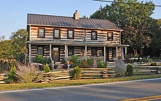
Slanesville is an unincorporated community in northeastern Hampshire County in the U.S. state of West Virginia. Slanesville is located at the crossroads of Bloomery Pike with Slanesville Pike and Cold Stream Road. Slanesville Pike and Cold Stream Road formerly made up the Springfield Grade Road that ran from Capon Bridge to Springfield. According to the 2000 census, the Slanesville community has a population of 691.

Frenchburg is an unincorporated community in Hampshire County in the U.S. state of West Virginia. Frenchburg is located along the Northwestern Turnpike where the Little Cacapon River is formed by the confluence of the North and South forks of the Little Cacapon east of Shanks. Frenchburg is also the location of the southern terminus of Little Cacapon River Road on U.S. Route 50. Frenchburg is primarily known for the events that took place there during the American Civil War.
West Virginia Route 45 is a state highway in the U.S. state of West Virginia. The state highway runs 25.8 miles (41.5 km) from the Virginia state line near Glengary east to WV 230 and WV 480 in Shepherdstown. WV 45 connects the communities of Glengary and Arden in southwestern Berkeley County with the county seat of Martinsburg. The state highway also connects Shepherdstown in northern Jefferson County with Martinsburg, where the highway meets Interstate 81 (I-81), U.S. Route 11, and WV 9.

Hancock is an unincorporated community hamlet in Morgan County in the U.S. state of West Virginia's Eastern Panhandle. It is located off Hancock Road on River Road along the Potomac River north of Berkeley Springs. Originally known as Brosius, its post office's name was changed to Hancock in 1948 to reflect its location on the Baltimore and Ohio Railroad mainline across the river from Hancock, Maryland.

Cherry Run is a 7.2-mile-long (11.6 km) meandering stream that forms the northern section of the boundary between Morgan and Berkeley counties in West Virginia's Eastern Panhandle. While it is mostly non-navigable, Cherry Run provides many pools of varying depths for fishing and swimming. As a tributary of the Potomac River, Cherry Run is part of the Potomac and Chesapeake Bay watersheds.

Orleans Cross Roads is an unincorporated community hamlet that lies on the western flanks of Sideling Hill on the Potomac River in Morgan County, West Virginia. To its south, Rockwell Run, a mountain stream fed by springs, empties into the Potomac. Orleans Cross Roads lies along the old Baltimore and Ohio Railroad directly across the river from Little Orleans. It is accessible by way of Orleans Road from Cacapon Road via Detour Road.

Unger is an unincorporated community in southern Morgan County in the U.S. state of West Virginia. Unger is distinguished amongst other towns in Morgan County for retaining an operating post office since one was established there in 1853. From 1857 to 1935, it was known as Unger's Store until March 31, 1950 its name was then shortened to Unger on April 1, 1950.

Sir Johns Run is an unincorporated community hamlet at the mouth of Sir Johns Run on the Potomac River in Morgan County, West Virginia northwest of Berkeley Springs. It is bound to its west by the Widmeyer Wildlife Management Area and to its east by Warm Springs Ridge. While Sir Johns Run formerly served on the old Baltimore and Ohio Railroad mainline as an early passenger station for Berkeley Springs, today it is primarily a residential community of Berkeley Springs accessible by Sir Johns Run Road. Sir Johns Run had its own post office in operation from 1850 to 1938. Today, the stream and its namesake hamlet are a site on the Washington Heritage Trail.

Rock Gap is an unincorporated community along Valley Road in Morgan County, West Virginia, United States. It is located between Omps to its south and Berkeley Springs to its north. Situated between Warm Springs Ridge to its west and Timber Ridge to its east, Rock Gap takes its name from the "Rock Gap" in Warm Spring Ridge, carved out by Rock Gap Run, a tributary stream of Sleepy Creek.

Spohrs Crossroads is an unincorporated community along Martinsburg Road to the west of Sleepy Creek in Morgan County in the U.S. state of West Virginia. The community was originally named Spohrs Cross Roads for the local Spohr family. It sometimes erroneously known as Stohrs Cross Roads or Stohrs Crossroads.

Holton is a small unincorporated community in northeastern Morgan County in the U.S. state of West Virginia. Holton lies on Martinsburg Road at its junction with Cherry Run Road along Cherry Run and the Berkeley County line. Holton had its own post office in operation between 1889 and 1903.

Burnt Factory is an unincorporated community in Morgan County, West Virginia north of Berkeley Springs. It is located along Sand Mine Road off Hancock Road and is the site of the U.S. Silica Company's Berkeley Springs plant. U.S. Silica is a leading producer of high quality ground and unground silica sand, kaolin clay, and aplite. These materials are mostly extracted from Warm Spring Ridge directly across U.S. Route 522 from the facility in Burnt Factory.

Ridge is an unincorporated community hamlet in Morgan County, West Virginia. It is located along Valley Road at its intersection with Fish Hatchery Road near the Frederick County, Virginia line. Sleepy Creek and Timber Ridge lie to its east with Warm Springs Ridge lying to its west.

Millen is an unincorporated community in Hampshire County, West Virginia, United States between Donaldson and Green Spring on Green Spring Road and the South Branch Valley Railroad. Millen is nestled in Green Spring Valley along Green Spring Run between Green Spring Ridge and Valley Mountain.

White Hall is an unincorporated farming community in northern Frederick County, Virginia, established in the late 1810s and located near the crossroads of Apple Pie Ridge Road with Green Spring and White Hall Roads, astride Apple Pie Ridge.

Darkesville is an unincorporated community in Berkeley County, West Virginia, United States. Established in 1791, Darkesville has been nationally recognized as a historic district.

Nollville is an unincorporated community on Tuscarora Creek in Berkeley County, West Virginia. It lies west of Martinsburg on the Tuscarora Pike.
Tilhance Creek is a 10.4-mile-long (16.7 km) tributary stream of Back Creek in Berkeley County of West Virginia's Eastern Panhandle.

Hainesville is an unincorporated community in Hampshire County, West Virginia, United States. Hainesville is located southwest of Slanesville at the crossroads of Old Martinsburg Road and Kedron Road. Additionally, formerly known as Haines Store, Hainesville once had its own post office in operation.

Goose Nest is an unincorporated community in Berkeley County, West Virginia, United States. Goose Nest is 6 miles (9.7 km) west-southwest of Martinsburg.


