
The National Road was the first major improved highway in the United States built by the federal government. Built between 1811 and 1837, the 620-mile (1,000 km) road connected the Potomac and Ohio Rivers and was a main transport path to the West for thousands of settlers. When improved in the 1830s, it became the second U.S. road surfaced with the macadam process pioneered by Scotsman John Loudon McAdam.

Morgan County is a county located in the U.S. state of West Virginia. As of the 2020 census, the population was 17,063. Its county seat is Berkeley Springs. The county was formed in 1820 from parts of Hampshire and Berkeley Counties and named in honor of General Daniel Morgan, prominent soldier of the American Revolutionary War. The county and town of Bath are considered an excellent jumping off point for exploring the Potomac and Cacapon Rivers valleys just to the north and west. Along with also being a tourist destination hosting numerous local artists, mineral water spas, and a large amount of outdoor recreation that includes fishing, boating, wildlife, hunting, and mountain scenery. The region is known for the famed Apple Butter Festival held annually in October. Morgan County is also the home of an important silica mine, part of U.S. Silica.

Berkeley Springs is a town in, and the county seat of, Morgan County, West Virginia, United States, in the state's Eastern Panhandle. Berkeley Springs is also commonly used to refer to the area in and around the Town of Bath. In 1776, the Virginia Legislature incorporated a town around the springs and named it Bath. Since 1802, it has been referred to by the name of its original post office, Berkeley Springs. The population was 758 at the 2020 census. It is part of the Hagerstown–Martinsburg metropolitan area.

U.S. Route 522 is a spur route of US 22 in the states of Virginia, West Virginia, Maryland, and Pennsylvania. The U.S. Highway travels in a north-south direction, and runs 308.59 miles (496.63 km) from US 60 near Powhatan, Virginia, to its northern terminus at US 11 and US 15 near Selinsgrove, Pennsylvania. US 522 serves many small cities and towns in the Piedmont, Blue Ridge Mountains, and northern Shenandoah Valley of Virginia. The highway serves the Virginia communities of Goochland, Mineral, Culpeper, the town of Washington, and Front Royal and the independent city of Winchester. US 522 then follows the Ridge-and-Valley Appalachians north and then east through the Eastern Panhandle of West Virginia, a 2-mile-wide (3.2 km) stretch of Western Maryland, and South Central Pennsylvania to its terminus in the Susquehanna Valley. The highway serves Berkeley Springs, West Virginia; Hancock, Maryland; and the Pennsylvania communities of McConnellsburg, Mount Union, Lewistown, and Middleburg.

The Cacapon River, located in the Appalachian Mountains of West Virginia's Eastern Panhandle region, is an 81.0-mile-long (130.4 km) shallow river known for its fishing, boating, wildlife, hunting, and wilderness scenery. As part of the Potomac River watershed, it is an American Heritage River.

Green Spring is a census-designated place (CDP) and railroad town in Hampshire County, West Virginia, United States. As of the 2010 census, its population was 218. Green Spring is located north of Springfield on Green Spring Road near the confluence of the North and South Branches of the Potomac River. Green Spring is also the location of the South Branch Valley Railroad's terminus with the old Baltimore & Ohio Railroad mainline. Green Spring is the site of a one-lane low-water toll bridge that connects Green Spring Road to Maryland Route 51 in Oldtown, Allegany County, Maryland. This bridge is one of only 17 privately owned toll bridges in the United States. The toll for the bridge is currently US$1.50.
Yellow Spring is an unincorporated community in Hampshire County in the U.S. state of West Virginia. According to the 2000 census, the Yellow Spring community has a population of 296. Yellow Spring is named after the "Yellow Spring" located there on the Cacapon River. The community lies at the junction of West Virginia Route 259 and Cacapon River Road. Yellow Spring is sometimes incorrectly listed or referred to as Yellowspring or Yellow Springs.

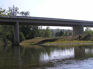
Capon Lake is an unincorporated community in Hampshire County of West Virginia's Eastern Panhandle region. Capon Lake is situated between Yellow Spring and Intermont at the junction of West Virginia Route 259 and Capon Springs Road along the Cacapon River. Capon Springs Run empties into the Cacapon here across from the old Capon Lake Whipple Truss Bridge. Capon Lake takes its name from the Cacapon River's lake-like characteristics there. It was a popular picnic spot for tourists and travelers on the Winchester and Western Railroad.

West Virginia Route 9 (WV 9) is a major east–west state highway located in the eastern extents of West Virginia's Eastern Panhandle. The western terminus of the route is at the Maryland state line north of Paw Paw, where WV 9 becomes Maryland Route 51 (MD 51) upon crossing the Potomac River. The eastern terminus is at the Virginia state line at Keyes Gap near Mannings, West Virginia, where WV 9 continues onward as Virginia State Route 9 (SR 9).

Neals Run is an unincorporated community in Hampshire County in the U.S. state of West Virginia. Neals Run is located south of Little Cacapon near the confluence of the Little Cacapon River and Neals Run on Spring Gap-Neals Run Road. The community derives its name from the stream.
Bubbling Spring is an unincorporated community in Hampshire County in the U.S. state of West Virginia. Bubbling Spring is situated on Cacapon River Road along the Cacapon River, south of Capon Bridge and north of Hooks Mills. It takes its name from the Bubbling Spring on the Cacapon there. Bubbling Spring has been known as Bubbling Spring Camps, Cacapon Bubbling Spring Camps, and Crystal Spring.

Cherry Run is a small unincorporated community hamlet located along the CSX Transportation mainline on the Potomac River in Morgan County in the U.S. state of West Virginia. The community is named for the stream, Cherry Run, that meets the Potomac in its vicinity. It was originally known as Cherry Run Depot because of the important interchange between the B&O and the Western Maryland Railway located there.

Cherry Run is a 7.2-mile-long (11.6 km) meandering stream that forms the northern section of the boundary between Morgan and Berkeley counties in West Virginia's Eastern Panhandle. While it is mostly non-navigable, Cherry Run provides many pools of varying depths for fishing and swimming. As a tributary of the Potomac River, Cherry Run is part of the Potomac and Chesapeake Bay watersheds.

Unger is an unincorporated community in southern Morgan County in the U.S. state of West Virginia. Unger is distinguished amongst other towns in Morgan County for retaining an operating post office since one was established there in 1853. From 1857 to 1935, it was known as Unger's Store until March 31, 1950 its name was then shortened to Unger on April 1, 1950.
Sir Johns Run is an unincorporated community hamlet at the mouth of Sir Johns Run on the Potomac River in Morgan County, West Virginia northwest of Berkeley Springs. It is bound to its west by the Widmeyer Wildlife Management Area and to its east by Warm Springs Ridge. While Sir Johns Run formerly served on the old Baltimore and Ohio Railroad mainline as an early passenger station for Berkeley Springs, today it is primarily a residential community of Berkeley Springs accessible by Sir Johns Run Road. Sir Johns Run had its own post office in operation from 1850 to 1938. Today, the stream and its namesake hamlet are a site on the Washington Heritage Trail.
Burnt Factory is an unincorporated community in Morgan County, West Virginia north of Berkeley Springs. It is located along Sand Mine Road off Hancock Road and is the site of the U.S. Silica Company's Berkeley Springs plant. U.S. Silica is a producer of ground and unground silica sand, kaolin clay, and aplite. These materials are extracted from Warm Spring Ridge directly across U.S. Route 522 from the facility in Burnt Factory.
Mill Creek is a 14.5-mile-long (23.3 km) tributary of Opequon Creek, belonging to the Potomac River and Chesapeake Bay watersheds, located in Berkeley County in West Virginia's Eastern Panhandle. Its name reflects its past as a popular site for various types of mills, beginning with one constructed by Morgan Morgan in the mid-18th century near his cabin in present-day Bunker Hill.
Davis Ford is an unincorporated community on the Cacapon River in Hampshire County in the U.S. state of West Virginia. It lies primarily on Cacapon River Road at the ford from which it takes its name. The Yellow Spring post office serves the Davis Ford community.


