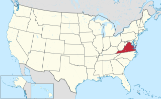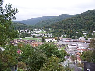
Morgan County is a county located in the U.S. state of West Virginia. As of the 2010 census, the population was 17,541. Its county seat is Berkeley Springs. The county was formed in 1820 from parts of Hampshire and Berkeley Counties and named in honor of General Daniel Morgan, prominent soldier of the American Revolutionary War.

Giles County is a county located in the U.S. state of Virginia on the West Virginia state line. As of the 2010 census, the population was 17,286. Its county seat is Pearisburg.

Springfield is a census-designated place (CDP) in Fairfax County, Virginia, United States. The Springfield CDP is recognized by the U.S. Census Bureau with a population of 30,484 as of the 2010 census. Homes and businesses in bordering CDPs including North Springfield, West Springfield, and Newington are usually given a "Springfield" mailing address. The population of the collective areas with Springfield addresses is estimated to exceed 100,000. The CDP is a part of Northern Virginia, the most populous region of the Washington Metropolitan Area.

Short Pump is a census-designated place (CDP) in Henrico County, Virginia, United States. It is a suburb of Richmond, Virginia. The population was 24,729 at the 2010 census.

Richwood is a city in Nicholas County, West Virginia, United States. In 2010, the census showed Richwood with a population of 2,051. During the 19th and early 20th century Richwood was a booming coal and lumber town. Richwood has a very rich history, including the formation of the Cherry River Navy civic organization to draw attention to issues important to the community. Richwood has also become known statewide as the "Ramp Capital of the World". Each year, in April, the city hosts a large festival that draws visitors from around the country.
U.S. Route 522 is a spur route of US 22 in the U.S. states of Virginia, West Virginia, Maryland, and Pennsylvania. The U.S. Highway runs 308.59 miles (496.63 km) from US 60 near Powhatan, Virginia, north to US 11 and US 15 near Selinsgrove, Pennsylvania. US 522 serves many small cities and towns in the Piedmont, Blue Ridge Mountains, and northern Shenandoah Valley of Virginia. The highway serves the Virginia communities of Goochland, Mineral, Culpeper, the town of Washington, and Front Royal and the independent city of Winchester. US 522 then follows the Ridge-and-Valley Appalachians north and then east through the Eastern Panhandle of West Virginia, a 2-mile-wide (3.2 km) stretch of Western Maryland, and South Central Pennsylvania to its terminus in the Susquehanna Valley. The highway serves Berkeley Springs, West Virginia; Hancock, Maryland; and the Pennsylvania communities of McConnellsburg, Mount Union, Lewistown, and Middleburg.

Sterling, Virginia refers most specifically to a census-designated place (CDP) in Loudoun County, Virginia. The population of the CDP as of the 2010 United States Census was 27,822. The CDP boundaries are confined to a relatively small area between Virginia State Route 28 on the west and Virginia State Route 7 on the northeast, excluding areas near SR 606 and the Dulles Town Center.

The West End is a part of Richmond, Virginia. Definitions of the bounds of the West End vary, it may include only the western part of the city of Richmond or extend as far as western Henrico County. As there is no one municipal organization that represents this specific region, the boundaries are loosely defined as being north of the James River, west of I-195, and south of Broad Street. Historically, the Richmond neighborhoods of the Fan and the Museum District were a part of the West End. A primary conduit through the West End is Interstate 64.

Slanesville is an unincorporated community in northeastern Hampshire County in the U.S. state of West Virginia. Slanesville is located at the crossroads of Bloomery Pike with Slanesville Pike and Cold Stream Road. Slanesville Pike and Cold Stream Road formerly made up the Springfield Grade Road that ran from Capon Bridge to Springfield. According to the 2000 census, the Slanesville community has a population of 691.

Purgitsville is an unincorporated community in Hampshire County in the U.S. state of West Virginia. According to the 2000 census, the ZCTA for Purgitsville had a population of 813. Purgitsville is located on U.S. Highway 220/West Virginia Route 28 at its intersection with Huffman Road south of Junction. An elementary school, Mill Creek Elementary, was open here until 1993 when it was consolidated with Romney Elementary.

Sleepy Creek is an unincorporated community in Morgan County, West Virginia on the Potomac River at the mouth of Sleepy Creek. By 1860, Sleepy Creek had a post office and functioned as an important station on the Baltimore and Ohio Railroad.

Cherry Run is a small unincorporated community hamlet located along the CSX Transportation mainline on the Potomac River in Morgan County in the U.S. state of West Virginia. The community is named for the stream, Cherry Run, that meets the Potomac in its vicinity. It was originally known as Cherry Run Depot because of the important interchange between the B&O and the Western Maryland Railway located there.

Cherry Run is a 7.2-mile-long (11.6 km) meandering stream that forms the northern section of the boundary between Morgan and Berkeley counties in West Virginia's Eastern Panhandle. While it is mostly non-navigable, Cherry Run provides many pools of varying depths for fishing and swimming. As a tributary of the Potomac River, Cherry Run is part of the Potomac and Chesapeake Bay watersheds.

Bunker Hill is an unincorporated community in Berkeley County, West Virginia, USA, located in the lower Shenandoah Valley on Winchester Pike at its junction with County Route 26 south of Martinsburg. It is the site of the confluence of Torytown Run and Mill Creek, a tributary of Opequon Creek which flows into Winchester, Virginia. According to the 2000 census, the Bunker Hill community has a population of 5,319.

Hoy is an unincorporated community in Hampshire County in the U.S. state of West Virginia. It is located southwest of Slanesville and northwest of Hanging Rock at the intersection of Offutt School Road and Hoy Road. A series of hills separates the community from the North River which lies to its east. Hoy once operated its own post office and elementary school before consolidation of both with Slanesville.
Mill Creek is a 14.5-mile-long (23.3 km) tributary of Opequon Creek, belonging to the Potomac River and Chesapeake Bay watersheds, located in Berkeley County in West Virginia's Eastern Panhandle. Its name reflects its past as a popular site for various types of mills, beginning with one constructed by Morgan Morgan in the mid-18th century near his cabin in present-day Bunker Hill.

Makinen is an unincorporated community in Saint Louis County, Minnesota, United States.

Quick is a small unincorporated community in Kanawha County, West Virginia, United States. It is located along Indian Creek Road. The community is where Whitoak Fork and Blue Creek come together and meet. It is also where the abandoned railroad that follows Blue Creek joins the road, and follows it all the way to the community of Hitop, along Pond Fork. Its post office is closed.

Rutherford is an unincorporated community in Fairfax County, Virginia, United States. It lies South of Virginia State Highway 236, North of Virginia State Route 620, East of Olley Lane, and West of Guinea Road. This is west of Annandale, east of the independent city of Fairfax.

Long Branch is a census-designated place in Fairfax County, Virginia, bordering the city of Fairfax. The population as of the 2010 census was 7,593.


