Garrett County is the westernmost county of the U.S. state of Maryland. As of the 2020 census, the population was 28,806, making it the third-least populous county in Maryland. Its county seat is Oakland. The county was named for John Work Garrett (1820–1884), president of the Baltimore and Ohio Railroad. Created from Allegany County, Maryland in 1872, it was the last Maryland county to be formed.
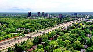
Oakland County is a county in the U.S. state of Michigan. It is a principal county of the Detroit metropolitan area, containing the bulk of Detroit's northern suburbs. The county seat is Pontiac. As of the 2020 Census, its population was 1,274,395, making it the second-most populous county in Michigan, and the largest county in the United States without a city of 100,000 residents.

The Shenandoah Valley is a geographic valley and cultural region of western Virginia and the Eastern Panhandle of West Virginia in the United States. The valley is bounded to the east by the Blue Ridge Mountains, to the west by the eastern front of the Ridge-and-Valley Appalachians, to the north by the Potomac River and to the south by the James River. The cultural region covers a larger area that includes all of the valley plus the Virginia highlands to the west, and the Roanoke Valley to the south. It is physiographically located within the Ridge and Valley province and is a portion of the Great Appalachian Valley.

Route 208 is a state highway in the northern part of New Jersey in the United States. It runs 10.07 miles (16.21 km) from an interchange with Route 4 and County Route 79 in Fair Lawn northwest to an interchange with Interstate 287 (I-287) in Oakland. The route runs through suburban areas of Bergen and Passaic counties as a four- to six-lane divided highway. It is a limited-access road, as intersections with cross roads are controlled by interchanges, but is not a controlled access road as several driveways exist. The route runs through the communities of Fair Lawn, Glen Rock, Hawthorne, Wyckoff, and Franklin Lakes along the way, interchanging with CR 507 in Fair Lawn and CR 502 in Franklin Lakes.

Interstate 880 (I-880) is a north–south auxiliary Interstate Highway in the San Francisco Bay Area of Northern California. It runs from I-280 and State Route 17 (SR 17) in San Jose to I-80 and I-580 in Oakland, running parallel to the eastern shore of San Francisco Bay. For most of its route, I-880 is officially known as the Nimitz Freeway, after World War II fleet admiral Chester W. Nimitz, who retired to the Bay Area. The northernmost five miles (8.0 km) is also commonly referred to as the Cypress Freeway, after the former alignment of the freeway and its subsequent replacement.
U.S. Route 21 or U.S. Highway 21 (US 21) is a major north–south United States Numbered Highway in the Southeastern United States that travels 394 miles (634 km). The southern terminus is in Hunting Island State Park, South Carolina, 14.4 miles (23.2 km) south of the junction with US 21 Business and South Carolina Highway 802 (SC 802) in Beaufort. The northern terminus is in Wytheville, Virginia, at an interchange with Interstate 81 (I-81) and US 52. Despite the "1" indicating that it is a major north-south highway, U.S. 21 only travels through three states, and is no longer a cross-country route as it has been replaced with Interstate 77 in both Ohio and West Virginia. It also has the second-shortest length of all of the major north-south routes, just behind U.S. 91. The route travels through the states of South Carolina, North Carolina, and Virginia. It also connects through major Southeastern cities such as Columbia, South Carolina, and Charlotte, North Carolina. The northern portion of the road travels parallel to I-77 in northern South Carolina and North Carolina. The road also has three interchanges with I-26 in Lexington and Calhoun counties in South Carolina.

U.S. Route 219 is a spur of US 19. It runs for 535 miles (861 km) from West Seneca, New York, at an interchange with Interstate 90 (I-90) to Rich Creek, Virginia, intersecting at US 460. US 219 is found in New York, Pennsylvania, Maryland, West Virginia, and Virginia. Much of the Route in West Virginia follows the old Indian warpath known as the Seneca Trail.

U.S. Route 522 is a spur route of US 22 in the states of Virginia, West Virginia, Maryland, and Pennsylvania. The U.S. Highway travels in a north-south direction, and runs 308.59 miles (496.63 km) from US 60 near Powhatan, Virginia, to its northern terminus at US 11 and US 15 near Selinsgrove, Pennsylvania. US 522 serves many small cities and towns in the Piedmont, Blue Ridge Mountains, and northern Shenandoah Valley of Virginia. The highway serves the Virginia communities of Goochland, Mineral, Culpeper, the town of Washington, and Front Royal and the independent city of Winchester. US 522 then follows the Ridge-and-Valley Appalachians north and then east through the Eastern Panhandle of West Virginia, a 2-mile-wide (3.2 km) stretch of Western Maryland, and South Central Pennsylvania to its terminus in the Susquehanna Valley. The highway serves Berkeley Springs, West Virginia; Hancock, Maryland; and the Pennsylvania communities of McConnellsburg, Mount Union, Lewistown, and Middleburg.
State Route 123 is a 7.39-mile (11.89 km) state highway in the U.S. state of California in the San Francisco Bay Area. Named San Pablo Avenue for almost its entire length except for its northernmost 0.10 miles (0.16 km), SR 123 is a major north–south state highway along the flats of the urban East Bay. Route 123 runs between Interstate 580 in Oakland in the south and Interstate 80 at Cutting Boulevard in Richmond in the north. San Pablo Avenue itself, a portion of Historic US 40, continues well past the SR 123 designation south to Downtown Oakland and north to Crockett.
Note: A fully interactive online map of the Lincoln Highway and all of its re-alignments, markers, monuments and historic points of interest can be viewed at the Lincoln Highway Association Official Map website.
Owens is a small unincorporated crossroads community at the intersection of Dahlgren Road, Windsor Drive, and Owens Drive in King George County, Virginia, United States. State Routes 206 and 218 meet at this intersection, with 206 going east towards U.S. Route 301 and Dahlgren, 218 going south towards US 301 and Colonial Beach and 206 and 218 joined together going west towards Arnolds Corner and Fredericksburg. The eastern part of the community is within the Dahlgren census-designated place.

U.S. Route 50 is a transcontinental highway which stretches from Ocean City, Maryland to West Sacramento, California. In the U.S. state of Virginia, US 50 extends 86 miles (138 km) from the border with Washington, D.C. at a Potomac River crossing at Rosslyn in Arlington County to the West Virginia state line near Gore in Frederick County.

U.S. Route 60 (US 60) in the Commonwealth of Virginia runs 303 miles (488 km) west to east through the central part of the state, generally close to and paralleling the Interstate 64 corridor, except for the crossing of the Blue Ridge Mountains, and in the South Hampton Roads area.

Maryland Route 39 is a state highway in the U.S. state of Maryland. Known for much of its length as Hutton Road, the state highway begins at the West Virginia state line in Hutton, where the highway continues west as West Virginia Route 7. MD 39, which is the westernmost state-numbered highway in Maryland, runs 6.22 miles (10.01 km) from Hutton east through Crellin to U.S. Route 219 in Oakland. The state highway was constructed in the early 1920s.
U.S. Route 219 (US 219) is a part of the U.S. Highway System that runs from Rich Creek, Virginia, to West Seneca, New York. In the U.S. state of Maryland, the U.S. Highway runs 48.40 miles (77.89 km) from the West Virginia state line near Redhouse to the Pennsylvania state line near Grantsville. Known as Garrett Highway for much of its length in Maryland, US 219 is the primary north–south route in Garrett County, connecting Interstate 68 (I-68) and Oakland. The highway also provides the main access to the resort area of Deep Creek Lake, which includes Maryland's only ski area, Wisp Ski Resort.

Maryland Route 38 is a state highway in the U.S. state of Maryland. Known as Kitzmiller Road, the state highway runs 5.67 miles (9.12 km) from the West Virginia state line at the North Branch Potomac River in Kitzmiller, where the highway continues south as West Virginia Route 42, north to MD 135 on top of Backbone Mountain. MD 38 connects Kitzmiller with the rest of Garrett County and across the North Branch Potomac River to Blaine and Elk Garden in western Mineral County. The state highway was constructed in the late 1920s and early 1930s. MD 38 originally ran from U.S. Route 219 near Thayerville through Deer Park and Altamont to Kitzmiller. The state highway was truncated at Backbone Mountain when MD 135 was extended west to Oakland in the mid-1950s.
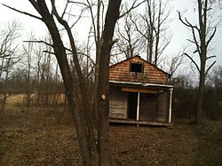
Crellin is an unincorporated community and census-designated place (CDP) in Garrett County, Maryland, United States, with a population of 264 as of the 2010 census. Crellin Elementary School is located in the community, notable for winning the U.S. Green School Award of 2007.

South Carolina Highway 441 (SC 441) is a 26.280-mile-long (42.294 km) state highway in the U.S. state of South Carolina. The highway connects the Sumter area in Sumter County with rural areas of Lee County.
Several special routes of U.S. Route 50 exist. In order from west to east they are as follows.