Valley Grove, West Virginia | |
---|---|
Coordinates: 40°5′16″N80°34′7″W / 40.08778°N 80.56861°W | |
Country | United States |
State | West Virginia |
County | Ohio |
Area | |
• Total | 0.55 sq mi (1.42 km2) |
• Land | 0.55 sq mi (1.42 km2) |
• Water | 0.00 sq mi (0.00 km2) |
Elevation | 932 ft (284 m) |
Population | |
• Total | 378 |
• Estimate (2019) [3] | 348 |
• Density | 636.20/sq mi (245.76/km2) |
Time zone | UTC-5 (Eastern (EST)) |
• Summer (DST) | UTC-4 (EDT) |
ZIP code | 26060 |
Area code | 304 |
FIPS code | 54-82732 [4] |
GNIS feature ID | 1555869 [5] |
Website | local |
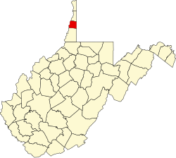
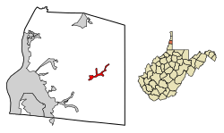
Valley Grove is a village in Ohio County, West Virginia, United States. It is part of the Wheeling, West Virginia Metropolitan Statistical Area. The population was 378 at the 2010 census. The village was named from a nearby recreational area at a grove in a valley. [6] [7]
Valley Grove is located at 40°05′16″N80°34′07″W / 40.087902°N 80.568611°W (40.087902, -80.568611), [8] along Little Wheeling Creek, a tributary of Wheeling Creek. [9]
According to the United States Census Bureau, the village has a total area of 0.55 square miles (1.42 km2), all land. [10]
Census | Pop. | Note | %± |
---|---|---|---|
1960 | 548 | — | |
1970 | 509 | −7.1% | |
1980 | 597 | 17.3% | |
1990 | 569 | −4.7% | |
2000 | 405 | −28.8% | |
2010 | 378 | −6.7% | |
2019 (est.) | 348 | [3] | −7.9% |
U.S. Decennial Census [11] |
At the 2010 census there were 378 people, 167 households, and 115 families living in the village. The population density was 687.3 inhabitants per square mile (265.4/km2). There were 177 housing units at an average density of 321.8 per square mile (124.2/km2). The racial makeup of the village was 98.9% White, 0.5% Native American, and 0.5% from two or more races. Hispanic or Latino of any race were 1.1%. [2]
Of the 167 households 26.9% had children under the age of 18 living with them, 49.7% were married couples living together, 11.4% had a female householder with no husband present, 7.8% had a male householder with no wife present, and 31.1% were non-families. 22.8% of households were one person and 9.6% were one person aged 65 or older. The average household size was 2.26 and the average family size was 2.63.
The median age in the village was 46 years. 19.3% of residents were under the age of 18; 5.5% were between the ages of 18 and 24; 23.6% were from 25 to 44; 34.2% were from 45 to 64; and 17.5% were 65 or older. The gender makeup of the village was 48.7% male and 51.3% female.
At the 2000 census there were 405 people, 158 households, and 121 families living in the village. The population density was 717.8 people per square mile (279.2/km2). There were 164 housing units at an average density of 290.7 per square mile (113.1/km2). The racial makeup of the village was 99.51% White, 0.25% African American, and 0.25% from two or more races. [4] Of the 158 households 36.1% had children under the age of 18 living with them, 56.3% were married couples living together, 14.6% had a female householder with no husband present, and 22.8% were non-families. 20.9% of households were one person and 8.2% were one person aged 65 or older. The average household size was 2.56 and the average family size was 2.92.
The age distribution was 25.2% under the age of 18, 6.7% from 18 to 24, 29.1% from 25 to 44, 22.5% from 45 to 64, and 16.5% 65 or older. The median age was 38 years. For every 100 females there were 92.9 males. For every 100 females age 18 and over, there were 93.0 males.
The median household income was $27,813 and the median family income was $30,000. Males had a median income of $25,179 versus $17,125 for females. The per capita income for the village was $20,542. About 6.5% of families and 8.7% of the population were below the poverty line, including 8.8% of those under age 18 and 5.3% of those age 65 or over.
Wheeling is a city in eastern Livingston County, Missouri, United States. The population was 220 at the 2020 census.
Bridgeport is a village in eastern Belmont County, Ohio, United States. It lies across the Ohio River from Wheeling, West Virginia, at the mouth of Wheeling Creek and is connected by two bridges to Wheeling Island. The population was 1,582 at the 2020 census. It is part of the Wheeling metropolitan area.
Brookside is a village in eastern Belmont County, Ohio, United States. The population was 538 at the 2020 census. It is part of the Wheeling metropolitan area.
Holloway is a village in Belmont County, Ohio, United States. The population was 330 at the 2020 census. It is part of the Wheeling metropolitan area. Holloway was laid out in 1883, and named after the local Holloway family.
Powhatan Point is a village in southeastern Belmont County, Ohio, United States, along the Ohio River. The population was 1,461 at the 2020 census. It is part of the Wheeling metropolitan area.
Brewster is a village in southwestern Stark County, Ohio, United States. The population was 2,113 at the 2020 census. It is part of the Canton–Massillon metropolitan area.
Beech Bottom is a village in Brooke County, West Virginia, United States, situated along the Ohio River. The population was 523 at the 2010 census. It is part of the Weirton–Steubenville metropolitan area.
Windsor Heights is a village in Brooke County, West Virginia, United States. It is part of the Wheeling, West Virginia Metropolitan Statistical Area. The population was 423 at the 2010 census. Grace Davis was the mayor as of June, 2017.
Anmoore is a town in Harrison County, West Virginia, United States. It is located at the intersection of WV 58 and Interstate 79. The population was 514 at the 2020 census.
Stonewood is a city in Harrison County, West Virginia, United States. The population was 1,810 at the 2020 census.
Cameron is a city in Marshall County, West Virginia, United States. It is part of the Wheeling metropolitan area. The population was 849 at the 2020 census.
Glen Dale is a city in Marshall County, West Virginia, United States, along the Ohio River. It is part of the Wheeling, West Virginia Metropolitan Statistical Area. The population was 1,514 at the 2020 census. Glen Dale was incorporated in 1924. It is in the northwest part of the county, which is above the Mason–Dixon line and forms the base of the Northern Panhandle of West Virginia.
McMechen is a city in Marshall County, West Virginia, United States, situated along the Ohio River. It is part of the Wheeling, West Virginia Metropolitan Statistical Area. The population was 1,714 at the 2020 census.
Bethlehem is a village in Ohio County, West Virginia, United States. It is part of the Wheeling, West Virginia Metropolitan Statistical Area. The population was 2,499 at the 2010 census.
Clearview is a village in Ohio County, West Virginia, United States. It is part of the Wheeling, West Virginia Metropolitan Statistical Area. The population was 565 at the 2010 census.
Triadelphia is a town in Ohio County, West Virginia, United States. It is part of the Wheeling, West Virginia Metropolitan Statistical Area. The population was 669 at the 2020 census.
West Liberty is a town in Ohio County, West Virginia, United States. The population was 1,557 at the 2020 census. It is part of the Wheeling metropolitan area.
Friendly is a town in Tyler County, West Virginia, United States. The population was 100 at the 2020 census.
Wilson is a village in Belmont and Monroe counties in the U.S. state of Ohio. The population was 129 at the 2020 census. It is part of the Wheeling metropolitan area.
Yorkville is a village in Belmont and Jefferson counties in the U.S. state of Ohio. The population was 968 at the 2020 census. Yorkville lies within two Metropolitan Statistical Areas; the Belmont County portion is part of the Wheeling metropolitan area, while the Jefferson County portion is part of the Weirton–Steubenville metropolitan area.