North Hills, West Virginia | |
---|---|
Coordinates: 39°18′54″N81°30′32″W / 39.31500°N 81.50889°W | |
Country | United States |
State | West Virginia |
County | Wood |
Incorporated | February 15, 1979 |
Area | |
• Total | 0.57 sq mi (1.47 km2) |
• Land | 0.57 sq mi (1.47 km2) |
• Water | 0.00 sq mi (0.00 km2) |
Elevation | 787 ft (240 m) |
Population | |
• Total | 837 |
• Estimate (2021) [3] | 827 |
• Density | 1,367.49/sq mi (527.63/km2) |
Time zone | UTC-5 (Eastern (EST)) |
• Summer (DST) | UTC-4 (EDT) |
Area code | 304 |
FIPS code | 54-59458 [4] |
GNIS feature ID | 2391335 [2] |
Website | northhillswv |
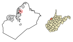
North Hills is a town in Wood County, West Virginia, United States. It is a suburb of Parkersburg. The population was 837 at the 2020 census. [3] North Hills was incorporated on February 15, 1979. [5]
According to the United States Census Bureau, the town has a total area of 0.56 square miles (1.45 km2), of which 0.55 square miles (1.42 km2) is land and 0.01 square miles (0.03 km2) is water. [6]
Census | Pop. | Note | %± |
---|---|---|---|
1980 | 940 | — | |
1990 | 849 | −9.7% | |
2000 | 880 | 3.7% | |
2010 | 832 | −5.5% | |
2020 | 837 | 0.6% | |
2021 (est.) | 827 | [3] | −1.2% |
U.S. Decennial Census [7] |
At the 2010 census there were 832 people, 295 households, and 250 families living in the town. The population density was 1,512.7 inhabitants per square mile (584.1/km2). There were 308 housing units at an average density of 560.0 per square mile (216.2/km2). The racial makeup of the town was 92.3% White, 2.0% African American, 4.6% Asian, 0.2% from other races, and 0.8% from two or more races. Hispanic or Latino of any race were 1.0%. [8]
Of the 295 households 35.3% had children under the age of 18 living with them, 76.3% were married couples living together, 6.4% had a female householder with no husband present, 2.0% had a male householder with no wife present, and 15.3% were non-families. 11.5% of households were one person and 6.7% were one person aged 65 or older. The average household size was 2.82 and the average family size was 3.07.
The median age in the town was 43.3 years. 26.7% of residents were under the age of 18; 6.1% were between the ages of 18 and 24; 20.7% were from 25 to 44; 32.5% were from 45 to 64; and 14.2% were 65 or older. The gender makeup of the town was 50.8% male and 49.2% female.
At the 2000 census there were 880 people, 294 households, and 264 families living in the town. The population density was 1,589.1 inhabitants per square mile (617.8/km2). There were 301 housing units at an average density of 543.5 per square mile (211.3/km2). The racial makeup of the town was 92.61% White, 0.57% African American, 0.11% Native American, 5.11% Asian, and 1.59% from two or more races. Hispanic or Latino of any race were 1.59%. [4]
Of the 294 households 44.2% had children under the age of 18 living with them, 85.4% were married couples living together, 3.7% had a female householder with no husband present, and 9.9% were non-families. 8.5% of households were one person and 3.7% were one person aged 65 or older. The average household size was 2.99 and the average family size was 3.16.
The age distribution was 30.3% under the age of 18, 4.2% from 18 to 24, 22.4% from 25 to 44, 33.3% from 45 to 64, and 9.8% 65 or older. The median age was 41 years. For every 100 females there were 97.3 males. For every 100 females age 18 and over, there were 97.7 males.
The median household income was $83,659 and the median family income was $85,768. Males had a median income of $71,944 versus $33,125 for females. The per capita income for the town was $31,862. About 1.8% of families and 2.5% of the population were below the poverty line, including 4.2% of those under age 18 and 3.0% of those age 65 or over.
Dyer Brook is a town in Aroostook County, Maine, United States. The population was 215 at the 2020 census. Dyer Brook is also host to the local school, Southern Aroostook Community School.
Eagle Lake is a town in Aroostook County, Maine, United States. The population was 772 at the 2020 census. The town was named by a body of troops heading from Bangor to the Aroostook War for the many eagles that they saw around the lake. A total of 49.0% of the population speaks French, reflecting a trend in Northeastern Maine.
Hersey is a town in Aroostook County, Maine, United States. The population was 73 at the 2020 census.
Mapleton is a town in Aroostook County, Maine, United States. The population was 1,886 at the 2020 census.
Merrill is a town in Aroostook County, Maine, United States. The population was 208 at the 2020 census.
Oakfield is a town in Aroostook County, Maine, United States. The population was 661 at the 2020 census. The village of Oakfield, listed as a census-designated place, is in the northwestern corner of the town.
Perham is a town in Aroostook County, Maine, United States. The population was 371 at the 2020 census. The town was named after Maine's 33rd governor, Sidney Perham.
Stockholm is a town in Aroostook County, Maine, United States. The population was 250 at the 2020 census.
Wallagrass is a town in Aroostook County, Maine, United States. The population was 519 at the 2020 census.
Vienna is a town in Kennebec County, Maine, United States. The population was 578 at the 2020 census.
Stoneham is a town in Oxford County, Maine, United States. The population was 261 at the 2020 census.
Upton is a town in Oxford County, Maine, United States. The population was 69 at the 2020 census.
Detroit is a town in Somerset County, Maine, United States. The population was 885 at the 2020 census.
Meddybemps is a town in Washington County, Maine, United States. The population was 139 at the 2020 census.
Talmadge is a town in Washington County, Maine, United States. The town was named after landowner Benjamin Tallmadge. The population was 70 at the 2020 census.
Northfork is a town in McDowell County, West Virginia, United States, located on U.S. Route 52 between Welch and Bluefield.
Bancroft is a town in Putnam County, West Virginia, United States, along the Kanawha River. The population was 389 at the 2020 census. It is part of the Huntington–Ashland metropolitan area.
Camden-on-Gauley is a town in Webster County, West Virginia, United States, along the Gauley River. The population was 126 at the 2020 census.
Pine Grove is a town in Wetzel County, West Virginia, United States. The population was 363 at the 2020 census. The community was named for a grove of pine trees near the original town site.
East Millinocket is a town in Penobscot County, Maine, United States. The population was 1,572 at the 2020 census.