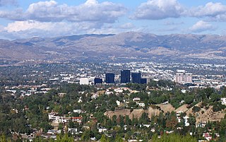
Woodland Hills is a neighborhood bordering the Santa Monica Mountains in the San Fernando Valley region of Los Angeles, California, United States.

The Hopewell tradition, also called the Hopewell culture and Hopewellian exchange, describes a network of precontact Native American cultures that flourished in settlements along rivers in the northeastern and midwestern Eastern Woodlands from 100 BCE to 500 CE, in the Middle Woodland period. The Hopewell tradition was not a single culture or society but a widely dispersed set of populations connected by a common network of trade routes.

The Allegheny Mountain Range, informally the Alleghenies, is part of the vast Appalachian Mountain Range of the Eastern United States and Canada and posed a significant barrier to land travel in less developed eras. The Allegheny Mountains have a northeast–southwest orientation, running for about 300 miles (480 km) from north-central Pennsylvania, southward through western Maryland and eastern West Virginia.
Woodland Park can refer to:

Woodlands is a planning area and residential town located in the North of Singapore. As of 2019, the town has a population of 254,733. Located approximately 25 km (16 mi) north of the central business district (CBD), it is the densest planning area and is the regional centre for the northern parts of the country.
Woodlands may back refer to:
Woodlawn Cemetery is the name of several cemeteries, including:

York River State Park is located near the unincorporated town of Croaker in James City County, Virginia on the south bank of the York River about 10 miles downstream from West Point.
Woodland Heights, VA is a neighborhood in the city of Richmond, Virginia. It began as a trolleycar neighborhood in the early 1900s and was built up along the James River beside Forest Hill Park. Woodland Heights is listed on the National Register of Historic Places and the Virginia Landmarks Registry.

The Bluestone National Scenic River protects a 10.5-mile (16.9 km) section of the Bluestone River in Summers and Mercer counties of southern West Virginia. It was created 26 October 1988 under the Wild and Scenic Rivers Act and is protected by the National Park Service.

Pennsylvania Route 381 is a 49.3-mile-long (79.3 km) state highway located in Fayette, and Westmoreland counties in Pennsylvania, United States. The southern terminus is the West Virginia state line near Elliottsville, Pennsylvania, where it continues as Preston County Route 8 to its southern terminus at WV 26 in Brandonville, West Virginia. The northern terminus is at U.S. Route 30 (US 30) near Ligonier.

Beury Mountain Wildlife Management Area is located on 9,232 acres (3,736 ha) near Babcock State Park and New River Gorge National River in Fayette County, West Virginia. Beury Mountain's sloping terrain is covered with mixed hardwoods and oak-hickory second growth woodlands overlooking New River Gorge. Camping is not allowed at Beury Mountain WMA, but is available at nearby Babcock State Park.

Big Ugly Wildlife Management Area is located on 3,061 acres (1,239 ha) near Logan in Lincoln County, West Virginia. The Big Ugly's steep terrain is covered with mixed hardwoods second growth woodlands. Camping is not allowed at Big Ugly WMA, but is available at nearby Chief Logan State Park.
Elklick Woodlands Natural Area Preserve is a 226-acre (91 ha) Natural Area Preserve located in Fairfax County, Virginia. Owned by the Fairfax County Park Authority, it is protected with a local conservation easement, and preserves a globally rare natural community known as a "northern hardpan basic oak-hickory forest". This kind of forest occurs on diabase soil with an underlay of dense plastic clay; such terrain is called "shrink-swell soil" due to extreme variations in moisture availability exhibited throughout the year. Trees which grow in such an environment are stunted, and their relatively open canopies encourage the growth of a wide variety of grasses and herbs in the understory. Such forests were once common around northern Virginia, but many have been lost due to increasing suburbanization of the area.

Pleasant Creek Wildlife Management Area is located near Philippi, West Virginia in Barbour and Taylor counties. Located on 3,030 acres (1,230 ha) land that varies from wetlands to steeply forested woodlands, the Pleasant Creek WMA rises to an elevation of 1,600 feet (490 m).

Ritchie Mines Wildlife Management Area, is located near Smithville, West Virginia, in Ritchie County. Ritchie Mines WMA is located on 2,300 acres (930 ha) of rugged, hilly woodlands.

Sand Hill Wildlife Management Area is located near Parkersburg, West Virginia in Wood and Ritchie counties. Sand Hill WMA is located on 1,987 acres (804 ha) of rugged, hilly oak-hickory woodlands interspersed with timber, oil and gas development sites.

This is a list of the National Register of Historic Places listings in Franklin County, Virginia.

Woodland Indian and Whistling Swans is a bronze sculpture created by American sculptor Marshall Fredericks in 1963. It is located at the Milwaukee Public Museum at 800 West Wells Street, Milwaukee, Wisconsin.
The Rocks, also known as Raven's Rock and Raven Rocks, is a late-18th-century stone residence and 79-acre (32 ha) farm complex near Charles Town, Jefferson County, in the U.S. state of West Virginia. The Rocks is a historic district consisting of four contributing structures. The primary structure is a 2-and-a-half-story stone residence known as The Rocks, which was built around 1790, in the Georgian architectural style.


