"},"unit_pref":{"wt":"Imperial"}},"i":0}}]}" id="mwBQ">Town in West Virginia, United States
Eleanor, West Virginia | |
---|---|
Coordinates: 38°32′21″N81°55′52″W / 38.53917°N 81.93111°W | |
Country | United States |
State | West Virginia |
County | Putnam |
Government | |
• Mayor | Charles Cameron "Cam" Clendenin |
Area | |
• Total | 2.13 sq mi (5.51 km2) |
• Land | 2.12 sq mi (5.50 km2) |
• Water | 0.01 sq mi (0.01 km2) |
Elevation | 604 ft (184 m) |
Population | |
• Total | 1,548 |
• Estimate (2021) [2] | 1,539 |
• Density | 747.88/sq mi (288.78/km2) |
Time zone | UTC-5 (Eastern (EST)) |
• Summer (DST) | UTC-4 (EDT) |
ZIP code | 25070 |
Area code | 304 |
FIPS code | 54-24292 [3] |
GNIS feature ID | 1538590 [4] |
Website | eleanorwv |
Eleanor is a town in Putnam County, West Virginia, United States, along the Kanawha River. [5] Its population was 1,548 at the 2020 census. [2] It is part of the Huntington–Ashland metropolitan area. [6] The town, named for Eleanor Roosevelt, was established as a New Deal project in the 1930s like other Franklin D. Roosevelt towns around the nation (e.g. Greenbelt, Greenhills, Greendale, Hanford, or Norris). [7] [8]
Eleanor was established in 1934, when President Franklin D. Roosevelt and First Lady Eleanor visited the county and developed it as a test site for families. [7]
As a "sundown town", like other Franklin Roosevelt towns around the nation (such as Greenbelt, Greenhills, Greendale, Hanford, or Norris), it was for whites only. [9]
It was one of three resettlement communities in West Virginia, the others being Arthurdale and Tygart Valley. When the town was developed, the houses were built to look very similar to one another and are now referred to as old Eleanor houses. There are three schools in Eleanor: George Washington Elementary School, George Washington Middle School and the Putnam County Career and Technical Center.
Eleanor is located at 38°32′21″N81°55′52″W / 38.53917°N 81.93111°W (38.539037, -81.931046). [10]
According to the United States Census Bureau, the town has a total area of 2.13 square miles (5.52 km2), of which 2.12 square miles (5.49 km2) is land and 0.01 square miles (0.03 km2) is water. [11]
The climate in this area is characterized by relatively high temperatures and evenly distributed precipitation throughout the year. According to the Köppen Climate Classification system, Eleanor has a Humid subtropical climate, abbreviated "Cfa" on climate maps. [12]
Climate data for Eleanor, West Virginia (Winfield Locks) (1991–2020 normals, extremes 1939–present) | |||||||||||||
---|---|---|---|---|---|---|---|---|---|---|---|---|---|
Month | Jan | Feb | Mar | Apr | May | Jun | Jul | Aug | Sep | Oct | Nov | Dec | Year |
Record high °F (°C) | 80 (27) | 81 (27) | 87 (31) | 93 (34) | 96 (36) | 102 (39) | 101 (38) | 103 (39) | 102 (39) | 96 (36) | 87 (31) | 80 (27) | 103 (39) |
Mean maximum °F (°C) | 67.2 (19.6) | 70.4 (21.3) | 77.6 (25.3) | 86.2 (30.1) | 89.2 (31.8) | 92.7 (33.7) | 94.5 (34.7) | 94.1 (34.5) | 92.4 (33.6) | 84.7 (29.3) | 77.1 (25.1) | 68.7 (20.4) | 96.0 (35.6) |
Mean daily maximum °F (°C) | 43.6 (6.4) | 47.5 (8.6) | 56.3 (13.5) | 69.0 (20.6) | 76.3 (24.6) | 84.0 (28.9) | 87.0 (30.6) | 86.4 (30.2) | 80.7 (27.1) | 69.5 (20.8) | 57.7 (14.3) | 47.3 (8.5) | 67.1 (19.5) |
Daily mean °F (°C) | 33.8 (1.0) | 36.8 (2.7) | 44.3 (6.8) | 55.3 (12.9) | 63.9 (17.7) | 72.1 (22.3) | 75.8 (24.3) | 74.9 (23.8) | 68.7 (20.4) | 57.1 (13.9) | 46.0 (7.8) | 38.0 (3.3) | 55.6 (13.1) |
Mean daily minimum °F (°C) | 24.0 (−4.4) | 26.1 (−3.3) | 32.3 (0.2) | 41.6 (5.3) | 51.4 (10.8) | 60.2 (15.7) | 64.6 (18.1) | 63.4 (17.4) | 56.7 (13.7) | 44.6 (7.0) | 34.3 (1.3) | 28.6 (−1.9) | 44.0 (6.7) |
Mean minimum °F (°C) | 6.3 (−14.3) | 10.6 (−11.9) | 17.7 (−7.9) | 27.8 (−2.3) | 36.9 (2.7) | 49.4 (9.7) | 56.2 (13.4) | 55.1 (12.8) | 44.4 (6.9) | 32.1 (0.1) | 21.4 (−5.9) | 14.3 (−9.8) | 3.5 (−15.8) |
Record low °F (°C) | −18 (−28) | −9 (−23) | 0 (−18) | 18 (−8) | 27 (−3) | 37 (3) | 48 (9) | 43 (6) | 34 (1) | 21 (−6) | 7 (−14) | −10 (−23) | −18 (−28) |
Average precipitation inches (mm) | 2.71 (69) | 2.93 (74) | 3.70 (94) | 3.18 (81) | 4.07 (103) | 3.55 (90) | 4.32 (110) | 3.68 (93) | 2.93 (74) | 2.70 (69) | 2.58 (66) | 3.13 (80) | 39.48 (1,003) |
Average snowfall inches (cm) | 4.1 (10) | 2.7 (6.9) | 2.6 (6.6) | 0.0 (0.0) | 0.0 (0.0) | 0.0 (0.0) | 0.0 (0.0) | 0.0 (0.0) | 0.0 (0.0) | 0.0 (0.0) | 0.0 (0.0) | 1.3 (3.3) | 10.7 (27) |
Average precipitation days (≥ 0.01 in) | 11.5 | 11.1 | 12.4 | 12.1 | 12.9 | 11.9 | 10.7 | 9.2 | 8.1 | 9.3 | 9.9 | 13.1 | 132.2 |
Average snowy days (≥ 0.1 in) | 2.6 | 2.0 | 0.6 | 0.0 | 0.0 | 0.0 | 0.0 | 0.0 | 0.0 | 0.0 | 0.0 | 1.2 | 6.4 |
Source: NOAA [13] [14] |
Census | Pop. | Note | %± |
---|---|---|---|
1970 | 1,035 | — | |
1980 | 1,282 | 23.9% | |
1990 | 1,256 | −2.0% | |
2000 | 1,345 | 7.1% | |
2010 | 1,518 | 12.9% | |
2020 | 1,548 | 2.0% | |
2021 (est.) | 1,539 | [2] | −0.6% |
U.S. Decennial Census [15] |
As of the census [16] of 2010, there were 1,518 people, 624 households, and 445 families living in the town. The population density was 716.0 inhabitants per square mile (276.4/km2). There were 659 housing units at an average density of 310.8 per square mile (120.0/km2). The racial makeup of the town was 98.0% White, 0.1% African American, 0.3% Native American, 0.3% Asian, 0.4% from other races, and 1.0% from two or more races. Hispanic or Latino of any race were 0.9% of the population.
There were 624 households, of which 28.0% had children under the age of 18 living with them, 58.7% were married couples living together, 9.1% had a female householder with no husband present, 3.5% had a male householder with no wife present, and 28.7% were non-families. 24.4% of all households were made up of individuals, and 12.5% had someone living alone who was 65 years of age or older. The average household size was 2.43 and the average family size was 2.90.
The median age in the town was 41.9 years. 21.5% of residents were under the age of 18; 6.6% were between the ages of 18 and 24; 26.2% were from 25 to 44; 26.5% were from 45 to 64; and 19.3% were 65 years of age or older. The gender makeup of the town was 48.9% male and 51.1% female.
As of the census [3] of 2000, there were 1,345 people, 574 households, and 416 families living in the town. The population density was 1,597.1 inhabitants per square mile (618.2/km2). There were 608 housing units at an average density of 722.0 per square mile (279.5/km2). The racial makeup of the town was 99.55% White, 0.07% African American, 0.07% Native American, 0.15% Asian, and 0.15% from two or more races. Hispanic or Latino of any race were 0.52% of the population.
There were 574 households, out of which 29.3% had children under the age of 18 living with them, 62.2% were married couples living together, 9.8% had a female householder with no husband present, and 27.4% were non-families. 25.6% of all households were made up of individuals, and 12.5% had someone living alone who was 65 years of age or older. The average household size was 2.34 and the average family size was 2.79.
In the town, the population was spread out, with 21.3% under the age of 18, 7.0% from 18 to 24, 28.6% from 25 to 44, 26.2% from 45 to 64, and 17.0% who were 65 years of age or older. The median age was 41 years. For every 100 females, there were 93.0 males. For every 100 females age 18 and over, there were 89.1 males.
The median income for a household in the town was $35,284, and the median income for a family was $43,274. Males had a median income of $35,000 versus $21,198 for females. The per capita income for the town was $19,104. About 5.6% of families and 6.8% of the population were below the poverty line, including 12.2% of those under age 18 and 3.9% of those age 65 or over.
Hallwood is a town in Accomack County, Virginia, in the United States. As of the 2010 census, the town population was 206.
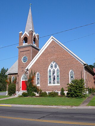
Toms Brook is a town in Shenandoah County, Virginia, United States. The population was 258 at the 2010 census.
Gassaway is a town in Braxton County, West Virginia, United States. The population was 769 at the 2020 census. Gassaway was incorporated in 1905 and named for Henry Gassaway Davis, the Democratic Party's nominee for Vice President of the United States in 1904. The center of population of West Virginia is located approximately 7 miles (11 km) north of Gassaway.
Grantsville is a town in Calhoun County, West Virginia, United States. The population was 482 at the 2020 census. It is the county seat of Calhoun County. The town was established along the Little Kanawha River in 1865 and named for Ulysses S. Grant. Grantsville is home to Wayne Underwood Park, which includes a .25-mile-long (0.40 km) walking trail, and to the annual West Virginia Wood Festival.
Bayard is a town in Grant County, West Virginia, United States. The population was 200 at the 2020 census. Bayard was incorporated in 1893 and named in honor of Thomas F. Bayard, Jr., who later became a United States senator from Delaware (1923–1929). Bayard was founded on the West Virginia Central and Pittsburgh Railroad as a coal mining community. Coal mining has remained the town's chief industry.
Hamlin is a town in and the county seat of Lincoln County, West Virginia, United States, along the Mud River. The population was recorded as 1,040 at the 2020 census. It is part of the Huntington–Ashland metropolitan area.
Man is a town in Logan County, West Virginia, United States. The population was 772 at the 2020 census. The town is located along the Guyandotte River at the mouth of Buffalo Creek, which was the site of the 1972 Buffalo Creek Flood following a dam collapse. The name of the town reportedly derives from the last syllable of the surname of Ulysses Hinchman, who was a member of the House of Delegates from Logan County between 1866 and 1869.
McMechen is a city in Marshall County, West Virginia, United States, situated along the Ohio River. It is part of the Wheeling, West Virginia Metropolitan Statistical Area. The population was 1,714 at the 2020 census.
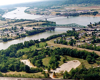
Henderson is an unincorporated community and former town in Mason County, West Virginia, United States, at the confluence of the Ohio and Kanawha Rivers. The population was 231 at the 2020 census. It is part of the Point Pleasant, WV–OH Micropolitan Statistical Area. The town was incorporated in 1893 and named for Samuel Bruce Henderson, who owned the townsite at the time. The town was unincorporated following a public hearing on August 11, 2022.
Matoaka is a census-designated place in Mercer County, West Virginia, United States. The population was 173 at the 2020 census. It is part of the Bluefield, WV-VA micropolitan area which has a population of 100,093. This town is named for Chief Powhatan's daughter Matoaka who was better known by her nickname "Pocahontas". Matoaka became an unincorporated town when it voted to dissolve its charter in May 2018.
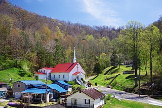
Kermit is a town in Mingo County, West Virginia, United States. The population was 406 at the 2010 census. Kermit is located along the Tug Fork, opposite Warfield, Kentucky. The Norfolk Southern Railway's Kenova District runs through town.
Blacksville is an Incorporated Town in Monongalia County, West Virginia, United States. The population was 118 at the 2020 census. It is included in the Morgantown, West Virginia Metropolitan Statistical Area.
Albright is a town in central Preston County, West Virginia, United States, along the Cheat River. The population was 260 at the 2020 census. A former coal town, it is part of the Morgantown metropolitan area.
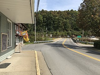
Bruceton Mills is a town in northern Preston County, West Virginia, United States, along Big Sandy Creek. The population was 64 at the 2020 census, making it the second-least populous town in West Virginia, after Thurmond. It is part of the Morgantown metropolitan area.
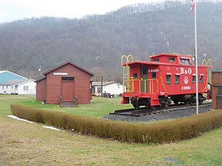
Rowlesburg is a town in southern Preston County, West Virginia, United States, along the Cheat River. The population was 438 at the 2020 census. It is part of the Morgantown metropolitan area. A former railroad town, it is home to the Downtown Rowlesburg Historic District, and was the site of action during the American Civil War.
Cairo is a town in Ritchie County, West Virginia, United States, along West Virginia Route 31, the North Fork of the Hughes River, and the North Bend Rail Trail. The population was 174 at the 2020 census.
Hambleton is a town in Tucker County, West Virginia, United States. The population was 216 at the 2020 census. Hambleton was established in 1889, but not incorporated until 1905. It was named by then United States Senator Stephen B. Elkins in honor of a stockholder by this name in the West Virginia Central Railroad Company. The town was previously known as Hulings.
Middlebourne is a town and the county seat of Tyler County, West Virginia, United States. The population was 715 at the 2020 census.
Elizabeth is a town in and the county seat of Wirt County, West Virginia, United States, situated along the Little Kanawha River. The population was 724 as of the 2020 census.
Birnamwood is a village in Marathon and Shawano counties in the U.S. state of Wisconsin. It is part of the Wausau, Wisconsin Metropolitan Statistical Area. The population was 818 at the 2010 census. Of this, 802 were in Shawano County, and 16 were in Marathon County. The village is located mostly within the town of Birnamwood in Shawano County; only a small portion extends into the town of Norrie in adjacent Marathon County.