Teays, West Virginia

Last updated
Teays
USA West Virginia location map.svg
Red pog.svg
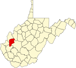
Teays
Location within the state of West Virginia
Usa edcp location map.svg
Red pog.svg
Teays
Teays (the United States)
Coordinates: 38°26′30″N81°57′10″W / 38.44167°N 81.95278°W / 38.44167; -81.95278 Coordinates: 38°26′30″N81°57′10″W / 38.44167°N 81.95278°W / 38.44167; -81.95278
Country United States
State West Virginia
County Putnam
Time zone UTC-5 (Eastern (EST))
  Summer (DST) UTC-4 (EDT)
ZIP codes
25569

Teays, written Seays until circa 1884, is an unincorporated community in Putnam County, West Virginia, United States. The town is centered on the former general store / post office on Teays Lane, which sits across from the site of the Teays railroad depot, which was demolished in the mid-1900s.

Teays is a namesake and part of the census-designated place of Teays Valley, which was in turn named for Thomas Teays, a hunter and trapper who once spent a considerable amount of time in the vicinity. [1]

Geologist William G. Tight (1865–1910) named the preglacial Teays River after Teays, which lies in the "riverless" Teays Valley that once was the bottom of the river. [2]

Related Research Articles

Putnam County, West Virginia U.S. county in West Virginia

Putnam County is a county in the U.S. state of West Virginia. As of the 2010 census, the population was 55,486. Its county seat is Winfield and its largest city is Hurricane. Putnam County is part of the Huntington-Ashland, WV-KY-OH Metropolitan Statistical Area, across the Kanawha River from Charleston, West Virginia.

Charleston, West Virginia Capital of West Virginia

Charleston is the capital and most populous city of the U.S. state of West Virginia. Located at the confluence of the Elk and Kanawha rivers, the city had a population of 51,400 at the 2010 census and an estimated population of 46,536 in 2019. The Charleston metropolitan area as a whole had an estimated 208,089 residents in 2019. Charleston is the center of government, commerce, and industry for Kanawha County, of which it is the county seat.

Fairmont, West Virginia City in West Virginia, United States

Fairmont is a city in Marion County, West Virginia, United States. The population was 18,704 at the 2010 census. It is the county seat of Marion County.

Keyser, West Virginia City in West Virginia, United States

Keyser is a city in and the county seat of Mineral County, West Virginia, United States. It is part of the Cumberland, MD-WV Metropolitan Statistical Area. The population was 5,439 at the 2010 census.

Teays Valley, West Virginia CDP in West Virginia, United States

Teays Valley is a census-designated place (CDP) in Putnam County, West Virginia, United States. The place is divided into the two districts of Teays Valley and Scott Depot. The population was 13,175 at the 2010 census. Teays Valley is part of the Huntington-Ashland, WV-KY-OH, Metropolitan Statistical Area (MSA). As of the 2010 census, the MSA had a population of 287,702. New definitions from February 28, 2013 placed the population at 363,000.

Scioto River

The Scioto River is a river in central and southern Ohio more than 231 miles (372 km) in length. It rises in Hardin County just north of Roundhead, Ohio, flows through Columbus, Ohio, where it collects its largest tributary, the Olentangy River, and meets the Ohio River at Portsmouth. Early settlers and Native Americans used the river for shipping but it is now too small for modern commercial shipping. The primary economic importance for the river now is for recreation and drinking water. It is the longest river that is entirely within Ohio.

Teays River

The Teays River (pronounced taze) was a major preglacial river that drained much of the present Ohio River watershed, but took a more northerly downstream course. Traces of the Teays across northern Ohio and Indiana are represented by a network of river valleys. The largest still existing contributor to the former Teays River is the Kanawha River in West Virginia, which is itself an extension of the New River. The name Teays from the Teays Valley is associated with this buried valley since 1910. The more appropriate name would be ancestral Kanawha Valley. The term Teays is used when discussing the buried portion of the ancestral Kanawha River. The Teays was comparable in size to the Ohio River. The River's headwaters were near Blowing Rock, North Carolina; it then flowed through Virginia, West Virginia, Ohio, Indiana and Illinois.. The largest tributary to the Teays River was the Old Kentucky River, which extended from southern Kentucky through Frankfort and subsequently flowed northeast, meeting other tributaries and eventually joining the Teays.

U.S. Route 35

U.S. Route 35 (US 35) is a United States Highway that runs southeast–northwest for approximately 412 miles (663 km) from the western suburbs of Charleston, West Virginia to northern Indiana. Although the highway is physically southeast–northwest, it is nominally north–south. The highway's southern terminus is in Teays Valley, West Virginia, near Scott Depot, at Interstate 64 (I-64). Its northern terminus is near Michigan City, Indiana, at US 20. As of 2020, the final West Virginia portion of the highway is being expanded to four lanes, mostly along a completely new route. The Ohio portion has been upgraded to a four-lane highway/freeway between the West Virginia state line and Trotwood, west of Dayton.

William Nelson Page

William Nelson Page was an American civil engineer and industrialist. He was active in the Virginias following the U.S. Civil War. Page was widely known as a metallurgical expert by other industry leaders and investors as well as state and federal authorities.

Greenbrier River

The Greenbrier River is a tributary of the New River, 162 miles (261 km) long, in southeastern West Virginia, in the United States. Via the New, Kanawha and Ohio rivers, it is part of the watershed of the Mississippi River, draining an area of 1,656 square miles (4,290 km2). It is one of the longest rivers in West Virginia.

Slanesville, West Virginia Unincorporated community in West Virginia, United States

Slanesville is an unincorporated community in northeastern Hampshire County in the U.S. state of West Virginia. Slanesville is located at the crossroads of Bloomery Pike with Slanesville Pike and Cold Stream Road. Slanesville Pike and Cold Stream Road formerly made up the Springfield Grade Road that ran from Capon Bridge to Springfield. According to the 2000 census, the Slanesville community has a population of 691.

Lake Tight

Lake Tight, named for geologist William G. Tight, was a glacial lake in what is present-day Ohio, Kentucky, and West Virginia, during the Ice Age the early Pleistocene before 700 ka.

William G. Tight

William G. Tight (1865–1910) was an American geomorphologist who became the third president of the University of New Mexico.

Scott Depot, West Virginia Unincorporated community in West Virginia, United States

Scott Depot is an unincorporated community in Putnam County, West Virginia, United States. It is located along Crooked Creek at and downstream from the creek's intersection with Teays Valley Road. The ZIP code is 25560. It is part of the census-designated place of Teays Valley which is a part of the Huntington-Ashland Metropolitan Statistical Area (MSA).

Ferrellsburg, West Virginia Unincorporated community in West Virginia, United States

Ferrellsburg is an unincorporated community in southern Lincoln County, West Virginia, United States. It is located in Harts Creek District and is part of the Harts census-designated place.

The Mountain Parkway Byway and Mountain Parkway Backway are two routes in northern Webster County, West Virginia. The Byway is a state-designated scenic byway which follows West Virginia Route 20 for 9.8 miles (15.8 km), traversing the headwaters of several mountain streams including the Right Fork Little Kanawha River, Jerry Run, and the Left and Laurel Forks of Holly River. The Backway explores backroads in the same area, is 32 miles (51 km) long, and follows stretches of the Right Fork Little Kanawha River and Left Fork Holly River for portions of its route.

Parchment Valley, West Virginia Unincorporated community in West Virginia, United States

Parchment Valley is an unincorporated community in Jackson County, West Virginia, United States. Parchment Valley is located at the junction of County Routes 15 and 30, 3.5 miles (5.6 km) south-southwest of Ripley. Parchment Valley once had a post office, which is now closed.

Gill, West Virginia Unincorporated community in West Virginia, United States

Gill is an unincorporated community and former railroad town in Lincoln County, West Virginia, United States.

Lake Monongahela

Lake Monongahela was a proglacial lake in western Pennsylvania, West Virginia, and Ohio. It formed during the Pre-Illinoian ice epoch when the retreat of the ice sheet northwards blocked the drainage of these valleys to the north. The lake formed south of the ice front continued to rise until it was able to breach a low divide near New Martinsville, West Virginia. The overflow was the beginning of the process which created the modern Ohio River valley.

Kanauga, Ohio Census-designated place in Ohio, United States

Kanauga is an unincorporated community and census-designated place (CDP) in Gallia County, Ohio, United States. As of the 2010 census it had a population of 175.

References

  1. Kenny, Hamill (1945). West Virginia Place Names: Their Origin and Meaning, Including the Nomenclature of the Streams and Mountains. Piedmont, WV: The Place Name Press. p. 621.
  2. Sullivan, Walter (1983-11-29). "A Great Lost River Gets Its Due". The New York Times . The New York Times Company . Retrieved 2009-05-19. [William G. Tight] called it the Teays (pronounced taze) River, for a village in West Virginia.