Cherry Grove, Putnam County, West Virginia

Last updated
Cherry Grove
USA West Virginia location map.svg
Red pog.svg
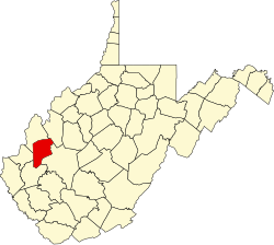
Cherry Grove
Location within the state of West Virginia
Usa edcp location map.svg
Red pog.svg
Cherry Grove
Cherry Grove (the United States)
Coordinates: 38°26′22″N81°55′19″W / 38.43944°N 81.92194°W / 38.43944; -81.92194 Coordinates: 38°26′22″N81°55′19″W / 38.43944°N 81.92194°W / 38.43944; -81.92194
Country United States
State West Virginia
County Putnam
Elevation
738 ft (225 m)
Time zone UTC-5 (Eastern (EST))
  Summer (DST) UTC-4 (EDT)
GNIS ID 1740670 [1]

Cherry Grove is an unincorporated community in Putnam County, West Virginia, United States.

Related Research Articles

Putnam County, Ohio County in Ohio, US

Putnam County is a county located in the U.S. state of Ohio. As of the 2010 census, the population was 34,499. Its county seat is Ottawa. The county was created in 1820 and later organized in 1834. Its name is in honor of Israel Putnam, who was a hero in the French and Indian War and a general in the American Revolutionary War.

Putnam County, West Virginia U.S. county in West Virginia

Putnam County is a county in the U.S. state of West Virginia. As of the 2010 census, the population was 55,486. Its county seat is Winfield and its largest city is Hurricane. Putnam County is part of the Huntington-Ashland, WV-KY-OH Metropolitan Statistical Area, across the Kanawha River from Charleston, West Virginia.

Webster may refer to:

Pendleton County, West Virginia U.S. county in West Virginia

Pendleton County is a county located in the U.S. state of West Virginia. As of the 2010 census, the population was 7,695, making it the fifth-least populous county in West Virginia. Its county seat is Franklin. The county was created by the Virginia General Assembly in 1788 from parts of Augusta, Hardy, and Rockingham Counties and was named for Edmund Pendleton (1721–1803), a distinguished Virginia statesman and jurist. Pendleton County was strongly pro-Confederate during the American Civil War; however, there were pockets of Unionists who supported the state government in Wheeling.

Cherry Grove, New York Hamlet in New York, United States

Cherry Grove is a hamlet in the Town of Brookhaven, Suffolk County, New York, United States. It is located on Fire Island, a barrier island separated from the southern side of Long Island by the Great South Bay. The hamlet has approximately 300 houses on 41 acres (170,000 m2), a summer seasonal population of 2,000 and a year-round population of 15.

Walnut Grove may refer to:

Cherry Grove may refer to:

West Virginia Senate upper house of the West Virginia Legislature

The West Virginia Senate is the upper house of the West Virginia Legislature. There are seventeen senatorial districts. Each district has two senators who serve staggered four-year terms. The Republicans gained three seats in the 2020 senate election, bringing their total number of seats to 23, while the Democrats hold 11 seats.

Cherry Grove, Minnesota Unincorporated community in Minnesota, United States

Cherry Grove is an unincorporated community in Fillmore County, Minnesota, United States.

James McDowell

James McDowell was the 29th Governor of Virginia from 1843 to 1846 and was a U.S. Congressman from 1846 to 1851.

Cherry Run

Cherry Run is a 7.2-mile-long (11.6 km) meandering stream that forms the northern section of the boundary between Morgan and Berkeley counties in West Virginia's Eastern Panhandle. While it is mostly non-navigable, Cherry Run provides many pools of varying depths for fishing and swimming. As a tributary of the Potomac River, Cherry Run is part of the Potomac and Chesapeake Bay watersheds.

Cherry Grove, West Virginia Unincorporated community in West Virginia, United States

Cherry Grove is an unincorporated community located in Pendleton County, West Virginia, United States. Cherry Grove lies within the Monongahela National Forest at the confluence of Big Run with the North Fork South Branch Potomac River.

Charleston metropolitan area, West Virginia Metropolitan statistical area in West Virginia, United States

The Charleston Metropolitan Statistical Area, as defined by the United States Census Bureau, is an area consisting of three counties in West Virginia, anchored by the city of Charleston. It is the largest metropolitan area entirely within the state of West Virginia. While the Huntington Metro Area is more populous, it spans three states, and the core county of the Charleston area, Kanawha County, is more populous than the West Virginia portion of the Huntington area.

Cherry Grove, Oregon Unincorporated community in Oregon, United States

Cherry Grove is an unincorporated community in Washington County, Oregon, United States. Cherry Grove is situated on the north bank of the Tualatin River near where it exits the Northern Oregon Coast Range and enters Patton Valley.

National Register of Historic Places listings in Putnam County, West Virginia

This is a list of the National Register of Historic Places listings in Putnam County, West Virginia.

Arbuckle District, Mason County, West Virginia Magisterial district in West Virginia, United States

Arbuckle Magisterial District is one of ten magisterial districts in Mason County, West Virginia, United States. The district was originally established as a civil township in 1863, and converted into a magisterial district in 1872. In 2010, Arbuckle District was home to 1,121 people.

Clendenin District, Mason County, West Virginia Magisterial district in West Virginia, United States

Clendenin Magisterial District is one of ten magisterial districts in Mason County, West Virginia, United States. The district was originally established as a civil township in 1863, and converted into a magisterial district in 1872. In 2010, Clendenin District was home to 3,715 people.

Hannan District, Mason County, West Virginia Magisterial district in West Virginia, United States

Hannan Magisterial District is one of ten magisterial districts in Mason County, West Virginia, United States. The district was originally established as a civil township in 1863, and converted into a magisterial district in 1872. In 2010, Clendenin District was home to 3,715 people.

References